- Table View
- List View
Mean Little deaf Queer: A Memoir
by Terry GallowayIn 1959, the year Terry Galloway turned nine, the voices of everyone she loved began to disappear. No one yet knew that an experimental antibiotic given to her mother had wreaked havoc on her fetal nervous system, eventually causing her to go deaf. As a self-proclaimed "child freak," she acted out her fury with her boxy hearing aids and Coke-bottle glasses by faking her own drowning at a camp for crippled children. Ever since that first real-life performance, Galloway has used theater, whether onstage or off, to defy and transcend her reality. With disarming candor, she writes about her mental breakdowns, her queer identity, and living in a silent, quirky world populated by unforgettable characters. What could have been a bitter litany of complaint is instead an unexpectedly hilarious and affecting take on life.
Meaning Making in Planning: Theorising ‘Policy Entitlement’ in the Emergence of Green Infrastructure Planning in Ireland
by Mick LennonPlanning theorists normally focus on issues of contest and critique. The field of planning theory is thereby replete with studies of conflict, collaboration and criticism. Considerably less critical attention is afforded to policy approaches that emerge, evolve and are widely adopted in the apparent absence of discord. This book addresses this knowledge gap. A case study of the emergence of green infrastructure policy in Ireland is used to both inform and illustrate a theory of ‘Policy Entitlement’. This interpretive approach focuses on meaning making in context to explain the counter-intuitive processes through which a new policy concept can emerge and reprofile planning activities by producing the seemingly pre-existing objective reality to which such policy is then applied and the discipline (re)orientated. This approach accounts for how a new planning concept can appear to resolve problematic policy ambiguity by suspending disagreement on issues where dispute could be expected. This book will be of interest to those studying planning theory and the policy process, as well as those concerned with the undertheorized but swift rise to prominence of green infrastructure planning.
Meaning and Authenticity: Further Works in the Sociology of Art
by Cesar GranaThis outstanding collection of hitherto unpublished work, written over the last fifteen years of the author's life, reveals the development and maturation of his ideas about sociology and art, and specifically about the relationship between them. Grafia sees in the artistic traditions of Western society the sociological sources of our sense of cultural form, as well as cultural and intellectual meaning. He discusses theories of art and theories of artists as they have changed over time, although the book is neither a history of art nor a criticism of specific artistic works. Rather, it is a defense of the sociology of art.Grafia believes that the difficult and ambitious questions in the sociology of art are not merely questions of the proper role or status of the artist, or the recognition of art as an ornament, perhaps the supreme ornament, of our culture. He believes that what the sociologist must come to terms with is the view of art as the representation, indeed the revelation of what is most telling and pervasive in culture itself. This perspective assumes that the most serious claims made for art are in fact inseparable from the unique claims that are made about art. Art can make visible what is implicit in our lives. Art can put before us a statement of what we are but do not always recognize in oursleves. Art is the mask and mimicry through which society gestures to us its ultimate and most poignant meanings. Grafia contends that this vision of art derives from Hegelian aesthetics, and he believes that this grand view-whether one takes an idealist, a literary, or a Marxist-materialist position-also implies a dramatically changed conception of society itself.The essays cover a variety of subjects, from Marx, museums, and modern literature, to Durkheim, Daniel Bell, and bullfighting-the last being the apotheosis of cultural expression rendered into artistic form. Throughout, Grafia considers questions of the social origins of our artistic and intellectual traditions, the influence of these traditions on our ways of thinking about society, and their pervasiveness as standards for social meaning.
Meaning and Interpretation of Music in Cinema
by David P. NeumeyerBy exploring the relationship between music and the moving image in film narrative, David Neumeyer shows that film music is not conceptually separate from sound or dialogue, but that all three are manipulated and continually interact in the larger acoustical world of the sound track. In a medium in which the image has traditionally trumped sound, Neumeyer turns our attention to the voice as the mechanism through which narrative (dialog, speech) and sound (sound effects, music) come together. Complemented by music examples, illustrations, and contributions by James Buhler, Meaning and Interpretation of Music in Cinema is the capstone of Neumeyer's 25-year project in the analysis and interpretation of music in film.
Meaning in Landscape Architecture and Gardens
by Laurie Olin Marc Treib Susan Herrington Jane GilletteWhile we all live our lives in designed landscapes of various types, only on occasion do we consider what these landscapes mean to us and how they have acquired that significance. Can a landscape architect or garden designer really imbue new settings with meaning, or does meaning evolve over time, created by those who perceive and use these landscapes? What role does the selection and arrangement of plants and hard materials play in this process and just where does the passage of time enter into the equation? These questions collectively provide the core material for Meaning in Landscape Architecture and Gardens, a compendium of four landmark essays written over a period of twenty years by leading scholars in the field of landscape architecture. New commentaries by the authors accompany each of the essays and reflect on the thinking behind them as well as the evolution of the author’s thoughts since their original publication. Although the central theme of these writings is landscape architecture broadly taken, the principal subject of several essays and commentaries is the garden, a subject historically plentiful in allusions and metaphors. As a whole Meaning in Landscape Architecture and Gardens offers the general reader as well as the professional a rich source of ideas about the designed landscape and the ways by which we perceive, consider, react, and dwell within them – and what they mean to us. The essays have been perennial favorites in landscape courses since their original publication in Landscape Journal. Bringing them together – bolstered by the new commentaries – creates a book valuable to all those creating gardens and landscapes, as well as those teaching and studying these subjects.
Meaning in Motion: New Cultural Studies of Dance
by Jane C. DesmondDance, whether considered as an art form or embodied social practice, as product or process, is a prime subject for cultural analysis. Yet only recently have studies of dance become concerned with the ideological, theoretical, and social meanings of dance practices, performances, and institutions. In Meaning in Motion, Jane C. Desmond brings together the work of critics who have ventured into the boundaries between dance and cultural studies, and thus maps a little-known and rarely explored critical site.Writing from a broad range of perspectives, contributors from disciplines as varied as art history and anthropology, dance history and political science, philosophy and women's studies chart the questions and challenges that mark this site. How does dance enact or rework social categories of identity? How do meanings change as dance styles cross borders of race, nationality, or class? How do we talk about materiality and motion, sensation and expressivity, kinesthetics and ideology? The authors engage these issues in a variety of contexts: from popular social dances to the experimentation of the avant-garde; from nineteenth-century ballet and contemporary Afro-Brazilian Carnival dance to hip hop, the dance hall, and film; from the nationalist politics of folk dances to the feminist philosophies of modern dance. Giving definition to a new field of study, Meaning in Motion broadens the scope of dance analysis and extends to cultural studies new ways of approaching matters of embodiment, identity, and representation.Contributors. Ann Cooper Albright, Evan Alderson, Norman Bryson, Cynthia Cohen Bull, Ann Daly, Brenda Dixon Gottschild, Susan Foster, Mark Franko, Marianne Goldberg, Amy Koritz, Susan Kozel, Susan Manning, Randy Martin, Angela McRobbie, Kate Ramsey, Anna Scott, Janet Wolff
Meaning in the Midst of Performance: Contradictions of Participation (Routledge Advances in Theatre & Performance Studies)
by Gareth WhiteBeing an audience participant can be a confusing and contradictory experience. When a performance requires us to do things, we are put in the situation of being both actor and spectator, of being part of the work of art while also being the audience who receives it, and of being both perceiving subject and aesthetic object. This book examines these contradictions – and many others – as they appear by accident and by design in increasingly popular forms of interactive, immersive, and participatory performance in theatre and live art. Borrowing concepts from cognitive philosophy and bringing them into a conversation with critical theory, Gareth White sharply examines meaning as a process that happens to us as we are engaged in the problems and negotiations of a participatory performance. This study will be of great interest to scholars and students of theatre and performance, intermedial arts and games studies, and to practising artists.
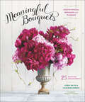
Meaningful Bouquets: Create Special Messages with Flowers
by Leigh Okies Lisa McguinnessSay it with flowers. This visual bouquet includes a photographic glossary of popular flower types and their Victorian meanings, followed by step-by-step instructions for creating 25 beautiful arrangements. From Celebration and Luck, to Happiness and Forgiveness, each bespoke bunch of flowers suits an important occasion or recipient. Blooming with inspiring lifestyle photography and watercolor botanical illustrations throughout, Meaningful Bouquets brings a truly personal touch to flower arranging.
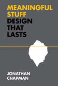
Meaningful Stuff: Design That Lasts (Design Thinking, Design Theory)
by Jonathan ChapmanAn argument for a design philosophy of better, not more.Never have we wanted, owned, and wasted so much stuff. Our consumptive path through modern life leaves a wake of social and ecological destruction--sneakers worn only once, bicycles barely even ridden, and forgotten smartphones languishing in drawers. By what perverse alchemy do our newest, coolest things so readily transform into meaningless junk? In Meaningful Stuff, Jonathan Chapman investigates why we throw away things that still work, and shows how we can design products, services, and systems that last. Obsolescence is an economically driven design decision--a plan to hasten a product's functional or psychological undesirability. Many electronic devices, for example, are intentionally impossible to dismantle for repair or recycling, their brief use-career proceeding inexorably to a landfill. A sustainable design specialist who serves as a consultant to global businesses and governmental organizations, Chapman calls for the decoupling of economic activity from mindless material consumption and shows how to do it.Chapman shares his vision for an "experience heavy, material light" design sensibility. This vital and timely new design philosophy reveals how meaning emerges from designed encounters between people and things, explores ways to increase the quality and longevity of our relationships with objects and the systems behind them, and ultimately demonstrates why design can--and must--lead the transition to a sustainable future.
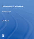
Meanings Of Modern Art, Revised
by John RussellA survey of modern art from the Impressionists to the present, with a new chapter on the art of the seventies and eighties, and corrections and revisions in the text.
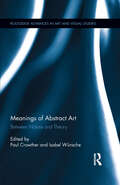
Meanings of Abstract Art: Between Nature and Theory (Routledge Advances in Art and Visual Studies)
by Paul Crowther Isabel WünscheTraditional art is based on conventions of resemblance between the work and that which it is a representation "of". Abstract art, in contrast, either adopts alternative modes of visual representation or reconfigures mimetic convention. This book explores the relation of abstract art to nature (taking nature in the broadest sense—the world of recognisable objects, creatures, organisms, processes, and states of affairs). Abstract art takes many different forms, but there are shared key structural features centered on two basic relations to nature. The first abstracts from nature, to give selected aspects of it a new and extremely unfamiliar appearance. The second affirms a natural creativity that issues in new, autonomous forms that are not constrained by mimetic conventions. (Such creativity is often attributed to the power of the unconscious.) The book covers three categories: classical modernism (Mondrian, Malevich, Kandinsky, Arp, early American abstraction); post-war abstraction (Pollock, Still, Newman, Smithson, Noguchi, Arte Povera, Michaux, postmodern developments); and the broader historical and philosophical scope.
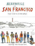
Meanwhile in San Francisco: The City in its Own Words
by Wendy MacNaughtonTake a stroll through the City by the Bay with renowned artist Wendy MacNaughton in this collection of illustrated documentaries. With her beloved city as a backdrop, a sketchbook in hand, and a natural sense of curiosity, MacNaughton spent months getting to know people in their own neighborhoods, drawing them and recording their words. Her street-smart graphic journalism is as diverse and beautiful as San Francisco itself, ranging from the vendors at the farmers' market to people combing the shelves at the public library, from MUNI drivers to the bison of Golden Gate Park, and much more. Meanwhile in San Francisco offers both lifelong residents and those just blowing through with the fog an opportunity to see the city with new eyes.
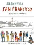
Meanwhile, in San Francisco
by Wendy MacnaughtonTake a stroll through the City by the Bay with renowned artist Wendy MacNaughton in this collection of illustrated documentaries. With her beloved city as a backdrop, a sketchbook in hand, and a natural sense of curiosity, MacNaughton spent months getting to know people in their own neighborhoods, drawing them and recording their words. Her street-smart graphic journalism is as diverse and beautiful as San Francisco itself, ranging from the vendors at the farmers' market to people combing the shelves at the public library, from MUNI drivers to the bison of Golden Gate Park, and much more. Meanwhile in San Francisco offers both lifelong residents and those just blowing through with the fog an opportunity to see the city with new eyes.
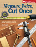
Measure Twice, Cut Once: Simple Steps to Measure, Scale, Draw and Make the Perfect Cut-Every Time.
by Jim TolpinThe First Book a Woodworker Needs!Professional woodworker Jim Tolpin offers solid instruction on the principles of measurement and proportion, walking you through every step of the woodworking process. From design and layout to developing a cutting list, his easy-to-follow style introduces a variety of tools (new and old) used to transfer measurements accurately to the wood. You'll learn the best cutting techniques, how to prevent mistakes before they happen, and for those unavoidable mistakes, you'll learn how to fix them so no one will know!
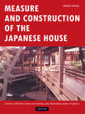
Measure and Construction of the Japanese House
by Heino EngelA remarkable classic work on traditional Japanese architecture and its general integrative quality, the order of space and form, the flexibility of partitions and room functions and other important or unique qualities. The author describes in detail, and with numerous architectural plans and drawings, the influence of the anatomy of the Japanese human body on traditional units of measurement and on house construction. This work is not simply a description of the features of the Japanese house, but "an invitation to probe the possibilities of utilizing this architectural achievement of the Japanese . . . in modern living and building," according to the author, who further believes that the unique features of the Japanese house are better suited to serve as a pattern for contemporary housing than any other form of residential structure.
Measure and Design in American Painting, 1760-1860 (Routledge Library Editions: Art and Culture in the Nineteenth Century #1)
by Lisa Fellows AndrusFirst published in 1977. The purpose of this study is to locate the sources for the American style of painting characterised by measure and design – the representation of the specific and familiar according to principles of pictorial order. The reader shall see that there were a variety of conventions available to the artist and that his selection of one or another of them depended upon pragmatic, philosophical, and aesthetic considerations.
Measure for Measure (SparkNotes Literature Guide Series)
by SparkNotesMeasure for Measure (SparkNotes Literature Guide) by William Shakespeare Making the reading experience fun! Created by Harvard students for students everywhere, SparkNotes is a new breed of study guide: smarter, better, faster. Geared to what today's students need to know, SparkNotes provides: *Chapter-by-chapter analysis *Explanations of key themes, motifs, and symbols *A review quiz and essay topicsLively and accessible, these guides are perfect for late-night studying and writing papers
Measure of a Man: From Auschwitz Survivor to Presidents' Tailor
by Wynton Hall Martin GreenfieldHe's been called "America's greatest living tailor" and "the most interesting man in the world." Now, for the first time, Holocaust survivor Martin Greenfield tells his incredible life story. Taken from his Czechoslovakian home at age fifteen and transported to the Nazi concentration camp at Auschwitz with his family, Greenfield came face to face with "Angel of Death" Dr. Joseph Mengele and was divided forever from his parents, sisters, and baby brother.In haunting, powerful prose, Greenfield remembers his desperation and fear as a teenager alone in the death camp-and how an SS soldier's shirt dramatically altered the course of his life. He learned how to sew; and when he began wearing the shirt under his prisoner uniform, he learned that clothes possess great power and could even help save his life.Measure of a Man is the story of a man who suffered unimaginable horror and emerged with a dream of success. From sweeping floors at a New York clothing factory to founding America's premier custom suit company, Greenfield built a fashion empire. Now 86 years old and working with his sons, Greenfield has dressed the famous and powerful of D.C. and Hollywood, including Presidents Dwight Eisenhower, Bill Clinton, and Barack Obama, celebrities Paul Newman, Leonardo DiCaprio, and Jimmy Fallon, and the stars of Martin Scorsese's films.Written with soul-baring honesty and, at times, a wry sense of humor, Measure of a Man is a memoir unlike any other-one that will inspire hope and renew faith in the resilience of man.
Measured Words: Computation and Writing in Renaissance Italy
by Arielle SaiberMeasured Words investigates the rich commerce between computation and writing that proliferated in fifteenth- and sixteenth-century Italy. Arielle Saiber explores the relationship between number, shape, and the written word in the works of four exceptional thinkers: Leon Battista Alberti’s treatis on cryptography, Luca Pacioli’s ideal proportions for designing Roman capital letters, Niccolò Tartaglia’s poem embedding his solution to solving cubic equations, and Giambattista Della Porta’s curious study on the elements of geometric curves. Although they came from different social classes and practiced the mathematical and literary arts at differing levels of sophistication, they were all guided by a sense that there exist deep ontological and epistemological bonds between computational and verbal thinking and production. Their shared view that a network or continuity exists between the arts yielded extraordinary results. Through measuring their words, literally and figuratively, they are models of what the very best interdisciplinary work can offer us.
Measuring Impact
by Sandra GattenhofThis book investigates the relationship developed between the researcher/evaluator and the commissioning arts and cultural producer in providing an opportunity to rethink the traditional process of reporting back on value and impact through the singular entity of funds acquittal. Using three commissioned evaluations as examples, the discussion outlines the two positions most often adopted by researchers/evaluators, external and distanced or embedded and collaborative, and will argue the merits and deficiencies of the two approaches. This text also investigates the role of the researcher/evaluator as a broker of stakeholder interests; how cultural organizations can partner in data gathering and develop a participatory approach to the research; what role the researcher/evaluator can have in the dissemination of evaluation findings and recommendations; and makes recommendations on which partnership type is more affective in a commissioned evaluation model for an arts and culture organization in the Australian landscape.
Measuring Landscapes: A Planner's Handbook
by Jack Ahern Joseph Miller Kevin Mcgarigal Andre Botequilha LeitaoThis practical handbook bridges the gap between those scientists who study landscapes and the planners and conservationists who must then decide how best to preserve and build environmentally-sound habitats. Until now, only a small portion of the relevant science has influenced the decision-making arenas where the future of our landscapes is debated and decided. The authors explain specific tools and concepts to measure a landscape's structure, form, and change over time. Metrics studied include patch richness, class area proportion, patch number and density, mean patch size, shape, radius of gyration, contagion, edge contrast, nearest neighbor distance, and proximity. These measures will help planners and conservationists make better land use decisions for the future.
Measuring Quality in Planning: Managing the Performance Process
by Matthew Carmona Louie SiehThis book deals with one of the current major debates in planning: how to measure the quality and effectiveness of the output of the planning process. It deals with issues of defining quality, public sector management, the use of indicators and the planning process. Although case study material is drawn from UK practice this topic is universal and the authors include discussions of international practice and experience.
Measuring Shape
by John C. Russ F. Brent Neal"John Russ is the master of explaining how image processing gets applied to real-world situations. With Brent Neal, he’s done it again in Measuring Shape, this time explaining an expanded toolbox of techniques that includes useful, state-of-the-art methods that can be applied to the broad problem of understanding, characterizing, and measuring shape. He has a gift for finding the kernel of a particular algorithm, explaining it in simple terms, then giving concrete examples that are easily understood. His perspective comes from solving real-world problems and separating out what works in practice from what is just an abstract curiosity." —Tom Malzbender, Hewlett-Packard Laboratories, Palo Alto, California, USA Useful for those working in fields including industrial quality control, research, and security applications, Measuring Shape is a handbook for the practical application of shape measurement. Covering a wide range of shape measurements likely to be encountered in the literature and in software packages, this book presents an intentionally diverse set of examples that illustrate and enable readers to compare methods used for measurement and quantitative description of 2D and 3D shapes. It stands apart through its focus on examples and applications, which help readers quickly grasp the usefulness of presented techniques without having to approach them through the underlying mathematics. An elusive concept, shape is a principal governing factor in determining the behavior of objects and structures. Essential to recognizing and classifying objects, it is the central link in manmade and natural processes. Shape dictates everything from the stiffness of a construction beam, to the ability of a leaf to catch water, to the marketing and packaging of consumer products. This book emphasizes techniques that are quantitative and produce a meaningful yet compact set of numerical values that can be used for statistical analysis, comparison, correlation, classification, and identification. Written by two renowned authors from both industry and academia, this resource explains why users should select a particular method, rather than simply discussing how to use it. Showcasing each process in a clear, accessible, and well-organized way, they explore why a particular one might be appropriate in a given situation, yet a poor choice in another. Providing extensive examples, plus full mathematical descriptions of the various measurements involved, they detail the advantages and limitations of each method and explain the ways they can be implemented to discover important correlations between shape and object history or behavior. This uncommon assembly of information also includes sets of data on real-world objects that are used to compare the performance and utility of the various presented approaches.
Measuring Urban Design
by James W. Quinn Reid Ewing Otto Clemente Kathryn M. Neckerman Marnie Purciel-Hill Andrew RundleWhat makes strolling down a particular street enjoyable? The authors of Measuring Urban Design argue it's not an idle question. Inviting streets are the centerpiece of thriving, sustainable communities, but it can be difficult to pinpoint the precise design elements that make an area appealing. This accessible guide removes the mystery, providing clear methods to measure urban design. In recent years, many "walking audit instruments" have been developed to measure qualities like building height, block length, and sidewalk width. But while easily quantifiable, these physical features do not fully capture the experience of walking down a street. In contrast, this book addresses broad perceptions of street environments. It provides operational definitions and measurement protocols of five intangible qualities of urban design, specifically imageability, visual enclosure, human scale, transparency, and complexity. The result is a reliable field survey instrument grounded in constructs from architecture, urban design, and planning. Readers will also find a case study applying the instrument to 588 streets in New York City, which shows that it can be used effectively to measure the built environment's impact on social, psychological, and physical well-being. Finally, readers will find illustrated, step-by-step instructions to use the instrument and a scoring sheet for easy calculation of urban design quality scores. For the first time, researchers, designers, planners, and lay people have an empirically tested tool to measure those elusive qualities that make us want to take a stroll. Urban policymakers and planners as well as students in urban policy, design, and environmental health willfind thetools and methods in Measuring Urban Design especially useful.