- Table View
- List View
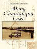
Along Chautauqua Lake (Postcard History Series)
by Dorothy E. Levin Karen E. LivseyShortly after settlement began along Chautauqua Lake, steamboats furnished transportation and the first hotel catered to visiting hunters and fishermen. Families escaping the summers in the city soon followed to enjoy the cool, healthy air. Chautauqua Institution and Point Chautauqua both began as religious assembly grounds. Celoron Park, often called the "Coney Island of the West," and later Midway Park provided entertainment for families and attracted thousands of visitors who traveled by trolley and steamboat in the summer. Local residents and visitors alike enjoyed the parks, picnic groves, and assorted resorts along the lake. A century later, fish are still caught, boats still ply the waters, and families continue to enjoy everything Chautauqua Lake has to offer.
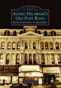
Along Delaware's Old Post Road: From Claymont to Iron Hill
by Ken BaumgardtAlong Delaware's Old Post Road: From Claymont to Iron Hill snakes through the Colonial towns of Claymont, Wilmington, Newport, Stanton, Christiana, and the Pencader Hundred portion of northern Delaware. This 13-mile route has different names, from Philadelphia Pike to Maryland Avenue to Old Baltimore Pike, but it is along this road that the State of Delaware has its earliest roots. The photographs of the people and places are mostly misty memories as the route grew from a narrow dirt road to a modern four-lane thoroughfare. From Cooch's Bridge at one end, where the only battle on Delaware soil was fought, to Archmere Academy at the northern end, the corridor has a largely forgotten place in history. Travelers now trace the same route once traversed by George Washington, Thomas Jefferson, and Charles Mason and Jeremiah Dixon as they rode into history.
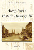
Along Iowa's Historic Highway 20
by Michael J. TillUS Highway 20 was designated a federal highway in 1926. For the first half of the 20th century, it was the most important east-west road across northern Iowa, extending from the Mississippi to the Missouri River. The road connected 13 counties, four major metropolitan areas, and many smaller communities along its route. Fortunately, the historic two-lane road remains almost completely intact and can be driven much as travelers did in years gone by. Along Iowa's Historic Highway 20 celebrates such a trip, illustrated by more than 200 antique postcards that show the personality of the road: town and city scenes, rural vistas, rivers, bridges, and historic sites. Not to be forgotten are the tourist courts, hotels, diners, and gas stations that made travel possible.
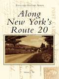
Along New York's Route 20 (Postcard History Series)
by Michael J. TillFew roads can match Route 20's beauty, history, or contribution to New York's vitality. In 1926, Route 20 became a federal highway and evolved into New York's foremost east-west road. But unlike most early highways, it has survived almost completely intact. The story of Route 20 is told through more than 200 vintage postcards showing scenes from the Shaker communities in Columbia County to the Lake Erie Shore. The postcards show the personality of the road: main streets, the Finger Lakes, and scenic vistas. Not to be forgotten are the tourist courts, hotels, diners, and gas stations that made travel possible.
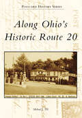
Along Ohio's Historic Route 20 (Postcard History Series)
by Michael J. TillRoute 20 was named a federal highway in 1926, and for the first half of the 20th century it was the most important east-west road across northern Ohio. Extending from the Pennsylvania border east of Conneaut to its western terminus with Indiana, it made Ohio the connecting link between Northeastern and Midwestern states. Fortunately, Route 20 has remained virtually intact and can be traveled much as people did in years past. Postcard History Series: Along Ohio's Historic Route 20 celebrates such a trip, illustrated by more than 200 vintage postcards depicting views along the way. Town and city scenes, rural vistas, and historic sites that drew early motorists to the highway are featured. Not to be forgotten are the tourist courts, hotels, diners, and gas stations that made automobile journeys possible.
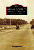
Along Route 52: Delaware's Historic Kennett Pike (Images of America)
by Andrew D. EngelCreated through an act of the Delaware Legislature in 1811, the Wilmington and Kennett Turnpike would become one of the most important roads in New Castle County. Linking the city of Wilmington, Delaware, to Kennett Square, Pennsylvania, it would become crucial in the transportation of goods from a growing industrial Wilmington to Philadelphia and the eastern counties of Pennsylvania. Kennett Pike, as it would come to be known, operated as a toll road until it was purchased in 1919 by industrialist Pierre S. du Pont (1870-1954). Du Pont would work over the next year and a half to widen and modernize the highway and eliminate its tolls. When work was completed, he sold the road back to the state for just $1. Kennett Pike has continued to grow through the 20th century, with dozens of private estates gracing its borders. Villages such as Greenville and Centreville have been characterized by their country charm and local businesses, including Shields Lumber & Coal and Buckley's Tavern.
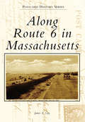
Along Route 6 in Massachusetts (Postcard History Series)
by James A. GayRoute 6 in Massachusetts runs from Provincetown to Seekonk and passes through some of the most beautiful scenery in the state. What had once been a mere footpath for Native Americans, then widened for the use of stagecoaches, Route 6 would be officially designated the “King’s Highway” in 1920. The moniker was extremely unpopular with the local residents, so much so that the governor officially changed the name to the Grand Army of the Republic Highway in 1937. Depicted from the author’s personal collection of postcards from the 1920s to the 1960s, Route 6 winds its way around tiny fishing villages, sand dunes, marshes, beaches, lighthouses, campgrounds, hotels, restaurants, and historic cities. The combination of Route 6 and the automobile would make Cape Cod a world-renowned tourist destination.
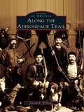
Along The Adirondack Trail
by Donald R. WilliamsNative Americans called the area Couxsaxrage, "beaver hunting ground." Professor Ebenezer Emmons named it Adirondack, after one of the native tribes. Along the Adirondack Trail traces the history and lore of the Adirondacks up the scenic roadway through the heart of New York's mountain-and-lake country. Included are tales of the Mohawk Indians and their beatified princess, Tekakwitha; the site of the mansion of Sir William Johnson, one of America's most influential citizens of the 1700s; and an important battleground of the Revolution. Rare original photographs portray each of the twenty settlements on the trail from Fonda to Malone, reflecting the lives of the guides, loggers, trappers, sportsmen, camp owners, tourists, leather workers, and health seekers who opened up the unknown county.
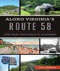
Along Virginia’s Route 58: True Tales From Beach to Bluegrass (History And Guide Ser.)
by Joe TennisRoute 58 stretches across all five hundred miles of Virginia, from the sandy shores of the Atlantic to the waterfalls and wild ponies of the Blue Ridge Highlands. Weird, quirky and intriguing legends and lore lie along this historic highway, including a UFO landing in South Hill, Virginia Beach's "witch duck" controversy of 1706 and Nat Turner's bloody insurrection in 1831. Country music icon Johnny Cash played his final shows at the world-famous Carter Fold. Civil War skirmishes touched towns. The "Wreck of the Old 97" happened in Danville, and haunting memories of a schoolhouse lost to a tornado remain in Rye Cove. Author Joe Tennis provides a guide to Route 58 with a trail of tales, accompanied by easy driving directions and vivid photography.
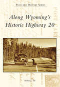
Along Wyoming's Historic Highway 20 (Postcard History)
by Michael J. TillHighway 20 was designated a federal highway in 1926, and until the arrival of the Interstate Highway System in the 1950s it was a primary route across northern Wyoming. From the Great Plains in the east to the mountains in the west, Highway 20 passed though cities and towns that retain their frontier visages and such wonders as Hell's Half Acre, the Wind River Canyon, Natural Hot Springs, Buffalo Bill Scenic Byway, and spectacular Yellowstone National Park. Fortunately, historic Highway 20 remains almost completely intact and can be driven much as travelers did in years past. Postcard History Series: Along Wyoming's Historic Highway 20 celebrates this trip, illustrated by more than 200 vintage postcards showing the personality of the road. Not to be forgotten are the tourist courts, hotels, diners, and gas stations that made automobile travel possible.

Along for the Ride
by Rachel MeinkeThe worst summer of her life has one seriously hot perk . . .These days, everything in Katelyn Jackson’s life revolves around her pop star brother. His schedule, his tour, his fans—it’s like Connor Jackson’s become the center of the universe. And when the entire family decides to join Connor’s tour, Katelyn has to kiss her soccer team, her friends—and her entire summer—goodbye.The only good news is the opening act is none other than her favorite band with the hottest lead singer ever. Zach Matthews, with his deep caramel eyes, makes Katelyn’s heart pound a zillion beat per minute. Don’t mind me, I’m just fangirling over here.Between the endless bus rides and cruddy room service, some serious chemistry develops between Katelyn and Zach. But as they say, all is not fair in love and pop stardom and Katelyn will have to decide if she’s willing to take a risk or if she’s just along for the ride.
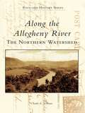
Along the Allegheny River: The Northern Watershed
by Charles E. WilliamsThe Allegheny River, of western Pennsylvania and New York, flows through a region rich in natural resources and human history. While the river is 320 miles long, the northern watershed district originates in Potter County, Pennsylvania, and joins the Clarion River near Parker, Pennsylvania. Along the Allegheny River: The NorthernWatershed showcases over 200 vintage postcards of the river, its landscape, and its people. These captivating images chronicle over 200 years of history, from the French and Indian War to the timber and oil booms of the late 19th and early 20th centuries.

Along the Allegheny River: The Southern Watershed
by Charles E. WilliamsThe Allegheny River of western Pennsylvania and New York rises in Potter County, Pennsylvania, and flows 320 miles to its confluence with the Monongahela River in Pittsburgh. The Allegheny's southern watershed district begins in East Brady, Pennsylvania, and ends in Pittsburgh, and it includes the historic Redbank Creek, Mahoning Creek, Crooked Creek, and Kiskiminetas River valleys. Along the Allegheny River: The Southern Watershed features over 200 vintage postcards of the landscapes, people, industries, and events that shaped the history of the southern Allegheny River Valley and of the nation. These absorbing images chronicle over 200 years of history from the frontier wars of the 18th century to the rise and growth ofthe Industrial Revolution in the late 19th and early 20th centuries.
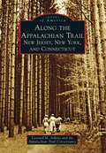
Along the Appalachian Trail: New Jersey, New York and Connecticut
by Leonard M. Adkins Appalachian Trail ConservancyCrossing through 14 states from Maine to Georgia, the Appalachian Trail enters New Jersey through the Delaware Water Gap, crosses New York's Hudson River, and rises over Connecticut's Lion's Head. The area is considered by some to be the pathway's birthplace, for in 1923, just two years after Benton MacKaye originally proposed the trail, the first few miles specifically constructed for the Appalachian Trail were built by volunteers in New York's Harriman and Bear Mountain State Parks. These photographs and the corresponding narrative present a historical perspective on what it took to create the trail, including the thousands of volunteers and the arduous tasks they performed, those who lived along the trail before and during its creation, the many people who have enjoyed the trail through the years, and the original routes that are no longer part of the present-day Appalachian Trail.
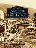
Along the Baltimore & Ohio Railroad: From Cumberland to Uniontown (Images of America)
by Marci Lynn McguinnessDuring the turn of the century, the railroad was anextremely important transportation and shipping resource to thousands of people and businesses inPennsylvania. Along the Baltimore & Ohio Railroad:From Cumberland to Uniontown dedicates its pages to this mass transportation provider. This book includes images from every B&O bridge and station from Cumberland, Maryland, to Uniontown, Pennsylvania, in 1891. Many of the towns stretched along the miles of tracks, such as Somerfield and Ohiopyle, are depicted in these vintage photographs. Experience the coal and coke booms of the 1880s to 1920s through people from many different locations who had one thing in common: the railroad.
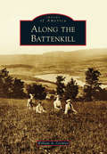
Along the Battenkill (Images of America)
by William A. CormierThe Battenkill Valley, in the southern part of Washington County, is the historical backdrop to many homesteading settlers as well as the Mohawk and Mahican tribes. Two retired Roger's Rangers, James Turner and Joshua Conkey, came to Salem and purchased 25,000 acres of land--known as the Turner Patent--bringing many families from Pelham, Massachusetts, to settle along White Creek and the Battenkill. With the advent of photography, the results of this pioneering spirit were captured, first on glass negative plates and later with roll film, by numerous Salem photographers from 1865 to the early 1900s. As new canals, roads, and railroads of the 1800s were built, local photographers could travel easily with their heavy photography equipment, capturing scenes of the towns and villages nestled in the Adirondack Mountains, replete with their own rivers and lakes. Now, the region thrives off agriculture, logging, mining, and tourism. The Battenkill draws hundreds of fishermen, boaters, and swimmers to the area in the spring and summer.
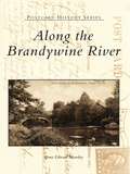
Along the Brandywine River
by Bruce Edward MowdayThis fascinating new history of the historical river that winds through Chester County, Pennsylvania, and the upper regions of Delaware and emptying into the Christina River in Wilmington, Delaware, showcases more than two hundred of the best vintage postcards available. The collected postcards show the countryside as it appeared during the Revolutionary War Battle at Brandywine through the time of nineteenth-century settlements in the region and into the twentieth century.
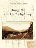
Along the Bucktail Highway
by Charles E. WilliamsThe Bucktail Highway, Pennsylvania Route 120, traverses over 100 miles of the commonwealth's historic northern tier, linking Ridgway in the west with Lock Haven in the east. The Bucktail Highway crosses the eastern continental divide east of St. Marys and closely follows the picturesque, deep valleys carved by Sinnemahoning Creek and the West Branch of the Susquehanna River. Originally a Native American path and later a road that carried settlers west beyond the Allegheny Front, today's Bucktail Highway is a centerpiece of the Pennsylvania Wilds, a public-private initiative to promote and conserve the unique natural and historic resources of the region. Along the Bucktail Highway showcases over 200 vintage postcards profiling the cultural and natural history of the towns, forests, and waters linked by this scenic route from its beginnings as a westward trail, its growth as a commercial and industrial corridor in the late 1800s and early 1900s, and its recent emergence as a premier Pennsylvania scenic byway.
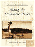
Along the Delaware River
by Richard C. Albert Carrie E. AlbertThe Delaware River has been home to steamboats and canoes, swimmers and fishermen, and shipyards and factories for generations. Recreation and industry have long coexisted along its changing banks. Along the Delaware River presents the Delaware River corridor-from Hancock, New York, in the Catskill Mountains, to the mouth of the Delaware Bay-at the beginning of the twentieth century. Postcards, many nearly a hundred years old, are used to show a river system that both resembles and differs greatly from the one we know today.
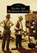
Along the Huerfano River (Images of America)
by Kay Beth AveryLong before English speakers set eyes upon it, the volcanic plug on the south bank of the Huerfano River was tagged with a moniker that means "the orphan." Spanish conquistadors saw it as a rock pile that God dumped in the middle of nowhere, an odd little cone far removed from the regular foothills edging the Sangre de Cristo Mountain Range. In the 18th century, this outcropping and the river that bears the same name were famous landmarks for Native American tribes, Hispanic explorers, and French adventurers. Then in the 19th century, along came US mountain men, gold-seekers, cowboys, sheep ranchers, railroad workers, town developers, and coal miners from 31 different countries, speaking 27 different languages. Counterculture revolutionaries discovered the area in the 1960s and established five separate communes west of Walsenburg. Each wave of immigrants brought new perspectives and lifestyles.
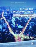
Along the Indian Highway: An Ethnography of an International Travelling Exhibition (Visual and Media Histories)
by Cathrine BublatzkyThis book is an ethnographic study of the travelling art exhibition Indian Highway that presented Indian contemporary art in Europe and China between 2008 and 2012, a significant period for the art world that saw the rise and fall of the national exhibition format. It analyses art exhibition as a mobile "object" and promotes the idea of art as a transcultural product by using participant observation, in-depth interviews, and multi-media studies as research method. This work encompasses voices of curators, artists, audiences, and art critics spread over different cities, sites, and art institutions to bridge the distance between Europe and India based on vignettes along the Indian Highway. The discussion in the book focuses on power relations, the contested politics of representation, and dissonances and processes of negotiation in the field of global art. It also argues for rethinking analytical categories in anthropology to identify the social role of contemporary art practices in different cultural contexts and also examines urban art and the way national or cultural values are reinterpreted in response to ideas of difference and pluralism. Rich in empirical data, this book will be useful to scholars and researchers of modern and contemporary art, Indian art, art and visual culture, anthropology, art history, mobility, and transcultural studies.
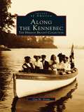
Along the Kennebec: The Herman Bryant Collection
by Gay M. GrantThis wonderful new book takes us back in time to visit the rural communities that thrived along the banks of the Kennebec River around the turn of the century--from Augusta and Gardiner down to Merrymeeting Bay on the coast. Local author Gay M. Grant has brought together more than two hundred beautiful photographs taken by gifted local photographer Herman Bryant between 1890 and 1936. This volume makes these photographs available to the public for the first time. The images bring to life the people, places, and events that defined the history of the area during this exciting era. We see the Kennebec River at its industrial peak, when industries such as lumber, paper, ice, and shipbuilding lined its banks. We encounter buildings such as Maine's old capitol building (before its refurbishment) and the Blaine House as it used to look. We witness terrible tragedies such as the train wreck of 1905, and share in local celebrations too. We experience the Age of Steam and the Age of Sail in their heyday. Most important of all, we meet the people who lived and loved, worked and played in these communities throughout this fascinating period. Through the pages of this book, our past reaches out to us.
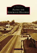
Along the Kirkwood Highway
by William FrancisThe Kirkwood Highway is an almost six-mile portion of State Route 2 in New Castle County, Delaware. Built as a bypass of Marshallton after the opening of Delaware Park at Stanton in 1937, it was meant to provide Wilmington-area horse-racing fans a straighter and faster route to the track. It is named after a distinguished officer of the American Revolution, Robert Kirkwood Jr., who was born at his family's farm along Polly Drummond Hill Road in Newark in 1756. Since it opened to automobile traffic, the highway has undergone numerous renovations and the scenery along its route has changed dramatically. Today, it is the fifth-busiest roadway in the state and is lined by shopping centers, national retailers, fast-food and chain restaurants, gas stations, subdivisions, and historic sites. Through vintage photographs, Along the Kirkwood Highway takes a nostalgic look back at the travel corridor, its cross streets, and familiar sites along its path.
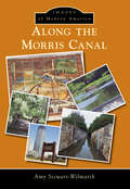
Along the Morris Canal
by Amy Stewart-WilmarthDug by hardworking men in the late 1820s, the Morris Canal is considered to be an engineering marvel. Comprised of 34 locks and 23 inclined planes, it created a waterway from the Delaware River in Phillipsburg, across northern New Jersey, and down into the Hudson River in Jersey City. It was drained in 1924, with its prisms mostly filled in. The 1960s brought a steadfast movement for the preservation of the largely buried Morris Canal, including the historic Silas Riggs Saltbox House being rescued from demolition and later the opening of the restored Waterloo Village. These challenging years set in motion the formation of organizations and societies dedicated to protecting, restoring, and preserving the Morris Canal. Through the persistent efforts and dedication of historians, canal enthusiasts, and neighboring communities, the Morris Canal and its buried history are gradually being unearthed. This book captures the Morris Canal's original pathway and its restoration and preservation accomplishments.
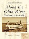
Along the Ohio River: Cincinnati to Louisville
by Robert Schrage Donald ClareThe Ohio River is not only a river of scenery and beauty, but also one of opportunity. It is a river of journey and exploration; a river of dreams, both personal and private; a river of commerce and enterprise. It is also a river of floods and destruction. Along the Ohio River: Cincinnati to Louisville journeys down this dynamic river. The postcard images show many riverfront scenes, from the cities along the way to excursion steamboats, river scenery, and the river at work.