- Table View
- List View
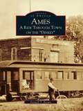
Ames: A Ride Through Town on the "Dinkey" (Images of America)
by Farwell T. BrownAmes has been referred to as a railroad town; more correctly the railroad established itself at the same moment that Iowa Agricultural College, now Iowa State University, was taking form. While the railroad helped to develop Ames, it was the college that drew people with names like Welch, Beardshear, "Tama Jim" Wilson, Charles F. Curtiss, and their successors. The flourishing academic community also drew families like the Loughrans and the Tildens, who were attracted by the positive town-gown relationship.In Ames: A Ride Through Town on the "Dinkey," readers will meet some of these people and tour historic Ames, as the narrow-gauge train nicknamed the "Dinkey" weaves its way through the city's history in over 220 vintage photographs. The images in this book, featuring people and landmarks both past and present, include Ames native J. Herman Banning, the first African-American aviator to be licensed in the U.S.; the dramatic 1922 burning and destruction of the Iowa State College Armory; a rare image of the 1895 Iowa State football team, the first to be called the Cyclones; and finally, downtown Ames' growth from dirt streets with wooden sidewalks to a modern college town.
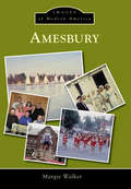
Amesbury (Images of Modern America)
by Margie WalkerIn 1968, Amesbury celebrated its 300th anniversary. Residents compiled a cookbook, commemorative coins were sold, dances and plays were held, and townspeople dressed in period costume as part of the many events for the town's tercentenary. Since then, Amesbury has grown considerably, with many new businesses--furniture makers, fine food products, Norman's Restaurant, and clothing shops--emerging. Old mills have been reinvented into spaces for artists, photographers, and other creative outlets. The downtown area has been redeveloped and is a welcoming site as one enters Amesbury. One only needs to sit in Market Square, stroll along the Riverwalk, watch the falls of the Powow River in the Millyard, or listen to a concert in the amphitheater to experience Amesbury's charm. Despite a 1996 vote changing the town into a city, this great community retains the same small-town feel it has held for so many years.
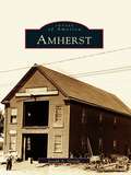
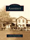
Amherst
by Joseph A. GrandeAmherst depicts the breathtaking evolution of a small farming community into a major economic, educational, and medical hub of western New York. The book reveals how Amherst's rich soils, rapid falls, and near-Buffalo location led to the community's great progress and growth. In a single century, the population rose from just over four thousand in 1900 to one hundred fifteen thousand in 2000. Today, the town includes the thousand-acre campus of the new State University of New York at Buffalo and the Amherst Museum, visited by more than fifty thousand people each year.
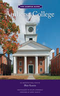
Amherst College: The Campus Guide (The Campus Guide)
by Blair KaminAmherst College: The Campus Guide is an architectural tour of one of North America's most prestigious liberal arts colleges. Founded in Western Massachusetts some two hundred years ago, the one thousand-acre campus is a living museum of architectural history, bearing the imprint of distinguished firms in architecture and landscape architecture: Frederick Law Olmsted; McKim, Mead & White; Benjamin Thompson; Edward Larrabee Barnes; Shepley Bulfinch; and Michael Van Valkenburgh. Organized as a series of six walks, the guide interweaves the history of the college with the story of the campus's development. Newly commissioned photographs and a hand drawn pocket map enhance this engaging journey through Amherst's architecture, landscape, interior design, and sculpture.
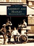
Amherst and Hadley, Massachusetts (Images of America)
by Daniel LombardoOnce part of Hadley, the town of Amherst is known the world over as the home of celebrated poet Emily Dickinson. This photographic portrait of Emily'ssurroundings reveals the beautiful landscape that inspired her art, and also includes less typical but nonetheless significant images of hard-working farmhands, Irish laborers, Italian peanut vendors, riotous college students, and feuding factory workers. These two towns at the heart of the Connecticut River Valley have been appreciated by poets and artists for many years, and their bucolic and pastoral character is celebrated in this marvelous new examination of the towns' historyin photographs from 1860 through the early twentiethcentury. Famous residents of and visitors to the area are featured, including Dickinson, Robert Frost, Henry Ward Beecher and Noah Webster. Mr. Lombardo's book combines a serious look at these historical figures with a humorous perspective on some of the area's more colorful characters, such as Charles King, the Amherst barber who became famous for eating fifty eggs in fifteen minutes.
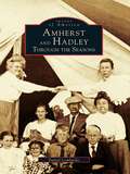
Amherst and Hadley: Through the Seasons (Images of America)
by Daniel LombardoNestled deep in the Connecticut River Valley areAmherst and Hadley, two New England towns responsible for the inspiration of many classic poets, writers, and thinkers of America. In Amherst and Hadley: Through the Seasons, the landscape changes continuously throughout the seasons. Each season brings its own natural beauty and dangers, from the scorching summers to the bitter winters.This photographic history offers a rare glimpse of Robert Frost's world of fire and ice. Visit a place where Ralph Waldo Emerson ate dinners with Emily Dickinson's family and see the site on which Noah Webster founded Amherst College. Look through a visual record of small towns, where the seasonal changes of the hills, fields, and woods inspired local writer Ray Stannard Baker and area photographer Clifton Johnson. Meander through a place that left fond memories in the hearts and minds of former Supreme Court Chief Justice Harlan Fiske Stone and writer Sylvia Plath.
Amherst: 1881-1982 (Images of America)
by Amherst Historical Society Donna M. Deblasio Martha I. PallanteEstablished in 1811, Amherst has been actively engaged in the quarrying of high-quality sandstone since before the American Civil War. The products of the town's quarries have graced buildings and other structures in the United States and around the world. The promise of work at the quarries drew potential employees from the surrounding countryside, as well as from across the ocean, giving the community's population its diverse character. This photographic history presents the unique and fascinating story of Amherst, the self-described "Sandstone Center of the World."
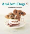
Ami Ami Dogs 2
by Mitsuki HoshiThis Amigurumi handbook is filled with new breeds of adorable miniature puppies. Photos inside reveal the secret, devilish world of your little friends, along with easy-to-follow patterns to help you create them. These sweet creatures are perfect additions to any Amigurumi collection. The world needs more Ami Ami Dogs
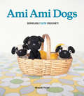
Ami Ami Dogs: Seriously Cute Crochet
by Mitsuki HoshiThis Amigurumi handbook is filled with adorable photographsof puppies and easy-to-follow patterns to help youcreate them. Treat yourself to a darling friend to cuddle up with,make an entire family of puppies, or gift one to a loved one.The world needs moreAmi Ami Dogs
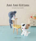
Ami Ami Kittens: Seriously Cute Crochet!
by Mitsuki HoshiThe third colorful and imaginative installment in the illustrated amigurumi series, following Ami Ami Dogs and Ami Ami Dogs 2. Amigurumi, which translates to knitted stuffed toy in Japanese, is the art of crocheting cute stuffed animals with large heads and small bodies. Ami Ami Kittens is packed with projects for all crochet lovers offering them directions and inspiration for creating a range of fun and irresistible yarn kittens. Detailed, easy-to-follow instructions, illustrations, and enchanting color photographs teach them how to create these super adorable felines of various breeds and types, including Tabby, Pointed, Black/White Solid, Black and White, Calico, Scottish Fold, Siamese, Russian Blue, Munchkin, Maine Coon, British Shorthair, and American Shorthair. Here, too, are instructions for transforming them into key chains, finger puppets, and magnets. Ami Ami Kittens covers a wide range of techniques, from basic crochet skills perfect for beginners to more challenging patterns for experts, and offers spiral methods to ensure that the stuffing stays inside the finished piece. Filled with pretty, fun, and irresistibly adorable young cats, Ami Ami Kittens provides hours of fun for every knitter-and cat lovers, too.
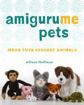
AmiguruME Pets: Make Cute Crochet Animals
by Allison HoffmanCrochet yourself a cute pet with the irresistible art of amigurumi! Amigurumi is the Japanese art of crocheting small, adorable, stuffed animals and creatures—and this collection delivers on the sweetness. Crochet more than 60 projects, including dogs (Chihuahua, Yorkshire Terrier, Toy Poodle, Pug, Bulldog, Corgi), cats (American shorthair, Maine Coon, Siamese), small pets (like rabbits and turtles), pets we wish we could own (T-Rex, unicorn, and dragon), as well as accessories (beds, bowls, leashes) to complement your pets. The dog and cat sections include recipes for individual body parts with information on how to combine the components. A helpful dog and cat breed guide will show you which parts to combine to create a specific breed or even designer breed (Goldendoodle, Puggle, Yorkipoo), or use your imagination to create your own unique and lovable mixed breed. All other projects include specific patterns for each animal. Give them as gifts . . . or keep them to snuggle yourself! Most patterns are created to scale with the dolls from AmiguruME, so make a best friend for your AmiguruME doll to enjoy.
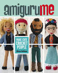
AmiguruME: Make Cute Crochet People
by Allison HoffmanMake a miniature version of you, your friends, and celebrities too! Youll absolutely love this comprehensive guide to creating amigurumi people. Media favorite Allison Hoffman—whose delightful creations have graced the sets of Conan, Martha Stewart, Jimmy Kimmel Live!, and more—explains how to craft and customize these Japanese dolls at every stage. Youll learn everything from depicting the face of the person youre designing to getting the clothing, hair, and accessories just right. The possibilities are infinite . . . and infinitely fun!
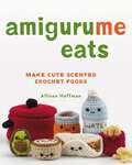
AmiguruMe Eats: Make Cute Scented Crochet Foods
by Allison HoffmanAmiguruMe Eats serves up a buffet of projects that recreate the look, scents, and textures of your favorite foods! This irresistible collection of 40 food-themed amigurumi makes a delicious treat for crafters. Perfect for beginners, it offers a menu of charming projects, including a plate of pancakes served with strips of bacon, a sandwich (with your filling of choice), and a full dinner of spaghetti and meatballs, a freshly crocheted salad, and a slice of pie. There are even patterns for kitchen accessories, from a lunch box that opens and closes to a miniature pot with a removable lid. Every project features instructions for adding scent using wax melts or common household items like herbs and coffee beans, and there's plenty of guidance on creating fun variations and customizing your creations. Crochet novices will be able to tackle these super-cute items in no time with the help of the &“Getting Started&” section, illustrated with step-by-step photos.
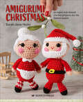
Amigurumi Christmas
by Sarah-Jane HicksDo you love to decorate your home and make wonderful Christmas decorations for all your family and friends to enjoy? Then this is the book for you. It will delight and surprise with its fantastically cute, kawaii-style crocheted Christmas cuties. There are 20 great projects to make, including a wonderful Santa Claus accompanied by a lovely Mrs Claus; a cute penguin, polar bear and gingerbread man; Brussels sprouts, Christmas angel and even pigs in blankets! With a short techniques section at the beginning to explain the basics, these projects can be worked up quickly and easily using small amounts of yarn in your stash. You can even customize some of the projects if you wish and make Santa, the elf or the snowman's head into baubles with a short piece of yarn to hang them up. Whether you make these for your family or as gifts for friends, now is the time to pick up your hook and get crocheting amigurumi style!
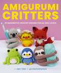
Amigurumi Critters: 25 Imaginative Crochet Designs for All Skill Levels
by Amy TingUnleash your creativity and find your next crochet project! With step-by-step instructions, every stitch brings an adorable creature to life.The brilliant creative mind of Amy Ting, a well-known individual in the needle work community, brings you Amigurumi Critters – a book for every yarn enthusiast. This guidebook contains all the knowledge you need to make a collection of stuffed animals. Tiny penguins, adorable capybaras, playful pandas and other lovable plushies are waiting to be crafted!Inside you&’ll find:25 pattern instructions with helpful tips on technique and materialsFull-color photographs for referencesEducation on basic skills to improve personal customizationDesigns that cater to all skill levels from beginners to experts Whether you&’re a needle novice or an advanced crafter, Amigurumi Critters will not disappoint. Grab your crochet hook and your favorite yarn and bring some cuteness to your life with this charming collection of handmade companions!
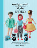
Amigurumi Style Crochet: Make Betty & Bert and Dress Them In Vintage Inspired Crochet Doll’s Clothes and Accessories (Crafts Ser.)
by Cara MedusCrochet cute and quirky dolls that explore the fun side of the 1950s. Boudoir Betty is a must-see! Crochet Betty, an amigurumi-style doll, with patterns for her fifties outfits ranging from shopping to movie-going. There&’s a detailed explanation of how to make the basic doll Betty, as well as her cute cat Bert. Each section has patterns for a selection of stylish removable garments and accessories on a fifties theme, with a few added extras for Bert too. Come with Betty as she channels her inner Audrey Hepburn at the movies or takes off on holiday in the glamorous footsteps of Grace Kelly.Praise for Amigurumi Style Crochet&“This little slip of a book from crochet designer Medus will delight crafters. Using the Japanese style of amigurumi, which involves &“working in a spiral without closing off each round with a slip stitch,&” Medus presents plans for creating two dolls, Betty, a &“1950s housewife, stylish to a tee&” and her cat, Bert, along with accessories for both. . . . Medus provides shortcuts that make creating Betty somewhat easier. . . . It&’s this attention to detail that makes the book enjoyable.&” —Publishers Weekly
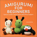
Amigurumi for Beginners: Learn to Crochet Creative Figures with 20 Easy Patterns
by Julia SimpsonCreate beautiful amigurumi critters—even if you've never crocheted before!Amigurumi is the Japanese art of crocheting stuffed toys—and it's easy to make your own with this fun project book for beginners! Inside, you'll find expert guidance and stitch-by-stitch instructions to help you craft adorable amigurumi, from pudgy penguins to four-limbed foxes. Crochet for beginners—Find photos of every creature along with tips for the essential supplies and techniques, so you can jump right into amigurumi, no experience necessary. Cute and cuddly patterns—Build a whole menagerie of creatures to keep, gift, and share with 20 patterns for cats, dogs, frogs, and more. Grow your skills—All of these projects are designed for beginners, but still offer a range of complexity so you can get better at crochet as you work through the book. Begin your journey into the whimsical world of amigurumi with this crochet book for beginners.
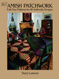
Amish Patchwork: Full-Size Patterns for 46 Authentic Designs (Dover Quilting)
by Suzy LawsonThis treasury of Amish patchwork artistry will introduce quilting enthusiasts to a wealth of traditional designs as ingenious as they are beautiful. Based on concepts and unwritten rules that have long governed Amish quiltmaking, most of these lovely patterns date from the late 1800s to the early 1930s.Ms. Lawson, a well-known quilt designer, first devotes a chapter to Amish color combinations, color suggestions, and possible decorative combinations. She then goes on to offer expert advice on borders, patterns, quilting, backing and binding, and more.Dimensions, full-size patterns, and over 100 black-and-white illustrations show how to make 48 beautiful Amish-style quilts, including such intriguing examples as "Botch Handle," "Hole in the Barn Door," "Sunshine and Shadow," and "Wild Goose Chase." In addition, you'll find patterns and instructions for creating such favorite quilting designs as teardrops, feathers, cables, stars, baskets, and floral and foliate motifs.Often spectacular, embodying an amazing diversity of patterns and combinations, Amish quilts are among the most sought-after of all quilting patterns. This book provides a comprehensive, inexpensive source of Amish quilt motifs geared to needleworkers at all levels of expertise.
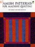
Amish Patterns for Machine Quilting
by John W. Lee Pat HollyAn easy-to-follow guide translates traditional hand-quilted Amish designs into convenient sewing machine patterns. The 83 heirloom-quality designs -- including flowers, feathers, cables, baskets, stars, and more -- can be adapted in size, shape, or any other aspect. A brief history of the Amish, diagrams, and simple instructions are included.
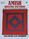
Amish Quilting Patterns: 56 Full-Size Ready-to-Use Designs and Complete Instructions
by Joe Cunningham Gwen MarstonAuthentic Amish quilting patterns are among the most sough-after quilting styles today. Elegant and graceful, these eye-catching designs are widely recognized as a unique art form. Now with this useful guide, prepared by two noted quilt designers and teachers, needleworkers at all levels of expertise can re-create many popular Amish motifs passed down from generation to generation.Over 50 full-size, ready-to-use templates provide attractive designs for feathers, flowers, pinwheels, tulips, cables, pumpkin seeds, a star, and much more. Easy-to-follow instructions and numerous diagrams allow beginning as well as advanced quilters to undertake a variety of projects, while an informative introduction points out the differences between Lancaster County and Midwestern Amish styles.Useful for creating repeating borders, centers, corners, and overall patterns for full-size bedcovers, these classic designs can also be used individually to embellish pillows, cushions, and countless other domestic items.
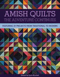
Amish Quilts, The Adventure Continues: Featuring 21 Projects from Traditional to Modern
by Lynn KoolishThis volume features 21 Amish-inspired quilts by some of today's top quilt designers—with simple patterns showing off beautiful solid fabrics.Thirty years after Roberta Horton’s classic, An Amish Adventure, introduced quilters to the joys of Amish quilting, the editors at C&T Publishing are proud to bring you the adventure's next chapter. Along with the 21 featured quilt projects, this volume includes a gallery of 17 more beautiful quilts and an introduction by Roberta herself on what makes a quilt Amish.Some of the quilt projects in this volume use traditional 19th-century patterns. Others offer distinctly modern takes on Amish ideas. They all celebrate the simplicity, the bold geometry, and the rich dark fabrics that give Amish quilts their ageless appeal.
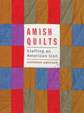
Amish Quilts: Crafting an American Icon (Young Center Books in Anabaptist and Pietist Studies)
by Janneken SmuckerThe definitive study on the history, meaning, art, and commerce of Amish quilts.Second Place Winner of the Design and Effectiveness Award of the Washington PublishersQuilts have become a cherished symbol of Amish craftsmanship and the beauty of the simple life. Country stores in Lancaster County, Pennsylvania, and other tourist regions display row after row of handcrafted quilts. In luxury homes, office buildings, and museums, the quilts have been preserved and displayed as priceless artifacts. They are even pictured on collectible stamps. Amish Quilts explores how these objects evolved from practical bed linens into contemporary art.In this in-depth study, illustrated with more than 100 stunning color photographs, Janneken Smucker discusses what makes an Amish quilt Amish. She examines the value of quilts to those who have made, bought, sold, exhibited, and preserved them and how that value changes as a quilt travels from Amish hands to marketplace to consumers. A fifth-generation Mennonite quiltmaker herself, Smucker traces the history of Amish quilts from their use in the late nineteenth century to their sale in the lucrative business practices of today. Through her own observations as well as oral histories, newspaper accounts, ephemera, and other archival sources, she seeks to understand how the term "Amish" became a style and what it means to both quiltmakers and consumers. She also looks at how quilts influence fashion and raises issues of authenticity of quilts in the marketplace.Whether considered as art, craft, or commodity, Amish quilts reflect the intersections of consumerism and connoisseurship, religion and commerce, nostalgia and aesthetics. By thoroughly examining all of these aspects, Amish Quilts is an essential resource for anyone interested in the history of these beautiful works.
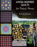
Amish-Inspired Quilts for Today's Home: 10 Brilliant Patchwork Quilts
by Carl HentschThe noted quilt designer shares his love of Amish craftsmanship with 10 new patchwork quilt patterns in this step-by-step guide.Carl Hentsch has always admired Amish quilts and quilters. Living only a short distance from an old-order Amish community has allowed him to explore their world, meet some of the quilters themselves, and more fully appreciate their ability to create beautiful quilts without the use of electricity. Amish-Inspired Quilts for Today’s Home explores their use of color and design in 10 quilts using modern fabrics and techniques. Ranging from easy to challenging, these projects offer beautiful bursts of color in blocks such as Basket, Log Cabin, and Star.
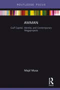
Amman: Gulf Capital, Identity, And Contemporary Megaprojects (Built Environment City Studies)
by Majd MusaGulf capital flows to Amman, Jordan, in the early twenty-first century and the investment of this capital in large-scale urban developments have significantly transformed the city’s built environment. Therefore, to understand urban transformation in Amman during this period it is important to analyze it against the backdrop of Gulf capital and its integration into Jordan’s economy and the integration of both the country’s economy and Gulf capital into the global capitalist economy. This book analyzes three cases of megaprojects planned for the city in the early twenty-first century: The New Downtown (Abdali), Jordan Gate, and Sanaya Amman. Drawing upon theories on urban development and capitalism, identity, and discourse, and urban development processes and cases in other cities, the book investigates how contemporary megaprojects in Amman fit into the capitalist economy and its modes of production, how capital flows construct a modern image of the city, and how the new image and megaprojects represent the city residents as modern and create Amman as a global city. This book presents a new approach to the study of the urban built environment in Amman, providing a valuable interdisciplinary contribution to the scholarly work on globalizing cities, especially in the Middle East.
Among Cannibals: An Account Of Four Years' Travels In Australia And Of Camp Life With The Aborigines Of Queensland
by Carl LumholtzCarl Lumholtz’s "Among Cannibals: An Account of Four Years' Travels in Australia and of Camp Life" is a riveting and detailed chronicle of the author’s extraordinary explorations in the remote regions of Australia during the late 19th century. This classic work offers a captivating insight into the diverse landscapes, cultures, and experiences encountered by Lumholtz during his extensive travels.Lumholtz, a renowned Norwegian explorer and ethnographer, embarked on his journey with the goal of studying the indigenous peoples of Australia, particularly those living in the most isolated and unexplored areas. His narrative vividly describes the challenges and triumphs of living in the Australian wilderness, from the dense rainforests of Queensland to the arid outback.Central to "Among Cannibals" is Lumholtz’s deep engagement with the Aboriginal communities he encounters. His empathetic and respectful approach to understanding their way of life, customs, and beliefs provides readers with a nuanced and humanizing portrayal of these cultures.Lumholtz’s narrative is not only a valuable ethnographic record but also an adventurous travelogue that captures the reader’s imagination. His encounters with wildlife, the natural beauty of the Australian landscape, and the everyday challenges of camp life are described with vivid detail and a keen sense of wonder."Among Cannibals" is a seminal work in the fields of anthropology and exploration, offering timeless insights into the lives of Australia’s indigenous peoples and the spirit of adventure that drove explorers like Lumholtz. This book remains an essential read for anyone interested in anthropology, Australian history, and the enduring allure of exploration.