- Table View
- List View
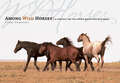
Among Wild Horses: A Portrait of the Pryor Mountain Mustangs
by Hope Ryden Lynne PomeranzSee the wild horses run! The Pryor Mountain Mustangs have roamed the high desert and mountains of the American West for centuries. Descended from steeds brought over by the Spanish conquistadores, their untamable nature and enduring courage inspire awe in all who have the chance to see them. Photographer Lynne Pomeranz spent two years with these magnificent creatures along the Montana-Wyoming state line, and her startlingly intimate photographs capture the resilience and free spirit that define these mustangs.
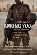
Among You: The Extraordinary True Story of a Soldier Broken by War
by Jake WoodAmong You is the gripping real-life story of a soldier serving on the front line in Iraq and Afghanistan, and an unforgettable, unflinching account of the effects of post-traumatic stress disorder.Jake Wood lives parallel lives: encased in the glass tower of an international investment bank by day, he is also a dedicated TA soldier who serves on the front line during the invasion of Iraq, later returning to the war zone to conduct surveillance on insurgents. Disillusioned with the dullness and amorality of the banking world, he escapes back to the army for a third tour of duty. But in Afghanistan he discovers the savage, dehumanising effects that war has on both the body and the mind. Diagnosed with chronic PTSD on his return, he must now fight the last enemy – himself – in order to exorcise the ghosts of his past.Brutally honest and beautifully written, Among You brings home the harsh reality of front-line combat in Iraq and Afghanistan, and the courage of the troops who risk their lives for their country, as well as revealing the devastating after-effects of service.
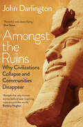
Amongst the Ruins: Why Civilizations Collapse and Communities Disappear
by John DarlingtonAmongst the Ruins explores the loss of ancient civilizations, the collapse of ruling elites, and the disappearance of more recent communities and their local traditions. Some of these are now sealed under 3,000-year-old peat, others lost to rising seas or sands, and the carcasses of twentieth-century buildings which serve as reminders of the destructive power of war. These compelling stories of fallen or lost places are brought together through themes of war, climate change, natural hazards, human self-destruction, and simple economics. From the ice of the Arctic fringe, through to the desert landscapes of North Africa, by way of South America&’s high mountains and Southeast Asia&’s urban sprawl, Amongst the Ruins charts the rise and fall of places and communities around the world, the fascinating characters associated with them, and the important events that punctuate their history. Exploring wide-ranging examples from prehistory to the present day, John Darlington challenges us to recognize past failures and identify what we need to do to protect the cultures of our current world.
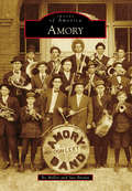
Amory (Images of America)
by Bo Miller Sue BrownIn November 1887, the Kansas City, Memphis & Birmingham Railroad (KCM&B)--later the St. Louis-San Francisco Railroad, or "Frisco"--established a new town as a halfway point on its route between Memphis and Birmingham. The town was named Amory in honor of Harcourt Amory, a prominent Bostonian and railroad executive. The 500 acres the railroad purchased from Amanda Owen were surveyed and drawn into plots parallel to the railroad tracks, creating Mississippi's first planned community. Amory prospered as men like E.D. Gilmore and Archibald Dalrymple moved to town and opened up shop. Businesses and homes from nearby Cotton Gin Port on the Tombigbee River were moved to Amory to be part of the growing town. The garment industry played a vital part in Amory's development, as the Glenn and Longenecker families established factories that made the town known as the "Pants Capital of the World." Today, the community is home to a regional medical center, top-rated schools, and a diverse mixture of retail and industrial businesses.
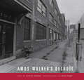
Amos Walker's Detroit: Amos Walker's Detroit
by Loren D. Estleman Monte NaglerA photographic tour of famous and infamous Detroit-area locations from Loren D. Estleman's popular Amos Walker series of detective novels.
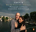
Amour: How the French Talk About Love--Photographs and Stories
by Stefania RousselleFrom award-winning journalist and filmmaker Stefania Rousselle, a stunning collection of photographs and essays that seek to understand the universality of love Journalist and filmmaker Stefania Rousselle found herself overwhelmed and dejected with the horrors of the news after covering terrorist attacks, human trafficking, and the rise of extremism. To renew her faith in humanity, she took off on a solo road trip across France, determined to see if love still exists. Traveling from village to village, farming towns to industrial cities, heart to heart, Rousselle sought out ordinary women and men, all to ask them one question, What is love?Collecting more than 90 personal testimonies, each one moving and beautiful in its own way, alongside over 100 intimate photographs, Rousselle reveals the many facets of love, and discovers that love can still be found even in the darkest of places. From a baker in Normandy to a shepherd in the Pyrenees, from a tree trimmer in Martinique to a mail woman in the Alps, Amour is a visual testament to love in all its many forms.
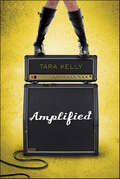
Amplified
by Tara KellyWhen privileged 17-year-old Jasmine gets kicked out of her house, she takes what is left of her savings and flees to Santa Cruz to pursue her dream of becoming a musician. Jasmine finds the ideal room in an oceanfront house, but she needs to convince the three guys living there that she's the perfect roommate and lead guitarist for their band, C-Side. Too bad she has major stage fright and the cute bassist doesn't think a spoiled girl from over the hill can hack it. . . .In this fresh new novel by critically acclaimed author Tara Kelly, Jasmine finds out what happens when her life gets Amplified.
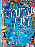
Amplified Art: Dynamic Techniques for High-Impact Pages
by Kass HallCreate art with a visual impact!Discover how to express yourself loud and proud with the help of Amplified Art. In this fiercely fun technique book, you'll learn to create art journal pages that pop, using step-by-step instruction for adding arresting color, high contrast graphic elements and dynamic hand-lettering!Learn an easy method for creating your own collage papers using the Gelli Plate, stencils, paint, stamps and moreDevelop visually-grabbing handwritten fontsCreate whimsical faces (even if you think you can't draw a face!)Experiment with processes for working in both black and white as well as limited color palettes and moreExperiment, play and express yourself boldly with Amplified Art!
Amputation in Literature and Film: Artificial Limbs, Prosthetic Relations, and the Semiotics of "Loss" (Literary Disability Studies)
by Maren Scheurer Erik GraysonAmputation in Literature and Film: Artificial Limbs, Prosthetic Relations, and the Semiotics of “Loss” explores the many ways in which literature and film have engaged with the subject of amputation. The scholars featured in this volume draw upon a wide variety of texts, both lesser-known and canonical, across historical periods and language traditions to interrogate the intersections of disability studies with social, political, cultural, and philosophical concerns. Whether focusing on ancient texts by Zhuangzi or Ovid, renaissance drama, folktales collected by the Brothers Grimm, novels or silent film, the chapters in this volume highlight the dialectics of “loss” and “gain” in narratives of amputation to encourage critical dialogue and forge an integrated, embodied understanding of experiences of impairment in which mind and body, metaphor and materiality, theory and politics are considered as interrelated and interacting aspects of disability and ability.
Amsterdam
by Robert H. von Hasseln Gerald R. SnyderIn the 1700s, Amsterdam was just a small trading village in upstate New York. Utilizing its superior location astride critical waterways, the village grew during the westward expansion of the early 1800s to become an industrial powerhouse. By the 20th century, Amsterdam had become America's foremost rug-making center, nicknamed the "Carpet City," and the seventh largest city in New York. Waves of Dutch, German, Irish, Italian, and eastern European immigrants were drawn to the city for work. Some became mill workers while others became millionaires. The vintage postcards in Amsterdam tell the story of an American dream created, lost, and still pursued on what was once America's frontier.
Amsterdam’s Canal District: Origins, Evolution, and Future Prospects
by Jan NijmanIn terms of design, scale, and blending of ecologicical and aesthetic function, Amsterdam’s seventeenth-century Canal District is a European marvel. Its survival for four centuries is a testament to its ingenuity, reflected in its designation as a UNESCO World Heritage Site in 2010. The Canal District today is an extraordinary example of resilient historic design and cultural heritage in a living city, but it is not without present-day challenges: in recent years, its urban ecology has become subject to severe pressures of global tourism and supergentrification. This edited volume brings together seventeen reputable scholars to debate questions about the origins, evolution, and future of the Canal District. With these differing approaches and perspectives, on the Canal District, the contributions render a collection where the whole is much more than the sum of the parts. The book breaks new ground in our understanding of the District’s historic design, its evolution over four hundred years, and the fundamental issues in future-facing strategies and policies towards the future. While the main focus is clearly on Amsterdam, the discussions in this collection have an important bearing on broader questions of urban historic preservation elsewhere, and on questions about enduring urban design.
Amulets and Talismans: Simple Techniques for Creating Meaningful Jewelry
by Tonia Davenport Robert DancikMaking Jewelry with MeaningThe things you collect - the ticket stubs, the coins, the pieces of shell from a beach - hold meaning and significance, reminding you not only where you've been, but also where you're capable of going. Making these items into wearable pieces of art - amplifying their power to become amulets and talismans - is a rewarding experience that's easy to do.Working with the most basic of tools, you will learn cold-connection jewelry techniques to expand your creative process. In addition to basics like creating jump rings and using a file, you will also:Make your own hook and latch claspsCut windows from sheets of metalInlay designs into polymer clayIncorporate concrete into your workAchieve patinas with heatJournal your thoughts onto faux boneTurn paper pulp into realistic rocksCreate "time capsule" beads from PlexiglasAnd much, much more!Discover the rewards of making your own amulets and talismans by learning new techniques to drive your creativity in an entirely new direction.
Amusing Ourselves to Death: Public Discourse in the Age of Show Business (Colección Ideas/tempestad Ser. #Vol. 2)
by Neil Postman Andrew PostmanWhat happens when media and politics become forms of entertainment? As our world begins to look more and more like Orwell's 1984, Neil's Postman's essential guide to the modern media is more relevant than ever."It's unlikely that Trump has ever read Amusing Ourselves to Death, but his ascent would not have surprised Postman.” -CNNOriginally published in 1985, Neil Postman’s groundbreaking polemic about the corrosive effects of television on our politics and public discourse has been hailed as a twenty-first-century book published in the twentieth century. Now, with television joined by more sophisticated electronic media—from the Internet to cell phones to DVDs—it has taken on even greater significance. Amusing Ourselves to Death is a prophetic look at what happens when politics, journalism, education, and even religion become subject to the demands of entertainment. It is also a blueprint for regaining control of our media, so that they can serve our highest goals.“A brilliant, powerful, and important book. This is an indictment that Postman has laid down and, so far as I can see, an irrefutable one.” –Jonathan Yardley, The Washington Post Book World

Amy Butler's Blossom
by Amy ButlerAmy Butler's Blossom magazine is a biannual collection of everything that inspires her: page after page of photographs from her travels to spiritual locales such as Morocco and Sedona; meditative articles from like-minded designers, artists, and life coaches; the signature designs and textiles that she creates from these inspirations; plus her ongoing exploration of positive and joyful living. Now available in print for the first time, this irresistible look-book compiles the first two issues of the magazine. Brimming with photographs, fashion, art, patterns, and written pieces that reflect Amy's unique philosophy of life and style, Blossom will capture the imagination of anyone in search of beauty and meaning.
Amy Butler's Blossom: Create Love - Express Beauty - Be Kind
by Amy ButlerAmy Butler's Blossom magazine is a biannual collection of everything that inspires her: page after page of photographs from her travels to spiritual locales such as Morocco and Sedona; meditative articles from like-minded designers, artists, and life coaches; the signature designs and textiles that she creates from these inspirations; plus her ongoing exploration of positive and joyful living. Now available in print for the first time, this irresistible look-book compiles the first two issues of the magazine. Brimming with photographs, fashion, art, patterns, and written pieces that reflect Amy's unique philosophy of life and style, Blossom will capture the imagination of anyone in search of beauty and meaning.
Amy Butler's In Stitches: More Than 25 Simple and Stylish Sewing Projects
by Colin Mcguire Amy ButlerCelebrated designer Amy Butler brings her fresh, modern style to the timeless craft of sewing. In this lavishly illustrated collection of patterns, she presents more than 25 charming projects ranging from cushy floor cushions to smart aprons to stylish handbags. Lush photographs inspire, while how-to illustrations and straightforward text (minus the confusing sewing lingo) make it a cinch to achieve beautifully finished projects. In addition, Amy offers thoughtful tips on finding and treating new or vintage fabrics, an easy-to-navigate techniques section, and a glossary and resource guide at back. Whether it's chic placemats and napkins for the kitchen, a luxurious kimono-style robe for the bath, or handy organizer baskets for the home office Amy Butler's In Stitches makes it easy to create beautiful accessories for every room and every mood.
Amy Butler's Little Stitches for Little Ones: 20 Keepsake Sewing Projects for Baby and Mom
by Amy ButlerIn this illustrated collection, the fabric designer shares twenty charming, contemporary projects for the nursery and beyond. Amy Butler’s Little Stitches for Little Ones features twenty handmade treasures that are destined to become cherished hand-me-downs for generations to come. There’s a snuggly wrap blanket, imaginative plush toys, bright diaper bags, handy travel bibs, and much more. Beautiful photos inspire, while illustrations and simple instructions explain the techniques. Amy also shares tips on choosing baby-friendly fabrics and includes a comprehensive techniques section, glossary, and resource guide. With her eye for detail and her signature fine craftsmanship, Amy has created a delightful selection of handcrafted keepsakes.
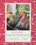
Amy Butler's Piece Keeping: 20 Stylish Projects that Celebrate Patchwork
by Amy ButlerIn this project-based sewing book, Amy Butler teaches what she does best: sewing, quilting, and pattern making. From lampshades to pillows, quilts to statement jewelry, Piece Keeping is the perfect go-to for the crafty. With clear sections on traditional sewing themes, tools, and methods, this book will appeal to Amy's core fans as well as those simply drawn to beautiful fabrics and DIY projects. The 20 inspiring projects include dozens of how-to diagrams, plus 9 downloadable patterns. Piece Keeping is both a practical guide and a source for stylish home décor and fashion inspiration, brimming throughout with Amy's unique color sense and eye-catching textile designs.
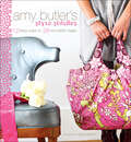
Amy Butler's Style Stitches: 12 Easy Ways to 26 Wonderful Bags
by Amy ButlerIn this illustrated sewing guide, the celebrated designer shares twelve new patterns with loads of variations for stylish bags of all kinds.With the patterns in Amy Butler’s Style Stitches, you can create everything from chic clutches and delicate wristlets to pretty hobo bags and handy coin purses. Each project is designed with Butler’s fresh, modern style and attention to detail. She also includes easy-to-follow instructions for altering dimensions, straps, and embellishments so you can make each piece truly your own.This ebook includes illustrated step-by-step directions, a comprehensive techniques section, and instructions for how to print the patterns themselves, making an essential and fashionable addition to every sewer’s digital library.
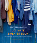
Amy Herzog's Ultimate Sweater Book: The Essential Guide for Adventurous Knitters
by Amy HerzogA comprehensive guide to knitting sweaters and designing and modifying sweater patterns, by the author of You Can Knit and Knit to Flatter.Yarn and fiber enthusiasts everywhere will celebrate the latest addition to Amy Herzog’s beloved knitting series (which includes You Can Knit That, Knit to Flatter, and Knit Wear Love). This essential guide details every aspect of sweater knitting, starting with instructions for four basic sweater types: yoke, raglan, drop shoulder, and set-in sleeve. Patterns are offered in multiple sizes and yarn gauges for broad appeal. Following the basics for each of the four sweater types are a diverse range of customizing options, including how to add a hood, cowl neck, turtleneck, pockets, and zip or cardigan front, just to name a few. Amy’s clear instruction and expert tips expand the many knitting possibilities, creating the essential knitting resource for knitters everywhere.
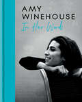
Amy Winehouse: In Her Words
by Amy WinehouseThe Estate of Amy Winehouse will donate 100% of the advance and royalties it receives from the production and sale of this book to The Amy Winehouse Foundation. These funds will help assist the charity in continuing their vital work helping thousands of young people to feel supported in managing their emotional wellbeing and making informed life choices.*Global iconSix-time Grammy winnerHeadline-makerThe most talented recording artist of her generationMuch has been said about Amy Winehouse since her tragic death aged at age 27. But who was the real Amy?Amy Winehouse: In Her Words shines a spotlight on her incredible writing talent, her wit, her charm and lust for life. Bringing together Amy’s own never-before-seen journals, handwritten lyrics and family photographs together for the first time, this intimate tribute traces her creative evolution from growing up in North London to global superstardom, and provides a rare insight into the girl who became a legend.* The Estate of Amy Winehouse will donate 100% of the advance and royalties it receives (net of agency fees charged) from the production and sale of this book to The Amy Winehouse Foundation (registered charity number1143740). The minimum donation will be £70,000. Initiatives include Amy’s Place, which provides addiction recovery housing for young women; resilience-building programs in schools and music therapy programs supporting children with special educational needs and life-limiting conditions. More information can be found at https://amywinehousefoundation.org.
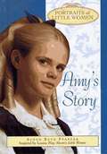
Amy's Story (Portraits of Little Women)
by Susan Beth PfefferBeautiful Amy March, the youngest March sister, is a talented artist. Everyone praises her lifelike portraits. The one person she can't draw is herself. So when a photographer's studio opens in town, Amy is thrilled. Now her pretty blond curls and piercing blue eyes can be captured forever in a photograph. A photograph costs quite a bit of money -- more than she has, and more than her parents can give her. Amy thinks of a clever way to come up with the money... and soon she has enough. But she decides to spend her savings on a gift for her father -- a gift that will warm his heart when he's far away from home, and that ultimately gives Amy an unexpected gift in return.
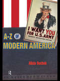
An A-Z of Modern America
by Alicia DuchakAn A-Z of Modern America is a comprehensive cultural dictionary which defines contemporary America through its history and civilization. The book includes entries on:key people from presidents to Babe RuthAmerican life, customs, clothing and educationlegal, religious and governmental practicesmulticulturalism, minorities and civil rightsAn A-Z of Modern America offers accessible and lively definitions of over 3,000 separate items. The book is cross-referenced and thus provides associated links and cultural connections while the appendices contain essential extra information on American institutions, structures and traditions.
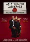
An Absolute Casserole: The Taskmaster Compendium
by Alex HorneHow many eggs have been broken in the making of this programme? What is the worst thing Alex has eaten? Are you more likely to win Taskmaster if you wear a hat? Why is the Taskmaster always right?This hilarious compendium celebrates a decade of Taskmaster's inspired chaos. Relive the most outrageous tasks, iconic meltdowns, and ingenious victories from your favourite contestants.Inside you'll find: - Unforgettable challenges: From the brilliantly bizarre to the wonderfully pointless, revisit the tasks that left us howling with laughter. - Comedy gold moments: Contestant blunders, inspired madness and Greg Davies' withering put-downs - Behind the scenes: Get the inside scoop on the show's creation, meet the show's creators and find out which tasks nearly set the Taskmaster house on fire. - Statistical analysis: 17 series, 85 contestants and thousands of smashed eggs - what's the best star sign to be if you want to win? This is the ultimate gift for any Taskmaster fanatic. So grab a cup of 'warm milk' (or something stronger) and relive ten years of comedic chaos!
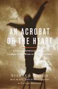
An Acrobat of the Heart: A Physical Approach to Acting Inspired by the Work of Jerzy Grotowski
by Stephen Wangh"The actor will do, in public, what is considered impossible. " When the renowned Polish director Jerzy Grotowski began his 1967 American workshop with these words, his students were stunned. But within four weeks they themselves had experienced the "impossible. " In An Acrobat of the Heart, teacher-director-playwright Stephen Wangh reveals how Jerzy Grotowski's physical exercises can open a pathway to the actor's inner creativity. Drawing on Grotowski's insights and on the work of Stanislavski, Uta Hagen, and others, Wangh bridges the gap between rigorous physical training and practical scene and character technique. Wangh's students give candid descriptions of their struggles and breakthroughs, demonstrating how to transform these remarkable lessons into a personal journey of artistic growth. Courageous and compelling, An Acrobat of the Heartis an invaluable resource for actors, directors, and teachers alike.