- Table View
- List View
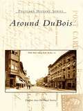
Around DuBois (Postcard History Series)
by DuBois Area Historical SocietyPrior to the 1870s, DuBois was a forest settlement with only a handful of families living in the area. John DuBois changed that when he settled in the area and created one of the largest lumber industries in the state. In less than two decades, a thriving town had sprung up. A devastating fire in 1888 destroyed the business district; however, as businesses such as coal mining, iron ore, and sandstone continued to grow, the area was rebuilt. With the expansion of the railroad, surrounding towns began to develop. Through rare photographs and early postcards, Around DuBois provides glimpses of industries such as the lumbermill, the area coal mines, the stone quarry of Falls Creek, the Van Tassell Tannery, the Brewery, and the Buffalo, Rochester, and Pittsburgh Railroads. Also included are images of events and people who left their mark on the area, including celebrities such as Thomas Edison, noted painter Richard Burfoot, and cowboy star of silent movies Tom Mix.
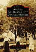
Around Egg Harbor City and Pleasantville (Images of America)
by Dennis M. NicelerWhen the Germans came to Atlantic County in 1855, they imagined a community with an urban center surrounded by a farm district. This would be a great industrial and agricultural community, served by direct railroad and maritime connections to Philadelphia and New York City. In 1858, the urban center these pioneers envisioned became Egg Harbor City. Eleven miles toward the coast is Pleasantville. Originally home to fishing and whaling settlers, it officially became a municipality in 1888. Its proximity to the increasingly popular Atlantic City helped Pleasantville to grow and prosper. Egg Harbor City and Pleasantville showcases the rich history of these two communities through a unique collection of historical images.
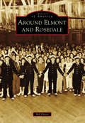
Around Elmont and Rosedale (Images of America)
by Bill FlorioOnce portions of a farming community called Fosters Meadow, Elmont and Rosedale have changed dramatically since Thomas and Christopher Foster first farmed the land in the 1600s. In the 1850s, immigrant German farmers settled in the area abutting Elmont Road, Brookville Boulevard, Linden Boulevard, and Merrick Boulevard. The remnants of that German farming community continued into the early 20th century, despite encroaching suburbanization, renamed streets, and subdivided farmland, along with Irish, Italian, and Jewish immigrants changing the area’s ethnic makeup. This new suburban area covering the southern corners of Nassau and Queens Counties became home to landmarks like the Argo Theatre, Rottkamp Farm, Schmitt Farm, Laurelton Parkway, Gouz Dairy, Sapienza Bakery, St. John’s Methodist Church, and world-famous Belmont Park. Today, Elmont, Rosedale, and the rest of the former Fosters Meadow are home to a large population of Caribbean immigrants, bringing a new culture to the area and, with it, new landmarks and new ideas.
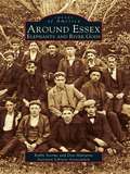
Around Essex: Elephants and River Gods
by Robbi Storms Don Malcarne Ivoryton Library AssociationThree hundred years of history follows you around today as you wander the streets of Essex, Centerbrook, and Ivoryton. Essex harbor is located on the Connecticut River six miles north of Long Island Sound, between Mystic Seaport and New Haven. It is a major stopping point for boaters in the Northeast who come from various ports to dock in the harbor, dine at the Griswold Inn, take in the maritime history at the Connecticut River Museum, or walk along the narrow streets to view the fine old houses in this New England community. Homes once owned by sea captains, shipbuilders, and captains of industry are a reminder of the area's glorious past. True, the old 1,200-foot Ropewalk, a mainstay of maritime manufacturing, was gone by 1900. Gone also are the Uriah Hayden Chandlery, Judea Pratt's New City Smithy, and Abner Parker's warehouse. The harbor where working vessels once ruled is now a vibrant waterfront filled with pleasure boats. A row of elegant Victorian houses lines the main street of Ivoryton village, where only a century ago lived executives from Comstock, Cheney & Company, the once great ivory and piano action factory. Enough of the past remains to remind us of the industry that thrived along these riverbanks.
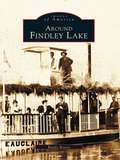
Around Findley Lake (Images of America)
by Randy BoerstAround Findley Lake recounts the story of a mill village that in the late 1800s began to develop into a prime destination-a social gathering place for not only local residents but also members of wealthy and socially prominent families from Cleveland, Pittsburgh, and Buffalo. As time went on, Findley Lake offered plays and musicals in the opera house, steamboat rides around the lake, roller-skating at the rink every night, and two islands for picnics or for viewing the logs being floated down the lake to the mill. Today, with its thriving year-round resort, the area has emerged as a tourist mecca. Showcased in Around Findley Lake are not only the distinct communities that developed around the lake but also the exceptional natural beauty of the lake itself, its importance to the early settlers, its recreational attributes, and most importantly its overall significance to the growth of the area. Each chapter's brief introduction offers historical highlights, followed by pages of fascinating facts and intriguing images of the Lakeside Assembly, steamboats, the Big Island, early cottages, and development of the resort Peek'n Peak.
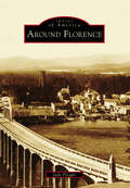
Around Florence
by Judy FleagleFlorence, located midway on the Oregon coast, has North America's largest stretch of dunes to the south and the most photographed headlands on the Pacific coast to the north. Although Florence is on the coast, it is a river town located on a bend of the Siuslaw River. Before the railroad arrived in 1916, the town was cut off and dependent upon ocean-going ships. The Siuslaw did not make it easy because of a notoriously shifting river mouth before the north jetty was built in 1893. Even after the jetty, crossing the bar continued to be treacherous due to shallow depths and fickle winds. Even so, entrepreneurs William Kyle and O.W. Hurd, in trying to outdo each other, developed a thriving town. For decades, fishing and logging were the mainstays. Now, they are tourists, retirees, and the arts. Old Town, where it all began, is a happening place once again.
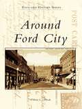
Around Ford City (Postcard History Series)
by William L. OleksakFord City was once known as one of the fastest-growing communities in Pennsylvania. The Pittsburgh Plate Glass Company and the Ford China Company, both established by John B. Ford, made this town the destination of many United States citizens, as well as European immigrants searching for a new life of employment and prosperity. The vintage postcards in Around Ford City reflect the essence of this hardworking, proud, ethnic community. The people, along with the factories, hotels, churches, and many homes, have grown together over generations to form the spirit of Ford City.
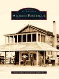
Around Fortescue
by Clarence Higbee Jr. Betty HigbeeFortescue, a small island located in Downe Township, has a history that dates back to the early 1700s. Situated on the shores of the Delaware Bay, it was once portrayed as one of the finest locations for a summer resort, especially for those fond of fishing and hunting. Possessing many natural advantages at little expense to visitors, this charming village became an oasis for vacationers from surrounding towns and cities in the 1800s. At a time when roads were poor, visitors found Fortescue easily accessible by water or horse and buggy, and they flocked to bathe in the water and breathe the invigorating salt air. Although many of the tourist attractions are now gone, Fortescue continues to come alive in the early spring as fishermen return. Around Fortescue showcases the history of this small fishing community.
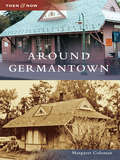
Around Germantown (Then and Now)
by Margaret ColemanGermantown is a new city. Until 1980, Germantown was a quiet, rural community of farms and cows with a few new houses built for employees of the Atomic Energy Commission. When the Maryland-Nation Capital Park and Planning Commission adopted the area, everything changed.
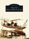
Around Great Moose Lake (Images of America)
by Brenda SeekinsAthens, Harmony, Hartland, and St. Albans surround the 3,500-acre Great Moose Lake in central Maine, and this volume reveals the fascinating history found here. Sportsmen discovered this land in the mid-1800s and established hunting lodges on the lake's shore, which continued for more than 60 seasons. In their heyday, the lodges provided employment for locals and planted alluring mysteries for later generations. Citizens later thrived on the farming and manufacturing in the late 19th and early 20th century. The colorful past left a rich heritage of seasonal and year-round residents and visitors that shaped the personality of the area. Around Great Moose Lake unravels some mysteries of the lodges and focuses on the changing culture around the lake and its four towns.
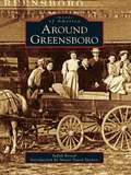
Around Greensboro
by Mayor David Spencer Judy RevealThe quaint town of Greensboro, Maryland, is nestled in the middle of the Delmarva Peninsula on Maryland's Eastern Shore where its American roots travel across the Choptank River and reach deep into the agricultural soil of Caroline County. The Choptank River's path meanders up the peninsula from the Chesapeake Bay, cutting through Caroline County, and it is at the great bend in the river that Peter Harrington brought into full bloom his grandfather Peter Rich's vision of a town. This location was vital to the movement of products to and from people living in the middle of the peninsula, and Greensboro quickly grew into a thriving small port town where businesses, including tanneries and shipbuilding, appeared. Greensboro's accessibility to Washington, Philadelphia, Baltimore, and Wilmington makes this quiet town a convenient bedroom community with big-town access and rural serenity.
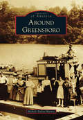
Around Greensboro
by Michele Buday-MurrayAround Greensboro covers communities of southeastern Greene County, including Greensboro at its heart. Greensboro was originally called Delight by the Mingo Indians who lived in the region. Because of its location on the Monongahela River, it quickly became an important trading location for the trappers and settlers moving through in the late 1700s. Later, Albert Gallatin introduced a group of Belgian glassblowers to the area, and in 1807, the glassworks in Greensboro was opened. As the glass business began to fade, another took its place. The area was rich in clay, which would be vital to the development of the pottery industry. From the 1840s to 1915, pottery was king in Greensboro, and the town boomed. As the pottery industry faded, it too would be replaced by another industry: coal. Greensboro, once famous for its glass and pottery, became known for its bituminous coal mines. This book covers the early days of Greensboro to the devastating Election Day Flood of 1985.
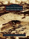
Around Gunnison and Crested Butte
by Crested Butte Mountain Heritage Museum Duane Vandenbusche Gunnison Pioneer MuseumThe Western Slope towns of Gunnison and Crested Butte are defined by their placement in the Colorado Rockies. Both are located in alpine valleys surrounded by 14,000-foot-high peaks with sparkling mountain-fed streams, and both dominate the Gunnison country, a unique wilderness covering over 4,000 square miles. Beginning over 400 years ago, Native Americans, fur traders, explorers, miners, railroaders, and cattlemen all made a place for themselves in the area. Today Gunnison, Crested Butte, and the Gunnison country remain isolated and tranquil. Recreation, tourism, and cattle ranching now reign supreme as Gunnison and Crested Butte attempt to preserve their distinctly Western heritage.
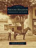
Around Haledon: Immigration and Labor (Images of America)
by Angelica M. Santomauro Evelyn M. HersheyBy 1908, when Haledon became independent from Manchester Township, thousands of southern and eastern European immigrants settled in the borough and its surrounding area. Immigrants found work in textile mills, machine shops, and other industries located in proximity to the city of Paterson and the Passaic River and its mighty Great Falls. Land promoters spurred home building in Haledon, a streetcar suburb. In 1913, nearly 25,000 workers went on strike, demanding an eight-hour workday. During the six-month strike, Haledon became the workers' haven for free speech and assembly as they demanded safer workplaces, a living wage, and an end to child labor. Archival photographs, documents, and postcards from 1890 to 1930 share the story of workers and immigrants who fought for the workplace benefits widely enjoyed by Americans today.
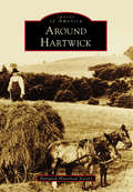
Around Hartwick
by Hartwick Historical SocietyAround Hartwick depicts the history of the rural Hartwick Township at the geographical heart of Otsego County, nestled along the Otego Valley between western hills and the Susquehanna River. Named for John Christopher Hartwick, an itinerant German preacher with the dream of a "New Jerusalem" church and school, the township became the site of the first Lutheran Theological Association in America. Abundant water sources powered large woolen, cotton, and paper mills in Clintonville, Toddsville, and South Hartwick. Fertile land produced farm crops, including a contribution to the highest yield of hops in the world. With extension of the electric trolley north through the Otego Valley to the Mohawk Valley, the Hartwick hamlet prospered as the site of railway headquarters, central carbarns, and the sole power source for this vital transportation link. With the advent of the mechanical age and changing economics, mills relocated, the railway ceased, and farm production declined. Today, the township enjoys renewed prosperity with the influence of history museums and baseball from nearby Cooperstown.
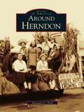
Around Herndon (Images of America)
by Margaret C. PeckThe town of Herndon is situated on the western edge of Virginia's picturesque Fairfax County. In the 18th and early 19th centuries, this part of Fairfax County was primarily agricultural, and as additional settlers arrived farming flourished. Early residents found woods, flat open fields, outcroppings of rocks, and workable soil throughout the region. By 1857, the installation of the railroad line brought summer residents, commuters, and real estate developers to the area. Residential growth continued into the 20th century, as more Washington, D.C. workers chose Herndon as a convenient town from which they could commute to their jobs. From 1959 to 1961, the railroad line experienced busy years when it was used to haul sand and construction materials to build neighboring Dulles Airport, which opened in 1962. Although the region has become a center of Internet technology, with several high tech companies located in the area, Herndon still retains a small-town charm.
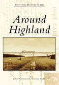
Around Highland (Postcard History Series)
by Ethan P. Jackman Vivian Yess WadlinThe history of Highland began on the shores of the Hudson River in 1754, when entrepreneur Anthony Yelverton started a sawmill, later followed by a brickyard, store, and ferry service to Poughkeepsie. During the 19th century, steamboats made regular stops near Yelverton's settlement. Starting around 1830, riverfront businesses began to relocate to the "high land" above the river, and a new Highland business district was born. The West Shore Railroad was completed in 1883, with a station at the riverfront. The area was called Highland Landing. The Poughkeepsie-Highland Railroad Bridge, now the Walkway Over the Hudson, was completed in 1888, and in 1897, a trolley line began operation from Highland Landing up to the Highland village and, from there, westward. Highland had a new claim to fame as the "Gateway to Ulster County."
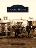
Around Hornell (Images of America)
by Kirk W. HouseAround Hornell tells the tale of western New York's "Maple City" and its neighbors, the rural towns of Canisteo, Dansville, Fremont, Hartsville, Hornellsville, and Howard. The region is set in the dramatic countryside between the Finger Lakes and the Appalachian Mountains, home to the deep gorges of Stony Brook State Park. Great arks floated down the Canisteo River to markets in Baltimore, and for more than a century, Hornell roared with round-the-clock work in the Erie Railroad shops. Hornell is a musical city of community bands, high-school operettas, and barbershop quartets, and its famous residents include radio star and pioneer pilot Blanche Scott, aspiring major leaguer Don Zimmer, and New York's longest-serving mayor, Shawn Hogan, who has graciously provided the introduction to Around Hornell.
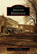
Around Keeseville
by Kyle M. Page Anderson Falls Heritage SocietyNestled in the northernmost section of the Adirondack Mountains, the communities of Keeseville, Port Kent, Ausable Chasm, Clintonville, Harkness, Port Douglas, Ausable, and Chesterfield provided early settlers of the 1800s with a wealth of natural resources in wood, iron, and stone. The Ausable Chasm and Ausable River provided the natural power to refine the materials on-site, while the nearby Lake Champlain provided the transportation to the rest of the world. For early America, this was a booming community that rapidly grew from the 1850s until the 1920s, when modernized transportation and factories around the country made the fairly isolated area less cost-effective. Today, Keeseville is a quiet stop on the Northway that connects New York City and Albany to Montreal. Impressive bridges, closed factories, and some old grand architecture are remnants of the glory days of the once-booming community.
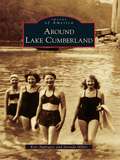
Around Lake Cumberland (Images of America)
by Jarenda Miller Kris ApplegateLake Cumberland is a premier vacation destination for millions of people each year. With its 1,255 miles of federally protected shoreline, an average depth of 90 feet, and a surface area of more than 60,000 acres, Lake Cumberland is one of the largest man-made lakes in the United States, yet visitors may not realize the storied history that lies beneath the deep water. Before Lake Cumberland became a recreational paradise, the wild and wondrous Cumberland River ruled the land. Although plagued by spring floods, towns and communities prospered along her banks. In an effort to control the Cumberland River and reduce flooding, Wolf Creek Dam was constructed following the Flood Control Act of 1938. With the dam in place, Lake Cumberland began filling in 1951. The dam offered protection to South Central Kentucky, but it drowned or forever changed many thriving towns and communities. Images of America: Around Lake Cumberland shows what life was like along the banks of the Cumberland River before Lake Cumberland was born.
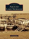
Around Lake Norman (Images of America)
by Cindy JacobsThe year 1957 brought change to Mooresville and southern Iredell County, and that change arrived in trucks. Big white ones flashed the logo of Burlington Industries, the new owners of the Mooresville Cotton Mills. Bright yellow ones from the Duke Power Company brought earth-moving machines to clear the Catawba River bottomland. That project, envisioned by James Buchanan Duke, Dr. Gill Wylie, and William States Lee Jr., had the end goal of harnessing the energy of the Catawba River to provide electricity for the textile industry in the Carolinas. Duke Power's plan for Cowans Ford Lake was the last piece of the network of hydroelectric stations, and the result was beautiful Lake Norman.
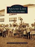
Around Lake Okeechobee
by Barbara D. Oeffner Amie DunningFrom the Calusa Indians to the travelers who used boats for transport in the early 1900s and up to the prosperous farms and cattle ranches of today, the Everglades has evolved into a mecca for fishing, birding, and hiking. The smell of orange blossoms entices the settler to an untamed land where bears, deer, and snakes still inhabit the wilderness and where alligator hunting and fishing are still popular sports. Lake Okeechobee is 110 miles around from Pahokee to Canal Point, Okeechobee, Lakeport, Moore Haven, Clewiston, South Bay, and Belle Glade. To cross Florida from the Atlantic to the Gulf, a boat starts in Stuart and ends at Port Mayaca, crossing Lake Okeechobee to the Moore Haven lock and out the Caloosahatchee River past Lake Hicpochee and west to Fort Myers. Around Lake Okeechobee presents images from the Clewiston Museum, Lawrence E. Will Museum, state archives, and private collections, painting a history of the boom and bust, the boaters and farmers, and the cattlemen and ranchers who have settled and raised their families here.
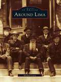
Around Lima
by Michael LeavySome twenty miles south of Rochester lies what was historically the "crossroads of western New York." Lima and its neighbors in the Genesee Valley are unique in many ways. An excellent network of trails had been developed by the Iroquois long before the area attracted its first permanent settler in 1788. As immigrants streamed westward, inns opened at this crossroads to serve them, and some of the travelers stayed to become farmers, tradesmen, and merchants. In the mid-1800s, Lima had several photography studios and a wealth of architectural gems, many of which still remain. Today, Lima has more than fifty structures listed on the National Register of Historic Places.Around Lima explores the fascinating evolution of Lima and the diverse adjoining towns that were inexorably connected. It illuminates the elegant streets of Lima, the rich heritage of nearby Bloomfield, the covered bridge and stone mills of Honeoye Falls, and the grandeur of the resort days of Avon Springs, which rivaled Saratoga Springs. Appearing within these pages are glimpses of Susan B. Anthony and Franklin Delano Roosevelt, as well as accounts of the Underground Railroad and a winter morning's journey to see Abraham Lincoln.
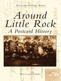
Around Little Rock: A Postcard History
by Ray Hanley Steven G. HanleyDuring the "Golden Age of Postcards," a craze that swept the nation in the early 1900s, postcard photographers captured images of everyday life in small towns all over the country. In this tradition, its creators unknowingly produced an invaluable archive of historical data that gives us a glimpse of the way life used to be.
Around Liverpool
by Joyce M. Mills Dorianne Elitharp GutierrezLiverpool, on the shore of Onondaga Lake, was settled by John Danforth and his family due to the natural brine springs near the lakeshore. The population of salt boilers quickly grew. The Oswego Canal opened in 1828, and the village was incorporated in 1830. German immigrants brought willow weaving to the village in the mid-1850s, and by the 1890s, Liverpool willow products were being shipped all over the nation. In the 20th century, as more lucrative work became available and the automobile ruled, the basket weavers gave way to factory workers, nurses, teachers, and engineers. Around Liverpool takes you on a tour of the unique history of Liverpool, with images of its salt boilers, weavers, firefighters, schoolchildren, churchgoers, ice boaters--the people and places that made the community.