- Table View
- List View
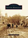
Around Marcellus
by Leslie Church KrausAround Marcellus recounts the rich history of a community founded by strong and determined settlers. Marcellus and its neighbors Otisco and Marietta are located just west of Syracuse. Founded in 1794, the town grew largely because of its successful mills and businesses. Its history from the mid-1800s to the mid-1900s is portrayed here in clear narrative and some 200 archival images from the Marcellus Historical Society.
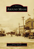
Around Miami
by Marlene Tiede Delvan Hayward Santos C. VegaDuring the late 1800s, prospectors in search of gold, silver, and copper began to settle around the Pinal Mountains area in Miami. By 1918, several mining companies had established roots and contributed to the town's booming growth. The community established housing, schools, a hospital, and a town government, and the population grew to 5,000. Soon, Miami achieved recognition as one of the main mining towns in the state, along with neighboring Globe, Jerome, Morenci, Superior, Ajo, and Ray-Sonora. The new mining opportunities brought immigrants from around the world to settle in the area and eventually turned Arizona into a leading contributor to the copper industry. Although mining's hold on the local economy has changed over the years, today at least 20 percent of Miami-area employment is centered around copper mining, which remains close to the heart of the first hardy miners' descendants.
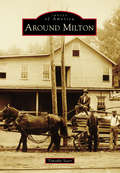
Around Milton
by Timothy StarrThe town of Milton, New York, lies near the center of Saratoga County. It is crisscrossed by a series of rivers, which have played an important role in the town's development--most notably, the Kayaderosseras. Milton's only village, Ballston Spa, with the attraction of its rare mineral springs, was once among the country's most popular tourist destinations. One of the largest and most elegant hotels in the world, the Sans Souci, vied with a host of others for the patronage of thousands of travelers who made the pilgrimage each summer to partake in the "healing waters." When the tourist trade faded, it was replaced by a massive expansion of industry that was situated along the town's waterways. Among the most significant of these concerns were the mills of the "Paper Bag King" George West, Isaiah Blood's ax and scythe works, and the mammoth tannery of Samuel Haight. Today, its proximity to the state capital and other cities makes the town an increasingly popular residential area, complemented by a quaint and bustling business district in Ballston Spa.
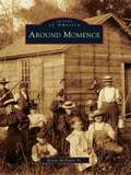
Around Momence
by Kevin Mcnulty Sr.As evidenced by the historic record of Burt E. Burrough's book entitled Tales of an Old Border Town and along the Kankakee (1925), the city of Momence owes its origins to the flow of the Kankakee River through eastern Kankakee County. This diverse tributary linked marshy areas in Indiana to the adjacent fertile fields on the Illinois side. Momence became a beacon, providing traders with the latest conveniences and a break from the frontier. Years later, the historic Dixie Highway crossed the river at Momence, assuring a modern era for the city. In her writings of 1983-1984, the great educator and historian Kay Hess revealed the community spirit, entrepreneurial zeal, and celebratory nature of Momence through the many personalities of this rural city. Today, as Momence approaches its 200th year, massive urban sprawl promises to wash over this ever-changing community and add to its history.
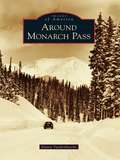
Around Monarch Pass
by Duane VandenbuscheMonarch Country is an incredibly beautiful mountain region spanning both sides of the Continental Divide in the southern portions of Chaffee and Gunnison Counties in the Rocky Mountains of south-central Colorado. Monarch Pass, at 11,312 feet above sea level, divides the Gunnison Country in the west from the Arkansas River watershed in the east. This scenic, wild, and rugged region surrounding the crossroads of U.S. Routes 50 and 285 is rich in mining, railroad, and skiing history and once included booming mining camps such as Maysville, Garfield, Monarch, and White Pine. The crown jewel of this spectacular high-country landscape is the Monarch Ski Area, which enjoys 350 to 500 inches of snowfall every year.
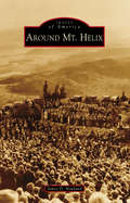
Around Mt. Helix
by James D. NewlandEvery year, the morning of Easter Sunday, thousands of intrepid souls trek to the summit of San Diego County's Mt. Helix. Once there, they experience the nearly century-old tradition of a community-based sunrise service held at the historic Mt. Helix Nature Theater. Constructed for that purpose in 1925, and located in a unique, privately-owned "public" park, the landmark serves as just one of the reasons this conically shaped peak has become a regional, cultural, and natural icon. Named for a rare gastropod, the 1,375-foot-high pinnacle also serves as a geographic beacon for the mostly unincorporated surrounding communities of Mt. Helix, Grossmont, Calavo Gardens, Casa de Oro, Spring Valley, and the adjacent, historically related municipalities of El Cajon, Lemon Grove, and La Mesa. Today, these semirural communities are renowned for their idyllic, family-friendly neighborhoods; classic early-20th-century Revival-style and custom midcentury Modern architecture; and long-standing commercial and civic institutions.
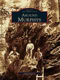
Around Murphys
by Judith MarvinMurphys is a bustling little town in the foothills--a town so popular that it won't be little for long. It's a favorite for weekend jaunts, and home to an eclectic group of people attracted by the natural surroundings, laid-back lifestyle, and, increasingly, world-class wineries. Originally named for the trading camp of John and Daniel Murphy, the area became a boomtown during the Gold Rush, and later hosted such notables as Mark Twain, Black Bart, Ulysses S. Grant, and Horatio Alger. Nearby, the majestic stands of redwood at Calaveras Big Trees State Park stand sentinel over the gullies and ranches of this area, which has changed much since the 1800s but still retains its compelling forested beauty.
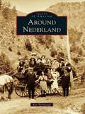
Around Nederland
by Kay TurnbaughNederland survived three boom-and-bust cycles involving three different minerals. During the silver boom, U.S. president Ulysses S. Grant visited Central City in 1873 and walked on silver bricks that had been mined in Caribou and milled in Nederland. The second boom followed the discovery of gold in Eldora in 1897 and lasted only a few years. The third boom was sparked by the discovery of tungsten by Sam Conger, the same man who made the original discovery of silver in Caribou. The Conger mine eventually became the greatest tungsten mine in the world. During World War I, Nederland's population swelled to 3,000--twice the size it is today--and another 2,000 were estimated to live nearby. In each boom, men came to mine, open stores, and transport goods and ore. They brought families with them, and many towns sprang up, including Caribou, Eldora, Lakewood, Tungsten, and Rollinsville. Some of these communities have survived, while others remain only in memories and photographs.
Around Neversink: From the Rondout Reservoir to the Neversink Reservoir
by Carol G. SmytheAround Neversink: From the Rondout Reservoir to the Neversink Reservoir takes readers back to rural life in the Catskill Mountains not long after its first settlers arrived. Before the land was commissioned to provide water for New York City's nine million residents, the area was known for some of the best trout fishing in the world. Red Hill, Peekamoose, Sundown, Branch, Frost Valley, Dewittville, Halls Mills, Willowemoc, Grahamsville, and Claryville were small communities mostly clustered around the banks of the headwaters of the Neversink River or the Rondout Creek. The area became a summer destination, and local farmhouses were converted into boardinghouses to accommodate seasonal travelers. In the 1900s, eminent domain took several communities to create the Rondout Reservoir and the Neversink Reservoir. As a result, Neversink Flats, Bittersweet, Eureka, Montela, and Lackawack ceased to exist. Today, residents and visitors enjoy a host of outdoor activities, including hiking on local mountains, snowmobiling on well-groomed trails, fishing in the reservoirs, bird watching, camping, and hunting.
Around Niwot (Images of America)
by Anne Quinby DyniBy the time the Colorado Central Railroad extended its tracks into Boulder County in 1873, much of the land along the foothills was already under cultivation. As rails were laid between Boulder City and Longmont to the northeast, they crossed land belonging to settlers who had first come to the region as prospectors with the Pikes Peak Gold Rush of 1858. At that time, the area was still the hunting and fishing grounds of Southern Arapaho Indians and their tribal leader, Chief Niwot, translated as "left hand" in the Arapaho language. Two ranchers, Porter Hinman and Ambrose Murray, whose land was traversed by the new railroad, platted the town of Niwot in 1875 as a shipping point for transporting local farm goods and livestock to distant markets. Thus the only authentic railroad town in Boulder County was founded.
Around North Collins
by Georgianne BowmanSouthern Erie County, around North Collins, was originally inhabited by the Seneca Nation of Native Americans. Beginning in the late 1790s, English Quakers moving west from New England arrived, and as the 1800s progressed, waves of German and Italian immigrants followed, seeking political and economic stability. Later, immigrants of other nationalities settled in the area, adding their contributions to this area of rich diversity.Around North Collins contains a unique combination of vintage photographs and historical knowledge on North Collins and fourteen other communities: Shirley, Langford, Clarksburg, New Oregon, Marshfield, Collins Center, Collins, Gowanda, Lawtons Station, Brant, Farnham, Angola, Pontiac, and Kerr's Corners. The photographs, many of which have never before been published, come from the collections of local historians, historical societies, and area families. Pictured are people at home, at school, at ceremonies, and at work, using the tools of their craft.
Around Orange
by Robert J. TuholskiLocated between the Quabbin Reservoir and the New Hampshire state line, Orange has developed from a sparsely-settled, agrarian countryside to a thriving industrial community along the banks of the Millers River. Around Orange includes images of this town and the surrounding towns of Athol, Erving, New Salem, Warwick, and Wendell. Through photographs, postcards, and stereoview cards from a bygone era, this volume provides a glimpse of what it was like to live and work in this area long ago. Seen here are vintage images of schools, churches, public buildings, homes, businesses, industries, celebrations, and disasters.
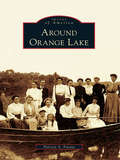
Around Orange Lake (Images of America)
by Patricia A. FavataAround Orange Lake portrays the history of the lake and the adjoining locales of Gardnertown and Meadow Hill. The only natural lake for miles, Orange Lake was the location of a Colonial coinage mill, a source of power for many early industrial ventures, and home to one of the East Coast's most famous amusement parks. In the late 1800s, cabins began to dot its shores, and by the 1920s, bungalow colonies flourished, with cottages that today have become substantial year-round homes. The lake also hosted famous personalities, including a Boston Tea Party participant, an early pilot, and a former governor. Their stories and others are intertwined with the history of the lake to create a picture of a very unique community.
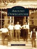
Around Oswegatchie (Images of America)
by David E. MartinAround Oswegatchie provides a vivid look at the lifestyle of an area of far northern New York State during the time that it depended primarily on an agrarian existence. In its early days, the town of Oswegatchie was subdivided numerous times into new townships. From Oswegatchie, Lisbon, Morristown, and DePeyster came artists, politicians, industrialists, inventors, and Civil War heroes-- people who left their footprints on a nation and helped make a better life for all.
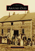
Around Ovid (Images of America)
by Ovid Historical SocietyOn land freed from American Indians upon the orders of George Washington, the town of Ovid was formed in 1794, after military lots were numbered by Simeon DeWitt and his assistants. In 1860, construction was completed on three brick buildings that became known as the Three Bears, which served as the town's courthouse, eventually served as the Seneca County Seat, and now serve as the Town of Ovid municipal offices. Gradually, more settlers came, cleared land, built roads, started businesses, and founded churches and schools. Bordered by the Seneca and Cayuga Lakes, where barges were used to transport goods, the town developed a vibrant farming community with productive orchards and vineyards. Tourism flourished, and summer homes were built by those looking to escape the city. One of these summer homes was that of Herman Westinghouse, who worked together with his brother George Westinghouse on their company's myriad inventions.
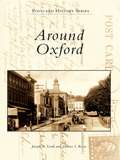
Around Oxford
by Joseph A. Lordi Dolores I. RoweAround Oxford features vintage postcards and photographs from Oxford and the surrounding area, including Lincoln University--the oldest African American institution of higher learning in America--and Nottingham. With the arrival of the Philadelphia-to-Baltimore railroad in 1860, Oxford began to grow and prosper. Because the area is one of the most fertile regions of Pennsylvania, it became a major agricultural center. Along with carriage and candy making, the surrounding area produced important industries, including chrome and magnesium mining, pottery making, and the quarrying of limestone.
Around Perry
by Christina B. NolanFertile land, waterpower, energetic residents, and a sea serpent all contributed to the growth of the town and village of Perry. The town of Perry was first settled in 1807, and later took the name of Commodore Oliver Hazard Perry, the hero of the War of 1812. Early mills along Silver Creek provided materials for the growing village, which was incorporated in 1830. Perry made headlines in 1855, when a sea serpent was sighted on Silver Lake and people flocked to the area. The mystery went unsolved until remains of the hoax were found in the ashes of the Walker House in 1857. Perry continued to grow, with Main Street businesses changing with the needs of residents. Later industries replaced the early mills, and immigrants arrived to work in the textile factories. Educational, religious, and civic buildings were added to the community, and farms grew in the countryside.
Around Philipsburg (Images of America)
by Dennis Mcgeehan Debra Schnarrs McgeehanPhilipsburg is a community on the Moshannon Creek, which flows east off the Allegheny Mountains in central Pennsylvania. The region was blessed with rich seams of bituminous coal that have provided the area with employment and prosperity. With interests in Philadelphia, the Philips brothers of England founded a colony in the wilds of frontier Pennsylvania in 1797. A gristmill, sawmill, iron forge, and screw factory began the taming of the wilderness. The Philips brothers eventually returned to England over political differences, but the town they founded carried on. Coal, timber, clay, railroads, and metal fabrication have created a community intensely proud of its history. Prone to flooding, the Moshannon Creek divides Centre and Clearfield Counties. This collection of photographs includes communities on both sides of the creek, highlighting the area's people, industry, commerce, architecture, and famous visitors to the town.
Around Phoenixville (Postcard History Series)
by Vincent Martino Jr.The small town of Phoenixville has a multifaceted industrious past that developed around the Phoenix Iron Company, the silk mill, and the Byrne Knitting Mill. It grew steadily through an influx of European immigrants drawn to the area by the promise of work. This growth resulted in Phoenixville's many cultural institutions, such as the Knights of Columbus, the St. Anna Italian Club, and the Holy Trinity Church. The vintage postcards in Around Phoenixville depict the people, places, and events that have shaped the community's rich history and heritage, with images of such landmarks as the Phoenix Hotel, the West End Fire Company, and the construction of the Gay Street Bridge.
Around Picture Rocks (Images of America)
by Sherry A. GardnerWhen the Sprout and Burrows families purchased what became Picture Rocks for $2,500 in October 1848, the land was considered worthless. The town consisted of a single house and a sawmill that sat at the bend of Muncy Creek. The mill produced window sashes and doors that were in demand for new homes being built in the West Branch Valley. In 1856, S. H. Burrows began manufacturing furniture. Then in the early 1850s, a chapel was built in eight days so that the Baptist community had a place to worship. Around Picture Rocks documents the evolution of this section of Lycoming County. Among the many original structures featured in the book is part of the old Handle and Excelsior building that still greets visitors as they cross the Muncy Creek.
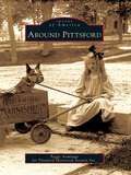
Around Pittsford (Images of America)
by Peggy Armitage Pittsford Historical Society Inc.Winding north through Pittsford, Otter Creek has powered the lumber, grain, and marble mills essential to this region since 1770. Chittenden lies east of Pittsford, on the west flank of the Green Mountains, where iron and manganese deposits supplied Pittsford's iron industry. To the south, Pittsford and Proctor share deep marble formations that support the economies of both towns. The first settlers were farmers drawn to the valley's fertile soil and mountain forests. They were joined by lumber barons, lawyers, merchants, and artists. European and French Canadian immigrants soon followed and farmed, built the railroad, or quarried and carved marble. Closely linked by the industries that helped build them, these communities have evolved into today's thriving hometowns of workers in Rutland.
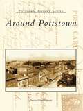
Around Pottstown
by Patricia Wanger SmithAround Pottstown travels back to Pottstown's golden era. Since its founding in 1752, Pottstown has had a catalytic effect on the surrounding area with its industrial and commercial growth during the nineteenth and twentieth centuries. The horse and wagon gave way to new transportation methods, such as canal boats, railroads, and bridges, which afforded connections to the world market. Most importantly, this collection of vintage postcards shows Pottstown's citizens through the places where they shopped, went to school, worshiped, and celebrated life.
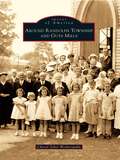
Around Randolph Township and Guys Mills
by Cheryl Seber WeiderspahnThe first frontier settlement in what is now Randolph Township took place in 1795 when a handful of brave pioneers overcame incredible odds to settle in the Pennsylvania wilderness. Slowly Randolph became dotted with small clearings, followed by self-sufficient farms. Ambitious tradesmen sold services, and scores of businesses sprouted up. Schools and churches followed as the crossroads of Guys Mills, Black Ash, Mount Hope, Brawley Stand, and Hickory Corners flourished, attracting men of influence. Rev. Timothy Alden, founder of Allegheny College, was pastor of Guys Mills Congregational Church. Famed abolitionist John Brown walked six miles to church in Guys Mills. During the great oil boom, John D. Rockefeller investigated the town's oil wells. Pennsylvania senator Raymond E. Smith resided here. Black Ash's Clint Brown enjoyed a 15-year major-league pitching career with the Cleveland Indians and Chicago White Sox and held a major-league record.
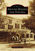
Around Remsen and Steuben (Images of America)
by Megan Plete PostolThe first settlers of the rugged wilderness that became the towns of Remsen and Steuben were hearty pioneers, Welsh immigrants, and a famous Revolutionary War hero. The untamed forest of Oneida County proved challenging but not insurmountable for Remsen’s first settler Barnabas Mitchell and the noble Friedrich Wilhelm August Heinrich Ferdinand Steuben, who was famed with being the sturdy backbone of Washington’s Continental Army and known as the “Drillmaster of the Revolution.” The area flourished into a place of farming, manufacturing, business, and religion. Settlers ranged from rollicking woodsmen to large working families to pious pastors. There were so many churches that the lands of Steuben became known as “the singing hills.” It has been said that the courage of a Welshman rises in proportion to the obstacles thrown in his path. This book strives to tell their tales through visuals of old Remsen and Steuben.
Around Selinsgrove (Images of America)
by Jim CampbellWhile Selinsgrove is typical of the many towns located along the shores of the Susquehanna River, it has cultivated its own identity as the home of Susquehanna University, founded in 1858 as the Missionary Institute and later becoming one of the nation's first coeducational colleges. Prior to the Pennsylvania Canal, several Selinsgrove mills were vital in the worldwide flour trade, where wheat was ground into flour and floated on arks downriver to Baltimore. For most of the 20th century, Rolling Green Park was a leading recreational attraction, and for over 60 years the Selinsgrove Speedway's sprint car races have caused spectators to hail it as "the fastest half-mile dirt track in the East." What truly makes Selinsgrove and the surrounding area prominent is the unique individuals that have marked its history. Through more than 200 photographs, many previously unpublished, Around Selinsgrove depicts the places and people who have made these communities into what they are today.