- Table View
- List View
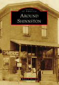
Around Shinnston
by Robert P. Bice IIISurrounding the West Fork River and its tributaries, the communities in northern Harrison County are rich in both history and pride. With an abundance of natural resources, such as coal and oil, the areas featured in Around Shinnston developed into industries that brought growth and commerce. Many of these towns were named for the coal companies that established mines there, including Gypsy and Owings. Viropa was named for Virginia, Ohio, and Pennsylvania, while Wyatt, previously called Goosetown, was renamed to honor a local physician. Big Elm once carried the roots of the largest water elm tree on record, and Enterprise was a large Indian territory. Shinnston is the largest community in Clay District (third largest in Harrison County) and is home to the oldest structure in this part of the state. These areas were the "heart of the Bituminous Coal Fields" and today take pride in their history.
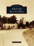
Around South Hill
by John Caknipe Jr.South Hill was formerly located on the old Buckhorn Road near the Meherrin River. It was the site of the first chartered school in Mecklenburg County in 1814. When the founder/teacher/minister/postmaster died in 1857, many from the community relocated 3 miles east to the Boydton-Petersburg Plank Toll Road. In 1888, W. W. "Buck" Harris, a local wheelwright and landowner at Piney Pond and Plank Road, died. At auction, 55 acres of his property were purchased, platted, and parceled for sale by A. E. Batemen and Charles Peck to establish a new South Hill community, which surrounded the Atlantic-Danville Railroad depot. Following this, South Hill became known as the town of highways. With each new highway came significant changes for the town and county.
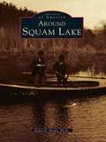
Around Squam Lake (Images of America)
by Bruce D. HealdLocated in the foothills of the White Mountains, Squam Lake was not discovered by English settlers until the mid-1700s. However, the lake area had long been inhabited by the Abenaki Nation of the Algonquin Federation. These people called the waters Kees-ee-hunk-nip-ee, meaning "goose lake in the highlands" (later shortened to Kusumpy or Casumpa) and also Asquam, meaning "water." The latter name was eventually shortened to become Squam Lake. With more than two hundred rare images, Around Squam Lake celebrates the beauty, the geology, and the history of Squam Valley. The book includes early Native American lore and the gradual development of what are known as the Five Towns-namely, Moultonboro, Sandwich, Holderness, Center Harbor, and Ashland. It reflects upon "big" Squam Lake and Little Squam Lake (where On Golden Pond was filmed), highlighting the shoreline points and coves, the succession of islands that dot the surface, and the surrounding mountains, which include the Squam Mountain range, the Sandwich range, and Red Hill, which rises at the head of the valley.
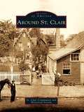
Around St. Clair
by St. Clair Community and Historical SocietySt. Clair lies in a narrow valley rich with anthracite resources. The town was born around 1831, during the great hard coal boom in northeast Pennsylvania. Over the years the town expanded to surrounding areas or patches known as Arnouts Addition, Wadesville, Dark Water, New Castle, Mount Laffee, Crow Hollow, Ravensdale, Lorraine, Diener's Hill, East Mines, and Mill Creek. People came from these areas to work in the mines, railroads, and supporting industries. As the demand for coal increased, the town grew to a high point of 7,000 residents. The decline of the coal industry also brought the decline of the railroads, and the population of St. Clair fell. The photographs in Around St. Clair show the fortitude of its people; the notable residents who have gained national acclaim for their achievements in the labor movement, medical field, and professional sports; and the diverse cultures that make up the town.
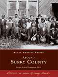
Around Surry County (Black America Series)
by Evelyn Scales ThompsonFrom slavery in the 1800s to freedom in the 1950s, Black America Series: Around Surry County traces the footsteps of African Americans through their transition from house servants and field hands to land owners, farmers, andsuccessful small business proprietors. This detailed pictorial history celebrates and honors the strong faith, courage, and determination of the Surry County area's black community.
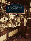
Around Swanzey: Swanzey, Ashuelot, Winchester, Richmond, Fitzwilliam, and Hinsdale (Images of America)
by Pamela Apkarian-RussellNestled against the Massachusetts and Vermont borders are six New Hampshire communities largely unconnected with the rest of their home state. The picturesque bedroom and summer vacation communities of Swanzey, Ashuelot, Winchester, Richmond, Fitzwilliam, and Hinsdale all developed from industrial or agricultural economies, although this fact is less than apparent today. The factories have nearly all vanished, and so has the extreme wealth and glamorous lifestyle of former residents like playwright Denman Thompson. Routes 10 and 12 are still the main roads that connect these towns, however, and the Ashuelot River is slowly recovering from years of pollution in a return to its pure and natural state. In fact, the area's Old Homestead persona seems to have experienced a revival in recent years in the absence of major industry, and it becomes more and more important for residents and tourists alike to be reminded of the area's nineteenth-century economic development.
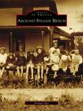
Around Sylvan Beach (Images of America)
by Brandy AnnOn the sandy shores and calm waters of Oneida Lake rests Sylvan Beach. For many years, the entire region was simply known as Fish Creek, and it was settled by George Haskins in the early 1800s. When the Erie Canal was completed in 1825, the area began to flourish. James D. Spencer arrived in the hamlet of Fish Creek in the 1840s and settled near Wood River and the Oswego Midland Railroad station. In the 1870s, he began to develop the sandy shores along Oneida Lake, and the first visitors to Spencer's Grove arrived in August 1878. Sylvan Beach received its name in the spring of 1886, when the New York, Ontario and Western Railroad built a loop into Spencer's Grove. Sylvan Beach continued to thrive with the addition of the railway station, allowing the shipment of produce and lumber as well as the arrival of large numbers of vacationers. These vintage images chronicle the history of Sylvan Beach and its surrounding communities, illustrating the region's strong link to the vast history of America.
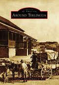
Around Terlingua
by Robert E. Wirt Thomas C. AlexThe origin of the name "Terlingua" is obscure and lost in time. For the past century and a half, the area covered by the name has expanded to include numerous concentrations of people engaged to varying degrees in ranching, farming, and mining, or the support thereof. Farmers and ranchers produced agricultural products, woodcutters supplied timbers for the mines or fuel for the furnaces, and storekeepers supplied the goods needed for sustenance of this diverse community that was spread over much of south Brewster County in West Texas. Hispanic people who began settling the region in the 18th century were the backbone of the mining industry. Many of the families here today are descendants of the mine workers and continue contributing to the community. This story tells of the establishment and abandonment of Terlingua following the rise and decline in demand for mercury and how the ghost town was resurrected in the 20th century.
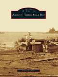
Around Three Mile Bay (Images of America)
by Elaine T. BockThree Mile Bay, located just below the Canadian border in the town of Lyme, was settled between 1810 and 1820. Early immigrants from Canada and Europe were drawn by the abundance of water-powered mills and factories along the area's waterways. At the mouth of Three Mile Creek stood the sawmill of Peter and Richard Estes, built in 1820; from 1860 to the 1900s, limestone quarried in the Three Mile Bay area was known for its superior quality. Resident Asa Wilcox built 48 brigs, propellers, schooners, and other seafaring vessels from 1835 to 1853, some ultimately joining the approximately 500 shipwrecked vessels now resting at the bottom of Lake Ontario. Fishing and selling potash were often carried on by farmers as side ventures. When loads of potash, and occasionally wheat, were hauled to Albany, on the return trip merchandise was brought back to be sold in local stores. For generations, families developed their trades and helped to sustain the hard-working people of the hamlet of Three Mile Bay.
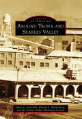
Around Trona and Searles Valley
by Russell L. Kaldenberg James L. Fairchild Searles Valley Historical SocietyTrona was once the most populous community in the Upper Mojave Desert. Originally explored by the Death Valley 49ers in 1850, Searles Valley was formed by remnants of the Owens River Lakes. The small towns of Borosolvay, Magnesium, Burnham, and Slaterange City prospered for a period before fading. Homewood Canyon, Westend, Argus, Pioneer Point, and Trona continue to provide pleasant housing for Searles Valley residents. The valley is dominated by mining history, and Searles Valley Minerals still produces products for worldwide markets. Wyatt Earp played cards and gambled at Poeville and was arrested in 1910 in Searles Valley for claim jumping. In 1913, Stafford Wallace Austin helped create the planned town of Trona. Amelia Earhart's husband, George Putnam, died at the Trona Hospital in 1950. Sit down and enjoy the jaunt through some of the most interesting history in the West.
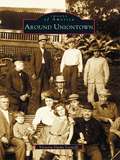
Around Uniontown
by Victoria Dutko LeonelliOnce scattered with frontier forts and Native American paths, Uniontown has changed considerably since Henry Beeson, a Virginia Quaker, offered fifty-four lots for sale on July 4, 1776. Around Uniontown captures this history with nearly two hundred vintage images culled from personal collections and the Uniontown Public Library's archives. In these pages, revisit 1896, when Uniontown had its greatest patriotic festivity. View beautiful tree-lined streets with the magnificent homes of coal barons. Visit the "patch towns," and meet the people who lived and worked during the booming coal and coke era. Witness the sensational Polly Williams murder trial, and learn about some of the unique individuals who have called Uniontown home, such as Gen. George C. Marshall, David Blythe, and "Crazy Billy."
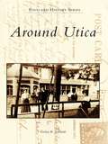
Around Utica (Postcard History Series)
by Evelyn R. EdwardsAround Utica features the work of A. J. Manning, who traveled with his camera through picturesque central New York in the early 1900s. Manning recorded historic events, such as Sherman Notification Day in 1908, honoring William Howard Taft's vice presidential nominee James Schoolcraft Sherman; catastrophes, such as the fires at Utica Free Academy and the YMCA; and nostalgic scenes of everyday life. His images were produced in small quantities as real-photo postcards, which today are quite rare and much sought after by collectors.
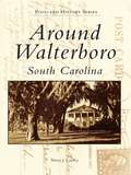
Around Walterboro, South Carolina
by Sherry J. CawleyWalterboro is a city of beautiful, living memories, with Old South plantations dotting its surrounding countrysides and peaceful scenes graced by Spanish moss swaying gently from hundred-year-old live oak trees. Established as a summer haven for rice planters from lower Colleton County in 1784, Walterboro served a similar purpose from the 1920s to the 1950s, when it was "The Place" to stop for anxious vacationers making the trek from New York to Florida. Around Walterboro hopes to recapture those earlier days when Walterboro's main commercial ingredients were made up of family-owned businesses located along two-lane highways instead of today's chain motels and fast food restaurants stationed along the exits on expressways. This volume allows the reader to walk down dusty, shady country roads, examine the exteriors and explore the interiors of some of Colleton County's most historic buildings, and stroll along the avenues of downtown Walterboro and the beaches of Edisto Island.
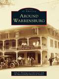
Around Warrensburg (Images of America)
by John T. Hastings Warrensburgh Historical SocietyWilliam Bond became the first Warrensburg settler, when he arrived in the Echo Lake area, in 1787. Shortly thereafter, Warrensburg became known as "the Bridge" because it was the location of the only bridge in the area that crossed the Schroon River. In February 1813, the town of Warrensburg was formed from part of Thurman. By the mid-1800s, A. C. Emerson and B. P. Burhans had moved to Warrensburg and begun to harness the waterpower of the Schroon River and utilize the nearby timber resource. The Emerson sawmill and Burhans's tannery and gristmill provided employment and capital to support a growing and thriving town. Other industries, such as a woolen mill and pants factory, sash and blind factory, shirt factory, and shoe peg factory, soon followed. With the dawn of the 20th century, improved transportation in the form of railroads and the automobile began bringing more people to Warren County. This trend continues today as numerous visitors summer in the Adirondacks to enjoy the clean air and water of the north country.
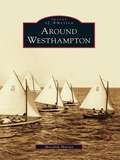
Around Westhampton
by Meredith MurrayRenowned as part of the Hamptons, the area known today as Westhampton, Westhampton Beach, Quiogue, and West Hampton Dunes was named Catchaponack by the Algonquin tribes who lived in the area when the English sheepherders arrived in the 1660s. A land of breathtakingly beautiful beaches and bays situated on the south shore of Long Island, just 65 miles east of New York City, Westhampton has evolved from an agricultural and fishing village to a summer vacation resort to a year-round oceanfront community. Fortune 500 chief executive officers and celebrities, such as Cary Grant, Charles Addams, and Marvin Hamlisch, have lived quietly amid locals. Together they have survived hurricanes, outlasted raucous night clubs, rebuilt eroded dunes, and fought off real estate developers. Around Westhampton depicts how an area blessed with uncommon physical beauty has managed to remain unspoiled in the face of natural disasters and international fame.
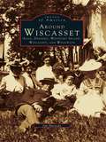
Around Wiscasset: Alna, Dresden, Westport Island, Wiscasset, and Woolwich (Images of America)
by Jim HarnedyThe Kennebec and Sheepscot Rivers of Maine, naturalboundaries for the Wiscasset region, provided the water highways for early explorers, traders, andmissionaries. By the early part of the seventeenth century, colonization by European settlers had begun. For over 360 years, the area has been home to shipbuilders, fishermen, farmers, and tradesmen. This marvelous photographic chronicle traces not onlythe rich historical traditions of the area, but also the shared sense of life's unbroken continuity present in the towns of the Wiscasset region: Alna, Dresden, Westport Island, Wiscasset, and Woolwich. Vintage photographs profile a few of those who quietly inspired others through their efforts to make life better in the region, as well as those men and women of wealth and vision who provided the area with a legacy by their lifestyles and great homes. The book also features views of local taverns, courthouses, general stores, churches, and schools--all the foundations of a changing, vivacious, and growing community.
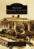
Around Yavapai County: Celebrating Arizona's Centennial
by Nancy Burgess Karen Despain Yavapai County Arizona Centennial CommitteeOn February 23, 1863, Pres. Abraham Lincoln signed the bill creating the Territory of Arizona. The first Arizona Territorial Legislature established the capital at Prescott and met in September 1864. They divided the territory into four counties: Mohave, Pima, Yavapai, and Yuma. Yavapai County, the "mother county," consisted of approximately 65,000 square miles and was believed to be the largest county in the United States. By the time Arizona attained statehood on February 14, 1912, there were 14 counties, and Yavapai County had been reduced in size to 8,125 square miles. Yavapai County has a rich history in mining, ranching, farming, military, and business. Today, Yavapai County is a thriving, growing county with nine incorporated cities and towns and numerous unincorporated communities, such as Ash Fork, Black Canyon City, Cornville, Mayer, and Skull Valley. Historic sites include Sharlot Hall Museum in Prescott, the town of Jerome, Fort Verde, Montezuma's Castle and Well, and Tuzigoot.
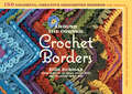
Around the Corner Crochet Borders: 150 Colorful, Creative Edging Designs with Charts and Instructions for Turning the Corner Perfectly Every Time
by Edie EckmanA crochet border is the perfect finishing touch on the edges of any fiber project, but creating one often means shaping the edging around an unforgiving 90-degree angle. It&’s no easy task, but Edie Eckman guides you through it with style and poise. This collection includes 150 vibrant crochet frames to suit every fiber need, with color photographs by John Polak that showcase the beautiful details of each technique. Now painless, marvelous crochet borders are just around the corner!
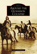
Around the Gunnison Country (Images of America)
by Duane VandenbuscheThe Gunnison country, 4,000 square miles of high valleys, heavy snows, deep canyons, and 14,000-foot-high mountains, is one of Colorado's most beautiful regions. Located on the Western Slope of Colorado, the Gunnison country has a long history involving Native Americans, mining, narrow-gauge railroads, ranching, Western State Colorado University, and recreation. The region has also been influenced by nearby Lake City in the San Juan Mountains, Aspen in the Elk Mountains, and towns on the east side of the famed and historic Alpine Railroad Tunnel. Today, the Gunnison country still is beautiful and tranquil, hosting nearly 2,000,000 visitors yearly while remaining much the same as it was over 125 years ago.
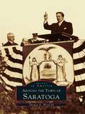
Around the Town of Saratoga
by Thomas N. Wood IIIAs the American struggle for independence intensified, Saratoga became a focal point of warring activities. Both colonists and loyalists maintained forts, camps, and officer headquarters within town. In 1777, after the two Battles of Saratoga, American forces gained the surrender of BritishGen. John Burgoyne, thus turning the tide of the Revolutionary War. The name Saratoga comes from the Mohawk word meaning either "place of the swift water" or "hillside country of the great river." True to its name, the town spreads across rolling hills along the western side of the Hudson River. The river itself, together with two early main roads and a canal, brought prosperity to the area. Saratoga became a major shipping terminal. The town boundaries changed several times throughout the years, but the rural character of the town and the spirit of its residents remained constant.

Around the World in 80 Birds
by Mike UnwinThis beautiful and inspiring book tells the stories of 80 birds around the world: from the Sociable Weaver Bird in Namibia which constructs huge, multi-nest 'apartment blocks' in the desert, to the Bar-headed Goose of China, one of the highest-flying migrants which crosses the Himalayas twice a year.Many birds come steeped in folklore and myth, some are national emblems and a few have inspired scientific revelation or daring conservation projects. Each has a story to tell that sheds a light on our relationship with the natural world and reveals just how deeply birds matter to us.

Around the World in 80 Buildings (Around the World in 80 #6)
by David LongWhere can you eat dinner under the sea? Which country has the most pyramids? Can a church become a swimming pool?Including a stunning central gatefold map that opens out to reveal where all 80 structures are located, this book is a visual celebration of the incredible structures people have built throughout history and their cultural significance. From ancient wonders such as Stonehenge to bridges spanning countries, record breaking rollercoasters and hotels where even the beds are made of ice.Discover a floating palace, a terracotta army, a cinema in a bank vault, and a building so tall that clouds form at the top!

Around the World in Cut-Outs
by PaperboyoGlobe-hopping artist Paperboyo transforms real iconic landmarks and settings around the world into works of art and amusement by just holding up a cut-out and snapping a photo. Here is New York's Guggenheim Museum as a flowerpot, the Eiffel Tower sporting butterfly wings, a giant octopus peeking its tentacles out of the Roman Colosseum, and nearly a hundred more images of wonder and humor. Organized into categories such as Quirky Architecture, Pop Culture, and Playing with Food, the book also covers Paperboyo's process with these topics:• Behind the Scenes• The Fails• D.I.Y.Featuring favorites from his wildly popular Instagram feed plus many never-before-seen delights, entertaining captions, behind-the-scenes, and cut-outs for readers to make their own images, Around the World in Cut-outs encourages a different and delightful view of the world around us.