- Table View
- List View
Geometric Science of Information: 6th International Conference, GSI 2023, St. Malo, France, August 30 – September 1, 2023, Proceedings, Part I (Lecture Notes in Computer Science #14071)
by Frank Nielsen Frédéric BarbarescoThis book constitutes the proceedings of the 6th International Conference on Geometric Science of Information, GSI 2023, held in St. Malo, France, during August 30-September 1, 2023. The 125 full papers presented in this volume were carefully reviewed and selected from 161 submissions. They cover all the main topics and highlights in the domain of geometric science of information, including information geometry manifolds of structured data/information and their advanced applications. The papers are organized in the following topics: geometry and machine learning; divergences and computational information geometry; statistics, topology and shape spaces; geometry and mechanics; geometry, learning dynamics and thermodynamics; quantum information geometry; geometry and biological structures; geometry and applications.
Geometric Science of Information: 6th International Conference, GSI 2023, St. Malo, France, August 30 – September 1, 2023, Proceedings, Part II (Lecture Notes in Computer Science #14072)
by Frank Nielsen Frédéric BarbarescoThis book constitutes the proceedings of the 6th International Conference on Geometric Science of Information, GSI 2023, held in St. Malo, France, during August 30-September 1, 2023. The 125 full papers presented in this volume were carefully reviewed and selected from 161 submissions. They cover all the main topics and highlights in the domain of geometric science of information, including information geometry manifolds of structured data/information and their advanced applications. The papers are organized in the following topics: geometry and machine learning; divergences and computational information geometry; statistics, topology and shape spaces; geometry and mechanics; geometry, learning dynamics and thermodynamics; quantum information geometry; geometry and biological structures; geometry and applications.
Geometric Structures of Information (Signals and Communication Technology)
by Frank NielsenThis book focuses on information geometry manifolds of structured data/information and their advanced applications featuring new and fruitful interactions between several branches of science: information science, mathematics and physics. It addresses interrelations between different mathematical domains like shape spaces, probability/optimization & algorithms on manifolds, relational and discrete metric spaces, computational and Hessian information geometry, algebraic/infinite dimensional/Banach information manifolds, divergence geometry, tensor-valued morphology, optimal transport theory, manifold & topology learning, and applications like geometries of audio-processing, inverse problems and signal processing. The book collects the most important contributions to the conference GSI’2017 – Geometric Science of Information.
Geometric Tolerancing Standard to Machine Design: A Design-for-Fit Approach
by Faryar EtesamiThis book is for students enrolled in undergraduate mechanical engineering, or similar, programs. The material presented is based on nearly thirty years of class-tested lecture notes for courses on the applications of geometric tolerancing for designers. The book’s emphasis is on fit requirements for machine components, as fit assurance makes up the majority of challenging applications in tolerancing. For design engineers, knowing how to apply geometric tolerances has been a challenge even for engineers who have practiced geometric tolerancing for a long time. The syntax and meaning of geometric tolerancing statements can be learned easily and quickly, but knowing how to use them correctly is much more difficult. In the Design-for-Fit approach, the presentation starts with the geometric requirements for various kinds of fit and then presents the geometric tolerance statements necessary to achieve those fits.
Geometric and Topological Inference (Cambridge Texts in Applied Mathematics #57)
by Jean-Daniel Boissonnat Frédéric Chazal Mariette YvinecGeometric and topological inference deals with the retrieval of information about a geometric object using only a finite set of possibly noisy sample points. It has connections to manifold learning and provides the mathematical and algorithmic foundations of the rapidly evolving field of topological data analysis. Building on a rigorous treatment of simplicial complexes and distance functions, this self-contained book covers key aspects of the field, from data representation and combinatorial questions to manifold reconstruction and persistent homology. It can serve as a textbook for graduate students or researchers in mathematics, computer science and engineering interested in a geometric approach to data science.
Geometrical Multiresolution Adaptive Transforms
by Agnieszka LisowskaModern image processing techniques are based on multiresolution geometrical methods of image representation. These methods are efficient in sparse approximation of digital images. There is a wide family of functions called simply 'X-lets', and these methods can be divided into two groups: the adaptive and the nonadaptive. This book is devoted to the adaptive methods of image approximation, especially to multismoothlets. Besides multismoothlets, several other new ideas are also covered. Current literature considers the black and white images with smooth horizon function as the model for sparse approximation but here, the class of blurred multihorizon is introduced, which is then used in the approximation of images with multiedges. Additionally, the semi-anisotropic model of multiedge representation, the introduction of the shift invariant multismoothlet transform and sliding multismoothlets are also covered. Geometrical Multiresolution Adaptive Transforms should be accessible to both mathematicians and computer scientists. It is suitable as a professional reference for students, researchers and engineers, containing many open problems and will be an excellent starting point for those who are beginning new research in the area or who want to use geometrical multiresolution adaptive methods in image processing, analysis or compression.
Geometry Dash Guía No Oficial
by Joshua Abbott I. Fernandez¡Con mi guía aprenderás justo lo que necesitas saber para convertirte en un jugador experto y pasar niveles! Es una guía completa con todo lo que necesitas saber sobre el juego Y ADEMÁS podrás descargar una copia del juego de forma gratuita con tu compra. *Resumen e información básica. *Consejos y estrategias de profesionales *Instrucciones detalladas y fáciles de seguir. *Supera niveles. *Trucos. *¡Secretos, consejos y trucos, que utilizan jugadores profesionales! *¡Y MUCHO MÁS! ¡Hazte con la guía ahora y destroza a tus adversarios! ¡Conviértete en un jugador pro hoy mismo! Descargo de responsabilidad Este producto no está asociado, afiliado, promocionado, certificado o patrocinado por RobTop Games. Esta guía ha de ser usada como referencia y como tal no Modifica el juego de ninguna forma. Es una guía escrita y no software.
Geometry Dash Meltdown Guida Non Ufficiale del Gioco
by Stefania Pezzato Hiddenstuff EntertainmentOltre ad comprare questo libro iscriviti per il nostro programma di guide supplementari gratuite. Copiando il link qui sotto avrai accesso agli ultimi aggiornamenti per i più popolari videogiochi e app. Iscriviti gratis qua sotto: http://emailsignupform.subscribemenow.com/ Guida con Suggerimenti & Strategie Avanzati. Questa è la guida più completa e la sola dettagliata che troverai online. Disponibile per il download immediato sul tuo smartphone, eBook reader o in cartaceo. Con il successo delle mie altre centinaia di guide e strategie scritte, ho creato un'altra guida professionale avanzata per i giocatori nuovi e veterani. Questa guida fornisce specifiche strategie e suggerimenti sul come progredire nel gioco, battere i tuoi avversari, ottenere più monete e denaro, e molto altro! Ecco cosa avrai comprando questa guida del gioco professionale avanzata e dettagliata. - Suggerimenti e Strategie Professionali. - Cheat e Hack. - Segreti, Suggerimenti, Cheat, Sbloccabili, e Triucchi Usati dai Giocatori Pro! - Come Avere Tonnellate di Denaro/Monete. - E MOLTO ALTRO! Tutte le versioni di questa guida hanno degli screenshot per aiutarti a capire meglio il gioco. Non c'è altra guida completa e avanzata quanto questa. Se stai cercando guide su altri giochi e app famosi cerca altri titoli di Joshua J Abbott o della HSE Games. Sarai felici di aver comprato questa guida e ne trarrai molti benefici in confronto ad altre guide meno efficaci sul mercato. Comprala ora e batti i tuoi avversari! Diventa un Giocatore Pro Oggi! Per supporto e altre informazioni sui nostri prodotti visitate: http://www.hiddenstuffentertainment.com/ Disclaimer: Questo prodotto non è associato, affiliato, promosso o sponsorizzato dal Proprietario Originale del Copyright. Tutti i marchi che appaiono in questo ebook sono registrati e appartengono ai rispettivi proprietari.
Geometry and Complexity Theory (Cambridge Studies in Advanced Mathematics #169)
by J. M. LandsbergTwo central problems in computer science are P vs NP and the complexity of matrix multiplication. The first is also a leading candidate for the greatest unsolved problem in mathematics. The second is of enormous practical and theoretical importance. Algebraic geometry and representation theory provide fertile ground for advancing work on these problems and others in complexity. This introduction to algebraic complexity theory for graduate students and researchers in computer science and mathematics features concrete examples that demonstrate the application of geometric techniques to real world problems. Written by a noted expert in the field, it offers numerous open questions to motivate future research. Complexity theory has rejuvenated classical geometric questions and brought different areas of mathematics together in new ways. This book will show the beautiful, interesting, and important questions that have arisen as a result.
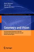
Geometry and Vision: First International Symposium, ISGV 2021, Auckland, New Zealand, January 28-29, 2021, Revised Selected Papers (Communications in Computer and Information Science #1386)
by Wei Qi Yan Minh Nguyen Harvey HoThis book constitutes selected papers from the First International Symposium on Geometry and Vision, ISGV 2021, held in Auckland, New Zealand, in January 2021. Due to the COVID-19 pandemic the conference was held in partially virtual format. The 29 papers were thoroughly reviewed and selected from 50 submissions. They cover topics in areas of digital geometry, graphics, image and video technologies, computer vision, and multimedia technologies.
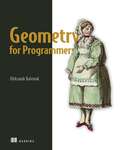
Geometry for Programmers
by Oleksandr KaleniukMaster the math behind CAD, game engines, GIS, and more! This hands-on book teaches you the geometry used to create simulations, 3D prints, and other models of the physical world.In Geometry for Programmers you will learn how to: Speak the language of applied geometry Compose geometric transformations economically Craft custom splines for efficient curves and surface generation Pick and implement the right geometric transformations Confidently use important algorithms that operate on triangle meshes, distance functions, and voxels Geometry for Programmers guides you through the math behind graphics and modeling tools. It&’s full of practical examples and clear explanations that make sense even if you don&’t have a background in advanced math. You&’ll learn how basic geometry can help you avoid code layering and repetition, and even how to drive down cloud hosting costs with more efficient runtimes. Cheerful language, charts, illustrations, equations, and Python code help make geometry instantly relevant to your daily work as a developer. About the Technology Geometry is at the heart of game engines, robotics, computer-aided design, GIS, and image processing. This book draws back what is for some a mathematical curtain, giving them insight and control over this central tool. You&’ll quickly see how a little geometry can help you design realistic simulations, translate the physical world into code, and even reduce your cloud services bill by improving the efficiency of graphics-intensive applications. About the Book Geometry for Programmers is both practical and entertaining. Fun illustrations and engaging examples show you how to apply geometry to real programming problems, like changing a scan into a CAD model or developing 3D printing contours from a parametric function. And don&’t worry if you aren&’t a math expert. There&’s no heavy theory, and you&’ll learn how to offload most equations to the SymPy computer algebra system. What&’s Inside Speak the language of applied geometry Compose geometric transformations economically Craft custom splines for efficient curves and surface generation Confidently use geometry algorithms About the Reader Examples are in Python, and all you need is high school–level math. About the Author Oleksandr Kaleniuk is the creator of Words and Buttons Online, a collection of interactive tutorials on math and programming. Table of Contents 1 Getting started 2 Terminology and jargon 3 The geometry of linear equations 4 Projective geometric transformations 5 The geometry of calculus 6 Polynomial approximation and interpolation 7 Splines 8 Nonlinear transformations and surfaces 9 The geometry of vector algebra 10 Modeling shapes with signed distance functions and surrogates 11 Modeling surfaces with boundary representations and triangle meshes 12 Modeling bodies with images and voxels
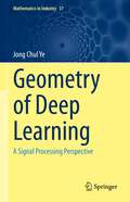
Geometry of Deep Learning: A Signal Processing Perspective (Mathematics in Industry #37)
by Jong Chul YeThe focus of this book is on providing students with insights into geometry that can help them understand deep learning from a unified perspective. Rather than describing deep learning as an implementation technique, as is usually the case in many existing deep learning books, here, deep learning is explained as an ultimate form of signal processing techniques that can be imagined. To support this claim, an overview of classical kernel machine learning approaches is presented, and their advantages and limitations are explained. Following a detailed explanation of the basic building blocks of deep neural networks from a biological and algorithmic point of view, the latest tools such as attention, normalization, Transformer, BERT, GPT-3, and others are described. Here, too, the focus is on the fact that in these heuristic approaches, there is an important, beautiful geometric structure behind the intuition that enables a systematic understanding. A unified geometric analysis to understand the working mechanism of deep learning from high-dimensional geometry is offered. Then, different forms of generative models like GAN, VAE, normalizing flows, optimal transport, and so on are described from a unified geometric perspective, showing that they actually come from statistical distance-minimization problems.Because this book contains up-to-date information from both a practical and theoretical point of view, it can be used as an advanced deep learning textbook in universities or as a reference source for researchers interested in acquiring the latest deep learning algorithms and their underlying principles. In addition, the book has been prepared for a codeshare course for both engineering and mathematics students, thus much of the content is interdisciplinary and will appeal to students from both disciplines.
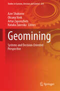
Geomining: Systems and Decision-Oriented Perspective (Studies in Systems, Decision and Control #224)
by Artur Zaporozhets Azer Shukurov Oksana Vovk Natalia ZuievskaThis book represents a comprehensive exploration of the intricate intersection between geology and mining through the lens of system-oriented perspectives. Geomining stands at the forefront of modern resource extraction, blending the principles of geology, engineering, transport, and environmental science to optimize the extraction of minerals and other valuable resources from the Earth's crust. It is a dynamic field that continually evolves in response to technological advancements, environmental concerns, and economic realities. In this book, we aim to capture the essence of geomining as a holistic system, emphasizing the interconnectedness of its various components and the importance of integrated approaches to resource management. The geomining is a complex of heavy industry sectors that includes the exploration of mineral deposits, the extraction of minerals from the Earth's subsurface, and the enrichment of valuable minerals. Among the main groups of the geomining industry, the following are distinguished—fuel extraction (coal, oil, shale, peat, natural gas extraction); ore mining (iron ore, manganese ore, extraction of non-ferrous ores, precious and rare metals, etc.); mining and chemical industry (extraction of potassium salts, rock salt, apatites, nephelines, bauxites, sulfur, phosphorites, etc.); extraction of mineral raw materials for the construction industry; extraction of mineral raw materials for refractory and ceramic industries; hydromeliorative activities. The concept of a system-oriented view on geomining recognizes that mining activities do not occur in isolation but are part of larger, interconnected systems that encompass geological, environmental, social, and economic dimensions. By adopting a systems perspective, we can better understand the complexities inherent in resource extraction and develop more sustainable and efficient mining practices. This book is divided into 3 parts, each focusing on different aspects of geomining from a systems perspective.
Geomorphic Risk Reduction Using Geospatial Methods and Tools (Disaster Risk Reduction)
by Rajib Shaw Basanta Raj Adhikari Raju Sarkar Sunil SahaThis book explores the use of advanced geospatial techniques in geomorphic hazards modelling and risk reduction. It also compares the accuracy of traditional statistical methods and advanced machine learning methods and addresses the different ways to reduce the impact of geomorphic hazards.In recent years with the development of human infrastructures, geomorphic hazards are gradually increasing, which include landslides, flood and soil erosion, among others. They cause huge loss of human property and lives. Especially in mountainous, coastal, arid and semi-arid regions, these natural hazards are the main barriers for economic development. Furthermore, human pressure and specific human actions such as deforestation, inappropriate land use and farming have increased the danger of natural disasters and degraded the natural environment, making it more difficult for environmental planners and policymakers to develop appropriate long-term sustainability plans. The most challenging task is to develop a sophisticated approach for continuous inspection and resolution of environmental problems for researchers and scientists. However, in the past several decades, geospatial technology has undergone dramatic advances, opening up new opportunities for handling environmental challenges in a more comprehensive manner.With the help of geographic information system (GIS) tools, high and moderate resolution remote sensing information, such as visible imaging, synthetic aperture radar, global navigation satellite systems, light detection and ranging, Quickbird, Worldview 3, LiDAR, SPOT 5, Google Earth Engine and others deliver state-of-the-art investigations in the identification of multiple natural hazards. For a thorough examination, advanced computer approaches focusing on cutting-edge data processing, machine learning and deep learning may be employed. To detect and manage various geomorphic hazards and their impact, several models with a specific emphasis on natural resources and the environment may be created.
Geoparticipatory Spatial Tools (Local and Urban Governance)
by Jiří PánekThe book explores the key factors affecting the successful implementation of public participation spatial systems in participatory planning as part of the urban governance system. It brings insight from nation-wide research in the Czech Republic and the implications to other countries in the region and beyond. The main aim of the proposed book is to analyse the state-of-the-art of using geoparticipatory tools for citizens’ participation in community decision-making process and to suggest the effective implementation of the geoparticipatory tools available in urban governance. This book explores the situation in the Czech Republic as a representative of for Eastern Bloc country, three decades after the political transition, on its way to public participation in local and urban governance. The active involvement of the citizens into the local and urban decision making process via geoparticipatory spatial tools is becoming a popular research field among human geographers, behavioural geographers, GIS scientists, environmental psychologists, policy scientists and many others scientific areas.
Geopedology: An Integration of Geomorphology and Pedology for Soil and Landscape Studies
by Joseph Alfred Zinck Graciela Metternicht Héctor Francisco del Valle Marcos AngeliniThis updated and revised second edition brings geopedology issues into the current context. This new edition extends the work on popular topics such as digital soil mapping, GIS and landscape mapping, and it also gives valuable insight with up-to-date theoretical discussions and new application with relevant case studies. This textbook offers a proven approach for reliable mapping of soil-landscape relationships to derive information for policy, planning and management at scales ranging from local to regional. Filled with didactic elements such as case studies, visual aids (maps, charts and figures), questions and answers, the book is of interest to geohazard studies, land use conflict analysis, land use planning, land degradation assessment, and land suitability analysis. Soil is a vital resource for society at large and an important determinant of the economic status of nations. The intensification of natural disasters and the increased land use competition for food and energy have raised awareness of the relevant role the pedosphere plays in natural and anthropogenic environments. Recent papers and global initiatives show a renewed interest in soil research and its applications for improved planning and management of this fragile and finite resource.
Geoprocessing with Python
by Christine GarrardSummaryGeoprocessing with Python teaches you how to use the Python programming language, along with free and open source tools, to read, write, and process geospatial data.Purchase of the print book includes a free eBook in PDF, Kindle, and ePub formats from Manning Publications.About the TechnologyThis book is about the science of reading, analyzing, and presenting geospatial data programmatically, using Python. Thanks to dozens of open source Python libraries and tools, you can take on professional geoprocessing tasks without investing in expensive proprietary packages like ArcGIS and MapInfo. The book shows you how.About the BookGeoprocessing with Python teaches you how to access available datasets to make maps or perform your own analyses using free tools like the GDAL, NumPy, and matplotlib Python modules. Through lots of hands-on examples, you’ll master core practices like handling multiple vector file formats, editing geometries, applying spatial and attribute filters, working with projections, and performing basic analyses on vector data. The book also covers how to manipulate, resample, and analyze raster data, such as aerial photographs and digital elevation models.What's InsideGeoprocessing from the ground upRead, write, process, and analyze raster dataVisualize data with matplotlibWrite custom geoprocessing toolsThree additional appendixes available onlineAbout the ReaderTo read this book all you need is a basic knowledge of Python or a similar programming language.About the AuthorChris Garrard works as a developer for Utah State University and teaches a graduate course on Python programming for GIS.Table of ContentsIntroductionPython basicsReading and writing vector dataWorking with different vector file formatsFiltering data with OGRManipulating geometries with OGRVector analysis with OGRUsing spatial reference systemsReading and writing raster dataWorking with raster dataMap algebra with NumPy and SciPyMap classificationVisualizing dataAppendixesA - InstallationB - ReferencesC - OGR - online onlyD - OSR - online onlyE - GDAL - online only
Geoscience Research and Outreach: Schools and Public Engagement
by Vincent C. TongFrom energy and water resources to natural disasters, and from changing climatic patterns to the evolution of the Earth's deep interior, geoscience research affects people's lives in many ways and on many levels. This book offers a stimulating cross-disciplinary perspective on the important relationship between geoscience research and outreach activities for schools and for the general public. The contributors - academics, research scientists, science educators and outreach program educators - describe and evaluate outreach programs from around the world. A section entitled Field-based Approaches includes a chapter describing an initiative to engage Alaskan communities and students in research, and another on problem-based learning in the field setting. The Online Approaches section discusses ways to connect students and scientists using online forums; use of the web and social media, including the United Nations University and its experience with the design of a web magazine featuring geoscience research; and video clips on marine geoscience created by students and scientists. The section on Workshop and Laboratory-based Approaches includes a chapter on teaching geochronology to high school students, and another describing an extracurricular school activity program on meteorology. The Program Design section presents chapters on Integrating Geoscience Research in Primary and Secondary Education, on ways to bridge research with science education at the high school level, and on use of online geoscience data from the Great Lakes. The concluding section, Promoting Research-enhanced Outreach, offers chapters on Geoscience Outreach Education with the local community by a leading research-intensive university, and on the use of research to promote action in Earth science professional development for schoolteachers.Geoscience Research and Outreach: Schools and Public Engagement will benefit geoscience researchers who wish to promote their work beyond academia. It offers guidance to those seeking research funding from agencies, which increasingly request detailed plans for outreach activities in research proposals. Policymakers, educators and scientists working in museums, learned societies and public organizations who wish to widen participation will also find this book useful. Together with the companion volume Geoscience Research and Education: Teaching at Universities, this book showcases the key role that geoscience research plays in a wide spectrum of educational settings.
Geospatial Analysis with SQL: A hands-on guide to performing geospatial analysis by unlocking the syntax of spatial SQL
by Bonny P McClainLeverage the power of SQL to perform geospatial analysis and increase your speed and efficiency working with a variety of spatial applications such as PostGIS and QGISKey FeaturesFollow along with actionable instructions with this practical guideBecome well-versed in advanced spatial modeling and machine learning techniquesLearn best practices for performing spatial analysis from an expert spatial data analystBook DescriptionGeospatial analysis is used in almost every industry to answer location-related questions. Combined with the power of SQL, which is becoming a popular choice for developers and analysts worldwide, this technology will help you to solve real-world spatial problems easily. This book shows you how to detect and quantify patterns in datasets through data exploration, data visualization, data engineering, and the application of analysis and spatial techniques.You'll begin by exploring the fundamentals of geospatial analysis and understand its importance along with vector and raster models, among other things. You'll then look at the framework for geospatial analysis using SQL and progress through the chapters to create a spatial database and analyze it. In the next part, you'll advance to learning about using SQL functions and building SQL queries.By the end of this book, you'll be able to make the most of open source libraries and frameworks such as PostGIS and QGIS for analyzing spatial information.What you will learnUnderstand geospatial fundamentals as a basis for learning spatial SQLGenerate point, line, and polygon data with SQLCreate geometry objects with WKT, WKB, and GeoJSONUse spatial data types to abstract and encapsulate spatial structuresWork with open source GIS combined with plug-insVisualize spatial data and expand QGIS functionality with PostgresApply location data to leverage spatial analyticsPerform single-layer and multiple-layer spatial analysesWho this book is forThis book is for anyone looking to leverage their SQL knowledge to perform geospatial analysis. GIS analysts, data analysts, and data scientists with a basic understanding of both geospatial analysis and SQL will find this book useful.
Geospatial Analysis with SQL: A hands-on guide to performing geospatial analysis by unlocking the syntax of spatial SQL
by Bonny P McClainLeverage the power of SQL to perform geospatial analysis and increase your speed and efficiency working with a variety of spatial applications such as PostGIS and QGISKey FeaturesFollow along with actionable instructions with this practical guideBecome well-versed in advanced spatial modeling and machine learning techniquesLearn best practices for performing spatial analysis from an expert spatial data analystBook DescriptionGeospatial analysis is industry agnostic and a powerful tool for answering location questions. Combined with the power of SQL, developers and analysts worldwide rely on database integration to solve real-world spatial problems. This book introduces skills to help you detect and quantify patterns in datasets through data exploration, visualization, data engineering, and the application of analysis and spatial techniques. You will begin by exploring the fundamentals of geospatial analysis where you’ll learn about the importance of geospatial analysis and how location information enhances data exploration. Walter Tobler’s second law of geography states, “the phenomenon external to a geographic area of interest affects what goes on inside.” This quote will be the framework of the geospatial questions we will explore. You’ll then observe the framework of geospatial analysis using SQL while learning to create spatial databases and SQL queries and functions. By the end of this book, you will have an expanded toolbox of analytic skills such as PostGIS and QGIS to explore data questions and analysis of spatial information.What you will learnUnderstand geospatial fundamentals as a basis for learning spatial SQLGenerate point, line, and polygon data with SQLUse spatial data types to abstract and encapsulate spatial structuresWork with open source GIS combined with plug-insVisualize spatial data and expand QGIS functionality with PostgresApply location data to leverage spatial analyticsPerform single-layer and multiple-layer spatial analysesWho this book is forThis book is for anyone looking to leverage their SQL knowledge to perform geospatial analysis. GIS analysts, data analysts, and data scientists with a basic understanding of both geospatial analysis and SQL will find this book useful.
Geospatial Analytics for Environmental Pollution Modeling: Analysis, Control and Management
by Majid Farooq Fayma Mushtaq Alok Bhushan Mukherjee Mili Ghosh Nee LalaThis book aims to provide a comprehensive study on various aspects of environmental pollution dynamics using geospatial technology and modeling techniques. The utility of geospatial technology will be demonstrated for the effective study of environmental pollution, as space and location are very important for effective environmental health surveillance. The timeliness of the work is due to the increasing relevance of geospatial technology applications in environmental health investigations. Moreover, different types of pollution are covered in detail, including air and soil, all of which are analyzed using latest Remote Sensing and GIS technology. The basics of environmental pollution and its impacts are covered in the book's first part, while the second part focuses on the use of geospatial technology in investigating and modeling various instances of environmental pollution. The third part discusses policy measures for mitigating environmental pollution hazards, using geospatial analyses and data to craft informed policy decisions. The primary audience for the book is researchers working in the field of environmental pollution with incorporation of geospatial technology, including upper-level undergraduate and graduate students taking courses in remote sensing and its environmental applications. The secondary audience is academicians, planners, environmentalists and policymakers working in the field of environment protection and management.
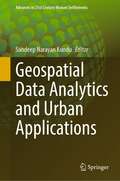
Geospatial Data Analytics and Urban Applications (Advances in 21st Century Human Settlements)
by Sandeep Narayan KunduThis book highlights advanced applications of geospatial data analytics to address real-world issues in urban society. With a connected world, we are generating spatial at unprecedented rates which can be harnessed for insightful analytics which define the way we analyze past events and define the future directions. This book is an anthology of applications of spatial data and analytics performed on them for gaining insights which can be used for problem solving in an urban setting. Each chapter is contributed by spatially aware data scientists in the making who present spatial perspectives drawn on spatial big data. The book shall benefit mature researchers and student alike to discourse a variety of urban applications which display the use of machine learning algorithms on spatial big data for real-world problem solving.
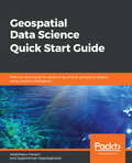
Geospatial Data Science Quick Start Guide: Effective techniques for performing smarter geospatial analysis using location intelligence
by Jayakrishnan Vijayaraghavan Abdishakur HassanDiscover the power of location data to build effective, intelligent data models with Geospatial ecosystemsKey FeaturesManipulate location-based data and create intelligent geospatial data modelsBuild effective location recommendation systems used by popular companies such as UberA hands-on guide to help you consume spatial data and parallelize GIS operations effectivelyBook DescriptionData scientists, who have access to vast data streams, are a bit myopic when it comes to intrinsic and extrinsic location-based data and are missing out on the intelligence it can provide to their models. This book demonstrates effective techniques for using the power of data science and geospatial intelligence to build effective, intelligent data models that make use of location-based data to give useful predictions and analyses.This book begins with a quick overview of the fundamentals of location-based data and how techniques such as Exploratory Data Analysis can be applied to it. We then delve into spatial operations such as computing distances, areas, extents, centroids, buffer polygons, intersecting geometries, geocoding, and more, which adds additional context to location data. Moving ahead, you will learn how to quickly build and deploy a geo-fencing system using Python. Lastly, you will learn how to leverage geospatial analysis techniques in popular recommendation systems such as collaborative filtering and location-based recommendations, and more.By the end of the book, you will be a rockstar when it comes to performing geospatial analysis with ease.What you will learnLearn how companies now use location dataSet up your Python environment and install Python geospatial packagesVisualize spatial data as graphsExtract geometry from spatial dataPerform spatial regression from scratchBuild web applications which dynamically references geospatial dataWho this book is forData Scientists who would like to leverage location-based data and want to use location-based intelligence in their data models will find this book useful. This book is also for GIS developers who wish to incorporate data analysis in their projects. Knowledge of Python programming and some basic understanding of data analysis are all you need to get the most out of this book.
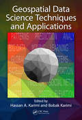
Geospatial Data Science Techniques and Applications
by Hassan A. Karimi and Bobak KarimiData science has recently gained much attention for a number of reasons, and among them is Big Data. Scientists (from almost all disciplines including physics, chemistry, biology, sociology, among others) and engineers (from all fields including civil, environmental, chemical, mechanical, among others) are faced with challenges posed by data volume, variety, and velocity, or Big Data. This book is designed to highlight the unique characteristics of geospatial data, demonstrate the need to different approaches and techniques for obtaining new knowledge from raw geospatial data, and present select state-of-the-art geospatial data science techniques and how they are applied to various geoscience problems.
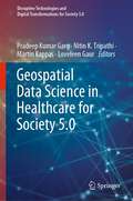
Geospatial Data Science in Healthcare for Society 5.0 (Disruptive Technologies and Digital Transformations for Society 5.0)
by Martin Kappas Loveleen Gaur Pradeep Kumar Garg Nitin K. TripathiThe book introduces a variety of latest techniques designed to represent, enhance, and empower multi-disciplinary approaches of geographic information system (GIS), artificial intelligence (AI), deep learning (DL), machine learning, and cloud computing research in healthcare. It provides a unique compendium of the current and emerging use of geospatial data for healthcare and reflects the diversity, complexity, and depth and breadth of this multi-disciplinary area. This book addresses various aspects of how smart healthcare devices can be used to detect and analyze diseases. Further, it describes various tools and techniques to evaluate the efficacy, suitability, and efficiency of geospatial data for health-related applications. It features illustrative case studies, including future applications and healthcare challenges. This book is beneficial for computer science and engineering students and researchers, medical professionals, and anyone interested in using geospatial data in healthcare. It is also intended for experts, offering them a valuable retrospective and a global vision for the future, as well as for non-experts who are curious to learn about this important subject. The book presents an effort to draw how we can build health-related applications using geospatial big data and their subsequent analysis.
