- Table View
- List View
Tales for Makers: Real-World Projects to Modify, Hack, and Reinvent (Maker Innovations Series)
by Enrico MiglinoRay Badmington's son Tommy has disappeared in a strange amusement park in the near future of Los Angeles. Explore the world of the BDTH6159 Amusement Park, hosting strange characters and incredible mechanisms, with Ray as he searches for his son. You'll find clues that help him, but also face unfamiliar technologies. Technologies you'll interact with and can even build in the real world today. This book springs the support of Element14.com, one of the largest Maker communities in the world. As the plot twists and turns and you follow along on Ray's adventures, you'll find each story beat matched with a specific application topic. Everything Ray interacts with will offer a real-world, complete experiment that can be modified, hacked and reinvented. Projects will introduce you to the use of distance sensors; managing stepper motors; creating an environmental sensor; working with sound; and programing languages, such as C/C++, Python, MicroPython, Java Script, and more. Each project covers not only different technologies, but also different approaches based on user-level. So whether you're a weekend hobbyist or a full-time engineer, you'll learn something new as you quest along with Ray. By the end of this book, you'll discover all the secrets of the BDTH6159 Amusement Park and have learned how to tackle a vast array of engaging and exciting Maker projects. What You'll LearnIncorporate sensors for environment, sound, distance, and more into your projectsTackle popular programming language basics for C/C++, Python, MicroPython, Java Script, and more3D print and solder together basic components to create new and exciting designs Who This Book Is ForThe projects are designed at various levels of complexity to engage any kind of Makers from hobbyist to professional engineer.
Tales from a Robotic World: How Intelligent Machines Will Shape Our Future
by Dario Floreano Nicola NosengoStories from the future of intelligent machines—from rescue drones to robot spouses—and accounts of cutting-edge research that could make it all possible.Tech prognosticators promised us robots—autonomous humanoids that could carry out any number of tasks. Instead, we have robot vacuum cleaners. But, as Dario Floreano and Nicola Nosengo report, advances in robotics could bring those rosy predictions closer to reality. A new generation of robots, directly inspired by the intelligence and bodies of living organisms, will be able not only to process data but to interact physically with humans and the environment. In this book, Floreano, a roboticist, and Nosengo, a science writer, bring us tales from the future of intelligent machines—from rescue drones to robot spouses—along with accounts of the cutting-edge research that could make it all possible. These stories from the not-so-distant future show us robots that can be used for mitigating effects of climate change, providing healthcare, working with humans on the factory floor, and more. Floreano and Nosengo tell us how an application of swarm robotics could protect Venice from flooding, how drones could reduce traffic on the congested streets of mega-cities like Hong Kong, and how a &“long-term relationship model&” robot could supply sex, love, and companionship. After each fictional scenario, they explain the technologies that underlie it, describing advances in such areas as soft robotics, swarm robotics, aerial and mobile robotics, humanoid robots, wearable robots, and even biohybrid robots based on living cells. Robotics technology is no silver bullet for all the world&’s problems—but it can help us tackle some of the most pressing challenges we face.
Tales from the National Press Club
by Gil KleinA behind-the-scenes history of the organization behind the White House Correspondents&’ Dinner—and the news-breakers and newsmakers who&’ve been part of it. Since the beginning of the twentieth century, the National Press Club has been the hub of Washington journalism. Started by reporters as a watering hole for late-night card games, the Club soon attracted not only icons from Edward R. Murrow to Bob Woodward to Helen Thomas, but every US president from Theodore Roosevelt onward, and various newsmakers who shaped American and world history. While adapting to changes in the news media, it continues to stand for the values of journalism and press freedom in the twenty-first century. Now journalist and longtime member Gil Klein tells just a few of the tales that stand out in the history of the Club, which CBS commentator Eric Sevareid once called &“the only hallowed place I know of that&’s absolutely bursting with irreverence.&”
Tales from the Pizzaplex #8: B7-2: An AFK Book (Five Nights At Freddy's)
by Kelly Parra Scott Cawthon Andrea WaggenerFive Nights at Freddy's fans won't want to miss this collection of three chilling stories that will haunt even the bravest player...In this eighth volume, Five Nights at Freddy's creator Scott Cawthon spins three sinister novella-length tales from uncharted corners of his series' canon. In the world of Five Nights at Freddy's, everything comes with a price to pay.Readers beware: This collection of terrifying tales is enough to rattle even the most hardened Five Nights at Freddy's fans.
Tales of Electrologica: Computers, Software and People (History of Computing)
by Gerard Alberts Jan Friso GrooteManufacturing computers in series was quite a feat in the 1950s. As mathematical as it gets, the machines discussed here were called X1 and X8.The industrial achievement combined with the background in a mathematical research center made the company Electrologica a legend in Dutch computing. The tales in this book are told by those who have a right to tell. Highly engaged professionals take readers back to their pioneering work with the machines and in retrospect unveil some of the values, which went without saying in the 1960s. To disagree, Paul Klint relates the contrasting views on software in Dutch research traditions. ALGOL culture: Frans Kruseman Aretz takes the reader along to the detailed decisions on constructing compilers and shows the values of an ALGOL culture transpiring. Signposts: Dirk Dekker for the first time ‘owns’ his algorithm for mutual exclusion. In particle physics: René van Dantzig’s use case was an Electrologica X8 computer controlling two other computers in three-dimensional detection of colliding particles. Early steps in AI: Lambert Meertens’ tale of the X8 machine composing a violin quartet comes with his original presentation, as well as the code in ALGOL 60. The reflections of first hand experiences combine well with the second thoughts of historical research into archival sources. Historians Huub de Beer and Gerard Alberts offer a view into the boardrooms of the local enterprise Electrologica, and of the electronics multinational Philips. Where pioneers and historians meet in an inspiring dialogue, the reader gains a view on the often implicit decisions constituting the field.Fortuitously, a copy of the X8 was retrieved from Kiel, Germany, and put on display at Rijksmuseum Boerhaave, Leiden. Sparked by the very material presence of an X8, the present book takes stock of the state of historiography of Electrologica.Gerard Alberts is an associate professor in History of Digital Cultures, retired from the University of Amsterdam. Jan Friso Groote is a full professor of Formal Methods at the Eindhoven University of Technology.
Talk Is Cheap
by James E. GaskinFed up with the high tolls charged by your ordinary telephone service? If you're itching to cut the copper cord with your costly, traditional phone service, you need Talk is Cheap, the new, easy-to-understand guide to understanding and using Voice over Internet Protocol (VoIP) and other Internet telephone options. Technologies such as VoIP are gaining a great deal of attention these days as more people switch from standard telephone service to phone service via the Internet. But while the cost savings are outstanding, there are some issues with Internet telephony that you should know about. Are the connections reliable? Is the quality comparable? Will it include 911 services? James Gaskin's Talk is Cheap addresses these issues and many more by explaining how to make the switch and what the trade-offs will be if you opt for Internet telephony over traditional phone services. Talk is Cheap focuses on the increasingly popular services from Vonage, which uses VoIP, and Skype--a free service that operates as a peer-to-peer (P2P) network with the ability to turn any PC, Mac, or Pocket PC into a telephone. The book explains your options; explores the background behind, the workings of, and differences between VoIP and P2P networks; and discusses the advantages and drawbacks of both technologies (including service offerings, quality, capabilities, completion rates, and more). Talk is Cheap then goes into detail on what you can expect in Internet service from traditional phone companies such as Verizon and ATT. In addition, you will learn more advanced techniques, including how to turn your Palm or Pocket PC into an Internet phone and how to work with Wi-Fi phones and videophones. A straightforward, quick introduction to the ins and outs of using Internet telephone services, this book provides everything you need to make informed telephone decisions--whether you're thinking about the switch from traditional phone service or have already made it and want to get the most out of your new Internet telephone.
Talk Radio’s America: How an Industry Took Over a Political Party That Took Over the United States
by Brian RosenwaldThe march to the Trump presidency began in 1988, when Rush Limbaugh went national. Brian Rosenwald charts the transformation of AM radio entertainers into political kingmakers. By giving voice to the conservative base, they reshaped the Republican Party and fostered demand for a president who sounded as combative and hyperbolic as a talk show host.
Talk to Me: How Voice Computing Will Transform the Way We Live, Work, and Think
by James Vlahos**To chat with the author, ask your Alexa device to "open the voice computing book."** The next great technological disruption is coming The titans of Silicon Valley are racing to build the last, best computer that the world will ever need. They know that whoever successfully creates it will revolutionize our relationship with technology—and make billions of dollars in the process. They call it conversational AI. Computers that can speak and think like humans may seem like the stuff of science fiction, but they are rapidly moving toward reality. In Talk to Me, veteran tech journalist James Vlahos meets the researchers at Amazon, Google, and Apple who are leading the way. He explores how voice tech will transform every sector of society: handing untold new powers to businesses, overturning traditional notions of privacy, upending how we access information, and fundamentally altering the way we understand human consciousness. And he even tries to understand the significance of the voice-computing revolution first-hand — by building a chatbot version of his terminally ill father. Vlahos&’s research leads him to one fundamental question: What happens when our computers become as articulate, compassionate, and creative as we are?
Talker Quality in Human and Machine Interaction: Modeling the Listener’s Perspective in Passive and Interactive Scenarios (T-Labs Series in Telecommunication Services)
by Benjamin WeissThe book discusses subjective ratings of quality and preference of unknown voices and dialog partners – their likability, for example. Human natural and artificial voices are studied in passive listening and interactive scenarios. In this book, the background, state of research, and contributions to the assessment and prediction of talker quality that is constituted in voice perception and in dialog are presented. Starting from theories and empirical findings from human interaction, major results and approaches are transferred to the domain of human-computer interaction (HCI). The main objective of this book is to contribute to the evaluation of spoken interaction in humans and between humans and computers, and in particular to the quality subsequently attributed to the speaking system or person based on the listening and interactive experience.Provides a comprehensive overview of research in evaluation of speakers and dialog partners;Presents recent results on the relevance of a first passive and interactive impression;Includes human and HCI evaluation results from a communicative perspective.
Talking to Artists / Talking to Programmers: How to Get Programmers and Artists Communicating
by Wendy DespainArtists and programmers often work together on complex projects in stressful environments and things don’t always go smoothly. Miscommunication and misunderstandings are common as these two disciplines often use the same words to mean different things when they talk to each other. Unintentional slights can turn into long-held grudges and productivity grinds to a crawl. This is a "flip book" that contains two narratives in one. Turn the book one way and read one perspective; turn the book over and upside down and read the other perspective. The narratives can be read separately, one after the other, or in alternating chapters. Talking to Artists / Talking to Programmers can help anyone who wants to improve communication with artists and programmers. It’s set up like a foreign language dictionary, so it addresses the cultural norms, attitudes and customs surrounding the words each group uses, so you’ll know not just what the words in the glossary mean, you’ll know why they’re used that way and how to get communication flowing again. It addresses common reasons for communication problems between these two groups and provides specific suggestions for solutions. The unusual format allows for each side to be given equal weight - learn how to talk to artists starting on one side of the book, turn it over and learn how to talk to programmers. The whole book stresses the things artists and programmers have in common. Focused primarily on videogame developers, it also applies to other fields where tech and art have to work together, including web developers and teams building mobile apps. Anyone who wants to communicate better with programmers or artists - this book can help Features Lists of common problems and strategies for solving them Specific ideas for building bridges between departments Case studies from real teams Glossary of terms causing the most confusion Explanations for common friction points Approaches for fostering goodwill Solutions for team dynamics problems Specific suggestions for providing feedback Ideas for holding successful meetings
Talking to Robots: A Brief Guide to Our Human-Robot Futures
by David Ewing DuncanOne of Time magazine's '32 Books You Need to Read This Summer' -- 'a riveting read'.'Intensely readable, downright terrifying, and surprisingly uplifting.'Vanity Fair'A fascinating work of imaginative futurology, a science journalist takes a look at our current technologies and anticipates the human-robot future that could await us - one full of warrior bots, politician bots, doctor bots and sex bots.'One of Barbara VanDenburgh's '5 Books Not to Miss', USA TodayOne of the best summer reads of 2019, according to top authors David Baldacci and Elizabeth Acevedo on USA Today's Today programme. 'A refreshing variation on the will-intelligent-robots-bring-Armageddon genre . . . this colorful mixture of expert futurology and quirky speculation does not disappoint' Kirkus ReviewsWhat robot and AI systems are being built and imagined right now? What do they say about us, their creators? Will they usher in a fantastic new future, or destroy us? What do some of our greatest thinkers, from physicist Brian Greene and futurist Kevin Kelly to inventor Dean Kamen, geneticist George Church and filmmaker Tiffany Shlain, anticipate for our human-robot future? For even as robots and AI intrigue us and make us anxious about the future, our fascination with robots has always been about more than the potential of the technology - it also concerns what robots tell us about being human.From present-day Facebook and Amazon bots to near-future 'intimacy' bots and 'the robot that swiped my job' bots, bestselling American popular science writer David Ewing Duncan's Talking to Robots is a wonderfully entertaining and insightful guide to possible future scenarios about robots, both real and imagined.Featured bots include robot drivers; doc bots; politician bots; warrior bots; sex bots; syntheticbio bots; dystopic bots that are hopefully just bad dreams; and ultimately, God Bot (asdescribed by physicist Brian Greene). These scenarios are informed by discussions with well-known thinkers, engineers, scientists, artists, philosophers and others, who share with us their ideas, hopes and fears about robots. David spoke with, among others, Kevin Kelly, David Baldacci, Brian Greene, Dean Kamen, Craig Venter, Stephanie Mehta, David Eagleman, George Poste, George Church, General R. H. Latiff, Robert Seigel, Emily Morse, David Sinclair, Ken Goldberg, Sunny Bates, Adam Gazzaley, Tim O'Reilly, Tiffany Shlain, Eric Topol and Juan Enriquez.These discussions, along with some reporting on bot-tech, bot-history and real-time societal andethical issues with robots, are the launch pads for unfurling possible bot futures that are informed by how people and societies have handled new technologies in the past.The book describes how robots work, but its primary focus is on what our fixation with botsand AI says about us as humans: about our hopes and anxieties; our myths, stories, beliefs andideas about beings both real and artificial; and our attempts to attain perfection.We are at a pivotal moment when our ancient infatuation with human-like beings with certainattributes or superpowers - in mythology, religion and storytelling - is coinciding with ourability to actually build some of these entities.
Talking to Robots: A Brief Guide to Our Human-Robot Futures
by David Ewing DuncanOne of Time magazine's '32 Books You Need to Read This Summer' -- 'a riveting read'.'Intensely readable, downright terrifying, and surprisingly uplifting.'Vanity Fair 'A fascinating work of imaginative futurology, a science journalist takes a look at our current technologies and anticipates the human-robot future that could await us - one full of warrior bots, politician bots, doctor bots and sex bots.'One of Barbara VanDenburgh's '5 Books Not to Miss', USA Today One of the best summer reads of 2019, according to top authors David Baldacci and Elizabeth Acevedo on USA Today's Today programme. 'A refreshing variation on the will-intelligent-robots-bring-Armageddon genre . . . this colorful mixture of expert futurology and quirky speculation does not disappoint' Kirkus ReviewsWhat robot and AI systems are being built and imagined right now? What do they say about us, their creators? Will they usher in a fantastic new future, or destroy us? What do some of our greatest thinkers, from physicist Brian Greene and futurist Kevin Kelly to inventor Dean Kamen, geneticist George Church and filmmaker Tiffany Shlain, anticipate for our human-robot future? For even as robots and AI intrigue us and make us anxious about the future, our fascination with robots has always been about more than the potential of the technology - it also concerns what robots tell us about being human.From present-day Facebook and Amazon bots to near-future 'intimacy' bots and 'the robot that swiped my job' bots, bestselling American popular science writer David Ewing Duncan's Talking to Robots is a wonderfully entertaining and insightful guide to possible future scenarios about robots, both real and imagined.Featured bots include robot drivers; doc bots; politician bots; warrior bots; sex bots; syntheticbio bots; dystopic bots that are hopefully just bad dreams; and ultimately, God Bot (asdescribed by physicist Brian Greene). These scenarios are informed by discussions with well-known thinkers, engineers, scientists, artists, philosophers and others, who share with us their ideas, hopes and fears about robots. David spoke with, among others, Kevin Kelly, David Baldacci, Brian Greene, Dean Kamen, Craig Venter, Stephanie Mehta, David Eagleman, George Poste, George Church, General R. H. Latiff, Robert Seigel, Emily Morse, David Sinclair, Ken Goldberg, Sunny Bates, Adam Gazzaley, Tim O'Reilly, Tiffany Shlain, Eric Topol and Juan Enriquez.These discussions, along with some reporting on bot-tech, bot-history and real-time societal andethical issues with robots, are the launch pads for unfurling possible bot futures that are informed by how people and societies have handled new technologies in the past.The book describes how robots work, but its primary focus is on what our fixation with botsand AI says about us as humans: about our hopes and anxieties; our myths, stories, beliefs andideas about beings both real and artificial; and our attempts to attain perfection.We are at a pivotal moment when our ancient infatuation with human-like beings with certainattributes or superpowers - in mythology, religion and storytelling - is coinciding with ourability to actually build some of these entities.
Talking to Robots: Tales from Our Human-Robot Futures
by David Ewing DuncanAward-winning journalist David Ewing Duncan considers 24 visions of possible human-robot futures—Incredible scenarios from Teddy Bots to Warrior Bots, and Politician Bots to Sex Bots—Grounded in real technologies and possibilities and inspired by our imagination. What robot and AI systems are being built and imagined right now? What do they say about us, their creators? Will they usher in a fantastic new future, or destroy us? What do some of our greatest thinkers, from physicist Brian Greene and futurist Kevin Kelly to inventor Dean Kamen, geneticist George Church, and filmmaker Tiffany Shlain, anticipate about our human-robot future? For even as robots and A.I. intrigue us and make us anxious about the future, our fascination with robots has always been about more than the potential of the technology–it’s also about what robots tell us about being human.
Tallinn Manual on the International Law Applicable to Cyber Warfare
by Michael N. SchmittThe product of a three-year project by twenty renowned international law scholars and practitioners, the Tallinn Manual identifies the international law applicable to cyber warfare and sets out ninety-five 'black-letter rules' governing such conflicts. It addresses topics including sovereignty, State responsibility, the jus ad bellum, international humanitarian law, and the law of neutrality. An extensive commentary accompanies each rule, which sets forth the rule's basis in treaty and customary law, explains how the group of experts interpreted applicable norms in the cyber context, and outlines any disagreements within the group as to each rule's application.
Tally.ERP 9 in Simple Steps
by Kogent Learning Solutions IncTally.ERP 9 in Simple Steps is a book that helps you to learn Tally quickly and easily. Precise and complete, with an easy to understand style, examples to support the concepts, and use of practical approach in presentation are some of the features that make the book unique in itself. The text in the book is presented in such a way that it will be equally helpful to the beginners as well as to the professionals. Apart from the basic concepts of Tally, this edition of the book deals with some advanced topics, such as VAT, TDS/TCS, Service Tax, Data BackUp and Restore, Emailing from Tally.ERP 9, Migration from Tally 7.2 to Tally 9, Configuring and using Tally.NET in Tally.ERP 9, etc.
Taming Silicon Valley: How We Can Ensure That AI Works for Us
by Gary F. MarcusHow Big Tech is taking advantage of us, how AI is making it worse, and how we can create a thriving, AI-positive world.On balance, will AI help humanity or harm it? AI could revolutionize science, medicine, and technology, and deliver us a world of abundance and better health. Or it could be a disaster, leading to the downfall of democracy, or even our extinction. In Taming Silicon Valley, Gary Marcus, one of the most trusted voices in AI, explains that we still have a choice. And that the decisions we make now about AI will shape our next century. In this short but powerful manifesto, Marcus explains how Big Tech is taking advantage of us, how AI could make things much worse, and, most importantly, what we can do to safeguard our democracy, our society, and our future.Marcus explains the potential—and potential risks—of AI in the clearest possible terms and how Big Tech has effectively captured policymakers. He begins by laying out what is lacking in current AI, what the greatest risks of AI are, and how Big Tech has been playing both the public and the government, before digging into why the US government has thus far been ineffective at reining in Big Tech. He then offers real tools for readers, including eight suggestions for what a coherent AI policy should look like—from data rights to layered AI oversight to meaningful tax reform—and closes with how ordinary citizens can push for what is so desperately needed.Taming Silicon Valley is both a primer on how AI has gotten to its problematic present state and a book of activism in the tradition of Abbie Hoffman&’s Steal This Book and Thomas Paine&’s Common Sense. It is a deeply important book for our perilous historical moment that every concerned citizen must read.
Taming Text: How to Find, Organize, and Manipulate It
by Grant Ingersoll Thomas S. Morton Drew FarrisSummaryTaming Text, winner of the 2013 Jolt Awards for Productivity, is a hands-on, example-driven guide to working with unstructured text in the context of real-world applications. This book explores how to automatically organize text using approaches such as full-text search, proper name recognition, clustering, tagging, information extraction, and summarization. The book guides you through examples illustrating each of these topics, as well as the foundations upon which they are built.About this BookThere is so much text in our lives, we are practically drowningin it. Fortunately, there are innovative tools and techniquesfor managing unstructured information that can throw thesmart developer a much-needed lifeline. You'll find them in thisbook.Taming Text is a practical, example-driven guide to working withtext in real applications. This book introduces you to useful techniques like full-text search, proper name recognition,clustering, tagging, information extraction, and summarization.You'll explore real use cases as you systematically absorb thefoundations upon which they are built.Written in a clear and concise style, this book avoids jargon, explainingthe subject in terms you can understand without a backgroundin statistics or natural language processing. Examples arein Java, but the concepts can be applied in any language.Written for Java developers, the book requires no prior knowledge of GWT. Purchase of the print book comes with an offer of a free PDF, ePub, and Kindle eBook from Manning. Also available is all code from the book. Winner of 2013 Jolt Awards: The Best Books—one of five notable books every serious programmer should read.What's InsideWhen to use text-taming techniquesImportant open-source libraries like Solr and MahoutHow to build text-processing applicationsAbout the AuthorsGrant Ingersoll is an engineer, speaker, and trainer, a Lucenecommitter, and a cofounder of the Mahout machine-learning project. Thomas Morton is the primary developer of OpenNLP and Maximum Entropy. Drew Farris is a technology consultant, software developer, and contributor to Mahout,Lucene, and Solr."Takes the mystery out of verycomplex processes."—From the Foreword by Liz Liddy, Dean, iSchool, Syracuse UniversityTable of ContentsGetting started taming textFoundations of taming textSearchingFuzzy string matchingIdentifying people, places, and thingsClustering textClassification, categorization, and taggingBuilding an example question answering systemUntamed text: exploring the next frontier
Taming Your Dragon: Addressing Your Technical Debt
by Dr. Andrew BrownTechnical debt is an often-overlooked problem that the software industry needs to take more seriously. All organizations are impacted by it, most wish that they had less of it, but need help in understanding the nature of the beast. This book aims to clear up any misconceptions and show you how to implement a sound technical debt management program to suit your company’s needs. You’ll learn the greatest challenge in solving the technical debt dilemma is not to find solutions to it, but rather to find solutions to the human and organizational issues that lead to that debt. For example, convincing senior stakeholders of the importance of addressing technical debt, getting stakeholders to acknowledge how their actions lead to unintentional debt, and enabling teams to prioritize technical debt over short-term goals. Therefore, this book is divided into three parts: defining technical debt, understanding technical debt, and tackling technical debt. It begins by explaining why technical debt should not be considered a technical problem, but rather a problem of how trade-off decisions are made. You’ll then examine how making decisions using the affect heuristic, more commonly known as a “gut feeling,” can lead to unnecessary technical debt, followed by some techniques for combating your vulnerability to this trap. Reducing your organization’s level of technical debt is not easy. Taming Your Dragon will show you how to implement a technical debt management program. What You Will Learn Review a new paradigm based on technical debt being a combination of trade-off problems and system problems Understand the many ways that technical debt adversely affects an organization’s ability to deliver IT change Create an effective process for addressing technical debt See why analogies are important Who This Book Is For Software teams supporting DevOps, managers, and other business stakeholders looking to implement a technical debt management program.
Taming the Hacking Storm: A Framework for Defeating Hackers and Malware
by Roger A. GrimesA transformative new approach to Internet security from an experienced industry expert Taming the Hacking Storm: A Framework for Defeating Hackers and Malware is a groundbreaking new roadmap to solving the ubiquitous Internet security issues currently plaguing countries, businesses, and individuals around the world. In easy-to-understand and non-technical language, author and cybersecurity veteran Roger Grimes describes the most prevalent threats to our online safety today and what ties them all together. He goes on to lay out a comprehensive and robust framework for combating that threat—one that rests on a foundation of identity verification—and explains exactly how to implement it in the real world. The author addresses each of the challenges, pitfalls, and roadblocks that might stand in the way of his solutions, offering practical ways to navigate, avoid, or counter those impediments. The book also includes: How to address peripheral security issues, including software and firmware vulnerabilities Strategies for addressing a lack of international agreement on the implementation of security standards and practices Things you can do today to encourage the development of a more secure, trusted Internet An insightful and original new approach to cybersecurity that promises to transform the way we all use the Internet, Taming the Hacking Storm is a must-read guide for cybersecurity practitioners, academic researchers studying Internet security, and members of the general public with an interest in tech, security, and privacy.
Taming the Infinities of Concurrency: Essays Dedicated to Javier Esparza on the Occasion of His 60th Birthday (Lecture Notes in Computer Science #14660)
by Stefan Kiefer Jan Křetínský Antonín KučeraJavier Esparza received his primary degree in Theoretical Physics and in 1990 his PhD in Computer Science from the University of Zaragoza. After positions at the University of Hildesheim, the University of Edinburgh, and the Technical University of Munich, he then held professorships at the University of Edinburgh and the University of Stuttgart, and finally returned to TU Munich where he currently holds the Chair of Foundations of Software Reliability and Theoretical Computer Science. Javier is a leading researcher in concurrency theory, distributed and probabilistic systems, Petri nets, analysis of infinite-state models, and more generally formal methods for the verification of computer systems. He has coauthored over 200 publications, many of them highly influential. He coauthored the monographs Free Choice Petri Nets, and Unfoldings: A Partial Order Approach to Model Checking, and more recently the textbook Automata Theory: An Algorithmic Approach. The latter is an exampleof Javier’s many activities as a teacher, he has supervised more than 20 PhD students, taught at more than 20 summer schools, and won many awards for his university teaching. He is regularly invited to deliver plenary talks at prestigious computer science conferences and participate in senior program committees, he has contributed as a senior member of technical working groups, society councils, and journal editorial boards, and in 2021 he became a founding Editor-in-Chief of the open-access TheoretiCS journal. This Festschrift celebrates Javier’s contributions on the occasion of his 60th birthday, the contributions reflect the breadth and depth of his successes in Petri nets, concurrency in general, distributed and probabilistic systems, games, formal languages, logic, program analysis, verification, and synthesis.
Taming the Machine: Ethically Harness the Power of AI
by Nell WatsonAI promises to transform our world, supercharging productivity and driving new innovations. Taming the Machine uncovers how you can responsibly harness the power of AI with confidence.AI has the potential to become a personal assistant, a creative partner, an editor and a research tool all at once. But it also represents a threat to your livelihood, data and privacy. Taming the Machine offers the practical insights and knowledge you need to work with AI with an ethical and responsible approach.In this book, celebrated AI expert and ethicist Nell Watson offers practical insights on how you can ethically innovate with AI. It delves into the ethical issues of unbridled AI, highlighting the challenges that it will bring to society and business unless we fortify cybersecurity, safeguard our data, and understand the dangerous potential of artificial intelligence.Step into the future and supercharge your performance safely by Taming the Machine.
Tangible Interactive Systems
by Guy André BoyDistinguishingbetween tangible user interfaces (TUI) and tangible interactive systems (TISs),this book takes into account not only the user interfaces but also looks at howinteraction can be enabled by using digital information through the physicalenvironment. TISs go far beyond the concept of tangible user interfaces,addressing large complex systems in the framework of human-centred design andputting the human at the center of the design process from the start. Howcan human-centered designers grasp the real world with computers? This questionis explored by looking at concepts such as innovation, complexity, flexibility,maturity, stability, sustainability and art to see whether we can assess bothphysical and figurative tangibility during the design process before productdelivery. Concepts like creativity, design thinking and team spirit arefundamental to TIS's human-centered design, and are presented together withhuman-systems integration (HSI), agile development and formative evaluations tobuild a greater understanding of this new area of research. TangibleInteractive Systems wouldbe an essential read to designers, academics and other professionals concernedwith product design within HCI, industrial design, virtual engineering andother related areas.
Tangible Modeling with Open Source GIS
by Helena Mitasova Anna Petrasova Brendan Harmon Vaclav PetrasThis book presents a new type of modeling environment where users interact with geospatial simulations using 3D physical models of studied landscapes. Multiple users can alter the physical model by hand during scanning, thereby providing input for simulation of geophysical processes in this setting. The authors have developed innovative techniques and software that couple this hardware with open source GRASS GIS, making the system instantly applicable to a wide range of modeling and design problems. Since no other literature on this topic is available, this Book fills a gap for this new technology that continues to grow. Tangible Modeling with Open Source GIS will appeal to advanced-level students studying geospatial science, computer science and earth science such as landscape architecture and natural resources. It will also benefit researchers and professionals working in geospatial modeling applications, computer graphics, hazard risk management, hydrology, solar energy, coastal and fluvial flooding, fire spread, landscape, park design and computer games.
Tangible Modeling with Open Source GIS
by Helena Mitasova Anna Petrasova Brendan Harmon Vaclav Petras Payam TabrizianThis book provides an overview of the latest developments in the fast growing field of tangible user interfaces. It presents a new type of modeling environment where the users interact with geospatial data and simulations using 3D physical landscape model coupled with 3D rendering engine. Multiple users can modify the physical model, while it is being scanned, providing input for geospatial analysis and simulations. The results are then visualized by projecting images or animations back on the physical model while photorealistic renderings of human views are displayed on a computer screen or in a virtual reality headset. New techniques and software which couple the hardware set-up with open source GRASS GIS and Blender rendering engine, make the system instantly applicable to a wide range of applications in geoscience education, landscape design, computer games, stakeholder engagement, and many others. This second edition introduces a new more powerful version of the tangible modeling environment with multiple types of interaction, including polymeric sand molding, placement of markers, and delineation of areas using colored felt patches. Chapters on coupling tangible interaction with 3D rendering engine and immersive virtual environment, and a case study integrating the tools presented throughout this book, demonstrate the second generation of the system - Immersive Tangible Landscape - that enhances the modeling and design process through interactive rendering of modeled landscape. This book explains main components of Immersive Tangible Landscape System, and provides the basic workflows for running the applications. The fundamentals of the system are followed by series of example applications in geomorphometry, hydrology, coastal and fluvial flooding, fire spread, landscape and park design, solar energy, trail planning, and others. Graduate and undergraduate students and educators in geospatial science, earth science, landscape architecture, computer graphics and games, natural resources and many others disciplines, will find this book useful as a reference or secondary textbook. Researchers who want to build and further develop the system will most likely be the core audience, but also anybody interested in geospatial modeling applications (hazard risk management, hydrology, solar energy, coastal and fluvial flooding, fire spread, landscape and park design) will want to purchase this book.
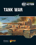
Tank War
by Warlord GamesTank War, the new supplement for Bolt Action, gives players the option to expand their games to a whole new level - armored warfare. Recreate such great engagements as the battle of Kursk with the scenarios, army options and special rules found in this book. Whether you want to add more armour to your existing armies or build an entirely armoured force, Tank War has you covered.