- Table View
- List View
Geohazards and Pipelines: State-of-the-Art Design Using Experimental, Numerical and Analytical Methodologies
by Spyros A. Karamanos Arnold M. Gresnigt Gert J. DijkstraThis book presents state-of-the-art methodologies for the design and analysis of buried steel pipelines subjected to severe ground-induced action, including tectonic (quasi-static) effects, slope movements (landslides), liquefaction-induced actions or excavation-induced settlements. The text is an amended version of the final deliverables of the GIPIPE project, sponsored by the European Commission (Research Fund for Coal and Steel programme, 2011-2014).Geohazards and Pipelines presents an integrated investigation of this subject, using advanced and innovative experimental techniques, high-performance numerical simulations and novel analytical methodologies, which account for the particularities of buried steel pipelines with an emphasis on soil-pipeline interaction.Geohazards and Pipelines will be of use to professionals working in the field of pipeline engineering, including design consultants and industrial practitioners involved in projects related to pipeline infrastructure. Structural engineers, mechanical engineers, geotechnical engineers, geologists and seismologists may also find this book of interest, as may graduate students and researchers in these areas.
Geohazards: Analysis, Modelling and Forecasting (Advances in Natural and Technological Hazards Research #53)
by Parveen Kumar Sandeep Himanshu Mittal Roshan KumarThis book presents a comprehensive analysis of diverse aspects of geohazards. The growing vulnerability and exposure to failures in risk reduction and policy-making increases the severity of geohazard impacts by many folds. Therefore, detailed geohazard analysis, modelling and forecasting are needed to reduce the impacts of extreme events.An interdisciplinary approach to hazard mitigation provides an advanced tool for risk reduction. The book thus summarizes recent modelling and analysis techniques for hazard assessment and risk mitigation. Topics discussed in the book are hazard and risk associated with earthquakes, vulnerability assessment for landslides and avalanches, the assessment of tsunami risk in coastal regions, the implementation of early warning systems to prevent catastrophic consequences, climate change risk modelling and risk communication. The convergent approach with the aspects of natural, engineering, and social sciences attracts a vast audience working to advance disaster science. This book also significantly facilitates the acquisition of policy-relevant knowledge for risk reduction, which is beneficial to the general public.
Geoheritage and Geodiversity of Cenozoic Volcanic Fields in Saudi Arabia: Challenges of Geoconservation and Geotourism in a Changing Environment (Geoheritage, Geoparks and Geotourism)
by Mohammed Rashad Moufti Károly NémethSaudi Arabia hosts at least six major volcanic fields located on the western margin of the Arabian Peninsula. The volcanic surface covered is comparable to about a fifth of the land surface of the country and the distinct appearance of the volcanic landscape of the region is deeply engraved in the geo-cultural perspective of the territory. Volcanic fields, especially their extensive lava fields form one of the largest if not the largest volcanic region on Earth, which are occupied by the most common volcanic landforms not only on Earth but the known Solar System. Volcanic fields are a vital part of the geoheritage and geodiversity elements of the Arabian Peninsula and beyond in the Middle East. Here we provide the most up-to-date overview of the geoheritage and geoheritage elements of these huge volcanic provinces both qualitative and quantitative outlines of their geodiversity and link to biodiversity. The volcanic province will be treated from the ecosystem, and geosystem services perspective and explore the challenges of such a concept in a region that is primarily industry and resource-based economy driven. This book will look beyond the traditional approach of describing geoheritage of volcanic regions as it will provide a conceptual framework for dispersed volcanic fields where scale and scope to define and estimate the value of geoheritage requires different approaches than those applied for long-lived polygenetic volcanoes. This book aims to provide a succinct overview of geoheritage and geodiversity aspects of monogenetic volcanic fields tested in an area globally outstanding and volcanically active. The book intends to be a good specialist handbook for a broad range of audiences from geologists, volcanologists, natural hazard experts, geoconservation experts, social geology experts, geotourism operators, and heritage researchers. The book will be a valuable resource for anyone directly or indirectly involved or wish to be involved in local development projects or experts looking for external information to apply to volcanic fields elsewhere.
Geoheritage of Volcanic Harrats in Saudi Arabia
by Mohammed Rashad Moufti Károly NémethThis book records the geoheritage values of globally significant, yet little-known, volcanic geosites in Saudi Arabia. It is the first of its kind to focus on the Middle East, clearly showing the hidden geoheritage value of the volcanic Arabian Peninsula's harrats and demonstrating why the Saudi Arabian volcanic fields are unique. Along with the systematic geosite description, the book introduces scientifically founded geoeducational programs that can be used to develop our understanding of volcanic geoheritage values of volcanic fields. It offers a detailed and comprehensive research-based description of four of the most accessible volcanic harratts in Saudi Arabia and an additional summary of other more remote fields. Additionally, it discusses geoeducational programs that could be used to link these volcanic areas and use them in volcanic hazard education.
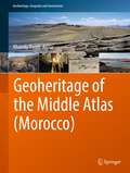
Geoheritage of the Middle Atlas (Geoheritage, Geoparks and Geotourism)
by Khaoula BaadiThis book is a condensed summary of a broad spectrum of the geological heritage of the Middle Atlas. It has the particularity of proposing an in-depth synthesis and a critical review of the geoheritage of the region. The book addresses the issues related to geoheritage and methodologies for the selection, inventory, assessment and preservation of geosites. It reviews the state of the art of geoheritage in Morocco, particularly in the Middle Atlas, in order to identify geosites with rare and unique geological features. The book presents a detailed study of lithostratigraphic and sedimentological heritage as geosites witnessing at different spatial and temporal scales the evolution and the stratigraphic, sedimentological and paleogeographic history of the Middle Atlas range. It also presents the paleontological heritage of vertebrates by reviewing the discoveries of paleontological sites and their risks in order to present its conservation plans. It also addresses the hydric and fluvial heritage by presenting the potential of water resources and the impact of climate change on the latter. Furthermore, it highlights the karst heritage by exposing an inventory of exo- and endokarst geosites in order to emphasize some unique sites on a national and African scale as well as revealing the underground biodiversity related to this heritage. Finally, it proposes a presentation of the volcanic heritage in order to assess the volcanic geosites that testify to the strombolian, phreatomagmatic and Hawaiian dynamism of the region. The book is mainly intended for researchers, geologists and specialists of the Moroccan Middle Atlas region wishing to acquire a broad multidisciplinary or even transdisciplinary knowledge. It will also be accessible to a non-initiated public, interested in the richness of the Moroccan geoheritage, as well as to Moroccan territorial authorities (High Commission for Water and Forests, Ministry of Tourism, National Institute of Archaeology and Heritage Sciences, etc.) who can benefit from it in the perspective of their strategies of preservation of the national geological heritage. This work will be an example for geoscientists, on an African scale, of a valorization of territorial geological heritage.
Geoid Determination
by Fernando Sansò Michael G. SiderisThis book will be based on the material of the lecture noties in several International Schools for the Determination and Use of the Geoid, organized by the International Geoid Serivice of the International Association of Geodesy. It consolidates, unifies, and streamlines this material in a unique way not covereed by the few other books that exist on this subjext. More specifically, the book presents (for the first time in a single volume) the theory and methodology of the most common technique used for precise determination of the geoid, including the computation of the marine geoid from satellite altimetry data. These are illustrated by specific examples and actual computations of local geoids. In addition, the book provides the fundamentals of estimating orthometric heights without spirit levelling, by properly combining a geoid with heights from GPS. Besides the geodectic and geophysical uses, this last application has made geoid computation methods very popular in recent years because the entire GPS and GIS user communities are interested in estimating geoid undulations in order to convert GPS heights to physically meaningful orthometric heights (elevations above mean sea level). The overall purpose of the book is, therefore, to provide the user community (academics, graduate students, geophysicists, engineers, oceanographers, GIS and GPS users, researchers) with a self-contained textbook, which will supply them with the complete roadmap of estimating geoid undulations, from the theoretical definitions and formulas to the available numerical methods and their implementation and the test in practice.
Geoid and its Geophysical Interpretations
by Petr Vanicek Nikolaos T. ChristouGeoid and its Geophysical Interpretations explains how an accurate geoid can be constructed and used for a variety of applied and theoretical geophysical purposes. The book discusses existing techniques for geoid computation, recently developed mathematical and computational tools designed for applications, and various interpretations. Principles and results are well illustrated. This book will be an excellent reference for geodesists, geophysicists, geophysical prospectors, oceanographers, and researchers and students in geophysics and geodesy.
Geoinformatics
by G. Randy Keller Chaitanya BaruAdvanced information technology infrastructure is being employed increasingly in the Earth Sciences to provide researchers with efficient access to massive databases and an ability to integrate diversely formatted information from a variety of sources.
Geoinformatics and Data Analysis: Selected Proceedings of ICGDA 2022 (Lecture Notes on Data Engineering and Communications Technologies #143)
by Salah Bourennane Petr KubicekThis book contains the proceedings of the 5th International Conference on Geoinformatics and Data Analysis (ICGDA 2022), held in January 21–23, Paris, France. Geoinformatics helps to support basic scientific inquiry as well as address the complex social and environmental challenges. It becomes very important technology to decision-makers across a wide range of disciplines such as computer science, information technology, software engineering, biogeography, geography, conservation, architecture, spatial analysis and reinforcement learning. The papers included in this proceeding share the latest research results and practical application examples on the methodologies and algorithms in the area of geoinformatics and data analysis, including software and information engineering, environmental geography and geographic information system, which makes the book a valuable reference for researchers, engineers and university students who are working in the field.
Geoinformatics and Modelling of Landslide Susceptibility and Risk: An RS & GIS-based Model Building Approach in the Eastern Himalaya (Environmental Science and Engineering)
by Sujit Mandal Subrata MondalThis book discusses various statistical models and their implications for developing landslide susceptibility and risk zonation maps. It also presents a range of statistical techniques, i.e. bivariate and multivariate statistical models and machine learning models, as well as multi-criteria evaluation, pseudo-quantitative and probabilistic approaches. As such, it provides methods and techniques for RS & GIS-based models in spatial distribution for all those engaged in the preparation and development of projects, research, training courses and postgraduate studies. Further, the book offers a valuable resource for students using RS & GIS techniques in their studies.
Geoinformatics for Spatial-Infrastructure Development in Earth and Allied Sciences: Proceedings of GIS-IDEAS 2023 (Lecture Notes in Civil Engineering #411)
by Dieu Tien Bui Anh Huy Hoang Thi Trinh Le Danh Tuyen Vu Venkatesh RaghavanThis volume gathers the latest advances, innovations, and applications in the field of GIS and geo-spatial technologies, as presented by leading researchers and engineers at the International Conference on Geoinformatics for Spatial-Infrastructure Development in Earth & Allied Sciences (GIS-IDEA), held in Hanoi, Vietnam on November 7-9 2023. The contributions cover a diverse range of topics, including geoinformatics, geomatics, geospatial AI for natural hazards, Big Data and AI in sustainable natural resource management, GIS and remote sensing for natural disaster monitoring, GIS for spatial analysis, planning and management, GeoAI for building digital maps. Selected by means of a rigorous peer-review process, they will spur novel research directions and foster future multidisciplinary collaborations.
Geoinformatics for Sustainable Development in Asian Cities (Springer Geography)
by Sathaporn Monprapussorn Zhaohui Lin Asamaporn Sitthi Parichat WetchayontThis proceedings volume focuses on the importance and power of spatial thinking and planning, especially by applying geospatial technologies in solving the past and current global problems such as environmental degradation, urban pollution, climate change, agricultural management and epidemiology.The proceedings of the International Conference on Geography and Geoinformatics for Sustainable Development 2018 (ICGGS 2018) consist of a wide range of case studies from developing countries. The contributions address challenges of developing countries in mainstreaming sustainable development paradigm into their economy with the aim to improve and manage natural resources and environment in a sustainable manner. One of the main goals of the conference and the proceedings is to share and exchange different perspectives on global, regional and local spatial issues and how the concept of spatial planning and thinking can be used in building resilience to natural and anthropogenic threats in many sectors (such as water, ecosystem, agriculture and health). This includes a summary of how the key concepts of geospatial technologies could contribute to environmental sustainability and the Sustainable Development Goals (SDGs) as well as an outlook on challenges and opportunities for sustainable development. This book explains how geoinformatics can help analyse, model and explain sustainable development within a geographic context and thus provide the integrative framework necessary for global collaboration consensus and evidence-based decision-making. It highlights the vital and integrative role of geospatial information in driving sustainable development and thus can be used as a tool to put the 2030 Agenda for Sustainable Development into practice. This volume can be a useful resource for readers regarding research on geospatial issues on both the regional and local scale. Both undergraduate and graduate students around the globe can advance their academic and research knowledge of past and present environmental problems and learn how geospatial planning can be applied for sustainable development. It also appeals to researchers, academics, practitioners, community developers and policy makers interested in promoting sustainable development.
Geoinformatics in Applied Geomorphology
by Xiaojun Yang Siddan Anbazhagan S. K. SubramanianWith recent innovations in the arena of remote sensing and geographic information systems, the use of geoinformatics in applied geomorphology is receiving more attention than ever. Geoinformatics in Applied Geomorphology examines how modern concepts, technologies, and methods in geoinformatics can be used to solve a wide variety of applied geomorph
Geoinformatics in Theory and Practice: An Integrated Approach to Geoinformation Systems, Remote Sensing and Digital Image Processing (Springer Textbooks in Earth Sciences, Geography and Environment)
by Norbert de LangeThis textbook is intended to display a broad, methodological introduction to geoinformatics and geoinformation science. It deals with the recording, modeling, processing and analysis as well as presenting and distributing of geodata. As an integrated approach it is dedicated to the multidisciplinary application of methods and concepts of computer science to solve spatial tasks. First the reader receives an introduction to the approach and tasks of geoinformatics, basic concepts and general principles of information processing as well as essentials of computer science. Then this textbook focuses on the following topics: spatial reference systems, digital spatial data, interoperability of spatial data, visualization of spatial information, data organization and database systems, geoinformation systems, remote sensing and digital image processing.The result is a comprehensive manual for studies and practical applications in geoinformatics. It serves also as a basis to support and deepen methodological courses in geography, geology, geodesy and surveying as well as all environmental sciences. In this first English edition, the author has updated and significantly expanded the fourth German edition. New additions include the development of apps, graphical presentation on the web, geodata-bases and recent methods of classification. This book is based on the original German 4th edition Geoinformatik in Theorie und Praxis by Norbert de Lange, published by Springer-Verlag GmbH Germany, part of Springer Nature in 2020 and still presents the only integrated perspective on geoinformatics and geoinformation science. This book was translated with the help of artificial intelligence (machine translation by the service DeepL.com) first and then significantly revised with regard to technical terms and special topics of geoinformatics.
Geoinformatik: Handbuch der Geodäsie, herausgegeben von Willi Freeden und Reiner Rummel (Springer Reference Naturwissenschaften)
by Monika SesterDas sechsbändige Handbuch ist ein hochwertiges Werk über die Geodäsie unserer Zeit. Neben einer guten Lesbarkeit vermittelt es dennoch den wissenschaftlichen Ansatz und richtet sich an Kollegen in Praxis und Wissenschaft, aus Nachbardisziplinen und allgemein an Studierende und Interessierte. Die in den Beiträgen behandelten Themen führen systematisch in Aufgabenstellung, Methodik und zukünftige Entwicklungen ein. Die Themen reichen von der Mathematischen und Physikalischen Geodäsie sowie der Satellitengeodäsie über die Ingenieurgeodäsie, die Bodenordnung und das Landmanagement, die Photogrammetrie und Fernerkundung bis zu Geoinformationssystemen und der Kartographie.
Geoinformation Metadata in INSPIRE and SDI
by Leszek Litwin Maciej RossaThe book is a new comprehensive textbook about creating and publishing geoinformation metadata. It is a compendium of knowledge about geoinformation metadata in INSPIRE Directive and Spatial Information Infrastructures. It contains the knowledge necessary to understand prior to the creation of geoinformation metadata. Metadata - "data about data" - describe the layers of spatial data (data series, services) responding to the questions: what?, why?, when?, who?, how? and where? Geoinformation metadata allows for exact search of the spatial data according to given criteria, regardless of where this data is located. On 15 May 2007 the EU Directive 2007/2/EC came into force establishing Infrastructure for Spatial Information in Europe - INSPIRE. The proper functioning of the infrastructure for spatial information would not be possible without the metadata.
Geoinformation Technologies for Geo-Cultural Landscapes: European Perspectives
by Niki Evelpidou Andreas Vassilopoulos Oliver Bender Alenka KrekThe focal main objective of the book is to constitute a meaningful linkage among research problems, geoinformation methods and corresponding applications. The research goals, related both to theoretical and practical issues, derive from multidisciplinary fields such as archaeology, history, geography, landscape planning, environment, geoinformation
Geoinformation: Remote Sensing, Photogrammetry and Geographic Information Systems, Second Edition
by Gottfried KonecnyWritten by a renowned expert, Geoinformation: Remote Sensing, Photogrammetry and Geographic Information Systems, Second Edition gives you an overarching view of how remote sensing, photogrammetry, and geographic information systems work together in an interdisciplinary manner. The book presents the required basic background of the geoinformatics co
Geol
by Reed Wicander James S. MonroeBring geology to life with GEOL, Second Edition. GEOL is designed to accommodate your busy lifestyle at a value-based price. This magazine-like book includes all of the key concepts of introductory physical geology, plus a full suite of learning aids—including integrated Virtual Field Trips, online videos, animations, and more—to help you master the material.
Geologic Disasters and the Environment Laboratory Manual
by Robert Leighty Donna Benson Chloe Branciforte Kelli WakefieldMesa College Geology 111 Lab Manual
Geologic Fundamentals of Geothermal Energy
by David R. BodenGeothermal energy stands out because it can be used as a baseload resource. This book, unlike others, examines the geology related to geothermal applications. Geology dictates (a) how geothermal resources can be found, (b) the nature of the geothermal resource (such as liquid- or vapor-dominated) and (c) how the resource might be developed ultimately (such as flash or binary geothermal plants). The compilation and distillation of geological elements of geothermal systems into a single reference fills a notable gap.
Geologic Structures of the Arctic Basin
by Alexey Piskarev Victor Poselov Valery KaminskyThis book contains the most complete description of the geologic and geophysical data of the structure of Arctic Basin including structures of the earth’s crust, crustal and acoustic basement, and sedimentary cover. The book includes information about extracted and studied cores and samples; observed, processed and interpreted data on geophysical anomalies and different conceptions, and a hypotheses of the origin of the modern Arctic Basin structures. Progress in solving the problems of the Arctic Basin geology is presented in the chapters and include contributions from leading field experts.
Geologic Trips: San Francisco and the Bay Area
by Ted KonigsmarkThis book is written for the non-geologist and describes seven geologic trips that will give the reader an understanding of the rocks, faults, earthquakes, and landforms of San Francisco and the Bay Area.
Geologic and Mine Modelling Using Techbase and Lynx
by Martin SmithThis text provides a process oriented discussion of the theory, methodology and philosophy of geologic and mine modelling using two commercial software packages: Techbase, a leader for mineral exploration and modelling bedded deposits; and Lynx, for modelling geology.
Geological And Geotechnical Engineering In The New Millennium: Opportunities For Research And Technological Innovation
by National Research Council of the National AcademiesThe National Academies Press (NAP)--publisher for the National Academies--publishes more than 200 books a year offering the most authoritative views, definitive information, and groundbreaking recommendations on a wide range of topics in science, engineering, and health. Our books are unique in that they are authored by the nation's leading experts in every scientific field.
