- Table View
- List View
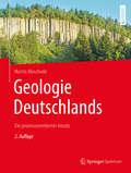
Geologie Deutschlands: Ein prozessorientierter Ansatz
by Martin MeschedeDeutschland ist vom geologischen Aufbau her sehr abwechslungsreich, wie dieses Lehrbuch in anschaulichen vierfarbigen Grafiken und auch für Nicht-Geologen verständlichen Texten vermittelt. Im Norden breitet sich die norddeutsche Tiefebene aus, die von jungen Lockersedimenten bedeckt ist. Daran schließen sich die Mittelgebirge an, in denen die ältesten Gesteine Deutschlands zu finden sind, und im Süden folgen die Alpen, ein nach geologischen Maßstäben junges Hochgebirge, mit ihrer Vorlandsenke, der alpinen Molasse.- Wie sind diese unterschiedlichen Gebirge und Landschaftsformen entstanden?- Welche Gesteine bilden den geologischen Untergrund Deutschlands?- Was ist der Grund dafür, dass Erdbeben nur in bestimmten Regionen Deutschlands auftreten?- Wo gibt es junge Vulkane und warum sind sie einst ausgebrochen?- Wie sind all diese Erscheinungen in das plattentektonische Geschehen in Mitteleuropa eingebunden?- Wie wurde schließlich die heutige Landoberfläche geformt?Auf all diese Fragen geht Martin Meschede im vorliegenden Buch ein und zeichnet die Entwicklung Deutschlands nach von seinen Anfängen auf verschiedenen Kontinenten bis hin zum heutigen Nebeneinander der unterschiedlichen Struktureinheiten.
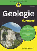
Geologie für Dummies (Für Dummies)
by Alecia M. SpoonerEiszeiten, Vulkanismus, Erosion, Meteoriteneinschläge - unser Planet hat in seiner Geschichte schon einiges mitgemacht. Und so vielgestaltig die Erde aussieht, so umfangreich und komplex ist auch das Thema Geologie. Aber keine Sorge, Alecia Spooner erklärt Ihnen leicht verständlich alles Wichtige, was es zum Thema Geologie zu wissen gibt: von den chemischen Grundlagen und der Bedeutung von Wind und Wasser für die Geowissenschaften bis zur Bildung und Bestimmung von Gesteinen. Sie erfahren alles Wissenswerte zu Konvektion, Plattentektonik, Mineralien, Fossilien, Erdbeben, Oberflächenprozessen, den geologischen Zeitaltern und vieles mehr.
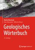
Geologisches Wörterbuch
by Martin Meschede Hans Murawski Wilhelm MeyerVon Aa-Lava bis ZylinderfalteÜber 5000 Begriffe aus der Geologie und ihren Nachbarwissenschaften stellt das Geologische Wörterbuch anhand kurzer Erläuterungen und einer Vielzahl von erklärenden Abbildungen vor. Das Buch wendet sich sowohl an Fachleute als auch an die Liebhaber der Geowissenschaften. Es will zum Verstehen geowissenschaftlicher Texte beitragen und ist zugleich ein wichtiger Studienbegleiter für angehende Geowissenschaftler.Die 13. Auflage wurde vollständig überarbeitet und neugestaltet. Die Begriffe wurden konsequent im Sinne der aktuell gültigen Theorie der Plattentektonik erläutert, wobei alte, überkommene Begriffe (wie z. B. Geosynklinale) nicht herausgenommen, sondern mit entsprechenden Erklärungen versehen und als heute nicht mehr verwendet gekennzeichnet wurden. Neu hinzugekommen ist die englische Übersetzung für jeden einzelnen Fachbegriff als Hilfestellung zum Verfassen geowissenschaftlicher Texte in englischer Sprache. Sämtliche Abbildungen sind in der neuen Ausgabe farbig angelegt. Sie wurden z. T. aus der vorherigen Auflage in überarbeiteter Form übernommen, zum größten Teil aber ganz neu erstellt.
Geology (Merit Badge Ser.)
by Boy Scouts of America StaffThis merit badge pamphlet gives Scouts the resources they need to learn earn the Geology merit badge! It is a comprehensive look into the science of Geology and gives Scouts the knowledge to apply it to their environment.
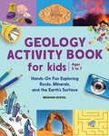
Geology Activity Book For Kids: Hands-On Fun Exploring Rocks, Minerals, and the Earth's Surface
by Meghan VestalHelp kids discover how mountains are formed and rocks are made with this interactive geology book for ages 5-7Learning about rocks and minerals is a lot more fun when kids can get their hands dirty. This book on rocks teaches budding scientists all about planet Earth through 19 geological topics that feature hands-on experiments, on-page activities, and fascinating facts.What sets this geology book apart from other rock books for kids:Real-life experiments—Kids can see what it's like to be a geologist with simple yet fascinating experiments such as pulling core samples from a candy bar, growing crystals, and creating a volcanic eruption!Earth-based activities—A variety of games, puzzles, and facts help young readers better understand geological concepts and build their scientific vocabulary.Rock spotting—This is also a rock identification book where kids can learn how to identify the rocks and minerals being used in the world around them, from the kitchen to the classroom.Inspire geology kids with this interactive exploring nature activity book—it's a standout among geology books for kids.
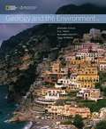
Geology And The Environment
by Richard Hazlett Paul Bierman Bernard Pipkin Dee TrentCengage Learning's GEOLOGY AND THE ENVIRONMENT, in partnership with the National Geographic Society brings course concepts to life with interactive learning, study, and exam preparation tools along with market leading text content for introductory geology courses. Whether you use a traditional printed text or all digital GEOLOGY AND THE ENVIRONMENT alternative, it's never been easier to explore the relationship between humans and the geologic hazards, processes, and resources that surround us.
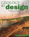
Geology By Design
by Carl Froede Jr.Presents and authoritative and biblical geological time-line for high school students and adults. Includes substantial illustrations, a glossary, and an extensive reference section. Clearly explains how data from volcanic deposits, seismic activity in Earth history, and even the presence of ripple marks in rock layers support the Bible as history. From the acclaimed Creation Research Society, this technical study of rock strata, and the fossils found therein, gives a solidly scientific rationale for believing in a young earth. This advanced guide is ideal for upper-level homeschool students, college students, or anyone wishing to explore this fascinating subject in-depth and includes questions for review at the end of each chapter. Froede presents a credible geological time-line and explains the formation and existence of fossil layers in rock sediments around the world.
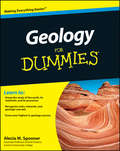
Geology For Dummies
by Alecia M. SpoonerGet a rock-solid grasp on geologyGeology is the study of the earth's history as well as the physical and chemical processes that continue to shape the earth today. Jobs in the geosciences are expected to increase over the next decade, which will increase geology-related jobs well above average projection for all occupations in the coming years.Geology For Dummies is the most accessible book on the market for anyone who needs to get a handle on the subject, whether you?re looking to supplement classroom learning or are simply interested in earth sciences. Presented in a straightforward, trusted format, it features a thorough introduction to the study of the earth, its materials, and its processes.Tracks to a typical college-level introductory geology courseAn 8-page color insert includes photos of rocks, minerals, and geologic marvelsCovers geological processes; rock records and geologic times; matter, minerals, and rock; and moreGeology For Dummies is an excellent classroom supplement for all students who enroll in introductory geology courses, from geology majors to those who choose earth science courses as electives.
Geology For Dummies
by Alecia M. SpoonerGet a rock-solid grasp on geology Geology For Dummies is ideal reading for anyonewith an interest in the fundamental concepts of geology, whether they're lifelong learners with a fascination for the subject or college students interested in pursuing geology or earth sciences. Presented in a straightforward, trusted format—and tracking to a typical introductory geology course at the college level—this book features a thorough introduction to the study of earth, its materials, and its processes. Rock records and geologic time Large-scale motion of tectonic plates Matter, minerals, and rocks The geological processes on earth's surface Rock that geology class with Geology For Dummies!
Geology and Environment In Britain and Ireland
by Nigel WoodcockA complete introductory text on an increasingly popular subject, "Geology and Environment in Britain and Ireland" aims to provide suitably broad coverage for students requiring a treatment clearly foucused on familiar examples but retaining a global perspective. The book summarizes for Earth and environmental scientists the ways in which geology re
Geology and Geochemistry of Molybdenum Deposits in the Qinling Orogen, P R China (Modern Approaches in Solid Earth Sciences #22)
by Franco Pirajno YanJing Chen Nuo Li XiaoHua Deng YongFei YangThis book is the first systematic treatise of available data and view-points obtained from geological and geochemical studies of the Mo deposits in Qinling Orogen, China. Qinling Orogen has a minimum reserve of 8.7 Mt Mo, ranking the largest molybdenum province both in China and the world. Incorporating all known Mo deposit types in the world, it presents extensive studies of Mo deposits of world-class and unusual types within tectonic settings. The Qinling Orogen was finally formed during continental collision between Yangtze and North China cratons, following the Triassic closure of the northernmost paleo-Tethys. It hosts 49 Mo deposits formed in seven mineralization events since 1850 Ma, with all the world-class deposits being formed during 160-105 Ma, coeval with collisional orogeny. These deposits are assigned to magmatic and metamorphic hydrothermal classes. The magmatic hydrothermal class includes porphyries, skarns, and intrusion-related veins (carbonatite, fluorite and quartz). The porphyry Mo systems in Qinling Orogen are predominated by Dabie-type formed in continental collision setting, followed by Endako- and Climax-types formed in continental arcs and rifts, respectively. The metamorphic hydrothermal Mo deposits are only reported in Qinling Orogen, and thus a new crustal continuum model for the orogenic class mineral systems is proposed. A scientific linkage between ore geology and fluid inclusions is introduced and verified both by theory and case studies. This is the first research book comprehensively displaying continental collision metallogeny. This literature will benefit both Western and Chinese mineral explorers and miners, as well as research scientists and students.
Geology and Landscapes of the Eastern Pyrenees: A Field Guide with Excursions (GeoGuide)
by Marc Calvet Magali Delmas Yanni Gunnell Bernard LaumonierThis book provides a synthesis of the physiography and geodynamics of the entire Pyrenean orogen and its foreland basins, providing the "big picture" (structure of the orogen and chronology of its formation, overview of its post-orogenic evolution, and Quaternary and recent landscape history). One part of the book proposes a 6–7 day itinerary across the eastern and east-central Pyrenees, two areas that currently provide the richest, best-documented, and most carefully curated database on the post-orogenic evolution of the mountain belt. The book deals with three complementary topics: (i) geodynamics, i.e. the long-term post-orogenic evolution of the Pyrenees since the declining stages of tectonic collision ca. 30 million years ago, and within the wider reference frame of Iberia, the Western Mediterranean, and the Atlantic margin; (ii) geomorphological processes and landforms that have conspired to shape the eastern part of the French and Spanish Pyrenees in response to base-level and climate-related changes over than same time period; (iii) geoheritage, i.e. educational vignettes of the flagship landscape units and typical geological sections of the study area. Written as a field guide, it is designed to help readers to construct discovery-based itineraries through the region (with options and variants depending on time and physical ability), allowing them to appreciate the key landscape and geoheritage features over the course of 1 week, with potential for much more.This GeoGuide is primarily aimed at confirmed geoscientists from most disciplines in Earth science, at postgraduate students engaged in field studies, and at curiosity-driven, educated amateurs keen to enhance their understanding of spectacular or enigmatic features encountered on their travels.
Geology and Mineral Resources (Springer Geology)
by R. K. UpadhyayThis book focuses on understanding Earth’s geology, its mineral resources, their exploration, and management of the environment. There are 3 parts and 12 chapters, and they provide an insight to the students of earth sciences. Part I, consisting of initial four chapters, provides snapshots on the Universe, the Earth, and its internal dynamics, and external geological processes. The mineral resources are covered in Part II with 5 chapters, featuring Earth’s elements, metals, minerals, rocks, and the mineral resources. As they are non-renewable, the importance of their scientific exploration, evaluation, mining, beneficiation, optimum utilization, and adverse impact, safety management, and environment are covered in the last 3 chapters in Part III.
Geology and Mineral Resources of Nigeria
by Nuhu George ObajeContains details on the geological units of Nigeria and the associated mineral resources. The book is divided into three parts. Part 1 discusses the geology of the crystalline rocks and their regional distribution while the sedimentary basins constitute the subject of Part 2. Part 3 takes the mineral resources of Nigeria one on one, their geological environment, mode of occurrence, localities and where possible the reserves estimation. Thereafter, an account of the previous and current mining policies (including that of petroleum) of the Nigerian government is given and goes ahead to list some specific investment opportunities in the solid minerals sector.
Geology and Mineralogy of Gemstones (AGU Advanced Textbooks)
by David Turner Lee A. GroatUnderstanding gemstones in a geological context Gemstones are colorful treasures of the Earth that have captivated humans for thousands of years. The physical and chemical characteristics of each type of gem provides insights into the geological processes that created them. Geology and Mineralogy of Gemstones is a textbook aimed at upper-level undergraduate and graduate students. It presents the basic mineralogical and geological knowledge needed to understand gemstones and examines the characteristics and geological origins of different types of gemstone. Volume highlights include: Concepts in mineralogy Structure and chemical composition of minerals Geological processes that lead to the formation and movement of gemstones Equipment and tools used to examine gemstones and their physical properties Description of small- and large-scale methods of gemstone mining The American Geophysical Union promotes discovery in Earth and space science for the benefit of humanity. Its publications disseminate scientific knowledge and provide resources for researchers, students, and professionals.
Geology and Natural Resources of Nigeria
by Silas S. Dada Samuel B. Olobaniyi Kamaldeen O.L OmosanyaGeology and Natural Resources of Nigeria is an up‑to‑date and comprehensive overview of the geological framework of the continental crust of Nigeria, its evolution, and the natural resources it holds. It covers a wide set of topics and provides a detailed description of the rock units of the Nigerian continental crust, their geological settings and structural characteristics, and the potential of their mineral, energy, and water resources. The book discusses the impact of geo‑resources on the Nigerian economy, includes recommendations on how to fully exploit geo‑resources, and explains how to prevent geological processes that could lead to natural hazards.FEATURES Provides different aspects of the Nigerian continental crust from a multidisciplinary approach Draws on the latest findings in geoscience research to present new insights and perspectives into the development and resource potential of the Nigerian continental crust Includes multiple case studies to illustrate the exploration and evaluation of the geological resources of Nigeria Explores the potential of geological resources for economic and industrial development Presents scientific achievements of authors and researchers from various disciplines and provides recommendations for mitigating natural hazards This handbook is intended for industry professionals, academics, researchers, and students studying earth sciences with a special interest in Africa and learning how its geology impacts the natural resources and overall economy of the continent.
Geology and Paleontology of the Quaternary of Uruguay
by Sergio Martínez Martin UbillaThis book provides an updated review and criticism ofthe progress of the continental, transitional and marine Quaternarydeposits of Uruguay. It is primarily based on an analysis of the geologicaland paleontological evidences, synthesizing the time (numerical ages,biostratigraphy), environment and climatic situations involved and highlightingthe most relevant paleontological content.
Geology and Resource Potential of the Congo Basin
by Maarten J. de Wit François Guillocheau Michiel C. J. de WitThis book summarizes the geomorphology, geology, geochronology, geophysics and mineral resources of the Congo Basin, one of the world's most enigmatic and poorly understood major intra-continental sedimentary basins, and its flanking areas of Central Africa. It provides an up to date analysis of the large region's origin and evolution. The book's nineteen chapters take the reader through the entire basement history, as well as the Basin's ca. 700 million years of cover sequences. Starting from its Archean cratons and Proterozoic mobile belts, and proceeding through the Phanerozoic sequences, including the most recent Cenozoic successions, the book also explores the present drainage systems and the subtle but complex topography of the Congo Basin. It also presents and evaluates new basin models and related dynamic processes, as well as revised correlation schemes with its Gondwana counterparts in South America, all of which provide key insights into its rich diamond deposits and other mineral wealth, which are documented in the final chapters. A specific feature of this book is its synthesis, performed by teams of active experts, of a vast amount of geoscientific data previously only recorded in research reports, company reports, survey bulletins, and scattered journal articles and books. The sheer size of the Congo Basin (ca. 1. 8 million km2, or just under half the area of the EU) and Central Africa (some 7 million km2, or more than 70% of the area of the USA) will make this a sought-after source of information and inspiration on this unique region.
Geology and Tectonics of Northwestern South America: The Pacific-Caribbean-Andean Junction (Frontiers in Earth Sciences)
by Fabio Cediel Robert Peter ShawThis book provides a comprehensive overview of the geological evolution of the Northern Andes and contiguous shield areas, with a focus upon Colombia. Updated geological interpretations are supported by modern lithogeochemical, seismic, gravity and magnetic data and radiogenic isotope and radiometric age determinations. The composite data permits a detailed interpretation of the tectono-magmatic history of the Northern Andean Block, including the Andes of Colombia, northern Ecuador, western Venezuela and eastern Panamá.Tectonic reconstructions based upon characterization of more than thirty litho-tectonic and morpho-structural units, terrane assemblages and tectonic realms, and their bounding suture and fault systems, highlight the intimate and complementary Mesozoic-Cenozoic history of the Northern Andean Block and the Pacific and Caribbean Plates.The complex nature of Northern Andean assembly contrasts with ‘‘classical’’ Central Andean ‘‘Cordilleran-type’’ orogenic models. Differences render the application of typical Cordilleran-type models inappropriate for the Colombian Andes.The importance of underlying Proterozoic through mid-Mesozoic elements, in the development of Meso-Cenozoic Northern Andean orogeny-phase tectonic configurations is analyzed in the light of spatial-temporal studies and reconstructions related to basin formation, sedimentation, deformation, uplift mechanisms, structural style and magmatic evolution. The pre-Andean architecture of north western South America has played a pre-determinative role in the development of the Northern Andean orogenic system. 16 contributions analyze key stratigraphic, structural, metamorphic, magmatic and tectonic questions, and provide solutions as far as the most recent published field-based studies permit. The volume provides geological interpretations and tectonic models which contrast with repetitive theoretical proposals frequently found in the available literature.
Geology for Ground Engineering Projects
by Chris J. FletcherBridges the Gap between Geology and Ground Engineering High-quality geological models are crucial for ground engineering projects, but many engineers are not always at ease with the geological terminology and analysis presented in these models, nor with their implications and limitations. Project engineers need to have a sound comprehension of the geological models presented to them, and to be able to discuss the models in so far as they might impinge on the design, safety and possible budgetary or time constraints of the project. They should also fully understand how site investigation data and samples are used to develop and substantiate geological models. Geology for Ground Engineering Projects provides a comprehensive presentation of, and insight into, the critical geological phenomena that may be encountered in many engineering projects, for example rock contact relationships, weathering and karst phenomena in tropical areas, composition of fault zones and variability of rock discontinuities. Examples are provided from around the world, including Southeast Asia, Europe, North and South America, China and India. Comprehensive and well-illustrated, this definitive book: Describes the important geological phenomena that could affect ground engineering projects Provides a practical knowledge-base for relevant geological processes Addresses common geological issues and concerns Rocks are described in relation to the environment of their formation, highlighting the variation in composition, distribution and geotechnical properties that can be expected within a variety of rock associations. Case studies, where geology has been a vital factor, are included. These are written by the project engineers or geologists responsible for the projects. Geology for Ground Engineering Projects is well illustrated with color diagrams and photographs. Readers are directed to satellite images of selected areas to explore for themselves many of the geological features described in this book.
Geology for Kids: A Junior Scientist's Guide to Rocks, Minerals, and the Earth Beneath Our Feet (Junior Scientists)
by Meghan VestalTake a trek to the center of the earth with Geology for KidsSet off on an adventure 4.6 billion years in the making with Geology for Kids. Start at the red-hot center of Earth and learn about each layer until you reach the rocky crust. Discover how mountains, valleys, and oceans form, and uncover secrets about the planet you call home. (Did you know that only 20% of deserts are covered by sand, and some can be blistering cold in the winter?)Geology for Kids is jam-packed with facts, illustrations, and photos that will teach you how volcanoes erupt, why earthquakes shake the land, and what causes tsunamis with waves 100 feet high. And when you're ready to go from curious kid to certified rock hound, use the photographic guide to help you identify rocks and minerals in your own backyard. Your collection will be the best on the block!Get your hands dirty—Use the sidebars with fun and engaging activities for a hands-on learning experience.What's the word?—The helpful glossary in Geology for Kids introduces you to plenty of geological words and terms.More to discover—Find out about the best places to visit in the country for fun adventures like The Grand Canyon, Arches National Park, and Glacier Bay National Park.It's time to dig deep into your geological curiosity with Geology for Kids.
Geology in the Nineteenth Century: Changing Views of a Changing World
by Mott T. GreeneIn this clear and comprehensive introduction to developments in geological theory during the nineteenth century, Mott T. Greene asserts that the standard accounts of nineteenth-century geology, which dwell on the work of Anglo-American scientists, have obscured the important contributions of Continental geologists; he balances this traditional emphasis with a close study of the innovations of the French, German, Austro-Hungarian, and Swiss geologists whose comprehensive theory of earth history actually dominated geological thought of the time. Greene's account of the Continental scientists places the history of geology in a new light: it demonstrates that scientific interest in the late nineteenth century shifted from uniform and steady processes to periodic and cyclic events—rather than the other way around, as the Anglo-American view has represented it. He also puts continental drift theory in its context, showing that it was not a revolutionary idea but one that emerged naturally from the Continental geologists' foremost subject of study-the origin of mountains, oceans, and continents. A careful inquiry into the nature of geology as a field poised between natural history and physical science, Geology in the Nineteenth Century will interest students and scholars of geology, geophysics, and geography as well as intellectual historians and historians of science.
Geology of Afar (East Africa)
by Jacques VaretThis book summarizes the geological knowledge accumulated on Afar in the last 60 years, demonstrating that it is, and will remain, a real "hot spot" for geological and geophysical research. It provides insights into the Earth processes along diverging plate boundaries, the study of both the continental and oceanic lithosphere and underlying asthenosphere, and margins and transitions including magmatic, volcanic, tectonic, sedimentary, hydrothermal and geodynamic processes. The Afar triangle is a geological depression that developed where the Gulf of Aden, Red Sea and East African Rift Valley meet. It is considered to be one of the Earth system's most important mantle plumes. In 1967, when the first expedition was organized, there was little information on the geology of the area, and even geographic base maps were lacking. However, the first satellite photographs from the Apollo and Gemini space missions offered a complete picture of the Red Sea-Gulf of Aden region, providing a new vision of the Afar triangle. The book describes the unique geological features that make Afar the only place in the world where an oceanic plate boundary with all its successive steps of development can be observed in the open air. It also presents the Afar triangle as one of the cradles of first, now extinct hominids. The Middle Awash area contains sites of several fossil discoveries, such as the well-known Lucy. The hydrothermal processes in Afar provide conditions suitable for the study of the most primitive forms of life (archaebacterial) and it is also one of the few places where significant quantities of telluric energy are available at the surface for geothermal development. Further, the area has economically interesting mineral deposits and illustrates a number of current climate change issues. In addition to providing geological information, the book shows that Afar is an area where an individual human population developed with its own language and culture, and which adapted to the rugged landscape and extremely dry and hot climate. It is a valuable resource for scientists and students, and also serves the needs of the Afar nation, currently split in three different countries as a result of recent historical events.
Geology of British Columbia
by Richard Cannings Sydney Cannings Joanne NelsonThis book tells the story of the province's geology and the history of its living creatures. The first edition of Geology of British Columbia,, with its accessible but rigorous science, struck a chord with readers. Since it was first published, theories about plate tectonics and the geological history of British Columbia have evolved, and this new edition reflects the current thinking. This book also features updated content throughout, seven new maps, and a number of new photographs. A brand new appendix lists and describes key geological sites in British Columbia, adding a field-guide component to this informative book that will engage readers and compel them to go see these rocks for themselves.
Geology of Coal Deposits of South Limburg, The Netherlands: Including Adjacent German and Belgian Areas (SpringerBriefs in Earth Sciences)
by J.H.L. VonckenThis book offers an up-to-date overview of the coal deposits of South Limburg (Netherlands), the Aachen area (Germany), and the Campine area (Belgium). Although the amount of available literature on these coal deposits is quite vast, the majority of the texts date back to the mid-twentieth century, and most publications focus more on the stratigraphy of the coal layers and the rank of the coal. Moreover, the concept of continental drift is largely ignored in these publications. In addition to providing updated information, this book also discusses coal mining in these regions; the formation and petrography of coal; and the geological evolution of Western Europe/the Netherlands, Germany and Belgium. In order to explain the tropical nature of the flora in the Carboniferous period, paleogeographic aspects are also taken into account.