- Table View
- List View
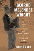
George Meléndez Wright: The Fight for Wildlife and Wilderness in the National Parks
by Jerry EmoryThe first biography of a visionary biologist whose groundbreaking ideas regarding wildlife and science revolutionized national parks. When twenty-three-year-old George Meléndez Wright arrived in Yosemite National Park in 1927 to work as a ranger naturalist—the first Hispanic person to occupy any professional position in the National Park Service (NPS)—he had already visited every national park in the western United States, including McKinley (now Denali) in Alaska. Two years later, he would organize the first science-based wildlife survey of the western parks, forever changing how the NPS would manage wildlife and natural resources. At a time when national parks routinely fed bears garbage as part of “shows” and killed “bad” predators like wolves, mountain lions, and coyotes, Wright’s new ideas for conservation set the stage for the modern scientific management of parks and other public lands. Tragically, Wright died in a 1936 car accident while working to establish parks and wildlife refuges on the US-Mexico border. To this day, he remains a celebrated figure among conservationists, wildlife experts, and park managers. In this book, Jerry Emory, a conservationist and writer connected to Wright’s family, draws on hundreds of letters, field notes, archival research, interviews, and more to offer both a biography of Wright and a historical account of a crucial period in the evolution of US parks and the wilderness movement. With a foreword by former NPS director Jonathan B. Jarvis, George Meléndez Wright is a celebration of Wright’s unique upbringing, dynamism, and enduring vision that places him at last in the pantheon of the great American conservationists.
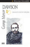
George Mercer Dawson
by William ChalmersDawson worked for the International Boundary Commission and the Geological Survey of Canada. He surveyed the 49th parallel, vast tracts of land in British Columbias Interior, and many rivers in the Yukon. He knew the value of the Klondike gold fields ten years before the rush of 1898.

Georgia Holt Science & Technology: Earth Science CRCT Preparation Workbook
by Holt Winston RinehartHolt Science & Technology Earth Science CRCT Preparation Workbook
Georgia: What's So Great About This State?
by Kate Boehm JeromeWHY does the land in the Okefenokee Swamp seems to move? WHAT threatened the entire Georgia cotton business in the early 1920s? Find these answers and more in the Georgia edition of What's So Great About This State?
Georgic Literature and the Environment: Working Land, Reworking Genre (Routledge Environmental Literature, Culture and Media)
by Sue Edney Tess SomervellThis expansive edited collection explores in depth the georgic genre and its connections to the natural world. Together, its chapters demonstrate that georgic—a genre based primarily on two classical poems about farming, Virgil’s Georgics and Hesiod’s Works and Days—has been reworked by writers throughout modern and early modern English-language literary history as a way of thinking about humans’ relationships with the environment. The book is divided into three sections: Defining Georgic, Managing Nature and Eco-Georgic for the Anthropocene. It centres the georgic genre in the ecocritical conversation, giving it equal prominence with pastoral, elegy and lyric as an example of ‘nature writing’ that can speak to urgent environmental questions throughout literary history and up to the present day. It provides an overview of the myriad ways georgic has been reworked in order to address human relationships with the environment, through focused case studies on individual texts and authors, including James Grainger, William Wordsworth, Henry David Thoreau, George Eliot, Thomas Hardy, Seamus Heaney, Judith Wright and Rachel Blau DuPlessis. This is a much-needed volume for literary critics, academics and students engaged in ecocritical studies, environmental humanities and literature, addressing a significantly overlooked environmental literary genre.
Geoscience Data and Collections: National Resources in Peril
by National Research CouncilGeoscience data and collections (such as rock and sediment cores, geophysical data, engineering records, and fossils) are necessary for industries to discover and develop domestic natural resources to fulfill the nation's energy and mineral requirements and to improve the prediction of immediate and long term hazards, such as land slides, volcanic eruptions, and global climate change. While the nation has assembled a wealth of geoscience data and collections, their utility remains incompletely tapped. Many could act as invaluable resources in the future but immediate action is needed if they are to remain available. Housing of and access to geoscience data and collections have become critical issues for industry, federal and state agencies, museums, and universities. Many resources are in imminent danger of being lost through mismanagement, neglect, or disposal. A striking 46 percent of the state geological surveys polled by the committee reported that there is no space available or they have refused to accept new material. In order to address these challenges, "Geoscience Data and Collections offers a comprehensive strategy for managing geoscience data and collections in the United States.
Geoscience Education
by Clara VasconcelosThis book presents research in Geoscience Education focusing on indoor and outdoor environments in which teaching geoscience gains particular relevance, significance and contextualization. The research areas that are presented throughout the thirteen chapters cover a wide variety of subjects ranging from educational resources and fieldwork to science models. Chapters discuss specific geoscience topics such as earthquakes, rocks, fossils and minerals. Other chapters present a more interdisciplinary approach addressing topics that aren't usually examined, such as geomedicine and geoethics, with a specific focus on sustainable development and their alignment with the school curricula. Throughout the book readers can find research-based arguments illustrated with practical examples, which will help them to innovate in their curriculum development area, classroom practices and pre and in-service teachers' education. The book challenges readers to improve Geoscience Education by changing the ways of teaching, by enabling students to exploit their natural curiosity, and by spurring a learning process that should not be confined to the classroom but rather maintained throughout life.
Geoscience Research and Education
by Vincent C. H. TongFocusing on geoscience, this book applies a uniquely cross-disciplinary perspective to its examination of the relationship between scientific research and teaching at universities. Contributions show how the use of technology and innovative pedagogical design allows students at different stages of their university studies to develop skills and experience in geoscience research. The book offers wide-ranging insight from academics in geoscience, science education and higher education policy and pedagogy, as well as from students and industry experts. The opening section sets the context, with a chapter on teaching and research in the contemporary university by a world-leading academic in higher education, and an essay by the editor on the case of moving from research-implicit to research-enhanced teaching. Part Two addresses the research-teaching nexus in geoscience, offering chapters entitled The Challenge of Combining Research and Teaching: A Young Geoscientist's Perspective; Teaching on the High Seas: How Field Research Enhances Teaching at All Levels; Curricula and Departmental Strategies to Link Teaching and Geoscience Research; and Geoscience Internships in the Oil and Gas Industry, among others. In Part Three, the use of technology is discussed in chapters such as Using Interactive Virtual Field Guides and Linked Data in Geoscience Teaching and Learning; and Towards Technology- and Research-enhanced Education (TREE): Electronic Feedback as a Teaching Tool in Geoscience. The Program Design section includes chapters on Introducing University Students to Authentic, Hands-on Undergraduate Geoscience Research, and the opportunity to link research and teaching in students' final projects and more. Geoscience Research and Education: Teaching at Universities is a useful resource for understanding the research-teaching nexus and how it has been implemented in different types of universities and in different countries. Science academics seeking to integrate research into teaching will find the book highly relevant to their work. The emphasis on using technology as a means to link research and teaching will be of great interest and practical benefit to learning technologists, science educators and university policymakers. Together with the companion volume Geoscience Research and Outreach: Schools and Public Engagement, this book showcases the key role that geoscience research plays in a wide spectrum of educational settings.
Geoscience Research and Outreach: Schools and Public Engagement
by Vincent C. TongFrom energy and water resources to natural disasters, and from changing climatic patterns to the evolution of the Earth's deep interior, geoscience research affects people's lives in many ways and on many levels. This book offers a stimulating cross-disciplinary perspective on the important relationship between geoscience research and outreach activities for schools and for the general public. The contributors - academics, research scientists, science educators and outreach program educators - describe and evaluate outreach programs from around the world. A section entitled Field-based Approaches includes a chapter describing an initiative to engage Alaskan communities and students in research, and another on problem-based learning in the field setting. The Online Approaches section discusses ways to connect students and scientists using online forums; use of the web and social media, including the United Nations University and its experience with the design of a web magazine featuring geoscience research; and video clips on marine geoscience created by students and scientists. The section on Workshop and Laboratory-based Approaches includes a chapter on teaching geochronology to high school students, and another describing an extracurricular school activity program on meteorology. The Program Design section presents chapters on Integrating Geoscience Research in Primary and Secondary Education, on ways to bridge research with science education at the high school level, and on use of online geoscience data from the Great Lakes. The concluding section, Promoting Research-enhanced Outreach, offers chapters on Geoscience Outreach Education with the local community by a leading research-intensive university, and on the use of research to promote action in Earth science professional development for schoolteachers.Geoscience Research and Outreach: Schools and Public Engagement will benefit geoscience researchers who wish to promote their work beyond academia. It offers guidance to those seeking research funding from agencies, which increasingly request detailed plans for outreach activities in research proposals. Policymakers, educators and scientists working in museums, learned societies and public organizations who wish to widen participation will also find this book useful. Together with the companion volume Geoscience Research and Education: Teaching at Universities, this book showcases the key role that geoscience research plays in a wide spectrum of educational settings.
Geoscience for Petroleum Engineers
by Sandeep Narayan KunduThis book highlights the fundamental and applied aspects of geoscience that an engineer and geologist would need to be effective in the upstream petroleum industry. Geoscience is integral to exploration and production of petroleum, and a good understanding of the subject enables petroleum engineers to execute their tasks effectively in an interdisciplinary and collaborative environment. Most petroleum engineers lack a geological perspective, owing to their increased focus on core engineering disciplines, and evaluate rocks from a mechanical object. At the same time, books in geoscience which are currently available for undergraduate education are written for educating geologists only. This book aims to provide geoscience fundamentals as required by engineers and geologists to prepare for a career in the upstream petroleum industry.
Geosciences and Human Survival, Environment, Natural Hazards, Global Change: Proceedings of the 30th International Geological Congress, Volume 2 & 3
by Liu Tungsheng Zhou Liping Zhang Zhonghu E.F.J. De MulderThe proceedings of the 30th International Geological Congress held in Beijing, China in August 1997. These two volumes focuses on geosciences and human survival, environment, natural hazards and global changes. They aim to present a view of contemporary geology.
Geosciences and the Sustainable Development Goals (Sustainable Development Goals Series)
by Martin Smith Joel C. GillMeeting the targets of the UN Sustainable Development Goals (SDGs) requires contributions by scientists focusing on understanding, monitoring, protecting, managing and restoring the natural environment, including geoscientists. This book presents the first detailed discussion on the role of the geological sciences (geosciences) community in the implementation of the SDGs. Unlike traditional geosciences textbooks, it is structured according to development priorities, framed in the context of the 17 SDGs. Written by international experts from diverse range of geosciences / development disciplines, it explores themes linked to both science and the professional practice of science (e.g., ethics, equity, conduct, and partnerships). The book is intended for graduate and senior undergraduate students in the earth sciences, as well as practicing geologists and experts from other sectors involved in sustainability initiatives.
Geosciences of Azerbaijan
by Akif A. Alizadeh Ibrahim S. Guliyev Fakhraddin A. Kadirov Lev V. EppelbaumThis book provides amulti-scale and multidisciplinary perspective on the geology of Azerbaijan, acountry characterized by a unique tectonic and geological setting including theGreater and Lesser Caucasus, the Talysh Mountains, and the Caspian and KurBasins. Essential geological and geophysical data shed light on the principlesof the evolution of the Earth within the region under study, seismic activityand the distribution of economic deposits. Further, special attention is paidto the history of geological-geophysical studies in the region. A combined,comprehensive interpretation of Azerbaijan's near-surface and deep geologicalstructure is achieved on the basis of an integrative analysis of stratigraphic,magmatic, morphological, lithological, tectonic, neotectonic, geophysical andother data, combining not only Russian and Azerbaijani-published, but also whollynew geological data. Volume I addresses theneeds of researchers focused on geology and the environmental sciences, butwill also be of interest to anyone looking to learn more about the naturalphenomena in Azerbaijan, a beautiful country situated at the boundary betweenEurope and Asia.
Geosciences of the Rajasthan Basins, India (Springer Geology)
by Soumyajit Mukherjee Nihar Ranjan KarThis book provides a thorough grasp of the geology and geophysics of hydrocarbon reserves in the Rajasthan Basins, India, and the latest updates from academicians and researchers in related industrial fields. The book covers a wide variety of geological and geophysical aspects related to the Rajasthan Basins, such as hydrocarbon exploration and production methods, stratigraphy, sedimentology, paleontology, source rock characterization, and hydrocarbon potential. This book is a useful resource for a wide range of readers who are interested in geology, petroleum geology and economic geology of the basin as well as professionals in the oil and gas industry. The Rajasthan Basin in the western part of the Rajasthan state of India hosts three petroliferous sedimentary sub-basins: the Barmer, Jaisalmer and Bikaner-Nagaur sub-basins. The Barmer sub-basin has been recognized as category 1, i.e., a basin with prolific production of hydrocarbons. These three sub-basins are important for the energy security of India and are being explored and developed by major oil and gas companies. Therefore, it is important to understand the geologic structures, sedimentary depositional systems and hydrocarbon potential of the sub-basins. This study necessitates studying the stratigraphy, sedimentology, structural geology and geophysical properties of the rocks and sediments and thermal history. Such studies help to identify potential reservoirs, seals and traps for oil and gas, and to estimate the volume and quality of hydrocarbons present.
Geoscientific Research in Northeast Africa
by ULF THORWEIHE & HEINZ SCHANDELMEIERThis volume focuses on approaches towards a better understanding of the geological, hydrogeological and paleoclimatic evolution of Northeast Africa. Among the topics discussed are Phanerozoic interplate dynamics, sedimentology and stratigraphy, and mineral deposits and metallogeny.
Geospatial Algebraic Computations
by Joseph L. Awange Béla PalánczImproved geospatial instrumentation and technology such as in laser scanning has now resulted in millions of data being collected, e. g. , point clouds. It is in realization that such huge amount of data requires efficient and robust mathematical solutions that this third edition of the book extends the second edition by introducing three new chapters: Robust parameter estimation, Multiobjective optimization and Symbolic regression. Furthermore, the linear homotopy chapter is expanded to include nonlinear homotopy. These disciplines are discussed first in the theoretical part of the book before illustrating their geospatial applications in the applications chapters where numerous numerical examples are presented. The renewed electronic supplement contains these new theoretical and practical topics, with the corresponding Mathematica statements and functions supporting their computations introduced and applied. This third edition is renamed in light of these technological advancements.
Geospatial Analysis and Modelling of Urban Structure and Dynamics
by Bin Jiang Xiaobai YaoThe increasingly urbanized world has created various problems of environment, climate, consumption of resources, and public health, which are closely linked to the side-effects of urbanization such as sprawl, congestion, housing affordability and loss of open space. Fundamental to the urban problems are two separate yet related issues: urban structure and urban dynamics. The chapters collected in this book present an excellent profile of the current state of geospatial analysis and modelling, and demonstrate how these approaches can contribute to the study of various urban issues. The book addresses key themes including new ways of capturing data digitally at the individual level, the development of systems based around networks, the notion of linking hierarchy to networks to morphology as in complexity theory, and the development of new ways of integrating diverse urban processes through simulation paying careful attention to the basic econometric and statistical principles of spatial analysis. With a foreword by Michael Batty and an epilog by Michael F. Goodchild.
Geospatial Analysis of Environmental Health
by Juliana A. Maantay Sara MclaffertyThis book focuses on a range of geospatial applications for environmental health research, including environmental justice issues, environmental health disparities, air and water contamination, and infectious diseases. Environmental health research is at an exciting point in its use of geotechnologies, and many researchers are working on innovative approaches. This book is a timely scholarly contribution in updating the key concepts and applications of using GIS and other geospatial methods for environmental health research. Each chapter contains original research which utilizes a geotechnical tool (Geographic Information Systems (GIS), remote sensing, GPS, etc.) to address an environmental health problem. The book is divided into three sections organized around the following themes: issues in GIS and environmental health research; using GIS to assess environmental health impacts; and geospatial methods for environmental health. Representing diverse case studies and geospatial methods, the book is likely to be of interest to researchers, practitioners and students across the geographic and environmental health sciences. The authors are leading researchers and practitioners in the field of GIS and environmental health.
Geospatial Analysis of Public Health (Global Perspectives on Health Geography)
by Gouri Sankar Bhunia Pravat Kumar ShitThis book is specifically designed to serve the community of postgraduates and researchers in the fields of epidemiology, health GIS, medical geography, and health management. It starts with the basic concepts and role of remote sensing, GIS in Kala-azar diseases. The book gives an exhaustive coverage of Satellite data, GPS, GIS, spatial and attribute data modeling, and geospatial analysis of Kala-azar diseases. It also presents the modern trends of remote sensing and GIS in health risk assessment with an illustrated discussion on its numerous applications.
Geospatial Analytics for Environmental Pollution Modeling: Analysis, Control and Management
by Majid Farooq Fayma Mushtaq Alok Bhushan Mukherjee Mili Ghosh Nee LalaThis book aims to provide a comprehensive study on various aspects of environmental pollution dynamics using geospatial technology and modeling techniques. The utility of geospatial technology will be demonstrated for the effective study of environmental pollution, as space and location are very important for effective environmental health surveillance. The timeliness of the work is due to the increasing relevance of geospatial technology applications in environmental health investigations. Moreover, different types of pollution are covered in detail, including air and soil, all of which are analyzed using latest Remote Sensing and GIS technology. The basics of environmental pollution and its impacts are covered in the book's first part, while the second part focuses on the use of geospatial technology in investigating and modeling various instances of environmental pollution. The third part discusses policy measures for mitigating environmental pollution hazards, using geospatial analyses and data to craft informed policy decisions. The primary audience for the book is researchers working in the field of environmental pollution with incorporation of geospatial technology, including upper-level undergraduate and graduate students taking courses in remote sensing and its environmental applications. The secondary audience is academicians, planners, environmentalists and policymakers working in the field of environment protection and management.
Geospatial Applications for Natural Resources Management
by Chander Kumar SinghShelving Guide: This book will present new research regarding the interdisciplinary applications of spatial information sciences for identification, assessment, monitoring, and modeling issues related to natural resources and environmental management. It will focus on the creation, collection, storage, processing, modeling, interpretation, display and dissemination of spatio-temporal data, which could greatly aid with environmental management issues including ecosystem change, resource utilization, land use management, and environmental pollution. The positive environmental impacts of information technology advancements with regard to global environmental and climate change will also be discussed. Features Explains how geospatial information can best serve environmental management needs, including ecosystem change, resource utilization, land use management, and environmental pollution. Examines the environmental impacts of information technology advancements with regard to global environmental and climate change. Focuses on the creation, collection, storage, processing, modeling, interpretation, display and dissemination of environmental spatio-temporal data. Presents examples of applications for spatial information sciences regarding the assessment, monitoring, and modeling of natural resources. Includes practical case studies in every chapter.
Geospatial Aspects of Managing the Development of Complex Systems (Earth and Environmental Sciences Library)
by Alexander Sokolov Eugene Istomin Valery Mikheev Yaroslav Petrov Sergey PrisyazhnyukThe monograph presents the results of the development of the theoretical foundations of geoinformation management of the development of distributed organizational and technical systems and territories. The objectives of the research identified the main tasks to be solved: 1) conceptual analysis of the processes of geoinformation management of the development of spatially distributed natural and technical systems. 2) methodological foundations for managing the development of natural and technical systems. 3) methodological apparatus for providing geoinformation management for the development of natural and technical systems. 4) geoinformation systems for managing the development of natural and technical systems. 5) methods and models of decision-making risk management in managing the development of natural and technical systems. The results obtained allow, at subsequent stages of research, to develop decision-making methods based on geoinformation for real control systems of various levels and purposes, practical recommendations for improving geoinformation risk management for the development of territories and organizational and technical systems, as well as methods for measuring the parameters of distributed systems, territories and water areas.
Geospatial Challenges in the 21st Century (Key Challenges in Geography)
by Rafael de Miguel González Kostis Koutsopoulos Karl DonertThis book focuses on 21st century geospatial technologies (GT). It highlights their broad range of capabilities and their essential role in effectively addressing and resolving critical everyday issues, such as environment, sustainability, climate change, urban planning, economy, culture and geopolitics. Featuring chapters written by leading international scientists, it discusses the application of GT tools and demonstrates that the problems requiring such tools transcend national boundaries, cultures, political systems and scientific backgrounds on a global scale. In addition, it enhances readers’ spatial understanding of, and geographical reasoning in connection with, societal issues. The book will appeal to scientists, teachers and students of geography, the earth sciences and related areas, as well as decision-makers interested in the application and capabilities of geospatial technologies and new, spatial methods for addressing important issues.
Geospatial Data Analytics and Urban Applications (Advances in 21st Century Human Settlements)
by Sandeep Narayan KunduThis book highlights advanced applications of geospatial data analytics to address real-world issues in urban society. With a connected world, we are generating spatial at unprecedented rates which can be harnessed for insightful analytics which define the way we analyze past events and define the future directions. This book is an anthology of applications of spatial data and analytics performed on them for gaining insights which can be used for problem solving in an urban setting. Each chapter is contributed by spatially aware data scientists in the making who present spatial perspectives drawn on spatial big data. The book shall benefit mature researchers and student alike to discourse a variety of urban applications which display the use of machine learning algorithms on spatial big data for real-world problem solving.