- Table View
- List View
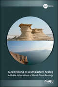
Geotrekking in Southeastern Arabia: A Guide to Locations of World-Class Geology (Special Publications #65)
by Benjamin R. JordanPublished by the American Geophysical Union as part of the Special Publications Series. Geotrekking in Southeastern Arabia presents the world's most diverse geology and reveals some of the unique rocks that were once covered under shallow seas and are now sub-aerially exposed. This guidebook describes various routes that leads to specific locations for viewing the distinctive and world class geology of the United Arab Emirates and Oman. Each route includes specific directions, satellite images, illustrations, and explanations that can help with locating the outstanding geology of the area. Certain sites preseve the world class ophiolites — a section of the Earth's oceanic curst and the underlying upper mantle that has been uplifted and exposed above sea level and often emplaced onto continental crustal rocks, a unique process of the Earth described by plate tectonics. Some salient features of this guidebook include: UAE and Oman are situated in the south east coast of the Arabian Peninsula, which is very well known for its vast reserves of oil and natural gas, hence this book is of great interest to exploration geologists Mountains of the UAE and Oman are the world's largest and best preserved ophiolite – a slice of the deep ocean crust that has been forced by tectonic forces onto a continental crust Within the mountains of these regions are sections of the deep Earth, rarely exposed anywhere – pieces of the Earth's underlying mantle and the lower parts of its oceanic crust Other characteristic features include deep sea sediments and volcanic rocks that were erupted by submarine volcanoes Among mineral ores, cpper deposits were commonly formed at ancient, deep sea, hydrothermal vents Some of the groundwater flowing out of ophiolite rocks reacts with the atmosphere to precipitate calcite and form vast pools of water that appear as blue swimming pools The shallow land and high evaporation conditions in the western region of the UAE forms giant, salt-lined mudcracks and the growth of gypsum clusters called "desert roses" Stromatolites, colonies of cyanobacteria that are probably some of the oldest living species on Earth are also very common in this region Some dunes in UAE rise upto 160 m above evaporative salt plains Rare occurrence of 100 million-year-old pillow lavas, which form underwater, uniquely preserved as if they erupted yesterday Many other geologic marvels exist in a region known more for its oil and gas geology
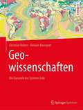
Geowissenschaften: Die Dynamik Des Systems Erde
by Christian Robert Romain BousquetDieses Lehrbuch bildet in einem Band mit über 800 erklärenden Grafiken und anschaulichen Fotos eine Synthese aller Themen rund um die Geowissenschaften. Die beiden Autoren Christian Robert und Romain Bousquet entwerfen ein umfassendes und kohärentes Bild der Entwicklung unseres Planeten von seinen Anfängen bis hin zu seinem heutigen Zustand. Nach einer grundlegenden Einführung behandelt das Werk vier große Themen: Es beginnt mit der Entstehung des Planeten Erde vom Aufbau des Weltalls bis zur Mineralogie und Stabilität der Materialen. Im zweiten Teil folgen die Kennzeichen der Dynamik der Erde und deren Untersuchung mit geophysikalischen und strukturgeologischen Methoden. Im dritten Teil geht es um den Kreislauf der Gesteine und Gebirgsbildungsprozesse. Abschließend behandeln die Autoren die Rohstoffe der Erde. Im gesamten Werk stellen sie die grundlegenden Aussagen neuen Erkenntnissen und Theorien gegenüber. Ein wichtiges Referenzwerk für Studierende der Geowissenschaften sowie Lehrende und Forschende.
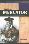
Gerardus Mercator: Father of Modern Mapmaking
by Ann HeinrichsMercator was destined to be one of the most famous mapmakers in history. Before his time, many maps were as much about myths as geographical reality, filled with exotic creatures and fabled lands. But he turned cartography, or map-making, into a science. He based his maps on firsthand reports, using mathematical calculations whenever possible to pinpoint locations.
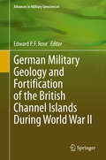
German Military Geology and Fortification of the British Channel Islands During World War II (Advances in Military Geosciences)
by Edward P. F. RoseThis volume discusses how the German armed forces made effective use of military geologists to assist their fortification of the Channel Islands after their capture from the British in 1940. The book presents a unique case history of German geologist expertise applied to British terrain, intended to make the Islands into an impregnable fortress that postwar would remain a permanent outpost of the German state. In doing so, the book explains why the Channel Islands constitute a ‘classic’ location for British geology; how German armed forces made far greater military use of geologists than either their British or American opponents; and the legacy of fortifications that may conveniently be seen by tourists today – fortifications bypassed by Allied forces that liberated nearby Normandy after D-Day in June 1944, and surrendered intact at the end of the War in Europe in May 1945.
German Radioactive Waste: Changes in Policy and Law (Routledge Focus on Environment and Sustainability)
by Robert RybskiThis book presents the universal issue of radioactive waste management from the perspective of the German legal system, analysing how lawmakers have responded to the problem of nuclear waste over the course of the last seventy years. In this book, Robert Rybski unwraps and explains the perplexing legal and social issues related to radioactive waste. He takes readers through the entire ‘life-cycle’: from the moment that radioactive material is classified as radioactive waste, through to the period of interim storage, and right up to its final disposal. However, this last step in radioactive waste management (that of final disposal) has not yet been achieved in Germany, or anywhere in the world, and has been the subject of hefty public debate for dozens of years. As a result, the book analyses the most recent regulations in place to enable final disposal. This book will be of interest to energy policy experts, academics and professionals who work in the area of nuclear energy.
Germans in the Antarctic
by Cornelia LüdeckeWhile science was usually at the forefront of German Antarctic expeditions, research into the Southern Polar region always had a political or economic component, whether it was about resource use or securing areas of influence.Cornelia Lüdecke presents the course of the three German Antarctic expeditions from 1901-03, 1911-12 and 1938/39 with their partly dramatic turns and twists and provides insights into everyday life under extreme conditions.She also evaluates unpublished material from the archives and private estates of the expedition members. She looks at the expeditions from a scientific and political point of view and also deals with the myths associated with the "Schwabenland" expedition during the National Socialist era.Finally, the author describes German south polar research after World War II, which took different paths in the German Democratic Republic and in the Federal Republic of Germany, and gives an outlook on future research. For the first time, this book presents the history of the Germans in Antarctica in a factual and informative way for the general public. With numerous pictures, some of which have never been published before.
Germany: Geographies of Complexity (World Regional Geography Book Series)
by Olaf Kühne Florian WeberThis book addresses the highly differentiated spatial, social, cultural and demographic structure(s) of Germany, with a particular focus on the reciprocal relations between different levels of spatial development. The historical development of Germany serves as a background in order to provide context for the development of spatially relevant ideas and ideals (whether in relation to politics, landscape, or culture). In this regard, questions of divergence and convergence become highly salient. The book makes the complexity of spatial and social developments in Germany comprehensible. The neopragmatic approach adopted here allows bringing together different theoretical strands while providing a basis for independent regional geographic research at the same time. Beginning with an overview of the physical structures of Germany which provides the material point of departure for the societal development of Germany, key aspects of the German history are discussed. Particular attention is paid to the reciprocal influence between material substrate and notions of landscape. Here, specific ‘German’ trajectories of aesthetic and normative conceptions of landscape become clear. A common theme throughout the book are questions of divergence and of efforts towards convergence, which become evident when considering past and present economic, political, and demographic developments. Efforts to tackle current challenges, such as adapting to climate change and mitigating it, or securing raw materials, also become apparent. The complexity of spatial processes in Germany is illustrated in case study regions dealing with the challenges of structural change in traditional industrial regions (such as the Ruhr area), or e.g. efforts of Berlin to position and find itself as the capital of a unified Germany. Overall, the book shows how theory-driven regional geographic research can make spatiotemporal complexities tangible and comprehensible.
Geschäftsmodell Nachhaltigkeit: Ökologische und soziale Innovationen als unternehmerische Chance
by Klaus-Michael AhrendDieses Praxishandbuch vermittelt, neben den theoretischen Grundlagen für die Bewertung von Nachhaltigkeit, eine positive Haltung zu ökologischen und sozialen Geschäftsmodellen. Nachhaltigkeit ist dabei mehr als eine gesellschaftliche Anforderung oder eine philanthropische Erwägung. Vielmehr ist sie eine unternehmerische Chance für Neugründungen und für etablierte Unternehmen. Für beide Zielgruppen stellt dieses Buch einen integrierten Ansatz für die Entwicklung von nachhaltigen Geschäftsmodellen bei Neugründungen und bei etablierten Unternehmen zur Verfügung. Mit über 1.600 Beispielen nachhaltiger Geschäftsmodelle aus verschiedenen Branchen wird es zu einem wichtigen Berater für jede Unternehmerin und jeden Unternehmer. In der aktualisierten Neuauflage wurden neben zahlreichen weiteren Beispielen nachhaltiger Geschäftsmodelle auch Interviews mit Vertreterinnen und Vertretern des Zentrums für nachhaltige Wirtschafts- und Unternehmenspolitik der Hochschule Darmstadt (ZNWU) ergänzt.
Gesteinskunde: Ein Leitfaden für Einsteiger und Anwender
by Ulrich SebastianDas vorliegende Buch vermittelt einen leicht verständlichen Überblick über das Gebiet der Petrographie. Einsteiger werden nicht durch theoretisches Detailwissen überfordert oder gar abgeschreckt, sondern erlangen schnell ein Grundwissen in Mineralogie mit den wichtigsten gesteinsbildenden Mineralen, Petrographie mit den häufigsten Gesteinen, technischer Gesteinskunde mit den Eigenschaften der Gesteine, die für die Verwendung wichtig sind. Instruktive Fotos, Übersichten und Schaubilder erleichtern das Lernen und Verstehen. Sie sind ein hervorstechendes Merkmal des Werkes und machen es zu einem hilfreichen Begleiter für alle Praktiker und Wiedereinsteiger, welche die Petrographie sonst eher selten benötigen. Das Buch ist in einen klassisch-petrographischen und einen angewandten Abschnitt geteilt. So kann jeder Nutzer die Gesichtspunkte der Gesteinskunde auswählen, die ihn besonders interessieren. Die nun bereits 5. Auflage wurde gemäß den letzten Normenänderungen aktualisiert und insbesondere mit Flashcards zum individuellen Lernen und Überprüfen der Inhalte ausgestattet sowie um wenige Unterkapitel ergänzt. Gesteinskunde – Ein Leitfaden für Einsteiger und Anwender richtet sich an Schüler und Studierende von Fach- und Hochschulen, an Profis wie Bauingenieure, Techniker und Geowissenschaftler sowie an interessierte Laien.
Gesundheitsressource Wald (essentials)
by Joachim RathmannJoachim Rathmann stellt die interdisziplinären Bezüge von Wäldern und menschlicher Gesundheit dar. Wälder stellen zahlreiche Ökosystemleistungen für das Überleben, das Wohlbefinden und die Erhaltung und Stärkung von Gesundheit von Menschen zur Verfügung. Wälder bieten multisensorische Erholungsräume und können daher als eine Ressource angesehen werden, die sowohl auf körperliche, mentale und soziale Aspekte von Gesundheit positiv wirkt. Der Autor bereitet natur-, sozial,- und geisteswissenschaftliche Untersuchungen für eine breit gefächerte Leserschaft verständlich, anschaulich und übersichtlich auf.
Get Involved in an Environmental Club! (Join the Club)
by Lisa J. AmstutzPassionate about the environment? If so, an environmental club might be the right fit for you! Find out what it takes to join an environmental club or start your own, including information on membership, meetings, and activities. Together, you and your fellow members can participate, create, and most importantly, have fun. Take the plunge, join the club, and get involved!
Get Outside!: How Humans Connect with Nature (Orca Footprints #30)
by Leah PayneWe know spending time in nature is good for us, but why? And how did people become so disconnected from the natural world, anyway? Get Outside! How Humans Connect with Nature explores the important relationship between people and nature. It asks big questions, like Are humans part of nature or separate from it? and Do all people have equal access to nature? By discussing global issues such as the climate crisis and environmental racism, the book shows us that, by strengthening our relationship with the natural world, we can learn how to take care of the environment and to let the environment take care of us too. The epub edition of this title is fully accessible.
Get Ready!: How to Prepare for and Stay Safe after a Pacific Northwest Earthquake
by Deb MollerThe definitive guide to getting ready for and staying safe after a major earthquake in the Pacific Northwest. FEMA recommends being prepared for two weeks of self-sufficiency after it occurs, and this handbook will show you how with clear, informative, and easy-to-implement steps.Recent seismic activity has made national headlines and underscored the fact that the Cascadia fault line off the coast of British Columbia, Washington, Oregon, and Northern California is overdue for a major earthquake. And when it happens, living conditions could be akin to those in the mid-nineteenth century. This handbook covers the supplies you need to stay safely in place, including water, food (and food prep), first aid, sanitation, health and hygiene needs, shelter and bedding, and light/fire. It also includes lists of what to purchase and how to store it, as well as simple excercises to gain confidence in perfoming necessary tasks. Learn what to do during and immediately after an earthquake, how to develop a reunification plan, and how to communicate when basic infrastructure is down. It also addresses the particular concerns of those living in coastal areas (the tsunami zone) as well as those outside of the severe impact zone. It covers long-term ways to stay safe without modern conveniences and a crash course in survival techniques should the quake happen before all preparations are complete. Get Ready! presents information in clear, practical, and managable steps, equipping the reader with the skills to care for themselves and their loved ones should a major earthquake hit. And when it does, the internet will not be an option, making this reference handbook invaluable. If you live in the Pacific Northwest, you need Get Ready!
Getting Development Right
by Eva PausThe celebratory tone about the emergence of the BRICs and the improved growth in Sub Saharan Africa and Latin America during the 2000s obscures the reality that, for large parts of the developing world, the development challenges are more acute than ever before. After three decades of Washington Consensus policies, deepening globalization, and China's and India's increasing competitiveness in ever more goods and services, many developing countries are now facing three critical challenges: how to engender a transformation of the production structure that creates many more productive jobs, how to make growth more inclusive, and how to stimulate a growth process compatible with environmental sustainability. This book brings together development scholars and practitioners from multiple academic disciplines and policy perspectives to analyze important facets of this triple challenge, to explore interconnections among them and suggest strategies for overcoming the challenges in the current age of globalization. Three features distinguish this book from other current works in the field. First, this book looks beyond the current global crisis and short-term growth opportunities and analyzes the challenges to development from a long-term perspective. Second, books on the barriers to development tend to concentrate on one of the three challenges, e. g. Barbier (2010) A Global Green New Deal on environmental sustainability; Cimoli, Dosi, Stiglitz (2009) Industrial Policy and Development on structural transformation; and Milanovic (2011) The Have and the Have-Nots on exclusion. This book, in contrast, brings the three challenges together to emphasize that they challenges are interlinked and that strategies and policies must begin to recognize these interconnections to address different aspects of the challenges concomitantly. Finally, the contributors to the book include some of the most renowned development thinkers of our time.
Getting Green Done: Hard Truths from the Front Lines of the Sustainability Revolution
by Auden SchendlerSoccer moms drive Priuses. Sport utility vehicles are going hybrid. Families are using hemp shopping bags. More and more companies are developing "green" buildings. What's more, the business consultants say going green is easy and profitable. In reality, though, many green-leaning businesses, families, and governments are still fiddling with the small stuff while the planet burns. Why? Because implementing sustainability is brutally difficult. In this witty and contrarian audiobook, Auden Schendler, a sustainable business foot soldier with fifteen year's worth of experience, gives us a peek under the hood of the green movement. The consultants, he argues, are clueless. Fluorescent bulbs might be better for our atmosphere, but what do you say to the boutique hotel owner who thinks they detract from his? And how do you convince a chain-smoking karate expert mechanic to put biodiesel in his vehicles? Scientists tell us we have to cut CO2 emissions 80 percent by mid-century. That's going to take more than a recycling program. We'll only solve our problems if we're realistic about the challenge of climate change. In this eye-opening inspiring audio book, Schendler illuminates the path. This recording features a new introduction wriiten and read by the author. Also, a new Afterword based on an article written by the author for Orion Magazine has been added to this recording.
Getting Healthy in Toxic Times: An ecological doctor’s prescription for healing your body and the planet
by Doctor Jenny GoodmanHow can we protect ourselves from the pollution, chemicals, and toxins that pervade our environment? Dr. Jenny Goodman connects the health of our planet with our own well-being, addressing the questions that very few doctors ask. We’re all too aware of the traffic pollution in the air, the chemicals in our water, the toxins in the soil (and therefore our food), and the electromagnetic energy emanating from our gadgets. If we can also understand how they affect our health, not least in the worrying rises in asthma and allergies, infertility, obesity, heart disease, behavioral and neurological disorders, as well as cancer, then we can take positive steps to avoid them. With the right information, we can: Safeguard ourselves with protective measures Minimize our interactions with pollutants Ensure our bodies have the right anti-toxin nutrients Take collective action to fight for our health and that of the environment Backed by the latest scientific and medical research, Getting Healthy in Toxic Times will empower you to look after your own health—and that of the planet. Let’s put the good stuff in and take the bad stuff out!

Getting to Green: A Bipartisan Solution
by Frederic C. Rich"Regardless of your place on the political spectrum, there is much to admire in this book, which reminds us that the stewardship of nature is an obligation shared by all Americans."--U.S. Senator Angus S. King Jr. The Green movement in America has lost its way. Pew polling reveals that the environment is one of the two things about which Republicans and Democrats disagree most. Congress has not passed a landmark piece of environmental legislation for a quarter-century. As atmospheric CO2 continues its relentless climb, even environmental insiders have pronounced "the death of environmentalism." In Getting to Green, Frederic C. Rich argues that meaningful progress on urgent environmental issues can be made only on a bipartisan basis. Rich reminds us of American conservation's conservative roots and of the bipartisan political consensus that had Republican congressmen voting for, and Richard Nixon signing, the most important environmental legislation of the 1970s. He argues that faithfulness to conservative principles requires the GOP to support environmental protection, while at the same time he criticizes the Green movement for having drifted too far to the left and too often appearing hostile to business and economic growth. With a clear-eyed understanding of past failures and a realistic view of the future, Getting to Green argues that progress on environmental issues is within reach. The key is encouraging Greens and conservatives to work together in the space where their values overlap--what the book calls "Center Green." Center Green takes as its model the hugely successful national land trust movement, which has retained vigorous bipartisan support. Rich's program is pragmatic and non-ideological. It is rooted in the way America is, not in a utopian vision of what it could become. It measures policy not by whether it is the optimum solution but by the two-part test of whether it would make a meaningful contribution to an environmental problem and whether it is achievable politically. Application of the Center Green approach moves us away from some of the harmful orthodoxies of mainstream environmentalism and results in practical and actionable positions on climate change, energy policy, and other crucial issues. This is how we get to Green.
Getting to Scale
by Homi Kharas Laurence Chandy Akio Hosono Johannes LinnThe global development community is teeming with different ideas and interventions to improve the lives of the world's poorest people. Whether these succeed in having a transformative impact depends not just on their individual brilliance but on whether they can be brought to a scale where they reach millions of poor people.Getting to Scale explores what it takes to expand the reach of development solutions beyond an individual village or pilot program so they serve poor people everywhere. Each chapter documents one or more contemporary case studies, which together provide a body of evidence on how scale can be pursued. The book suggests that the challenge of scaling up can be divided into two solutions: financing interventions at scale, and managing delivery to large numbers of beneficiaries. Neither governments, donors, charities, nor corporations are usually capable of overcoming these twin challenges alone, indicating that partnerships are key to success.Scaling up is mission critical if extreme poverty is to be vanquished in our lifetime. Getting to Scale provides an invaluable resource for development practitioners, analysts, and students on a topic that remains largely unexplored and poorly understood. Contributors: Tessa Bold (Goethe University, Frankfurt), Wolfgang Fengler (World Bank, Nairobi), David Gartner (Arizona State University), Shunichiro Honda (JICA Research Institute), Michael Joseph (Vodafone), Hiroshi Kato (JICA), Mwangi Kimenyi (Brookings), Michael Kubzansky (Monitor Inclusive Markets), Germano Mwabu (University of Nairobi), Jane Nelson (Harvard Kennedy School), Alice Ng'ang'a (Strathmore University, Nairobi), Justin Sandefur (Center for Global Development), Pauline Vaughan (consultant), Chris West (Shell Foundation)
Getting to Scale
by Homi Kharas Laurence Chandy Akio Hosono Johannes LinnThe global development community is teeming with different ideas and interventions to improve the lives of the world's poorest people. Whether these succeed in having a transformative impact depends not just on their individual brilliance but on whether they can be brought to a scale where they reach millions of poor people. Getting to Scale explores what it takes to expand the reach of development solutions beyond an individual village or pilot program so they serve poor people everywhere. Each chapter documents one or more contemporary case studies, which together provide a body of evidence on how scale can be pursued. The book suggests that the challenge of scaling up can be divided into two solutions: financing interventions at scale, and managing delivery to large numbers of beneficiaries. Neither governments, donors, charities, nor corporations are usually capable of overcoming these twin challenges alone, indicating that partnerships are key to success.Scaling up is mission critical if extreme poverty is to be vanquished in our lifetime. Getting to Scale provides an invaluable resource for development practitioners, analysts, and students on a topic that remains largely unexplored and poorly understood. Contributors: Tessa Bold (Goethe University, Frankfurt), Wolfgang Fengler (World Bank, Nairobi), David Gartner (Arizona State University), Shunichiro Honda (JICA Research Institute), Michael Joseph (Vodafone), Hiroshi Kato (JICA), Mwangi Kimenyi (Brookings), Michael Kubzansky (Monitor Inclusive Markets), Germano Mwabu (University of Nairobi), Jane Nelson (Harvard Kennedy School), Alice Ng'ang'a (Strathmore University, Nairobi), Justin Sandefur (Center for Global Development), Pauline Vaughan (consultant), Chris West (Shell Foundation)
Getting to Zero - Beyond Energy Transition Towards Carbon-Neutral Mediterranean Cities: Selected Papers from the World Renewable Energy Congress Med Green Forum 2024 (Innovative Renewable Energy)
by Ali Sayigh Antonella Trombadore Gisella CalcagnoThis book contains selected papers from the World Renewable Energy Congress and Network Forum's seventh edition of the biannual Med Green Forum (MGF2024) that highlight opportunities for energy transition based on the principles of efficiency, urban/building integration, and ecology. Contributions explore possible carbon-neutral solutions, technologies, strategies, processes, and policies for Mediterranean cities. The book addresses the transformation in the unique socio-climatic and cultural context of the Mediterranean basin, cities, and architecture, a transversal topic deeply related to social dynamics and new energy landscapes.
Gettysburg National Military Park (Images of Modern America)
by Jared Frederick Christopher GwinnThe picturesque Gettysburg Battlefield has long been memorialized as an iconic landscape of America's national identity. The tumultuous Civil War battle and Abraham Lincoln's subsequent address transformed the country in profound ways that continue to echo throughout the ages. In the aftermath of the struggle, Gettysburg National Military Park was embraced by citizens not only as a shrine of commemoration but also as a public space utilized for leisure, education, politics, and discovery. This compelling photographic history documents the park from the post-World War II era onward, chronicling the dramatic evolutions the battlefield has undergone in the wake of modern tourism. Exploring the fascinating issues of historical memory, preservation, and popular culture, the book paints a vivid picture of a national park at work for the benefit "of the people."
Gewöhnliche Differenzialgleichungen leicht gemacht!
by Jochen BallaDas vorliegende Buch bietet eine leicht lesbare Einführung in Theorie und Praxis gewöhnlicher Differenzialgleichungen. Es richtet sich an Studierende der Natur- und Ingenieurwissenschaften, der Wirtschaftswissenschaften und allgemein aller Fachgebiete, die Differenzialgleichungen benötigen. Auch Mathematikstudierende, die einen gut verständlichen Zugang suchen, werden angesprochen. Es werden gewöhnliche Differenzialgleichungen erster Ordnung, Differenzialgleichungssysteme, Differenzialgleichungen höherer Ordnung und lineare Differenzialgleichungen mit konstanten Koeffizienten behandelt. Auch ein Ausblick in partielle Differenzialgleichungen wird gegeben.Viele Beispiele und Übungsaufgaben ermutigen den Leser, sofort selbst „loszurechnen“, und Programmierbeispiele helfen dabei, Differenzialgleichungen auch numerisch zu bewältigen. Das Lehrbuch bietet verschiedene Hilfestellungen, die den Zugang erleichtern:Lesehilfen helfen über schwierige Stellen hinwegZwischenfragen mit Antworten regen zum Nachdenken anÜbungsaufgaben mit ausführlichen Lösungen motivieren zum praktischen Umgang mit Differenzialgleichungen„Das Wichtigste in Kürze“ fasst am Ende eines jeden Kapitels den Stoff zusammenEin Anhang bietet eine kurze Einführung in komplexe Zahlen Prof. Dr. rer. nat. Jochen Balla ist theoretischer Physiker. Seit 2004 unterrichtet er Mathematik für Ingenieure in verschiedenen Bachelor- und Master-Studiengängen der Hochschule Bochum.
Geysers: A True Book
by Larry Dane BrimnerDescribes what geysers are, how they are formed, and where they can be found.
Gezeiten und Wellen: In Küsteningenieurwesen und Ozeanographie
by Andreas MalcherekDas Fachbuch vermittelt alle Grundlagen der Hydromechanik am Beispiel der Küstengewässer. Der Autor wendet sich dabei an alle Ingenieure, die sich mit Küstenströmungen im Ökosystem Wattenmeer, Klimafolgen, dem Meeresspiegelanstieg, dem Küstenschutz und Offshoreanlagen beschäftigen.