- Table View
- List View
Good Crop / Bad Crop: Seed Politics and the Future of Food in Canada
by Devlin KuyekIN RECENT YEARS Canadians have become more and more concerned about the origins oftheir food and the environmental impacts of pesticides in agriculture. What is less well knownis that pesticide corporations such as Monsanto and Du Pont have bought their way into the seed industry and are taking control of what was once the exclusive domain of farmers.In Good Crop / Bad Crop, Devlin Kuyek deftly examines the economic and environmental background of the modern seed trade from a Canadian perspective. Historically seeds were viewed more as public goods than as commodities, and plant breeding objectives were widely shared by scientists, governments, and farmers. Now that approach is changing; seeds have become increasingly commodified, and plant breeding has become subject to corporate priorities. Farmers and citizens in Canada, Kuyek points out, need to heed the hard-won lessons from the developing world, where farmers greatly damaged by the much-heralded approaches of theGreen Revolution are now taking steps to reclaim control over seed supplies, food security, and their futures.
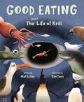
Good Eating: The Short Life Of Krill
by Matt LilleyCalifornia Eureka Silver Honoree award 2022 "To my delight, your average krill is a far stranger story of metamorphosis than anything our butterflies can come up with." - Elizabeth Bird, A Fuse 8 Production A fun exploration of a tiny animal at the base of the ocean food chain Just 2 inches long full-grown, this little guy is the foundation of the Southern Ocean food chain... “Hi. What are you? You appear to be an egg. You are an egg sinking. For many days, you sink. You sink a mile down, and you keep sinking down… down… until…” The unidentified narrator follows one krill among billions as it pursues its brief existence, eating and eating while metamorphosing from one thing into another and trying to avoid being eaten. Questions and advice are hurled at the krill on every page, but the krill never responds—because, after all, krill can’t talk, and this is nonfiction. Krill are the largest animals able to catch and eat phytoplankton, and they in turn are eaten by the largest animals ever to live on earth—blue whales—as well as by seals, penguins, and a host of others. In other words, krill are really good at eating, and they make really good eating. And that makes them the most important animals in the high-latitude oceans. As in The Whale Fall Café, Dan Tavis’s illustrations combine scientific accuracy with Nemo liveliness and humor. Our star krill is so good at gobbling up phytoplankton that he turns green, so we can pick him out from the crowd racing to escape a penguin’s beak or a blue whale’s gaping maw. The book has been reviewed and endorsed by global krill expert Dr. Stephen Nichol, and the manuscript earned an honorable mention in Minnesota’s McKnight Artist Fellowships for Writers. Helpful backmatter is included. The Good Eating manuscript won an honorable mention in Minnesota’s McKnight Artist Fellowships for Writers. Technical review and endorsement from Dr. Stephen Nichol, adjunct professor at the University of Tasmania and author of The Curious Life of Krill.
Good Education in a Fragile World: The Value of a Collaborative and Contextualised Approach to Sustainability in Higher Education (Routledge Studies in Sustainable Development)
by Alan Bainbridge Nicola KempThis edited collection aims to provoke discussion around the most important question for contemporary higher education – what kind of education (in terms of purpose, pedagogy and policy) is needed to restore the health and wellbeing of the planet and ourselves now and for generations to come? The book contains contributions from colleagues at a single UK University, internationally recognised for its approach to sustainability education. Introducing a conceptual framework called the ‘Paradox Model’, the book explores the tensions that underpin the challenge of developing sustainability in higher education in the 21st century. It asks probing questions about the purpose of higher education in the 21st century given growing concerns in relation to planetary safety and justice and calls for a rethinking of educational purpose. It draws upon the theory and practice of education and explores how these can develop an understanding of sustainability pedagogies in practice. Finally, it delivers thought-provoking discussion on what constitutes a ‘good’ higher education that meets the needs of a world in crisis. Drawing on a planetary health lens, the book concludes with a ‘manifesto’ that brings together the key insights from the contributing authors. This will be an engaging volume for academics and educators from a wide range of disciplines in higher educational settings interested in translating sustainability theory into educational practice.
Good Food, Bad Waste: Let's Eat for the Planet (Orca Think #9)
by Erin SilverA deep dive into why humans waste so much food and the consequences for people and the planet Around the world, a billion tons of food gets thrown away every year, even when hundreds of millions of people suffer from hunger. A lot of what we don't eat ends up rotting in landfills which contributes to global warming. The good news is that many governments, communities and individuals are working hard to tackle this giant problem. You can be part of the solution, starting in your own home—and working together, we can decrease our overall waste and make sure all people have food security. Plus, by reducing food waste, we can also fight climate change! With inspiring profiles of food-waste activists and tasty tidbits on things like best-before dates, Good Food, Bad Waste offers much food for thought. The epub edition of this title is fully accessible.
Good Governance and the Sustainable Development Goals in Southeast Asia (Routledge/ISDRS Series in Sustainable Development Research)
by Rasyikah Md Khalid and Ainul Jaria MaidinThis book discusses management and governance initiatives undertaken by agencies and stakeholders towards achieving the Sustainable Development Goals (SDGS) in the Southeast Asian region, specifically Malaysia, Indonesia, Thailand and Singapore. It highlights the theories, methodologies and action plans involved in implementing the goals in these countries and the importance of developing a positive relationship between the public and government agencies. With contributors coming from a range of disciplines and backgrounds across the Association of Southeast Asian Nations (ASEAN) region, this edited collection provides a holistic quantitative and qualitative approach to achieving the SDGs. In order to realise these development objectives, it argues that a strong understanding of the basic principles of governance across all levels is required, supported by effective citizen participation and conflict resolution. It provides a detailed overview of the importance of governance at the country level, addressing the key elements of an integrated framework to support sustainable transitions. Regional case studies highlight processes and recommendations for improving governance and risk management and elevating citizen awareness and participation. Good Governance and the Sustainable Development Goals in Southeast Asia is a comprehensive and valuable companion for researchers, government agencies, and professionals with an interest in the SDGs in Southeast Asia and beyond.
Good Governance, Scale and Power: A Case Study of North Sea Fisheries (Routledge Studies in Ecological Economics #29)
by Liza GriffinIn recent years there have been several alarming predictions about the future of the planet’s fish stocks. As a result, many national governments and supranational institutions, including the European Union, have instituted reforms designed to mitigate the crisis. This book examines the discourse and practice of ‘good governance’ in the context of fisheries management. It starts by examining the ‘crisis’ of fisheries in the North Sea, caused primarily by overfishing and failure of the European Union’s Common Fisheries Policy. It then goes on to analyse reforms to this policy enacted and planned between 2002 and 2013, and the proposition that collapse of fish stocks could occur as a result of deficiencies in new governing arrangements, i.e. failure to apply ‘principles of good governance’. The book argues that impediments to good governance practice in fisheries are not merely the result of implementation deficits, but that they constitute a more systematic failure. Governance theory addresses issues of power, but it does not recognise the many important spatially contingent and relational forms of power that are exercised in actual governing practice. For example, it frequently overlooks spatial practices and strategies, such as ‘scale jumping, ‘rescaling’ and the discursive redrawing of governing boundaries. This book exposes some of these spatial power relationships, showing that the presence of such relationships has implications for accountability and effective policymaking. In sum, this book explores some of the ways in which we might better understand governance practice using theories of scale and relational concepts of power, and in the process it offers a critique and rethinking of governance theory. These reflections are made on the basis of an in-depth case study of the attempted pursuit of ‘good governance’ in the European Union via institutional reforms, focusing particularly on the thorny and fascinating case of North Sea fisheries management.
Good Green Jobs in a Global Economy
by David J. HessGood Green Jobs in a Global Economy is the first book to explore the broad implications of the convergence of industrial and environnmental policy in the United States. Under the banner of "green jobs," clean energy industries and labor, environmental, and antipoverty organizations have forged "blue-green" alliances and achieved some policy victories, most notably at the state and local levels. In this book, David Hess explores the politics of green energy and green jobs, linking the prospect of a green transition to tectonic shifts in the global economy. He argues that the relative decline in U. S. economic power sets the stage for an ideological shift, away from neoliberalism and toward "developmentalism," an ideology characterized by a more defensive posture with respect to trade and a more active industrial policy. After describing federal green energy initiatives in the first two years of the Obama administration, Hess turns his attention to the state and local levels, examining demand-side and supply-side support for green industry and local small business. He analyzes the successes and failures of green coalitions and the partisan patterns of support for green energy reform. This new piecemeal green industrial policy, Hess argues, signals a fundamental challenge to anti-interventionist beliefs about the relationship between the government and the economy.
Good Green Jobs in a Global Economy: Making and Keeping New Industries in the United States (Urban and Industrial Environments)
by David J. HessAn examination of the politics of green jobs that foresees a potential ideological shift away from neoliberalism toward “developmentalism.”Good Green Jobs in a Global Economy is the first book to explore the broad implications of the convergence of industrial and environnmental policy in the United States. Under the banner of “green jobs,” clean energy industries and labor, environmental, and antipoverty organizations have forged “blue-green” alliances and achieved some policy victories, most notably at the state and local levels. In this book, David Hess explores the politics of green energy and green jobs, linking the prospect of a green transition to tectonic shifts in the global economy. He argues that the relative decline in U.S. economic power sets the stage for an ideological shift, away from neoliberalism and toward “developmentalism,” an ideology characterized by a more defensive posture with respect to trade and a more active industrial policy.After describing federal green energy initiatives in the first two years of the Obama administration, Hess turns his attention to the state and local levels, examining demand-side and supply-side support for green industry and local small business. He analyzes the successes and failures of green coalitions and the partisan patterns of support for green energy reform. This new piecemeal green industrial policy, Hess argues, signals a fundamental challenge to anti-interventionist beliefs about the relationship between the government and the economy.
Good Growth: How Brands Win with Social Impact
by Omar Rodriguez Vila Sundar BharadwajBusiness has a sustainability problem—and sustainability has a business problem, as many companies are fearful of engaging with social and environmental issues, owing to the costs and risks.Addressing these dual challenges head on, this book provides a blueprint for putting social and environmental benefits at the center of a company’s growth agenda. Many sustainability books offer 30,000-foot strategic views and broad-brush guidance on the business of “doing well by doing good,” but here is a ground-level guide for profitably integrating social and environmental benefits into individual products and brands. The book introduces the rapidly emerging phenomenon of social impact markets and shows how companies can capitalize on these new pockets of consumer demand through focused strategy, data-informed implementation, and a clear eye on the future, including how digital technologies are creating new ways for brands to expand their social impact and make social mission a central element of competitive strategy.Weaving together rich case studies and practical tools, this research-backed and real-world-ready guide fills a critical niche: a hands-on strategy playbook for the executives charged with driving brands’ top-line growth, making it essential reading for C-suite leaders, R&D, product, and brand managers, board members, NGOs, as well as MBA and executive education students.
Good Housekeeping 1,001 Amazing Science Facts
by Good Housekeeping Michael Burgan Rachel RothmanDo bees sleep? Can rocks bend? Discover the amazing answers to questions like these in this science fact-packed treasure trove for kids age 8 to 12!Join the experts at the Good Housekeeping Institute and get stoked about science! Discover incredible info about awesome animals, our exceptional planet Earth, exciting chemical reactions, extraordinary engineering, and more in this fun-filled, fact-packed book for budding scientists. Packed with hundreds of dynamite color photos and illustrations, hands-on STEAM activities, quizzes, and tons of cheeky jokes, this boredom-busting gift book provides young readers with a close-up look at the science all around us.Chapters cover super topics that kids love from animals to nature and Earth science to engineering and technology.Inside you&’ll find: Dig deep to explore Earth from the inside out, from what&’s going on deep below our feet, to why geysers erupt, and if we drink the same water as the dinosaurs did.Go inside the human body to learn how your eyes see, what happens to food after you eat it, and about the organ which is like a balloon.Investigate our natural world and find out if there are more trees or stars, how a coral reef grows from a tiny animal, and how freezing ice and fiery volcanoes are related.Travel back in time and check out why scientists study dinosaur poop. Then blast off into space to see how stars are born and innovations that will help people travel to Mars.Look at the animal kingdom, from your fellow primates like chimpanzees to insects with killer instincts (and you&’ll even get to find out which ones have the grossest gassy habits…ewww.) With the expert (and sometimes wacky!) science information kids crave, this ultimate book of answers is the perfect classroom resource or gift for the casual browser and the fact-obsessed budding young scientist.
Good Morning, Beautiful Business: The Unexpected Journey of an Activist Entrepreneur and Local-Economy Pioneer
by Judy WicksIt's not often that someone stumbles into entrepreneurship and ends up reviving a community and starting a national economic-reform movement. But that's what happened when, in 1983, Judy Wicks founded the White Dog Café on the first floor of her house on a row of Victorian brownstones in West Philadelphia. After helping to save her block from demolition, Judy grew what began as a tiny muffin shop into a 200-seat restaurant-one of the first to feature local, organic, and humane food. The restaurant blossomed into a regional hub for community, and a national powerhouse for modeling socially responsible business.Good Morning, Beautiful Business is a memoir about the evolution of an entrepreneur who would not only change her neighborhood, but would also change her world-helping communities far and wide create local living economies that value people and place as much as commerce and that make communities not just interesting and diverse and prosperous, but also resilient.Wicks recounts a girlhood coming of age in the sixties, a stint working in an Alaska Eskimo village in the seventies, her experience cofounding the first Free People store, her accidental entry into the world of restauranteering, the emergence of the celebrated White Dog Café, and her eventual role as an international leader and speaker in the local-living-economies movement.Her memoir traces the roots of her career - exploring what it takes to marry social change and commerce, and do business differently. Passionate, fun, and inspirational, Good Morning, Beautiful Business explores the way women, and men, can follow both mind and heart, do what's right, and do well by doing good.
Good News for a Change
by David Suzuki Holly DresselWe all know the bad news. Every day, along with all the bulletins on social upheavals and terrorist attacks, we read reports of another animal species on the brink of extinction, of how our ocean fisheries are collapsing, and of the damage industrial development is wreaking on our soil, air and water. We drive bigger cars, eat pesticide-sprayed, genetically altered foods and consume so much energy that even rich, industrialized countries suffer power outages. We seem intent on continuing to live this way, even though many scientific experts tell us our actions are suicidal.The good news, Suzuki and Dressel tells us, is that thousands of individuals, groups and businesses are already changing their ways. A growing number of companies are still making money while benefiting their local communities. Anti-globalization activists and Third World villagers are learning how to practice real participatory democracy and create real community. Farmers and ranchers are sharing their land with other species, including predators and pests, while still prospering. Even some governments, local and national, are starting to base economic development strategies on our collective dependency on nature, while decreasing large-scale interference in our ecosystems.
Good News, Planet Earth: What’s Being Done to Save Our World, and What You Can Do Too!
by Sam BentleyJoin sustainability enthusiast and climate activist Sam Bentley as he shares the hopeful developments combating climate change!Do you feel like climate change is just getting worse and there's nothing you can do to stop it? Good news—there are tons of efforts already underway to save our planet, and we'd love for you to join the fight.Good News, Planet Earth! is your go-to guide to learn all about the amazing sustainable developments that are happening worldwide to combat global warming, pollution, deforestation, the use of wasteful products, and threats to our diverse wildlife.Inside you'll find:· 25 chapters covering ocean-cleanup innovations, composting initiatives, animal rights activism, efforts to greenify public spaces, solar power advancements, public transportation solutions, and more!· 100 actionable steps you can take to fight climate change and live more sustainably!An uplifting and informative call to action for any environmentally conscious individual, Good News, Planet Earth! is the small but mighty book that might just help save the world!
Good Practices for Disaster Risk Management of Cultural Heritage: Practices of ITC Participants (Routledge Studies in Hazards, Disaster Risk and Climate Change)
by Rohit Jigyasu Dowon Kim Lata ShakyaThis book is a selection of case studies undertaken by cultural heritage and disaster risk management professionals across the world demonstrating good practices for disaster risk management of cultural heritage. The readers will learn about the practical application of various methodologies, tools, and techniques for disaster risk assessment, mitigation, preparedness, response, and recovery of cultural heritage. They will also learn about the application of traditional knowledge and engagement of communities for disaster risk management of cultural heritage. This will help relevant organisations and professionals to develop and implement projects in this field. The intended audience for this book are Practitioners or site managers of cultural heritage sites and museums. Also, researchers and students studying disaster risk management of cultural heritage. The book will also be of interest to disaster risk management institutions at the urban, regional or national level/cultural heritage management institutions at the urban, regional or national level/city administration, municipalities, urban local bodies and planning departments/educational and research institutions which have specialised programmes in engineering, planning, disaster risk management, and conservation of cultural heritage.
Good Urbanism: Six Steps to Creating Prosperous Places (Metropolitan Planning + Design)
by Nan EllinWe all have a natural nesting instinct--we know what makes a good place. And a consensus has developed among urban planners and designers about the essential components of healthy, prosperous communities. So why aren't these ideals being put into practice? In Good Urbanism, Nan Ellin identifies the obstacles to creating thriving environments, and presents a six-step process to overcome them: prospect, polish, propose, prototype, promote, present. She argues that we need to reach beyond conventional planning to cultivate good ideas and leverage the resources to realize them. Ellin illustrates the process withten exemplary projects, from Envision Utah to Open Space Seattle. Each case study shows how to pair vision with practicality, drawing on our best natural instincts and new planning tools. For planners, urban designers, community developers, and students of these fields, Ellin's innovative approach offers an inspired, yet concrete path to building good places.
Good to Green: Managing Business Risks and Opportunities in the Age of Environmental Awareness
by John-David Phyper Paul MacLeanThe business world is undergoing dramatic change that is driven by tough new legislation, expanded market based incentives and increased consumer awareness of environmental issues (e.g., hazard ingredients in products, alternative energy, reduction in greenhouse gases). This is forcing companies to reassess the life cycle of their products and the efficiency of their supply chains. Environmental issues are becoming business critical. Good to Green provides the vital information, backed by case studies and examples, that gives progressive business leaders the strategic know-how to pro-actively manage environmental issues and realize the business benefits of going green.
Goodbye Eastern Europe: An Intimate History of a Divided Land
by Jacob Mikanowski'Do not rush to bid farewell to eastern Europe until reading this book. Meticulously researched and beautifully written, this very personal story of the place that one can&’t find on the map pays tribute to the origins of the experiences, cultures and ideas that continue to shape political and ideological battles of the modern world.' Serhii Plokhy Eastern Europe is more than the sum total of its annexations, invasions and independence declarations. From the Baltics to the Balkans, from Prague to Kiev, the area exuded a tragicomic character like no other. This is a paean for a disappearing world of movable borders, sacred groves and syncretism. And an invitation to not forget.
Gorilas (Animals en espanol)
by Jaclyn Jaycox¡Los gorilas son los primates ma´s grandes del mundo! Estos amables mami´feros deambulan por la selva,viven en grupos grandes y buscan frutas y brotes de bambu´ para alimentarse. Sube a los a´rboles y conoce a estos poderosos y amigables primates.
Gorillas (Animals)
by Jaclyn JaycoxGorillas are the largest primates in the world! These gentle mammals roam through the jungle, living in big groups as they search for fruit and bamboo shoots to eat. Climb through the trees to learn all about these strong, social primates.
Gotham Unbound
by Ted SteinbergThis is the story of the monumental struggle between New York and the natural world. From Henry Hudson's discovery of Mannahatta to Hurricane Sandy, Gotham Unbound is Ted Steinberg's sweeping ecological history of one of the most man-made spots on earth.Here is a tale of "the world with us"--lots of us--a groundbreaking book that recounts the four-century history of how hundreds of square miles of open marshlands became home to six percent of the nation's population. Steinberg vividly brings a vanished New York back to life. You will see the metropolitan area anew, not just as a dense urban goliath but as an estuary once home to miles of oyster reefs, wolves, whales, and blueberry bog thickets. That world gave way to an onslaught managed by thousands, from Governor John Montgomerie, who turned water into land, and John Randel, who imposed a grid on Manhattan, to Robert Moses, Charles Urstadt, Donald Trump, and Michael Bloomberg. This book is a powerful account of the relentless development that New Yorkers wrought as they plunged headfirst into the floodplain and transformed untold amounts of salt marsh and shellfish beds into a land jam-packed with people, asphalt and steel, and the reeds and gulls that thrive among them. With metropolitan areas across the globe on a collision course with rising seas, Gotham Unbound is a penetrating history that helps explain how one of the most important cities in the world wound up in such a perilous situation.
Governability of Fisheries and Aquaculture: Theory and Applications
by Jan Kooiman Svein Jentoft Ratana Chuenpagdee Maarten BavinckFollowing from Fish for Life - Interactive Governance for Fisheries (Kooiman et al., 2005), which presents an interdisciplinary and intersectoral approach to the governance of capture and aquaculture fisheries, this volume pursues what interactive governance theory and the governability perspective contribute to the resolution of key fisheries problems, these include overfishing, unemployment and poverty, food insecurity, and social injustice. Since these problems are varied and can be felt among governments, resource users and communities globally, the diagnosis must be holistic, and take account of principles, institutions, and operational conditions. The authors argue that 'wicked problems' and institutional limitations are inherent to each setting, and must be included in the analysis. The volume thereby offers a new lens and a systematic approach for analysing the nature of problems and challenges concerning the governance of fisheries, explores where these problems are situated, and how potential solutions may be found. "It now seems clear that the crisis in the world's fisheries [is] a much larger and more complex problem than many had imagined. Yet, examining it through the lens of governability may offer the best hope for alleviating it--as well as alleviating similar crises in other social systems." James R. McGoodwin (Professor Emeritus, University of Colorado)
Governance & Climate Justice: Global South & Developing Nations (Politics, Economics, And Inclusive Development Ser.)
by Julia PuaschunderThis book examines international climate change mitigation and adaptation regimes with the aim of proposing fair climate stability implementation strategies. Based on the current endeavors to finance climate change mitigation and adaptation around the world, the author introduces a 3-dimensional climate justice approach to share the benefits and burdens of climate change equitably within society, across the globe and over time.
Governance Approaches to Mitigation of and Adaptation to Climate Change in Asia
by Tek Nath Dhakal Huong HaAcademics and practitioners from across Asia and beyond revisit the issues and impact of climate change in Asia. They examine the preconditions for good governance regarding climate change, and the role of state and non-state actors in climate change governance, and explore different political-legal frameworks.
Governance Ecosystems
by Julia Sagebien Nicole Marie LindsayAs debates rage about the responsibilities of business and government in global extractives industries, there remains a significant lack of empirical research and theoretical analysis focused on the dynamics of resource extraction, governance and corporate social responsibility. This collection takes a broad, 'governance ecosystem' view to exploring the complex and cross-cutting relationships between key actors involved in and affected by mining governance in Latin America. Case studies include the Kimberley process over conflict diamonds, the PERCAN Initiative in Peru, the Carajas iron ore complex in the Brazilian Amazon, Apex and Empresa Huanuni in Bolivia, and the gold producers Newmont and Goldcorp. "
Governance Networks for Sustainable Cities: Connecting Theory and Practice in Europe (Routledge Explorations in Environmental Studies)
by Katherine MaxwellThis book explores the effectiveness of governance networks on the design and implementation of sustainability strategies. European cities are actively developing sustainability strategies to address the impact of climate change. One recent approach many cities have taken is the creation of ‘governance networks’: groups of public, private and third sector organisations, which collaborate to support urban sustainability efforts. Drawing on two case studies in Glasgow and Copenhagen, this book explores the concept of governance networks in theory and practice, revealing how stakeholder collaboration, leadership and innovation within these networks can help or hinder the process. It also highlights the many benefits of these networks, including increased participation in the decision-making process, increased levels of resources and expertise on sustainability issues, as well as stakeholder buy-in for sustainability policies. This book provides recommendations for improving the efficiency of governance networks and will be of interest to academics and practitioners working in the areas of urban governance and sustainability.
