- Table View
- List View
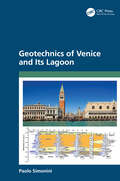
Geotechnics of Venice and Its Lagoon
by Paolo SimoniniWithout any protective intervention, the historic city of Venice and its surrounding islands would suffer rapid deterioration due to the increased frequency of tidal flooding, as the gap between land surface and sea levels has reduced due to a coupled effect of climate change-induced sea-level rise and natural and anthropic subsidence. Geotechnics of Venice and Its Lagoon provides a clear and comprehensive illustration of the extensive geotechnical aspects of not only the various environmental problems such as land subsidence and wetland surface reduction, but also solutions such as the design of the tilting gate foundations against high tides and the restoration and improvement of the drainage system of the renowned Piazza San Marco, which have been necessary for the preservation of the extraordinary cultural heritage of Venice. Readers will gain a better understanding of the complex phenomena occurring in the sensitive Venice silts, whose hydro-mechanical behavior has required comprehensive laboratory and site investigations and modeling. The book provides: An authoritative analysis of one of the largest and most important geotechnical issues in the world A description of a detailed case study of an ongoing engineering solution The book will be useful for engineers worldwide, and is also an excellent reference for students.
Geotechnik: Erkunden – Untersuchen – Berechnen – Ausführen – Messen
by Konrad Kuntsche Sascha RichterDas in der 2. Auflage erscheinende Lehrbuch zur Geotechnik wurde unter Beibehaltung des praxisbezogenen Konzepts grundlegend überarbeitet. Fragen, Beispiele und Übungsaufgaben unterstützen die Einarbeitung in die Thematik. Unter Berücksichtigung der aktuellen Normung wurden Abschnitte zur Felsmechanik, Bauausführung und zu Schäden im Gründungsbereich neu mit aufgenommen. Das Layout wurde so umgestaltet, dass auch ein Nachschlagen leichter fällt. So wird wichtiges Grundwissen der Geotechnik nicht nur dargestellt und erklärt, sondern auch schnell abrufbar - für Studenten genauso wie für den in der Praxis tätigen Ingenieur.
Geotechnik – Übungsaufgaben: Berechnungsbeispiele mit Lösungen
by Konrad Kuntsche Sascha RichterDas vorliegende Buch „Geotechnik – Übungsaufgaben, Berechnungsbeispiele mit Lösungen“ wendet sich in erster Linie an Studierende des Bauingenieurwesens bzw. der Geotechnik, die sich auf Klausuren zur Geotechnik vorbereiten wollen.Ein Leitgedanke bei der Konzeption dieses Werkes ist, den LeserInnen nicht gleich die von den Verfassern vorgeschlagenen Lösungen zu präsentieren. Denn ein nachhaltiger Lernerfolg entsteht erst mit der Mühe einer selbstständigen Bearbeitung. Als Motivationshilfe, zunächst diesen eigenen Weg zu gehen, wurden die Aufgaben mit einigen Gedanken zum Lösungsweg ergänzt.Aber nicht nur für Studierende werden die Berechnungsbeispiele hilfreich und nützlich sein. Mit ihrem Praxisbezug können sie auch erfahrenen IngenieurInnen helfen, geotechnische Kenntnisse aufzufrischen und zu ergänzen, um ähnliche Aufgabenstellungen sicherer zu bearbeiten.Dieses Buch ergänzt das Lehrbuch „Geotechnik – Erkunden, Untersuchen, Berechnen, Ausführen, Messen“, ISBN 978-3-658-32289-2.
Geotechnik für Ingenieure: Ein Überblick (essentials)
by Bernd SchröderDie geotechnischen Aufgaben betreffen Baugrunduntersuchungen und rechnerische Nachweise. Die Norm unterscheidet drei Kategorien. Für jede Bauaufgabe müssen Schichtgrenzen, Einschlüsse und Kennwerte von Boden und Fels sowie die Grundwasserverhältnisse bekannt sein. Je nach Kategorie unterscheiden sich Art und Umfang der erforderlichen geotechnischen Untersuchungen. Geotechnische Kennwerte beschreiben schließlich die Baugrundeigenschaften einer Bodenschicht.
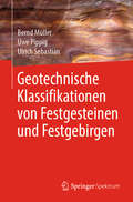
Geotechnische Klassifikationen von Festgesteinen und Festgebirgen
by Bernd Müller Uwe Pippig Ulrich SebastianIn diesem Fachbuch werden spezifische Eigenschaften der Gesteine und des Gebirges betrachtet, die sich aufgrund ihrer Quantifizierbarkeit für eine Klassifikation eignen. Trotz (und gerade wegen) einer großen Vielfalt an Normen (DIN, ISO, Taschenbücher) herrschen in der Geotechnik zuweilen Unsicherheiten bei der korrekten Klassifikation und Einschätzung von Festgesteinen. Es werden z.T. überraschende Zusammenhänge zwischen verschiedenen physikalischen Eigenschaften und Kennwerten aufgedeckt und erstmals quantitativ dargelegt. Das Buch verfolgt damit zwei Ziele. Erstens soll es zu einem besseren Verständnis der physikalischen Eigenschaften der Gesteine im Festgebirge führen. Darüber hinaus soll es zweitens Nachschlagewerk der nutzbaren Parameter bei der Klassifikation und Einordnung der Festgesteine und Festgebirge in der Praxis sein.
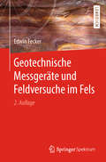
Geotechnische Messgeräte und Feldversuche im Fels
by Edwin FeckerGeotechnische Messungen liefern wichtige Werte über den Untergrund. Diese Werte bilden die Basis für die Planung von Bauwerken. Die häufigsten Schäden am Bau beruhen erfahrungsgemäß nicht auf Rechenfehlern, sondern auf falschen Annahmen für die Baugrundeigenschaften. Selbst wenn der Baugrund sorgfältig untersucht wurde, sollte die Qualität der Konstruktion und der Gründung durch Messungen nachgewiesen bzw. gesichert werden.Dieses Buch stellt die verschiedenen geotechnischen Instrumente vor, die zur Untersuchung des Untergrundes und der Konstruktion verwendet werden. Neben einer detaillierten Beschreibung der Messmethoden, liefert das Buch eine Anleitung dafür was beim Einsatz des jeweiligen Instrumentes beachtet werden muss. Die zweite Auflage dieses Fachbuches wurde gründlich überarbeitet und dem neusten Stand der Technik angepasst. Sie enthält im Anhang praktische Beispiele für Ausschreibungstexte und eine aktuelle Liste der Technischen Empfehlungen und DIN-Normen.
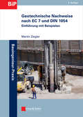
Geotechnische Nachweise nach EC 7 und DIN 1054: Einführung in Beispielen (Bauingenieur-Praxis)
by Martin Zieglerwww.ernst-und-sohn.de Mit der Veröffentlichung der deutschen Fassung des Eurocodes 7-1: Entwurf, Berechnung und Bemessung in der Geotechnik – Teil 1: Allgemeine Regeln als DIN EN 1997-1:2009 und des zugehörigen Nationalen Anhangs DIN EN 1997-1/NA:2010 mit den Ergänzenden Regelungen in DIN EN 1054:2010 liegt das geschlossene neue europäische Normenwerk für die Sicherheitsnachweise im Erd- und Grundbau nun für die Anwendung in Deutschland vor. Die in einem Normenhandbuch zusammengefassten Regelungen ersetzen die bisherige DIN 1054:2005. In dem vorliegenden Buch werden die Grundlagen und Begriffe der Nachweisführung vorgestellt. Soweit nötig wird dabei auch auf die mit geltenden Normen und Empfehlungen wie die Geländebruchnorm DIN 4084 oder die Erddrucknorm DIN 4085 sowie die EAB, EAU, EA-Pfähle und die EBGEO eingegangen. Die erforderlichen Nachweise werden erläutert und anhand von Ablaufdiagrammen und zahlreichen Beispielen verdeutlicht. Dabei werden alle gängigen geotechnischen Aufgaben wie Flächengründungen, Pfahlgründungen, Baugrubenwände, Verankerungen, Stützbauwerke sowie die Versagensformen durch Grundbruch, Geländebruch und hydraulisch bedingtes Versagen angesprochen. Im Juli 2012 sollen die Eurocodes ohne Übergangsfrist bauaufsichtlich eingeführt werden. Die Beispielsammlung im Buch ermöglicht einen schnellen Einstieg in das neue Normenwerk und bildet so für Geotechniker und Bauingenieure ein unverzichtbares Hilfsmittel bei der Anwendung des Regelwerks in der praktischen Tätigkeit.
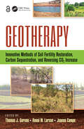
Geotherapy: Innovative Methods of Soil Fertility Restoration, Carbon Sequestration, and Reversing CO2 Increase
by Thomas J. Goreau Ronal W. Larson Joanna CampeA Practical, Get-Your-Hands-in-the-Soil ManualGlobal climate change, increasing pollution, and continued rapid population growth is wreaking havoc on the planet. Stabilizing the environment at safe levels requires a large-scale restoration of damaged ecosystems. Geotherapy: Innovative Methods of Soil Fertility Restoration, Carbon Sequestration, and
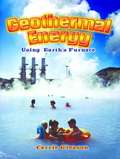
Geothermal Energy: Using Earth's Furnace
by Carrie GleasonThe need for safe sources of renewable energy has sent scientists underground to tap the natural heat produced by the Earth. Geothermal Energy: Using Earth's Furnace describes the three different ways electricity is produced from geothermal energy. Young readers will discover how this clean, safe energy is currently being used in twenty countries including the United States, the largest producer of geothermal energy.
Geothermal Energy: Utilization, Technology and Financing
by Kriti Yadav Anirbid Sircar Apurwa YadavThis book focuses on the usage of geothermal energy in countries with low-enthalpy reservoirs. It begins with the fundamentals of geothermal energy and classification of geothermal resources and their importance, including enhanced geothermal systems (EGS). Further, it discusses the creation, production, potential assessment, perspective analysis, life cycle, and environmental assessments of EGS. It describes applications in the field of geothermal energy with relevant case studies and introduces the application of machine learning techniques in the field of geothermal sectors. Features: Focuses on the development of low- to moderate-enthalpy geothermal resources Introduces machine learning tools and artificial intelligence as applied to geothermal energy Provides an understanding of geothermal energy resources and EGS Discusses the possibility of EGS using spallation and laser drilling Includes stimulation methods (thermal, hydraulic, chemical, and explosive) and case studies This book is aimed at researchers and graduate students in geology, clean energy, geothermal energy, and thermal engineering.
Geothermal Energy and Society (Lecture Notes in Energy #67)
by Adele Manzella Agnes Allansdottir Anna PellizzoneThis book addresses the societal aspects of harnessing geothermal resources for different uses, such as power production, heating and cooling. It introduces a theoretical framework for a social scientific approach to the field, and presents a preliminary collection of empirical case studies on geothermal energy and society from across the world. By providing a conceptual and methodological framework to the study of geothermal energy and societies, it brings together information and analyses in the field that to date have been sparse and fragmented.The contributors explore the diverse aspects of the relationship between the harnessing of geothermal resources and the societies and local communities in which these developments take place. After introducing geothermal technologies, renewable energy concepts as well as their social and policy context and the regulative and environmental aspects of geothermal energy, the book analyzes and discusses twelve global case studies, and compares the social engagement tools applied with those used in other sectors. Of interest to researchers from a range of disciplines who wish to explore the issues surrounding energy and society, it is also a valuable resource for geothermal experts and postgraduate students wish to study the field in greater detail.
Geothermal Energy Systems: Exploration, Development, and Utilization
by Ernst HuengesPresenting boundary conditions for the economic and environmental utilization of geothermal technology, this is the first book to provide basic knowledge on the topic in such detail. The editor is the coordinator of the European Geothermic Research Initiative, while the authors are experts for the various geological situations in Europe with high temperature reservoirs in shallow and deep horizons. With its perspectives for R&D in geothermic technology concluding each chapter, this ready reference will be of great value to scientists and decision-makers in research and politics, as well as those giving courses in petroleum engineering, for example.
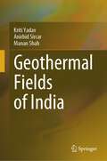
Geothermal Fields of India
by Kriti Yadav Anirbid Sircar Manan ShahThis book explores and highlights the geothermal fields of India. Until recently geothermal energy has little significance in India, therefore this book will help to provide an understanding of the potentials of Indian geothermal fields. This book will offer guidance on how to estimate the significance and resource potential of this geothermal region.The book aims to unfold the four tectonically divided geothermal regions of India namely, NW-SE Himalayan arc system with continuation to Andaman Nicobar Island, Son-Narmada-Tapti Lineament, West Coast Continental Margin and Gondwana Grabens along with Delhi Folding’s. The techniques for several direct to indirect applications of geothermal energy are described; such as power generation, desalination, honey processing, milk pasteurization, space heating and cooling, etc. This book covers the uses of geothermal water for industrial, domestic, and agricultural use. These applications increase the rate of employment in the rural and remote locations, in turn providing further societal benefits.The book also discusses the several base metal and rare earth element extractions using geothermal water, for example; lithium, zinc, manganese, and helium.This is an open access book.
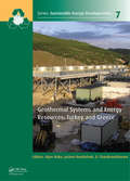
Geothermal Systems and Energy Resources: Turkey and Greece (Sustainable Energy Developments)
by Alper Baba Jochen Bundschuh D. ChandrasekaramIn the region comprising Turkey and Greece, people have been using water from geothermal sources for bathing and washing of clothes since ancient times. This region falls within the Alpine-Himalayan orogenic belt and hence is a locus of active volcanism and tectonism and experiences frequent seismic events. This volcanic and tectonic activity has g
Geothermics
by Vincenzo Pasquale Massimo Verdoya Paolo ChiozziAfter a brief review of global tectonics and the structure of the crust and upper mantle, the basic relations of conductive heat transport and the rock thermal properties are introduced as well as the various methods for measuring thermal conductivity and heat generation due to the decay of radioactive elements. The authors analyze geothermal flow and the thermal state of the lithosphere and deep interior and discuss the fundamental problems related to the formation, upwelling mechanisms, solidification and cooling of magmas. The text presents analytical methods that allow us to gain information on heat and groundwater flow from the analyses of temperature-depth data. It also provides ample data and examples to facilitate understanding of the different topics. This book is useful to researchers and graduate students interested in pure and applied geothermics.
Geothermics
by Vincenzo Pasquale Massimo Verdoya Paolo ChiozziThis book, now in its second edition, offers a comprehensive and modern treatment on the background knowledge of heat transfer processes in the lithosphere. In the light of the success of the first edition, several chapters of the book have been revised and the book has been enriched with a new chapter on geothermal methods used for the inference of past climate changes. The book starts with a brief review of global tectonics and of the structure of the crust and upper mantle. Then the theory of heat conduction as well as the thermal properties and the methods for the determination of thermal conductivity and radiogenic heat are introduced. Subsequently the geothermal flow and the thermal state of the lithosphere and deep interior are analyzed. The formation, upwelling mechanisms, solidification and cooling of magmas, which can be a fundamental heat source in many geothermal systems, are reviewed. Analytical methods used for gaining information on heat and groundwater flow from the analyses of temperature depth data are also covered. Data and practical examples are supplied to facilitate the understanding of the different topics. The book is intended for Earth science graduate students and researchers.
Geothermie
by Kurt Bucher Ingrid StoberDas Buch bietet neben einer Einführung in die Grundlagen der Geothermie und ihre wichtigsten thermischen und hydraulischen Parameter einen Überblick über alle derzeit verfügbaren geothermischen Nutzungssysteme. Dabei behandeln die Autoren nicht nur Fragen der Effizienz und potenzieller Umweltauswirkungen, sie besprechen auch detailliert die Planung, den Bau und Betrieb von Erdwärmesonden, von hydrothermalen Anlagen und von EGS-Systemen. Themen wie der Hydraulik oder der Hydrochemie, d. h. dem Bereich Lösung und Fällung, sind eigene Kapitel gewidmet.
Geothermie
by Ingrid Stober Kurt BucherNach einer Einführung in die Grundlagen der Geothermie werden die wichtigsten thermischen und hydraulischen Parameter in ihrer Bedeutung behandelt. Das nunmehr bereits in der 3., überarbeiteten und aktualisierten Auflage vorliegende Buch gibt einen Überblick über alle derzeit verfügbaren Nutzungssysteme der oberflächennahen und tiefen Geothermie und betrachtet diese bezüglich ihrer Effizienz und potentieller Umweltauswirkungen. Neu aufgenommen in die 3. Auflage wurden geothermische Nutzungen in Hochenthalpie-Gebieten mit Beispielen aus Island, USA und Neuseeland. Im Detail besprochen werden Planung, Bau und Betrieb von Erdwärmesonden, von hydrothermalen Anlagen, von EGS-Systemen und von Hochenthalpie-Nutzungen. Spezielle Kapitel sind der Hydraulik, d.h. der Durchführung und Auswertung hydraulischer Tests, der Hydrochemie, d.h. dem Themenbereich Lösung und Fällung, den geophysikalischen Untersuchungsmethoden an der Erdoberfläche und im Bohrloch sowie dem Abteufen und Ausbau von Tiefbohrungen gewidmet. Mit diesem Buch wird erstmalig die Geothermie in ihrer vollen Breite abgedeckt.
Geothermie
by Ingrid Stober Kurt BucherNach einer Einführung in die Grundlagen der Geothermie werden die wichtigsten thermischen und hydraulischen Parameter in ihrer Bedeutung behandelt. Das nunmehr bereits in der 2., überarbeiteten und aktualisierten Auflage vorliegende Buch gibt einen Überblick über alle derzeit verfügbaren Nutzungssysteme der oberflächennahen und tiefen Geothermie und betrachtet diese bezüglich ihrer Effizienz und potentieller Umweltauswirkungen. Im Detail besprochen werden Planung, Bau und Betrieb von Erdwärmesonden, von hydrothermalen Anlagen und von EGS-Systemen. Spezielle Kapitel sind der Hydraulik, d.h. der Durchführung und Auswertung hydraulischer Tests, und der Hydrochemie, d.h. dem Themenbereich Lösung und Fällung, gewidmet. Mit diesem Buch wird erstmalig die Geothermie in ihrer vollen Breite abgedeckt.
Geothermie
by Ingrid Stober Kurt BucherDieses Buch vermittelt umfassend die Grundlagen und technischen Anwendungen der Geothermie als erneuerbare Energiequelle und zeigt das enorme Potenzial der Erdwärmenutzung als Grundlastenergie für eine umweltfreundliche Energieversorgung auf. Nach einer Einführung in die physikalischen und chemischen Grundlagen der natürlichen geothermischen Energie werden die wichtigsten thermischen und hydraulischen Parameter sowie alle derzeit verfügbaren geothermischen Nutzungssysteme – von oberflächennahen bis zu tiefen Geothermieanlagen – im Detail besprochen. Dies umfasst die Planung, den Bau und Betrieb von Erdwärmesonden, hydrothermalen Anlagen, Untergrundspeichern, EGS-Systemen und Hochenthalpienutzungen. Dabei liegt der Fokus sowohl auf der Effizienz als auch auf den potenziellen Umweltauswirkungen dieser Systeme. In der 4., überarbeiteten und aktualisierten Auflage werden zudem die neuesten Entwicklungen in der Geothermie vorgestellt, wie etwa die Möglichkeiten zur Sektorkopplung durch neu entwickelte Großwärmepumpen und die CO2-Sequestrierung in Hochenthalpie-Anlagen. Besondere Kapitel widmen sich der Hydraulik – inklusive der Durchführung und Auswertung hydraulischer Tests – der Hydrochemie, der Herkunft der Tiefenfluide, der Abschätzung von Reservoirtemperaturen mittels Geothermometern sowie den geophysikalischen Untersuchungsmethoden an der Erdoberfläche und im Bohrloch. Mit dieser Auflage wird die Geothermie erstmalig in ihrer gesamten Breite abgedeckt, und durch praxisnahe Erklärungen bietet das Buch eine wertvolle Grundlage für Forschende, Planer und Anwender im Bereich der geothermischen Energie.
Geotourism in the Middle East (Geoheritage, Geoparks and Geotourism)
by Mamoon Allan Ross DowlingThe geotourism industry has grown rapidly in recent years. This book introduces the geotourism industry, its attractions, activities and developments, in selected countries of the Middle East. A number of publications and studies have investigated the nature and scope of the phenomenon of geotourism (tourism which starts from geology) and geotourists worldwide. However, despite the breadth of these studies, few publications have investigated the phenomena in the Middle Eastern countries.Consequently, this book seeks to shed light on the different aspects of geotourism and geo-diversity in the Middle East and provides a number of case studies from this region. It assists in bridging the lacuna in the tourism and geology literature and helps planners, marketers, managers, scholars and researchers to enhance their knowledge about such issues. It outlines opportunities for, as well as barriers to, geotourism development in the Middle East as well as providing recommendations for the advancement of geotourism in the region.
Geotourism Potential of Georgia, the Caucasus: History, Culture, Geology, Geotourist Routes and Geoparks (Geoheritage, Geoparks and Geotourism)
by Irakli Gamkrelidze Avtandil Okrostsvaridze Kakhaber Koiava Ferando MaisadzeGeorgia’s territory represents a real “natural geological laboratory,” exposing magmatic, metamorphic and sedimentary rocks, ranging from the Neoproterozoic to the Quaternary. After a brief presentation of Georgia’s history and culture, the authors present the stratigraphy, rock types of individual tectonic zones of Georgia, their tectonic structure and paleotectonic reconstructions of the Caucasus.This book describes the three main geotourism routes of Georgia meticulously: 1. Tbilisi-Pasanauri-Kazbegi (along the Georgian Military Road), 2. Tbilisi-Zugdidi-Mestia-Ushguli and 3. Tbilisi-Khashuri-Vardzia, which cross different parts of Fold Systems of the Greater and Lesser Caucasus and Transcaucasian Intermountain area.The following potential geoparks are described in this book: 1. Sataplia dinosaur footprints together with Sataplia and Prometheus caves; 2. Tskaltubo resort-town and mineral water deposit; 3. Borjomi resort-town and mineral water deposit; 4. Kazbegi Quaternary volcanoes and Keli volcanic highland;5. Dariali Paleozoic granitoid massif; 6. Dmanisi hominids site and the Mashavera gorge basaltic flow; 7. Dashbashi canyon; 8.Uplistsikhe rock-cut town and Kvakhvreli cave complex; 9.Udabno - Upper Miocene marine and continental deposits and David Gareja monastery complex;10. Dedoplistskaro - Vashlovani protected areas and mud volcanoes.
The Geotraveller: Geology of Famous Geosites and Areas of Historical Interest
by Roger N. ScoonThis book describes famous geosites and historical localities in national parks and conservation areas from North America, East Africa, and Europe. The geosites include iconic landforms associated with active volcanoes, canyons, glaciated landscapes, natural rock monoliths, and rifts. The potential for geotourism in historical localities such as the famous Greco-Roman antiquities of Greece, Italy, and Turkey, is emphasised.Some of the geosites and historical localities provide evidence that previous civilizations coped with active geology and major climatic cycles, whilst others reveal evidence of famous geological events recognized in history and ancient mythology that helped shape our current civilization.The book assists tour guides and visitors (both geologists and non-specialists) interested in geotourism by providing an understanding of geological processes in the national parks and historical locations with the assistance of photographs and simplified geological maps.
Geotrekking in Southeastern Arabia: A Guide to Locations of World-Class Geology (Special Publications #65)
by Benjamin R. JordanPublished by the American Geophysical Union as part of the Special Publications Series. Geotrekking in Southeastern Arabia presents the world's most diverse geology and reveals some of the unique rocks that were once covered under shallow seas and are now sub-aerially exposed. This guidebook describes various routes that leads to specific locations for viewing the distinctive and world class geology of the United Arab Emirates and Oman. Each route includes specific directions, satellite images, illustrations, and explanations that can help with locating the outstanding geology of the area. Certain sites preseve the world class ophiolites — a section of the Earth's oceanic curst and the underlying upper mantle that has been uplifted and exposed above sea level and often emplaced onto continental crustal rocks, a unique process of the Earth described by plate tectonics. Some salient features of this guidebook include: UAE and Oman are situated in the south east coast of the Arabian Peninsula, which is very well known for its vast reserves of oil and natural gas, hence this book is of great interest to exploration geologists Mountains of the UAE and Oman are the world's largest and best preserved ophiolite – a slice of the deep ocean crust that has been forced by tectonic forces onto a continental crust Within the mountains of these regions are sections of the deep Earth, rarely exposed anywhere – pieces of the Earth's underlying mantle and the lower parts of its oceanic crust Other characteristic features include deep sea sediments and volcanic rocks that were erupted by submarine volcanoes Among mineral ores, cpper deposits were commonly formed at ancient, deep sea, hydrothermal vents Some of the groundwater flowing out of ophiolite rocks reacts with the atmosphere to precipitate calcite and form vast pools of water that appear as blue swimming pools The shallow land and high evaporation conditions in the western region of the UAE forms giant, salt-lined mudcracks and the growth of gypsum clusters called "desert roses" Stromatolites, colonies of cyanobacteria that are probably some of the oldest living species on Earth are also very common in this region Some dunes in UAE rise upto 160 m above evaporative salt plains Rare occurrence of 100 million-year-old pillow lavas, which form underwater, uniquely preserved as if they erupted yesterday Many other geologic marvels exist in a region known more for its oil and gas geology
GEOValue: The Socioeconomic Value of Geospatial Information
by Jamie B. Kruse Joep Crompvoets Francoise PearlmanQuantifying the social and economic value that geospatial information contributes to modern society is a complex task. To construct reliable and consistent valuation measures requires an understanding of the sequence of processes that starts with data acquisition, and leads to decision-makers’ choices that impact society. GEOValue explores each step in this complex value chain from the viewpoint of domain experts spanning disciplines that range from the technical side of data acquisition and management to the social sciences that provide the framework to assess the benefit to society. The book is intended to provide foundational understanding of the techniques and complexities of each step in the process. As such it is intended to be assessable to a reader without prior training in data acquisition systems, information systems, or valuation methods. In addition, a number of case studies are provided that demonstrate the use of geospatial information as a critical input for evaluation of policy pertaining to a wide range of application areas, such as agricultural and environmental policy, natural catastrophes, e-government and transportation systems.
