- Table View
- List View
Air Pollution Modeling and its Application XXVI (Springer Proceedings in Complexity)
by Clemens Mensink Wanmin Gong Amir HakamiCurrent developments in air pollution modeling are explored as a series of contributions from researchers at the forefront of their field. This newest contribution on air pollution modeling and its application is focused on local, urban, regional and intercontinental modeling; emission modeling and processing; data assimilation and air quality forecasting; model assessment and evaluation; atmospheric aerosols. Additionally, this work also examines the relationship between air quality and human health and the effects of climate change on air quality.This work is a collection of selected papers presented at the 36th International Technical Meeting on Air Pollution Modeling and its Application, held in Ottawa, Canada, May 14-18, 2018.The book is intended as reference material for students and professors interested in air pollution modeling at the graduate level as well as researchers and professionals involved in developing and utilizing air pollution models.
Air Pollution Modeling and its Application XXVII (Springer Proceedings in Complexity)
by Clemens Mensink Volker MatthiasThis book is intended as reference material for students and professors interested in air pollution modeling at the graduate level as well as researchers and professionals involved in developing and utilizing air pollution models. Current developments in air pollution modeling are explored as a series of contributions from researchers at the forefront of their field. This newest contribution on air pollution modeling and its application is focused on local, urban, regional and intercontinental modeling; emission modeling and processing; data assimilation and air quality forecasting; model assessment and evaluation; aerosol transformation. Additionally, this work also examines the relationship between air quality and human health and the effects of climate change on air quality.This work is a collection of selected papers presented at the 37th International Technical Meeting on Air Pollution Modeling and its Application, held in Hamburg, Germany, September 23-27, 2019.
Air Pollution Modeling and its Application XXVIII (Springer Proceedings in Complexity)
by Clemens Mensink Oriol JorbaThis book states that current developments in air pollution modeling are explored as a series of contributions from researchers at the forefront of their field. This newest contribution on air pollution modeling and its application is focused on local, urban, regional and intercontinental modeling; long-term modeling and trend analysis; data assimilation and air quality forecasting; model assessment and evaluation; aerosol transformation. Additionally, this work also examines the relationship between air quality and human health and the effects of climate change on air quality.This work is a collection of selected papers presented at the 38th International Technical Meeting on Air Pollution Modeling and its Application, held in Barcelona, Spain, Oct 18–22, 2021. The book is intended as reference material for students and professors interested in air pollution modeling at the graduate level as well as researchers and professionals involved in developing and utilizing air pollution models.
Air Pollution and Climate Change: The Basics (The Basics)
by John K. Pearson Richard DerwentThis book identifies four key forms of air pollution: indoor, urban, regional and global. It discusses how these four types of pollution are manifest in today’s society and examines the scientific and policy challenges that stand in the way of progress. Written in a style that balances scientific underpinnings with accessible language, Pearson and Derwent examine the sources and historical context of air pollutants, before dedicating a chapter to each of the key forms. Armed with these basics, they begin to address the challenges faced by improving indoor, urban and regional air quality, whilst reducing global warming in the years ahead. This leads to a greater understanding of the challenges of global climate change, with new proposals for reducing global warming. However, the authors conclude that it is only when we have a scenario of reforestation combined with reductions in emissions of all greenhouse gases that real progress will be made in the fight against climate change. Then, air pollution will also be consigned to history. With a foreword written by Professor James Lovelock, this book will be of great interest to students and scholars of climate change and environmental policy, as well as air quality professionals working in this important field.
Air Pollution and Freshwater Ecosystems: Sampling, Analysis, and Quality Assurance
by Timothy J Sullivan Alan T. Herlihy James R. WebbA practical book for professionals who rely on water quality data for decision making, this book is based on three decades experience of three highly published water and watershed resource professionals. It focuses on the analysis of air pollution sensitive waters and the consequent effects associated with soil and water acidification, nutrient-
Air Pollution and Its Complications: From the Regional to the Global Scale (Springer Atmospheric Sciences)
by Pallavi Saxena Shani TiwariThis book provides an overview of the fundamental concept of air pollution, emission sources of air pollutants and their transportation.First, the book presents a brief background on air pollution and its emission sources, then it continues with their impact on agriculture, health, and climate change. Furthermore, it covers the basic concepts of air pollution, transportation of air pollutants, global climate change and the use of science in air pollution policy formulation in detail. It also emphasizes the effects of air pollutants in altering the onset pattern of the Indian Summer Monsoon. In addition, it describes the impacts of air pollution on the cryosphere and human health.In this book the editors provide an interdisciplinary unique collection of new studies and findings on the groove of air pollution, to improve the basic understanding of graduate students as well as researchers in the field of air pollution and its impacts on various aspects of the atmosphere and surroundings. This collection covers the basic concepts of air pollution, transportation of air pollutants, and global climate change and the use of science in air pollution policy formulation.
Air Pollution and Its Impacts on U.S. National Parks
by Timothy J. SullivanA variety of air pollutants are emitted into the atmosphere from human-caused and natural emissions sources throughout the United States and elsewhere. These contaminants impact sensitive natural resources in wilderness, including the national parks. The system of national parks in the United States is among our greatest assets. This book provides a compilation and synthesis of current scientific understanding regarding the causes and effects of these pollutants within national park lands. It describes pollutant emissions, deposition, and exposures; it identifies the critical (tipping point) loads of pollutant deposition at which adverse impacts are manifested.
Air Pollution and Turbulence: Modeling and Applications
by Davidson Moreira Marco VilhenaSince its discovery in early 1900, turbulence has been an interesting and complex area of study. Written by international experts, Air Pollution and Turbulence: Modeling and Applications presents advanced techniques for modeling turbulence, with a special focus on air pollution applications, including pollutant dispersion and inverse problems. The
Air Pollution: Concepts, Theory, and Applications
by Christian SeigneurThis textbook covers the entire spectrum of topics required to completely understand air pollution. It emphasizes the atmospheric processes governing air pollution (emissions, atmospheric dispersion, chemical transformations, deposition on surfaces and ecosystems). Other areas of focus include air pollutant emission control technologies, health and environmental impacts, regulations and public policies, and interactions between climate change and air pollution. Topics are first presented conceptually, and then in terms of their fundamental aspects. Actual case studies are incorporated throughout to illustrate major air pollution phenomena, such as the dispersion of pollutants in the atmosphere, and the development of strategies to reduce urban air pollution, mitigate acid rain, and improve atmospheric visibility. Graduate students, researchers, and air quality professionals will find the full coverage of these important matters to be well suited to their needs.
Air Pollution: Health and Environmental Impacts
by Luisa T. Molina Bhola R. Gurjar Chandra S. P. OjhaAir pollution is recognized as one of the leading contributors to the global environmental burden of disease, even in countries with relatively low concentrations of air pollution. Air Pollution: Health and Environmental Impacts examines the effect of this complex problem on human health and the environment in different settings around the world. I
Air Pollution: Measurement, Modelling and Mitigation (4th Edition)
by Ian Williams Abhishek TiwaryThis established textbook offers a one-stop, comprehensive coverage of air pollution, all in an easy-reading and accessible style. The fourth edition, broadly updated and developed throughout, includes a brand-new chapter providing a broader overview to the topic for general reading, and presents fresh materials on air pollution modelling, mitigation and control, tailored to the needs of both amateur and specialist users. Retaining a quantitative perspective, the covered topics include: gaseous and particulate air pollutants, measurement techniques, meteorology and modelling, area sources, mobile sources, indoor air, effects on plants, materials, humans and animals, impact on climate change and ozone profiles and air quality legislations. This edition also includes a final chapter covering a suite of sampling and laboratory practical experiments that can be used for either classroom teachings, or as part of research projects. As with previous editions, the book is aimed to serve as a useful reading resource for upper-level undergraduate and postgraduate courses specialising in air pollution, with dedicated case studies at the end of each chapter, as well as a list of revision questions provided at the end as a complementary section.
Air Pollution: Measurement, Modelling and Mitigation, Third Edition
by Jeremy Colls Abhishek TiwaryA one stop, comprehensive textbook, covering the three essential components of air pollution science. The Third Edition has been updated with the latest developments, especially the inclusion of new information on the role of air pollutants in climate change. The authors give greater coverage to the developing economies around the world where air pollution problems are on the rise. The Third Edition continues to cover a wide range of air quality issues, retaining a quantitative perspective. Topics covered include - gaseous and particulate air pollutants, measurement techniques, meteorology and dispersion modelling, mobile sources, indoor air, effects on plants, materials, humans and animals. Moving away from classical toxic air pollutants, there is a chapter on climate change and another on the depletion of stratospheric ozone. A special feature of this new edition is the inclusion of a fresh chapter on air pollution mitigation by vegetation, mainly its role in maintaining a sustainable urban environment. Recommended for upper-level undergraduate and postgraduate courses specialising in air pollution, both for environmental scientists and engineers. The new material included in the Third Edition extends its use by practitioners in consultancies or local authorities.
Air Quality
by Joshua S. Fu Wayne T. DavisThe sixth edition of a bestseller, Air Quality provides students with a comprehensive overview of air quality, the science that continues to provide a better understanding of atmospheric chemistry and its effects on public health and the environment, and the regulatory and technological management practices employed in achieving air quality goals. Maintaining the practical approach that has made previous editions popular, the chapters have been reorganized, new material has been added, less relevant material has been deleted, and new images have been added, particularly those from Earth satellites. New in the Sixth Edition New graphics, images, and an appended list of unit conversions New problems and questions Presents all-new information on the state of air quality monitoring Provides the latest updates on air quality legislation in the United States Updates the effects of air pollution and CO2 on climate change Examines the effects of the latest changes in energy production and the related emissions and pollutants Offers broadened coverage of air pollutant emissions and air quality in a global context This new edition elucidates the challenges we face in our efforts to protect and enhance the quality of the nation’s air. It also highlights the growing global awareness of air quality issues, climate change, and public health concerns in the developing world. The breadth of coverage, review questions at the end of each chapter, extensive glossary, and list of readings place the tools for understanding into your students’ hands.
Air Quality
by Thad Godish Joshua S. Fu Wayne T. DavisThe fifth edition of a bestseller, Air Quality provides students with a comprehensive overview of air quality, the science that continues to provide a better understanding of atmospheric chemistry and its effects on public health and the environment, and the regulatory and technological management practices employed in achieving air quality goals.
Air Quality Management In The United States
by National Research Council of the National AcademiesManaging the nation's air quality is a complex undertaking, involving tens of thousands of people in regulating thousands of pollution sources. The authors identify what has worked and what has not, and they offer wide-ranging recommendations for setting future priorities, making difficult choices, and increasing innovation. This new book explores how to better integrate scientific advances and new technologies into the air quality management system. The volume reviews the three-decade history of governmental efforts toward cleaner air, discussing how air quality standards are set and results measured, the design and implementation of control strategies, regulatory processes and procedures, special issues with mobile pollution sources, and more. The book looks at efforts to spur social and behavioral changes that affect air quality, the effectiveness of market-based instruments for air quality regulation, and many other aspects of the issue. Rich in technical detail, this book will be of interestto all those engaged in air quality management: scientists, engineers, industrial managers, law makers, regulators, health officials, clean-air advocates, and concerned citizens.
Air Quality Management and Research in Southeast Asia (SpringerBriefs in Earth System Sciences)
by Erik Velasco Armando Retama Dimitris StratouliasThis book examines the capabilities for monitoring air quality, developing emission inventories, and running chemical-transport models for regulatory, forecasting, and research purposes in Southeast Asia. It also reviews scientific efforts made to better understand and characterize air pollution in the region. Poor air quality poses a threat to public health. It affects people's lives and undermines economic growth, but as in many other parts of the world, it has been overlooked in Southeast Asia. International assessments suggest that it is the culprit of 260-thousand premature deaths in the region each year, entailing a monetary cost equivalent to 6.75% of the regional GDP. Reducing air pollution requires concerted efforts from all Southeast Asian nations to implement local and regional air quality policies following a science-policy approach. For such endeavor, it is essential to develop tools that enable timely and reliable air quality management. This entails collecting data to characterize the magnitude, origin, and impact of air pollution to support corrective actions. The objective of this book is to provide a starting point for a science-based conversation about implementing solutions to Southeast Asia's air pollution problem by bringing together an analysis of the availability of air quality data and studies from across the region.
Air Quality Networks: Data Analysis, Calibration & Data Fusion (Environmental Informatics and Modeling)
by Kostas Karatzas Saverio De Vito Alena Bartonova Grazia FattorusoThis volume offers expert contributions proposing new and recently set scientific standards for smart air quality (AQ) networks data processing, along with results obtained during field deployments of pervasive and mobile systems. The book is divided into 5 main sections; 1) future air quality networks, 2) general data processing techniques, 3) field deployments performances, 4) special applications, and 5) cooperative and regulatory efforts. The authors offer different sources of data for the production of trustworthy insights, including spatio-temporal predictive AQ maps meant to boost citizen awareness, and informed participation in remediation and prevention policies. Readers will learn about the best and most up-to-date practices for measuring and assessing air quality, while also learning about current regulatory statuses regarding air quality technology design and implementation. The book will be of interest to air quality regulatory agencies, citizen science groups, city authorities, and researchers and students working with air quality sensors and geostatistics.
Air Quality Permitting
by R. Leon LeonardThis practical book covers all of the fundamentals for obtaining air quality permits for new sources of air pollutant emissions and Title V operating permits for operating sources. Written for facility environmental managers, consultants, and air quality regulatory staff, Air Quality Permitting provides a thorough discussion on the strategies of successfully permitting a facility.
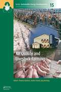
Air Quality and Livestock Farming (Sustainable Energy Developments)
by Thomas Banhazi Andres Aland Jörg HartungAir quality has a direct influence on health, welfare and production performance of livestock as the high concentrations of noxious gases, dust and airborne microorganisms are likely to reduce production efficiency and the general welfare of farm animals. Long term exposure to particulates in livestock buildings might also affect the respiratory health of farm workers. Dust in animal buildings contains many biologically active substances such as bacteria, fungi, endotoxins and residues of antibiotics (as a result of veterinary treatments) that are suspected to be hazardous to human health. Furthermore, air pollutants emitted from livestock buildings can reduce air, water and soil quality and can potentially undermine the health of nearby residents. Airborne emissions include ammonia, methane, nitrous oxide, particulates like dust and microorganisms. In addition, other potentially harmful substances such as heavy metals, antibiotic residues and components of disinfectants might be also emitted from livestock building that are potentially damaging to ecosystems. In this book, key aspects of agricultural air quality, such as monitoring, managing and reducing airborne pollutants in and around livestock facilities are reviewed. Features: addressing the raising awareness of the importance of optimal health and welfare for lifestock species with contributions from international specialists and researchers providing up-to-date information for professionals involved in modern animal producti This book will be useful for farming professionals, academics, students, policy makers, business leaders, regulatory bodies and agricultural consultants.
Air Sampling and Industrial Hygiene Engineering
by Martha J. Boss Dennis W. DayWe know certain chemicals cause problems in the workplace. The issues now are: Where do they occur in the workplace? How can we best evaluate them? What are the procedures for dealing with them safely? Many books simply define the problem and tell you that you need a program. Air Sampling and Industrial Hygiene gives you a guide to air sampling protocols from start to finish. The book presents sampling technology updated with today's tools - such as microcircuitry and remote sensing. The authors emphasize an interdisciplinary approach to understanding how air monitoring can adequately report current environmental conditions associated with outdoor media, indoor remediation efforts, proximal equipment, interior line monitoring, and the interrelationship of ventilation parameters. In addition to providing the how-tos of sampling, this guide covers the basics of chemical risk assessment, biological assessment, engineering evaluation of mechanical system design criteria, and chemical or process engineering hazard assessments. It presents the information using text, text outlines, graphics, and pictures - including cross sections of instrumentation and side bars to elaborate on complex concepts.Faulty readings caused by poor sampling techniques can be very costly. This book provides the how-tos for making design engineering and on-site decisions as to instrumentation selection and scheduled usage. Air Sampling and Industrial Hygiene Engineering will allow you to complete the sampling process systematically and correctly from initial suspicions to the use of obtained results.
Air Toxics: Problems and Solutions
by Kumar GanesanThis timely new workbook is the result of a year-long effort by a group of university professors who first met at Montana Tech during the summer of 1994 for a college faculty workshop. The workshop was funded by the National Science Foundation's support for those faculty developing courses in the newly emerging field of air toxics. Part I of the book contains over 100 problems dealing with a variety of topics in this area. Part II provides detailed solutions. The problems and solutions provided will become a useful resource for the training of engineers and scientists who are or soon will be working in the field.
Air and Waste Management: A Laboratory and Field Handbook
by Howard D. HeskethThis manual will serve a useful function in training and giving experience to environmental scientists at all levels. Included in this manual are explanatory materials, exercises and experiments. These are intended as training guides. The users of this manual will find it possible to use simple equipment and naturally occurring events to construct some of the needed equipment but may also find it necessary to use commercially available equipment with some of the procedures.
Air, Gas, and Water Pollution Control Using Industrial and Agricultural Solid Wastes Adsorbents
by Tushar SenAir and water pollution occurs when toxic pollutants of varying kinds (organic, inorganic, radioactive and so on) are directly or indirectly discharged into the environment without adequate treatment to remove these potential pollutants. There are a total of 13 book chapters in three sections contributed by significant number of expert authors around the world, aiming to provide scientific knowledge and up-to-date development of various solid wastes based cost-effective adsorbent materials and its sustainable application in the removal of contaminates/pollutants from air, gas and water. This book is useful for the professions, practicing engineers, scientists, researchers, academics and undergraduate and post-graduate students’ interest on this specific area. Key Features: • Exclusive compilation of information on use of industrial and agricultural waste based adsorbents for air and water pollution abatement. • Explores utilization of industrial solid wastes in adsorptive purification and agricultural and agricultural by-products in separation and purification. • Discusses cost-effective solid wastes based emerging adsorbents. • Alternative adsorbents in the removal of a wide range of contaminants and pollutants from water is proposed. • Includes performance of unit operations in waste effluents treatment.
Air, Water, Earth, Fire: How the System Earth Works
by Angelo PeccerilloThe book describes the structure, composition and evolution of the Earth, the main geological processes occurring on it, and how some crucial environmental matters that are amply debated in the media (e.g. pollution, greenhouse effect) can be fully understood by placing them in the holistic context of the system Earth as a whole. It provides basic information on a series of key geological issues, from the structure and composition of the Earth to the large-scale processes that characterize our planet, such as rock alteration and sedimentation, magmatism, geomagnetism, seismicity, plate tectonics, cyclical migration of chemical elements through various Earth reservoirs (Geochemical Cycles), and evolution of the planet from Hadean to present. It intends to reach a wide readership, which is interested in our planet and wish to have a general and comprehensive view of its origin, evolution and activity. Potential readership includes undergraduate and advanced undergraduate students in Geology and other scientific disciplines, and any moderately- to well-educated people interested in the surrounding world and eager to gain a basic knowledge of the Earth and to reach an integrated view of how our planet is working.
Airborne Measurements for Environmental Research
by Jean-Louis Brenguier Manfred WendischThis first comprehensive review of airborne measurement principles covers all atmospheric components and surface parameters. It describes the common techniques to characterize aerosol particles and cloud/precipitation elements, while also explaining radiation quantities and pertinent hyperspectral and active remote sensing measurement techniques along the way. As a result, the major principles of operation are introduced and exemplified using specific instruments, treating both classic and emerging measurement techniques.The two editors head an international community of eminent scientists, all of them accepted and experienced specialists in their field, who help readers to understand specific problems related to airborne research, such as immanent uncertainties and limitations. They also provide guidance on the suitability of instruments to measure certain parameters and to select the correct type of device. While primarily intended for climate, geophysical and atmospheric researchers, its relevance to solar system objects makes this work equally appealing to astronomers studying atmospheres of solar system bodies with telescopes and space probes.
