- Table View
- List View
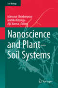
Nanoscience and Plant–Soil Systems
by Ajit Varma Mansour Ghorbanpour Khanuja ManikaThis book provides in-depth reviews of the effects of nanoparticles on the soil environment, their interactions with plants and also their potential applications as nanofertilizers and pesticides. It offers insights into the current trends and future prospects of nanotechnology, including the benefits and risks and the impact on agriculture and soil ecosystems. Individual chapters explore topics such as nanoparticle biosynthesis, engineered nanomaterials, the use of nanoclays for remediation of polluted sites, nanomaterials in water desalination, their effect on seed germination, plant growth, and nutrient transformations in soil, as well as the use of earthworms as bioremediating agents for nanoparticles. It is a valuable resource for researchers in academia and industry working in the field of agriculture, crop protection, plant sciences, applied microbiology, soil biology and environmental sciences.
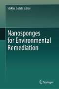
Nanosponges for Environmental Remediation
by Shikha GulatiThe book covers the chemistry of various nanosponges, as well as the methods for synthesizing them and altering them chemically, as well as their characterization and uses in environmental remediation. Sensors, adaptable materials for oil clean-up in the sea, the removal of dangerous organic and inorganic pollutants from wastewater, the adsorption of various poisonous and greenhouse gases from the air, and more are just a few of the environmental uses for nanosponges. This book aims to provide broad coverage of recent research progress or up-to-date knowledge addressing various aspects in this field. With this book, we aim to provide the readers with the opportunity to learn about different facets of environmental remediation using nanosponges. Thus, this book scrutinizes the state-of-the-art research and discovery in the use of nanosponges in environmental applications, highlighting the scope to which these novel materials have been incorporated by the community. Beyond bestowing a summary of recent research by major groups in the field, the book presents the approaches behind recent developments, providing a long-lasting situation for experienced researchers and novices in the field. This book also emphasizes the challenges with previous signs of progress and way for further research, details relating to the current pioneering technology, and future perspectives with a multidisciplinary approach. Furthermore, it presents up-to-date information on the economics, toxicity, and regulations related to these novel materials. This book is of interest to those in environmental science and applications, particularly graduate students, young faculty, and others exploring nanosponges.
Nanostructured Materials for Magnetoelectronics
by Bekir Aktas Faik MikailzadeThis book provides an up-to-date review of nanometer-scale magnetism and focuses on the investigation of the basic properties of magnetic nanostructures. It describes a wide range of physical aspects together with theoretical and experimental methods. A broad overview of the latest developments in this emerging and fascinating field of nanostructured materials is given with emphasis on the practical understanding and operation of submicron devices based on nanostructured magnetic materials.
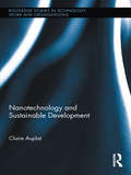
Nanotechnology and Sustainable Development (Routledge Studies in Technology, Work and Organizations)
by Claire AuplatPublic institutions, academic researchers and financial analysts among others hail nanotechnologies as one of the most promising sectors of social and economic development. Calculations predict that it will become a trillion euro industry by 2015 and that it will bring about economic change of at least the same magnitude as the industrial revolution. Nanotechnology is recent, younger by some thirty years than biotechnology, but it appears at a point in time in human history where there is a convergence between the globalization of access to information and increasing awareness of the importance of sustainable development. Nanotechnology and Sustainable Development explores the ways in which this convergence leads to a change in the management of innovation – and ultimately a reshaping of technological democracy. The scope of the study is global, with a particular focus on Europe and the United States, utilizing several case studies of stakeholders including entrepreneurs, commentators, end users, scientists, and policy makers.
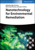
Nanotechnology for Environmental Remediation
by Sabu Thomas Merin Sara Thomas Laly A. PothenNanotechnology for Environmental Remediation Comprehensive resource on using nanomaterials to alleviate environmental pollution Contaminated land, soil and water pose a threat to the environment and health. These sites require immediate action in terms of assessing pollution and new remediation strategies. Nanotechnology for Environmental Remediation helps readers understand the potential of nanotechnology in resolving the growing problem of environmental contamination. The specific aim of this book is to provide comprehensive information relating to the progress in the development of functional nanomaterials and nanocomposites which are used for the environmental remediation of a variety of contaminants. The work deals with the different aspects of nanotechnology in water, air and soil contamination and presents the recent advances with a focus on remediation. Core topics discussed in the work include: Nanotechnology that can be used to engineer and tailor particles for specific environmental remediation applications A big-picture conceptual understanding of environmental remediation methods for researchers, environmentalists and professionals involved in assessing and developing new nano-based strategies A detailed approach towards the different remediation procedures by various nanomaterials such as metal nanoparticles, polymeric nanoparticles, carbon nanotubes, and dendrimers The societal impact that nanotechnology has on the environment Chemists and biotechnologists can use Nanotechnology for Environmental Remediation as a comprehensive reference work for thoroughly understanding this new type of technology and why it is so important when considering environmental remediation efforts. Due to the practical application of nanotechnologies, environmental organizations and agencies can also both utilize the work to explore new and more effective ways of doing things, both now and into the future as nanotechnology becomes more common.
Nanotechnology-based Sustainable Agriculture
by Vijay Kumar Pardeep Singh Ankit Kumar Singh Vipendra Kumar SinghProvides detailed guidance on harnessing nanotechnology for sustainable agriculture, combines theoretical frameworks with actionable strategies Nanotechnology-based Sustainable Agriculture offers an in-depth exploration of how nanotechnology is revolutionizing agricultural practices to enhance crop productivity and environmental sustainability. Addressing key challenges in conventional agriculture, this volume presents the cutting-edge roles of various nanomaterials, such as carbon nanotubes and quantum dots, in boosting efficiency and reducing environmental impact. Emphasizing practical solutions, ranging from nano biofertilizers and nanobioremediation to innovative pest control strategies, an expert panel of authors provides a roadmap for integrating nanotechnology into sustainable agricultural systems. In-depth chapters describe both the fabrication of nanomaterials and their application in soil quality assessment, pollutant remediation, and crop disease management. Throughout the text, the authors highlight opportunities and address challenges to ensure the safe and effective adoption of these technologies. Enhancing crop productivity and environmental health through innovative solutions, Nanotechnology-based Sustainable Agriculture: Explores a wide range of nanotechnologies for use in agriculture, including plant-based nanomaterials, chitosan nanoparticles, and silver nanoparticlesPresents strategies for minimizing environmental and health impacts while maximizing crop productivityIncorporates the latest developments in nanobiotechnology, phytonanotechnology, and nano-bioremediationDiscusses the challenges and potential risks of nanomaterial-based chemicals in agricultural systemsExamines diverse case studies and strategies to achieve food security and sustainable agriculture on a global scale Nanotechnology-based Sustainable Agriculture is essential reading for advanced students, researchers, and professionals in environmental science, material science, and agriculture. It is well-suited as a textbook for graduate and postgraduate courses in sustainable agriculture or nanotechnology, as well as a reference for professionals in research and development, policymaking, and industry.
Nanotechnology: Risk, Ethics and Law
by Geoffrey Hunt Michael D. MehtaNanotechnology - technology at the molecular level - is held out by many as the Holy Grail for creating a trillion dollar economy and solving problems from curing cancer to reprocessing waste into products and building superfast computers. Yet, as with GMOs, many view nanotech as a high risk genie in a bottle that once uncorked has the potential to cause unpredictable, perhaps irreversible, environmental and public health disasters. With the race to bring products to market, there is pressing need to take stock of the situation and to have a full public debate about this new technological frontier. Including contributions by renowned figures such as Roland Clift, K. Eric Drexler and Arpad Pusztai, this is the first global overview of the state of nanotech and society in Europe, the USA, Japan and Canada, examining the ethics, the environmental and public health risks, and the governance and regulation of this most promising, and potentially most dangerous, of all technologies.
Nanowire-assisted Flow-through Electrode Enabling Electroporation Disinfection of Reclaimed Water (Springer Theses)
by Zheng-Yang HuoThis Ph.D. book develops nanowire-assisted electroporation disinfection technology based on the flow-through porous electrode. The author presents pioneering results on theoretical modeling, experimental realization, and selected applications, showing the novel disinfection mechanism of electroporation guarantees an exceedingly low level of energy consumption. In this regard, three classes of novel dynamic behavior are investigated: (i) The developed nanowire-assisted flow-through electroporation disinfection technology enables great microbial disinfection performance with extremely low voltage (1V), which significantly reduce the formation potential of harmful disinfection by-products during the treatment process. (ii) The nanowire-assisted flow-through electroporation disinfection technology ensures no reactivation/regrowth of inactivated bacteria and meanwhile promotes the gradual death of damaged bacteria during the storage process. (iii) The application of high-frequency AC power supply (106 Hz) ensures the high microbial disinfection efficiency while suppressing the occurrence of electrochemical reactions and extending the electrode lifetime effectively.
Narnia and the Fields of Arbol: The Environmental Vision of C.S. Lewis (Culture of the Land #Cull)
by Matthew Dickerson David O'HaraAn exploration of the Chronicles of Narnia and the Space Trilogy that &“enriches our understanding of how to care for our world&” (Alan Jacobs, author of Breaking Bread with the Dead). In Narnia and the Fields of Arbol: The Environmental Vision of C. S. Lewis, authors Matthew Dickerson and David O&’Hara illuminate an important yet overlooked aspect of the author&’s visionary work. They go beyond traditional theological discussions of Lewis&’s writing to investigate themes of sustainability, stewardship of natural resources, and humanity&’s relationship to wilderness. The authors examine the environmental and ecological underpinnings of Lewis&’s work by exploring his best-known works of fantasy, including the seven books of the Chronicles of Narnia and the three novels collectively referred to as the Space Trilogy. Taken together, these works reveal Lewis&’s enduring environmental concerns, and Dickerson and O&’Hara offer a new understanding of his pioneering style of fiction. Narnia and the Fields of Arbol, the first book-length work on the subject, finds the author&’s legacy to have as much in common with the agrarian environmentalism of Wendell Berry as it does with the fantasy of J. R. R. Tolkien. In an era of increasing concern about deforestation, climate change, and other environmental issues, Lewis&’s work remains as pertinent as ever. The widespread adaption of his work in film lends credence to the author&’s staying power as an influential voice in both fantastical fiction and environmental literature. With Narnia and the Fields of Arbol, Dickerson and O'Hara have written a timely work of scholarship that offers a fresh perspective on one of the most celebrated authors in literary history. &“Both revelatory and a pleasure to read.&” —Robert Siegel, award-winning author of The Whalesong Trilogy
Narrating Sustainability through Storytelling (Routledge-SCORAI Studies in Sustainable Consumption)
by Daniel Fischer Sonja Fücker Hanna Selm Anna SundermannStories and narratives are powerful tools for explaining the world around us. This book explores storytelling as a way of engaging audiences with sustainable development issues and reflects on the opportunities and limitations of storytelling for sustainability as an innovative approach to sustainability communication. Bringing together voices and perspectives from research and practice, this volume explores the ways in which storytelling can support change toward sustainability. Unlike other anthologies, the book first provides a sound scientific basis by unfolding the storytelling approach and presenting empirical studies on its impact on effects. It clarifies important terms and presents recent findings on the impact of storytelling on sustainability from an extensive 3-year research project on this question. The second part shows how storytelling can be used in different fields of practice to communicate sustainability in more engaging and effective ways. Here, the main focus is on not only case-based accounts of positive change, but also tensions, arising from the application of storytelling for sustainability in journalism, higher education, corporate communication, or science communication. Combining theory with practical examples, this innovative book will be a great resource for students and scholars of environmental communication and sustainable development, as well as professionals working in related fields.
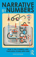
Narrative by Numbers: How to Tell Powerful and Purposeful Stories with Data (Using Data Better)
by Sam KnowlesShortlisted for the Business Book of the Year Awards in the Sales and Marketing category. As jobs become increasingly similar, there are two skills that everyone needs if they’re going to thrive. These are the ability to interrogate and make sense of data, and the ability to use insights extracted from data to persuade others to act. Analytics + storytelling = influence. Humans are hardwired to respond to stories and story structure. Stories are how we make sense of and navigate the world. We respond best to stories that are based on evidence. But storytellers need to use data as the foundation of stories, not as the actual stories themselves. To be truly impactful, rational facts need to be presented with a veneer of emotion. The Big Data revolution means more data is available than ever. The trouble is, most people aren’t very numerate or good at statistics. Many find it hard to look at data and extract insights. Meanwhile, those for whom numbers hold no fear don’t always make the best storytellers. They mistakenly believe they need to prove their point by showing their workings. There are some simple and effective rules of data-driven storytelling that help everyone tell more compelling, evidence-based stories, whoever they need to convince. Narrative by Numbers shows you how.
Narratives of Faith from the Haiti Earthquake: Religion, Natural Hazards and Disaster Response (Routledge Focus on Religion)
by Roger Philip Abbott Robert S. WhiteThis book presents an in-depth ethnographic case study carried out in the years following the 2010 Haiti earthquake to present the role of faith beliefs in disaster response. The earthquake is one of the most destructive on record, and the aftermath, including a cholera epidemic and ongoing humanitarian aid, has continued for years following the catastrophe. Based on dozens of interviews, this book gives primacy to survivors’ narratives. It begins by laying out the Haitian context, before presenting an account of the earthquake from survivors’ perspectives. It then explores in detail how the earthquake affected the religious, mainly Christian, faith of survivors and how religious faith influenced how they responded to, and are recovering from, the experience. The account is also informed by geoscience and the accompanying "complicating factors." Finally, the Haitian experience highlights the significant role that religious faith can play alongside other learned coping strategies in disaster response and recovery globally. This book contributes an important case study to an emerging literature in which the influence of both religion and narrative is being recognised. It will be of interest to scholars of any discipline concerned with disaster response, including practical theology, anthropology, psychology, geography, Caribbean studies and earth science. It will also provide a resource for non-governmental organisations.
Narratives of Low-Carbon Transitions: Understanding Risks and Uncertainties (Routledge Studies in Energy Transitions)
by Jenny Lieu Susanne Hanger-Kopp Alexandros Nikas"The Open Access version of this book, available at https://doi.org/10.4324/9780429458781, has been made available under a Creative Commons Attribution-Non Commercial-No Derivatives 4.0 license." This book examines the uncertainties underlying various strategies for a low-carbon future. Most prominently, such strategies relate to transitions in the energy sector, on both the supply and the demand side. At the same time they interact with other sectors, such as industrial production, transport, and building, and ultimately require new behaviour patterns at household and individual levels. Currently, much research is available on the effectiveness of these strategies but, in order to successfully implement comprehensive transition pathways, it is crucial not only to understand the benefits but also the risks. Filling this gap, this volume provides an interdisciplinary, conceptual framework to assess risks and uncertainties associated with low-carbon policies and applies this consistently across 11 country cases from around the world, illustrating alternative transition pathways in various contexts. The cases are presented as narratives, drawing on stakeholder-driven research efforts. They showcase diverse empirical evidence reflecting the complex challenges to and potential negative consequences of such pathways. Together, they enable the reader to draw valuable lessons on the risks and uncertainties associated with choosing the envisaged transition pathways, as well as ways to manage the implementation of these pathways and ultimately enable sustainable and lasting social and environmental effects. This book will be of great interest to students, scholars, and practitioners of environmental and energy policy, low-carbon transitions, renewable energy technologies, climate change action, and sustainability in general.
Narratives of Scale in the Anthropocene: Imagining Human Responsibility in an Age of Scalar Complexity (Routledge Interdisciplinary Perspectives on Literature)
by Gabriele Dürbeck and Philip HüpkesThe Anthropocene concept draws attention to the various forms of entanglement of social, political, ecological, biological and geological processes at multiple spatial and temporal scales. The ensuing complexity and ambiguity create manifold challenges to widely established theories, methodologies, epistemologies and ontologies. The contributions to this volume engage with conceptual issues of scale in the Anthropocene with a focus on mediated representation and narrative. They are centered around the themes of scale and time, scale and the nonhuman and scale and space. The volume presents an interdisciplinary dialogue between sociology, geography, political sciences, history and literary, cultural and media studies. Together, they contribute to current debates on the (re-)imagining of forms of human responsibility that meet the challenges created by humanity entering an age of scalar complexity.
Narratives of Scale in the Anthropocene: Imagining Human Responsibility in an Age of Scalar Complexity (Routledge Interdisciplinary Perspectives on Literature)
by Gabriele Dürbeck and Philip HüpkesThe Anthropocene concept draws attention to the various forms of entanglement of social, political, ecological, biological and geological processes at multiple spatial and temporal scales. The ensuing complexity and ambiguity create manifold challenges to widely established theories, methodologies, epistemologies and ontologies. The contributions to this volume engage with conceptual issues of scale in the Anthropocene with a focus on mediated representation and narrative. They are centered around the themes of scale and time, scale and the nonhuman and scale and space. The volume presents an interdisciplinary dialogue between sociology, geography, political sciences, history and literary, cultural and media studies. Together, they contribute to current debates on the (re-)imagining of forms of human responsibility that meet the challenges created by humanity entering an age of scalar complexity.Chapter 3 of this book is freely available as a downloadable Open Access PDF under a Creative Commons Attribution-Non Commercial-No Derivatives 4.0 license available at http://www.taylorfrancis.com/books/e/9781003136989
Narrowing the Development Gap in ASEAN: Drivers and Policy Options
by David Carpenter Mark McGillivrayAn important part of the vision of the Association of Southeast Asian Nations (ASEAN) is to ensure that the benefits of development and economic integration are equitably shared by all member states and their citizens. ASEAN’s work therefore aims to narrow the development gap between ASEAN member states (Indonesia, Malaysia, the Philippines, Singapore, Thailand, Brunei Darussalam, Myanmar, Cambodia, Laos and Vietnam) and between sub-regions within ASEAN. Written by a team of internationally recognised experts in development economics, this book communicates the latest findings on narrowing the development gap in a practical, policy-relevant way, in a format that can influence decision makers within ASEAN member states and international donors. There have been significant development achievements in many ASEAN countries over the last 20 years, but the ASEAN region continues to be characterised by significant development gaps, particularly in income. Gaps in development achievement are also seen at the regional and sub-national levels. This book offers a better understanding of development gaps, as they exist in 2012, and provides important context that can inform the strategic needs of decision makers in the ASEAN region. Due to improvements in conceptualising and measuring well-being, including through the use of multidimensional indicators, this book gives policy makers and scholars in development economics, development policy and Asian studies well-grounded insights into the nature of the development gaps within and between ASEAN countries as well as high-level policy advice on those interventions that can contribute to a narrowing of the development gap.
Nation-Building, Education and Culture in India and Canada: Advances in Indo-Canadian Humanities and Social Sciences Research
by K. Gayithri B. Hariharan Suchorita ChattopadhyayThis volume provides comparative perspectives on issues related to education, culture, sustainable development and nation-building in India and Canada. It takes cognizance of current research in Indo-Canadian comparative studies and is meant to facilitate further research in these areas. It importantly highlights the trends and growth areas in comparative social science and humanities research between the countries. The chapters in this volume discuss the research that scholars have recently undertaken in both countries and the impact that such comparative research has on developing partnerships, learning methodologies, and socio-cultural narratives that empower interdisciplinary research. The chapter authors take up important issues related to community college development, mental health in education, multilingual education, indigenous populations and their education and development. They discuss issues related to bilateral and foreign trade agreements as well as policies of the two countries on climate change research. Lastly, they discuss indigenous performance cultures and sports in the two countries and the long history of migration from India to Canada. The volume is of interest to a wide readership from the humanities and social sciences, particularly readers interested in Indo-Canadian scholarship.
National 4 & 5 Geography: Global Issues
by Susan Clarke Calvin ClarkeCover every base with the complete resource for National 4 & 5 Geography endorsed by SQA!One of a three-book series, this title offers detailed, comprehensive and rigorous coverage of four of the global issues in National 4 and 5 Geography.- Ensure understanding with end-of-chapter questions for each topic at N4 and N5 levels- Promote Active Learning through specific activites in each chapter- Engage students with a full-colour, accessible format
National 4 & 5 Geography: Global Issues, Second Edition
by Susan Clarke Calvin ClarkeExam Board: SQALevel: National 4 and National 5Subject: GeographyFirst teaching: August 2017First exam: Summer 2018Meet the individual needs of every student with this Second Edition textbook, updated for the revised N5 specification and designed to support mixed-ability teaching across National 4 and 5 Geography.> Builds geographical skills and knowledge through clear diagrams, explanations, examples and case studies> Offers thorough exam preparation with numerous exam practice sections that contain advice on how to answer different questions, plus sample answers with commentary> Enables you to check and ensure understanding of each topic, with separate N4 and N5 practice questions
National 4 & 5 Geography: Global Issues: Second Edition Epub
by Susan Clarke Calvin ClarkeExam Board: SQALevel: National 5Subject: GeographyFirst Teaching: September 2017First Exam: Summer 2018This second edition now includes N5 examination-style questions, together with detailed advice on answering them, as well as exemplar answer, included for every topic.- Now includes the Natural Regions topic - Covers Climate Change, Health and Environmental Hazards- Natural Regions topic takes the place of Trade and Globalisation
National 4 & 5 Geography: Human Environments
by Susan Clarke Calvin ClarkeCover every base with the complete resource for National 4 & 5 Geography endorsed by SQA!One of a three-book series, this title offers detailed, comprehensive and rigorous coverage of the human environment elements in National 4 and 5 Geography.- Ensure understanding with end-of-chapter questions for each topic at N4 and N5 levels- Promote Active Learning through specific activites in each chapter- Engage students with a full-colour, accessible format
National 4 & 5 Geography: Human Environments, Second Edition
by Susan Clarke Calvin ClarkeExam Board: SQALevel: National 4 and National 5Subject: GeographyFirst teaching: August 2017First exam: Summer 2018Meet the individual needs of every student with this Second Edition textbook, updated for the revised N5 specification and designed to support mixed-ability teaching across National 4 and 5 Geography.> Builds geographical skills and knowledge through clear diagrams, explanations, examples and case studies> Offers thorough exam preparation with numerous exam practice sections that contain advice on how to answer different questions, plus sample answers with commentary> Enables you to check and ensure understanding of each topic, with separate N4 and N5 practice questions
National 4 & 5 Geography: Human Environments: Second Edition Epub
by Susan Clarke Calvin ClarkeExam Board: SQALevel: National 5Subject: GeographyFirst Teaching: September 2017First Exam: Summer 2018This second edition now includes N5 examination-style questions, together with detailed advice on answering them, as well as exemplar answers, included for every topic.- Comprehensive coverage of the Human Environment elements in National 4 and 5 Geography- End-of-chapter questions for each topic at N4 and N5 levels
National 4 & 5 Geography: Physical Environments
by Susan Clarke Calvin ClarkeCover every base with the complete resource for National 4 & 5 Geography endorsed by SQA!One of a three-book series, this title offers detailed, comprehensive and rigorous coverage of the physical environment elements in National 4 and 5 Geography.- Ensure understanding with end-of-chapter questions for each topic at N4 and N5 levels- Promote Active Learning through specific activites in each chapter- Engage students with a full-colour, accessible format
National 4 & 5 Geography: Physical Environments, Second Edition
by Susan Clarke Calvin ClarkeExam Board: SQALevel: National 4 and National 5Subject: GeographyFirst teaching: August 2017First exam: Summer 2018Exam board: SQALevel: National 4 and National 5Subject: GeographyFirst teaching: August 2017First exam: Summer 2018Meet the individual needs of every student with this Second Edition textbook, updated for the revised N5 specification and designed to support mixed-ability teaching across National 4 and 5 Geography.> Builds geographical skills and knowledge through clear diagrams, explanations, examples and case studies> Offers thorough exam preparation with numerous exam practice sections that contain advice on how to answer different questions, plus sample answers with commentary> Enables you to check and ensure understanding of each topic, with separate N4 and N5 practice questions
