- Table View
- List View
National 4 & 5 Geography: Physical Environments: Second Edition Epub
by Susan Clarke Calvin ClarkeThis second edition now includes N5 examination-style questions, together with detailed advice on answering them, as well as exemplar answers. These are included for every topic and represent a significant addition to each title.
National 5 Geography: Practice Papers for SQA Exams
by Sheena WilliamsonExam Board: SQALevel: National 5Subject: GeographyFirst Teaching: September 2013First Exam: Summer 2014Practise for your SQA exams with three specially commissioned Hodder Gibson Practice Exam Papers with fully worked answers.- Practise with model papers written and checked by experienced markers and examiners- Worked answers show how solutions are arrived at and where marks are gained- Get extra advice with study-skills guidance sections- Avoid common mistakes with examiner tips- A revision grid allows students to revise by topic
National Audubon Society® Field Guide to the Night Sky
by Wil Tirion Mark R. Chartrand National Audubon Society StaffThe perfect companion volume for Hale-Bopp watchers, this guide explores the fabulous mysteries above, from planets in our solar system to the constellations in both the Northern and Southern hemispheres, stars, galaxies (including the Milky Way), nebulae, astronomical bodies, objects, phenomena, and -- yes -- comets. Night Sky provides a concise guided tour of the heavens with 48 monthly sky charts of the northern sky and 88 constellation charts, each offering a detailed map of individual constellations. Essays on the universe, the solar system, and constellations introduce the reader to the wonders of the sky.
National Earthquake Resilience
by The National Academy of SciencesThe National Institute of Standards and Technology asked the Council to conduct a study building on its 2008 Strategic Plan for the National Earthquake Hazards Reduction Program, established by Congress in 1977. A committee was established with representatives of all relevant disciplines, and this is its report. Among the matters it deals with are earthquake risk and hazard, measuring disaster resilience, advanced national seismic systems, techniques for evaluating and retrofitting existing buildings, and costing the road map elements. It is not indexed. Annotation ©2011 Book News, Inc. , Portland, OR (booknews. com)
National Environmental Accounting: Bridging the Gap between Ecology and Economy
by Joy E HechtThis book presents national environmental, or 'green' accounting as it has developed in Europe and other parts of the world. It introduces the most recent methods developed through the United Nations Statistical Department and other international organizations, but bridges the gap between the superficial treatment of environmental accounting in economics textbooks and environmental literature, on the one hand, and the highly technical manuals of international organizations, on the other. Joy Hecht begins with a history and introduction to national income accounting. The first part of her book explains how the environmental accounts build on the structure of the 1993 System of National Accounts. She then shows the UN approach to accounting applied to pollution, recycling, and the management of natural resources such as forests, minerals, and fisheries. The third section discusses how the accounts approach green GDP and other macroeconomic indicators. The book concludes by going beyond the UN structures to discuss other adjusted macroeconomic measures and how accounting data can be used to build them. National Environmental Accounting is a non-technical introduction to an increasingly important field. It is a must-read for anyone interested in how environmental accounts can help society move towards greater sustainability.
National Geographic Extreme Weather Survival Guide
by Thomas M. KostigenHurricanes, floods, wildfires, tornadoes--weather is becoming extreme, and this book tells you how to plan ahead and prepare, respond to emergencies, and survive the worst-case scenarios. From the risks of building on changing coastlines to the safety kit you should have packed up at home, from the telltale signs of a hurricane on the horizon to how to power up when the grid goes down--this will be the one book to carry with you through all kinds of bad weather. Divided into four sections (Hot, Cold, Wet, Dry) each chapter includes a level-headed discussion of current weather extremes, facts and details on conditions, and theories for why these changes are occurring; dos and don'ts for inside and outside; and gives at-a-glance guidance for how to prepare for, survive, and recover from every extreme. Sidebar features include: gears and gadgets; protecting your pet; and firsthand accounts from survivors and the experts who help them. Spectacular photographs of wicked weather plus useful checklists and how-to illustrations make page after page both useful and entertaining, even when you're contemplating the unthinkable.
National Geographic Kids Animal Encyclopedia, 2,500 Animals with Photos, Maps, and More!
by National GeographicDiscover the thousands of animals that call Earth home in this new edition of National Geographic's best-selling Animal Encyclopedia. Updated and reviewed by experts in the field for the most accurate, up-to-date information, this comprehensive reference book features 2,500 species, 1,000 stunning photos, and more than a dozen engaging maps. Jam-packed with fun facts--such as the world's tallest animal, the longest living animal on Earth, and even the smelliest--it also contains new, exclusive "From the Field" reports highlighting National Geographic explorers working around the world to study and protect every kind of animal, from giraffes to penguins and sharks to snails. Kids will love diving into topics like animal homes and habitats, migration, life cycles and babies, conservation and more! This must-have encyclopedia for all animal lovers also includes an extensive listing of animal species with basic facts and figures, and a comprehensive glossary and index.
National Geographic Kids Chapters: And More True Dolphin Stories (NGK Chapters)
by Moira Rose DonohueThis chapter book is sure to make a splash! Find fun, funny, and TRUE stories of heroic and talented dolphins and amazing dolphin friendships. It's perfect for budding bookworms and animal lovers alike.
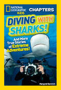
National Geographic Kids Chapters: And More True Stories of Extreme Adventures! (NGK Chapters)
by Margaret GurevichFans of Shark Week, Sharknado, and all things shark-related will want to sink their teeth into this exciting shark-infested chapter book. Join real-life cave divers, extreme photographers, and researchers as they brave thrilling undersea adventures! Kids who are familiar with the popular National Geographic Kids Chapters line are sure to be on the edge of their seats over these new totally true tales of adventure and survival.
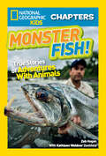
National Geographic Kids Chapters: True Stories of Adventures With Animals (NGK Chapters)
by Kathleen Weidner Zoehfeld Zeb HoganFor Zeb Hogan, bigger is better – especially when it comes to fish. From sawfish to alligator gars to giant stingrays, Zeb's on a mission to save the world's freshwater giants. In this cool Chapter book, you'll join Zeb on amazing – and TRUE – adventures with supersize swimmers.
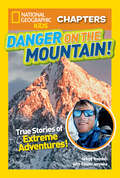
National Geographic Kids Chapters: True Stories of Extreme Adventures! (NGK Chapters)
by Kitson JazynkaAccomplished outdoor explorer Gregg Treinish loves adventure! Whether it's spending two years hiking the remote and perilously high Andes Mountains or coming face to face with wolverines, lynx, and bears, Gregg always knows where the action is. With gripping—and totally true—stories of incredible adventures, extreme excursions, and ultimate survival, this book will have you on the edge of your seat.
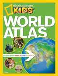
National Geographic Kids World Atlas for Young Explorers, Third Edition
by National Geographic SocietyThis edition of National Geographic's award-winning "World Atlas for Young Explorers" includes more than 200 color images and 115 pages of full-size maps help kids locate countries, cities, regions, and more.
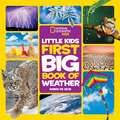
National Geographic Little Kids First Big Book of Weather
by Karen de SeveHow does a rainbow form? What causes it to snow? What makes the wind blow? This adorable reference book introduces young children to every aspect of weather and answers the questions curious kids want to know! Always an important topic for young kids, they'll learn how all the various types of weather systems work, from droughts and deserts to snowflakes and blizzards. Stories are accompanied by 100 colorful photos that capture the awe and wonder of our natural world. This charming book is sure to capture kids' imaginations and become a favorite at storytime, bedtime, and anytime.
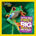
National Geographic Little Kids First Big Book of the Rain Forest (National Geographic Little Kids First Big Books)
by Moira Rose DonohueColoful birds! Jaguars! Tree frogs! National Geographic presents a delightful, age-appropriate introduction to tropical rain forest creatures big and small in this new title in the popular Little Kids First Big Book series.This adorable animal book about all things jungle features favorite animals found in tropical rain forests. Readers meet jaguars prowling the forest floor, snakes slithering through the understory, red-eyed tree frogs leaping through the canopy, butterflies flitting through the tallest treetops, and many other creatures that inhabit all the different layers. More than 200 charming animal photos illustrate the profiles, with facts about the creatures' sizes, diets, homes, and more. A map of tropical rain forests around the world shows where the animals in the book are found, and the book also introduces readers to plant life. This book will quickly become a favorite at storytime, bedtime, and any time.
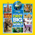
National Geographic Little Kids First Big Book of the World (National Geographic Little Kids First Big Books)
by Elizabeth CarneyThis charming reference introduces young readers to the wider world by exploring languages, landscapes, weather, animals, capital cities, mountains, deserts, and other landscapes and landforms, and more. It encourages kids to get play with activities such as creating a mini-rainforest in a bottle and singing a simple song in Spanish. More than 100 colorful photos are paired with kid-friendly and age-appropriate maps along with basic facts about each continent. This book will quickly become a favorite at storytime, bedtime, or any other time.

National Geographic Map Essentials: A Comprehensive Map Skills Program
by National Geographic Society (U.S.) StaffThis is a comprehensive book from National Geographic that enables kids to learn about maps.
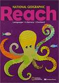
National Geographic Reach: Language, Literacy, Content (Grade 2)
by Deborah J. Short Sylvia Linan-Thompson Lada Kratky Nonie K. Lesaux Nancy Frey Jennifer D. TurnerThe Student Anthology features paired reading selections with exclusive National Geographic content. Built-in instructional support and activities are also included.
National Geographic Reach: Reach B: Student Anthology, Volume 1
by Sylvia Linan-Thompson Deborah Short Lada Kratky Nancy Frey Jennifer Turner Nonie LesauxVolume 1 of 2. The Student Anthology features paired reading selections with exclusive National Geographic content. Built-in instructional support and activities are also included.
National Geographic Readers: Coral Reefs (Readers Series)
by Kristin RattiniIn this level 2 reader, young readers explore the amazing underwater world of coral reefs. Beautiful photos and carefully leveled text make this book perfect for reading aloud and for independent reading.
National Geographic Reading Expeditions World Regions: South America Geography and Environment
by Carl ProujanTake a look at the dramatically different environments in South America, the towering Andes, the grasslands, the Amazon rain forest, and the varied coastal areas. Examine how elevation and latitude affect the land and its vegetation and wildlife.
National Geographic Reading Expeditions: Geography and Environments
by Robert HendersonClimb to the top of Mount Everest, the world's tallest mountain. Float in the Dead Sea, the lowest place on Earth's surface. Celebrate the arrival of the monsoon rains in India, and walk through countries where most of the land is desert.
National Geographic Windows on Literacy: Caves
by Meredith CostainLook at how caves are formed and compare different kinds of caves.
National Geographic World Cultures and Geography: Eastern Hemisphere
by National Geographic LearningThe World Cultures and Geography Copyright Update will maintain the high quality content and stunning visuals of the original program, but will include updated maps, charts, graphs, and data sources as well as new religious content developed with the help of accredited religious reviewers. It will also include general content updates to address current events, death dates, geographical name and border changes, and recent social and political changes.
National Geographic: World Cultures and Geography, Eastern Hemisphere
by National Geographic LearningThis book provides a detailed coverage of World culture with special features like National Geographic Explorers,Global Issues,Graphs,Charts and Tables and Infographics.
National Identity and Geopolitical Visions: Maps of Pride and Pain
by Gertjan DijinkFrom the Third Reich to Bosnia, nationalism - a sense of a nation's place in the world - has been responsible for much bloodshed. Nationalism may be manipulated by political leaders or governments but it springs from the people. Something in the history and environment of a national group creates it. This volume aims to locate and analyze the myth of national identity and its value in creating pride, deflecting fear or legitimating aggression. A range of essays - on Britain, the United States, Germany, Russia, Iraq, Serbia, Argentina, Australia, and India - illustrate the different manifestations of the geographical imagination across the countries of the world.