- Table View
- List View
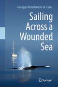
Sailing Across a Wounded Sea
by Giuseppe Notarbartolo di SciaraThe capacity of humans to destroy their environment is playing out like a Greek tragedy in the Mediterranean Sea. After having coexisted with a diversity of marine animals throughout their history, humans have broken the balance in recent decades, and the survival of countless marine creatures is now increasingly uncertain. However, unlike in classical tragedies, real-life entities are not necessarily doomed by their fate, and there must be hope to turn the tide in nature’s favour. Lack of concrete conservation action might be simply due to a lack of awareness: how can we feel sad about a loss if we don’t know what we are losing? “Sailing Across a Wounded Sea” is the story of an ideal journey around the Mediterranean to meet its non-human inhabitants, consisting of real episodes collected over half a century as the author observed real animals, exchanged views with a variety of contacts, and argued for such views in the policy arena. Encountering whales, dolphins,seals and rays in their habitat and on their terms will hopefully contribute to building up in readers a collective commitment to help secure a future for these species. A future where they are allowed to flourish as they were meant to - had humans never trod so heavily on the sea’s delicate ecological balance and the interwoven natural processes. Giuseppe Notarbartolo di Sciara has been involved for a lifetime in protecting marine biodiversity in various capacities – as a scientist, civil servant, advocate and sailor. Having studied in California and worked with whales, dolphins and sharks worldwide, he returned to the Mediterranean in 1985, keen on using his acquired tools to discover more about the ancient sea's natural history. Here, he described small but vibrant populations of fin and sperm whales, along with various species of dolphins, manta rays and the monk seal. At the same time, seeing the Mediterranean’s progressive degradation at the hands of humans, he felt a surge of rebellion against this squandering of natural values, and wished to raise awareness of the existence of these marine natural treasures and the risk of losing them. “Drawing from decades of first-hand experiences, in ‘Sailing Across a Wounded Sea’ Giuseppe Notarbartolo di Sciara offers a compelling narrative that interweaves the beauty of the Mediterranean Sea’s non-human inhabitants with the challenges they face due to human activity. As he reflects on his journey, the author underscores the imperative for collective action and the need for heightened awareness and proactive conservation measures to protect our oceans. ‘Sailing Across a Wounded Sea’ serves not only as a captivating voyage but also as a sobering call to responsibility. Join Giuseppe Notarbartolo di Sciara on this insightful expedition and discover the profound significance of preserving our marine ecosystems for future generations.” —Peter Thomson, United Nations Secretary General’s Special Envoy for the Ocean “The Mediterranean, the cradle of civilisation, is a sea steeped in history. From Apollon and Artemis to Pythagoras and Hercules, names in this book summon up images of civilisations past and lost. The greatest Greek philosopher of them all, Aristotle, is also regarded as the father of marine biodiversity, stemming from his research conducted on Lesbos Island. And yet this ancient world, familiar to so many, is under threat. In this book Notarbartolo di Sciara takes us on a modern-day odyssey through these waters, based on over 50 years of personal observations. He reminds us of the impact of the progressive footprint of human action and endeavour, which has spread out across the whole sea, changing, and depleting its beauty and splendour. His voyage paints a picture not just of what is at stake but also of the potential the future can hold if we all work together to give nature a breathing space, to allow it to restore and recover. In our modern world, where we h
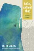
Sailing without Ahab: Ecopoetic Travels
by Steve MentzJourney through uncharted literary waters and explore Melville’s epic in bold new lightCome sail with I.We’re not taking the same trip, though you might recognize the familiar course. This time, the Pequod’s American voyage steers its course across the curvature of the Word Ocean without anyone at the helm. We are leaving one man and his madness on shore. Our ship overflows with glorious plurality—multiracial, visionary, queer, conflicted, polyphonic, playful, violent. But on this voyage something is different. Today we sail headless without any Captain. Instead of binding ourselves to the dismasted tyrant’s rage, the ship’s crew seeks only what we will find: currents teeming with life, a blue-watered alien globe, toothy cetacean smiles from vasty deeps. Treasures await those who sail without.This cycle of one hundred thirty-eight poems—one for each chapter in Moby-Dick, plus the Etymology, Extracts, and Epilogue—launches into oceanic chaos without the stabilizing mad focus of the Nantucket captain. Guided by waywardness and curiosity, these poems seek an alien ecopoetics of marine depths, the refraction of light, the taste of salt on skin. Directionless, these poems reach out to touch oceanic expanse and depth. It’s not an easy voyage, and not a certain one. It lures you forward. It has fixed its barbed hook in I.Sailing without means relinquishing goals, sleeping at the masthead, forgetting obsessions. I welcome you to trace wayward ways through these poems. Read them any way you can—back to front, at random, sideways, following the obscure promptings of your heart. It’s the turning that matters. It’s a blue wonder world that beckons.
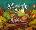
Salamander Song
by Ginny NeilA spring refrain! A salamander rain! This lush, lyrical story illuminates the convergence of wildlife and citizen science--and the big impact young readers can have on vulnerable species. Salamanders and children alike hear the rhythms and song of the seasons as winter gives way to spring. Salamanders begin to squirm and stretch in the early spring sun, while the children and their teacher plan. They meet on a night of salamander rain (the first warm rain of spring), when the children and their teacher work to help the salamanders cross a busy road to the vernal pool on the other side. This lyrical, parallel narrative story reinforces the idea that kids can make a big difference. The author's note includes information about amphibian migrations and descriptions of citizen science activities that kids can participate in to help keep the world wild and beautiful.
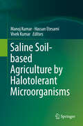
Saline Soil-based Agriculture by Halotolerant Microorganisms
by Manoj Kumar Vivek Kumar Hassan EtesamiThis book discusses the role of salt in current agricultural approaches, including the low salt tolerance of agricultural crops and trees, impact of saline soils, and salt-resistant plants. Halophytes are extremely salt tolerant plants, which are able to grow and survive under salt at concentrations as high as 5 g/l by maintaining negative water potential. The salt-tolerant microbes inhabiting the rhizospheres of halophytes may contribute to their salt tolerance, and the rhizospheres of halophytic plants provide an ideal opportunity for isolating various groups of salt-tolerant microbes that could enhance the growth of different crops under salinity stress. The book offers an overview of salt-tolerant microbes' ability to increase plant tolerance to salt to facilitate plant growth, the potential of the halophytes’ rhizospheres as a reservoir of beneficial salt-tolerant microbes, their future application as bio-inoculants in agriculture and a valuable resource for an alternative way of improving crop tolerance to salinity and promoting saline soil-based agriculture. This special collection of reviews highlights some of the recent advances in applied aspects of plant (halophytes)-microbe interactions and their contribution towards eco-friendly approaches saline soil-based agriculture.
Saline and Alkaline Soils in Latin America: Natural Resources, Management and Productive Alternatives
by Edith Taleisnik Raúl S. LavadoThis book provides the first comprehensive overview of saline and alkaline soils in Latin America, known for having one of the most extensive surface of salt-affected soils in the world. It is organized along two main axes: soils and vegetation. The book discusses the occurrence of such soils in the region, focusing mainly in management strategies for their sustainable use, and it presents accounts of natural vegetation and crops in the various environments of the region. Social impacts of such conditions and ongoing projects to overcome them are considered. Likewise, the book highlights physiological mechanisms that are responsible for the negative effects these soils exert on crops and forest resources and determine vegetation distribution in them. Plant breeding challenges and new perspectives for such environments are discussed. Technologies such as irrigation and drainage are included. The readership includes soil and plant scientists, as well as policy makers.
Salinity Resilience and Sustainable Crop Production Under Climate Change (Earth and Environmental Sciences Library)
by Hassan Auda AwaadThe book provides a comprehensive review of the rapidly expanding and includes in-depth discussions on salinity resilience, sustainable production under climate change, how do plants resilience saline conditions?, Beside Genetic Diversity and inheritance of resistance to Salinity. Furthermore, covers a vast array of special topics and applications illustrating the wide use recent approach of techniques and measurements of assessing genotypes for salinity resilienceThis book has been prepared and supported by recent references and statistics with tables and colourful figures to deliver recent advances to the audience of lower and upper undergraduate, and professional/Practitioner researchers at universities and research centers in the fields of crop breeding and production, physiology, genetics, molecular biology and biotechnology, and allied fields such as agro ecology, sustainable agriculture, climate-resilient agriculture.
Salinity and Sodicity: A Growing Global Challenge to Food Security, Environmental Quality and Soil Resilience (ASA, CSSA, and SSSA Books)
by Sharon A. Clay David E. Clay, Thomas M. DeSutter Thomas M. DeSutter Thandiwe NleyaExplore the growing problem of soil salinity and sodicity and its impact on the environment, profitability, the human population, and soil resilience In Salinity and Sodicity: A Global Challenge to Food Security, Environmental Quality, and Soil Resilience, a team of distinguished educators delivers an expert discussion of salinity and sodicity management. This book is designed to improve the problem-solving capabilities of students, soil health professionals, certified crop advisors, and other practicing professionals in this area. In addition to an introduction to the causes of a rapidly growing problem, Salinity and Sodicity explores different measurement techniques, provides answers to common questions, provides potential solutions in a way that’s appropriate for introductory classes on soil salinity and sodicity management. It’s an ideal reference manual for professionals, as well as an effective tool for classrooms and crop advisor workshops. Readers will also find: A thorough introduction to the use of supplemental irrigation and the impact of salts on the environmentComprehensive explorations of the economic considerations for farming problematic soilsPractical discussions of the effects of salinity and sodicity on erosion and greenhouse gas emissionsPractical case studies, problem sets, and an instructor answer key Perfect for undergraduate, graduate, and doctoral students and certified and practicing soil professionals and advisors, Salinity and Sodicity will also benefit industry and academic researchers with an interest in soil salinity and sodicity in dryland regions.
Salmon Without Rivers: A History Of The Pacific Salmon Crisis
by James A. LichatowichFrom a mountain top where an eagle carries a salmon carcass to feed its young to the oceanic waters of the California current and the Alaskan Gyre, salmon have penetrated the Northwest to an extent unmatched by other animals. Since the turn of the twentieth century, natural productivity of salmon in Oregon, Washington, California, and Idaho has declined 80 percent. The decline of Pacific salmon to the brink of extinction is a sign of serious problems in the region.In Salmon Without Rivers, fisheries biologist Jim Lichatowich offers an eye-opening look at the roots and evolution of the salmon crisis in the Pacific Northwest. He describes the multitude of factors over the past century and a half that have led to the salmon's decline, and examines the failure of restoration efforts that have focused almost exclusively on hatcheries to return salmon stocks to healthy levels without addressing underlying causes of the decline.Lichatowich argues that the dominant worldview of our society -- a worldview that denies connections between humans and the natural world -- has created the conflict that characterizes the recent history of salmon; unless that worldview is challenged, there is little hope for recovery. Salmon Without Rivers exposes the myths that have guided recent human-salmon interactions. It explains the difficult choices facing citizens of the region, and provides unique insight into one of the most tragic chapters in our nation's environmental history.
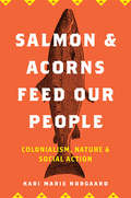
Salmon and Acorns Feed Our People: Colonialism, Nature, and Social Action (Nature, Society, and Culture)
by Kari Marie NorgaardSince time before memory, large numbers of salmon have made their way up and down the Klamath River. Indigenous management enabled the ecological abundance that formed the basis of capitalist wealth across North America. These activities on the landscape continue today, although they are often the site of intense political struggle. Not only has the magnitude of Native American genocide been of remarkable little sociological focus, the fact that this genocide has been coupled with a reorganization of the natural world represents a substantial theoretical void. Whereas much attention has (rightfully) focused on the structuring of capitalism, racism and patriarchy, few sociologists have attended to the ongoing process of North American colonialism. Salmon and Acorns Feed Our People draws upon nearly two decades of examples and insight from Karuk experiences on the Klamath River to illustrate how the ecological dynamics of settler-colonialism are essential for theorizing gender, race and social power today.
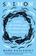
Salmon: A Fish, the Earth, and the History of a Common Fate
by Mark KurlanskyMost of what we do on land ends up impacting the ocean, but never is that clearer than when we look at salmon. Centuries of our greatest assaults on nature, from overfishing to dams, from hatcheries to fish farms, from industrial pollution to the ravages of climate change, can be seen in their harrowing yet awe-inspiring life cycle. From the Pacific to the Atlantic, through Scotland, Ireland, Norway, Iceland, Japan and Siberia, Mark Kurlansky traces the history of the world through his fish-eye lens, laying bare our misdirected attempts to manipulate salmon for our own benefit. Attempts that have had a devastating impact on both fish and earth. Now, the only way to save salmon is to save the planet, and the only way to save the planet may be to save the salmon.
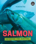
Salmon: Swimming for Survival (Orca Wild #8)
by Rowena RaeSalmon: Swimming for Survival introduces us to the dramatic life story of salmon. These fish hatch in streams, swim extreme distances out to sea, and then migrate home to where they were born to produce the next generation. But today their habitats and very survival are threatened by human activity. This book looks at the unique biology of salmon, their importance to many Indigenous communities, their cultural and economic impact and the vital role they play in ecosystems. With profiles from scientists, educators, fishers and more, learn about the people who are working hard to change the uncertain future of salmon and improve the chance that these iconic fish can survive for generations to come.
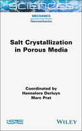
Salt Crystallization in Porous Media (ISTE Consignment)
by Marc Prat Hannelore DerluynThe crystallization of one or multiple salts in porous media (rocks, soils, building materials, etc.) is a subject of major interest in connection with numerous issues such as soil salinization, evaporation, CO2 injection into saline aquifers, the durability of building materials and the preservation of our cultural heritage. Salt Crystallization in Porous Media provides an interdisciplinary review of the key scientific knowledge required to understand this field of research, and illustrates the issues involved through a series of concrete examples. This book has been written for students completing their Master’s level degree or higher in the field, as well as researchers and engineers interested in this research. It may also be of interest to a wider readership, as certain sections can be used to illustrate basic concepts, reaching beyond the subject of salt crystallization itself.
Salt Systems of the Earth: Distribution, Tectonic and Kinematic History, Salt-Naphthids Interrelations, Discharge Foci, Recycling
by Galina BelenitskayaLike water, salt is one of the most commonplace items in our everyday lives. From the omnipresent shaker that you see on every table in every restaurant, to the ocean water we swim in, salt is something that we rarely think about. But there is much more to the story of salt than most people think. Not only is salt a natural resource that must be captured and refined for public consumption, but “salt domes,” large deposits of salt that form under the ground, are important for finding and drilling for petroleum and natural gas. Salt is so important that, in ancient times, it was sometimes used as a currency in various cultures around the world, and it has been used as a food preservative, long before refrigeration was invented. Salt is something we rarely think about, but it is one of the most important natural resources that exists. This is the first integrated study of salt’s global development in the Earth’s subsurface, its tectonic history and kinematic evolution, “live” salt-naphtide interconnections, and their geological recycling. The Earth’s salt is shown as a peculiar umbilical thread in the analysis of numerous geological processes of salt formation, transformation, migration, discharge and regeneration, and their association with hydrocarbons. Presented here is the science of salt, including the active salt bodies’ “live” in Earth’s subsurface, their fate and influence over the other geological processes, including grandiose systems of kinetically interrelated allochthonous nappe-like and sub-vertical bodies formed by the migrating salt. Also included are a description of sub-conformable sheet-like salt bodies formed not by the evaporation but by emigration of buried brine-salt masses and their discharge at new, younger stratigraphic levels, a description of a phenomenon of the “halo-volcanism” due to depth breakthroughs and explosive discharges of the hydrocarbon-brine-salt masses, an examination of the over-diapir surface and brine lakes with fluctuating levels, and many other things. The book provides new interpretations of numerous issues reflecting the salt “life” manifestations and gives a key to a broad circle of the geological enigmas, from global events like the Messinian crisis in the Mediterranean to Biblical legends and enigmas of the Dead Sea-lake. Whether you are a scientist or student working in the natural or Earth sciences, a geologist, an anthropologist, a petroleum engineer, a petrophysicist, or any other engineer or student working in petroleum engineering, this groundbreaking work is a must-have. Perfect for any scientist or engineer’s library, this volume can be a must-read page-turner or a valuable reference work.
Salt-affected Soils and Marginal Waters: Global Perspectives and Sustainable Management
by Ranbir ChhabraThis book presents systematic scientific appraisal, classification, genesis and viable technologies for reclamation and management of salt-affected soils and marginal quality waters across India and several other countries. Nature, solubility and geo-chemical mobility of salts have been provided as basis for the development of alkali and saline soils and groundwaters under specific agro-hydro-ecological regions. Chemical amendment (gypsum) based reclamation technology of alkali soils and related pre and post-reclamation water, nutrient and crop management interventions, including re-sodification issues have been comprehensively addressed. Features and operational guidelines of surface, subsurface, vertical and bio-drainage systems have been thoroughly discussed; likewise, amelioration of irrigation induced saline soils in inland and coastal regions and preventive measures for control of salinity and waterlogging along with environmental trade-offs. Practical approaches for amelioration and judicious use of saline, alkali, high SAR- saline and waste waters have been synthesized for different cropping and agro- forestry systems. Emerging issues on use of industrial by-products as amendments for alkali soils, physiological aspects of salt resistance, anatomical and biochemical mechanism of submergence tolerance, specific ion effects of poor quality waters, crop diversification, groundwater recharge, rejuvenation of tsunami affected coastal soils, safety against occurrence of poisonous gas in tube well pits, paddy straw burning and others have been adequately deliberated upon. Combining scientific principles with field experiences, the book is expected to serve as a useful knowledge base for research workers, teachers and students of soil science, agronomy, plant breeding, forestry, irrigation engineering, extension workers, environmentalists and planners associated with reclamation and management of salt affected soils and waters on sustainable basis in developing and developed countries.
Salt: A World History (Core Ser.)
by Mark KurlanskyAn unlikely world history from the bestselling author of Cod and The Basque History of the WorldIn his fifth work of nonfiction, Mark Kurlansky turns his attention to a common household item with a long and intriguing history: salt. The only rock we eat, salt has shaped civilization from the very beginning, and its story is a glittering, often surprising part of the history of humankind. A substance so valuable it served as currency, salt has influenced the establishment of trade routes and cities, provoked and financed wars, secured empires, and inspired revolutions. Populated by colorful characters and filled with an unending series of fascinating details, Salt is a supremely entertaining, multi-layered masterpiece.From the Trade Paperback edition.
Saltwater in the Blood: Surfing, Natural Cycles and the Sea's Power to Heal
by Easkey BrittonPowerful feminist nature writing by the pioneer of women's big-wave surfing in Ireland. Easkey Britton provides a rare female perspective on surfing, exploring the mental skills it fosters, and the need to recognize the value of the ocean and of nature's cycles in our lives.This is an incredibly inspiring exploration of the sea's role in the wellness of people and the planet, beautifully written by Easkey Britton – surfer, scientist and social activist. She offers a powerful female perspective on the sea and surfing, explaining what it&’s like to be a woman in a man's world and how she promoted the sport to women in Iran, surfing while wearing a hijab. She speaks of the undiscussed taboo around entering the water while menstruating – and of how she has come to celebrate her own bodily cycles. She has developed her own approach to surfing, which instead of seeking to dominate the waves, works in tune with the natural cycles of her body, the moon and the seasons. In a society that rewards busyness, she believes that understanding the influence of cycles becomes even more important – and we all have them, men and women. For Easkey, the sea is a source of mental and physical wellbeing. She explores the mental toughness needed in big-wave surfing, and presents surfing as an embodied mindfulness practice in which we can find flow and connect with the movement of the waves. She stresses the need to recognize the ocean as our most powerful ally when addressing our greatest global challenge: the climate crisis. Above all, Easkey&’s relationship to the sea has taught her about the need to meet life and evolve with it, rather than seeking to control it. By such wisdom our planet might just survive and thrive.
Salutogenic Urbanism: Architecture and Public Health in Early Modern European Cities
by Mohammad Gharipour Anatole TchikineThis book offers a new, salutogenic, perspective on the development of early modern cities by exploring profound and complex ways in which architecture and landscape design served to promote public health on an urban scale. Focusing on fifteenth- through nineteenth-century Europe, it addresses the histories of spaces and institutions that supported salubrious living, highlighting the intersections of medical theory, government policy, and architectural practice in designing, improving, and monumentalizing the infrastructure of sanitation and healthcare. Studies in this book highlight the joint role of design thinking and scientific practice in reforming the facilities for treating and preventing disease; the impact of cross-cultural exchange on early modern strategies of urban improvement; and the creation of new therapeutic environments through state, communal, and private initiatives concerned with the preservation of physical and mental health, from recreational landscapes to spa resorts.

Samkalin Bharat Bhag-1 class 9 - JCERT: समकालीन भारत भाग-१ ९वीं कक्षा - जेसीईआरटी
by Jharkhand Shaikshik Anusandhan Evam Prashikshan Parishad Ranchi"समकालीन भारत - 1" कक्षा 9 की सामाजिक विज्ञान की पाठ्यपुस्तक है, जो छात्रों को भारत के भूगोल, जलवायु, वनस्पति, जनसंख्या आदि विषयों की जानकारी प्रदान करती है। यह पुस्तक छात्रों को भारत की भौगोलिक विविधताओं, जनसंख्या वृद्धि, जलवायु परिवर्तन, और संसाधनों के बारे में विस्तृत रूप से समझाती है। इसमें भारत के भौतिक स्वरूप को विभिन्न भौगोलिक विभाजनों में बाँटा गया है, जैसे कि हिमालय पर्वत, उत्तरी मैदान, प्रायद्वीपीय पठार, तटीय मैदान और द्वीप समूह। साथ ही, भारत की प्रमुख नदियों और उनके अपवाह तंत्रों पर भी विस्तार से चर्चा की गई है। पुस्तक में जलवायु और प्राकृतिक वनस्पति के विभिन्न प्रकारों की चर्चा की गई है, जो छात्रों को पर्यावरण और उसकी संरचना के प्रति जागरूक करती है। इस पाठ्यपुस्तक में दी गई जानकारी छात्रों को भारत के समग्र भूगोल और उसके विभिन्न पहलुओं को समझने में मदद करती है। पुस्तक के अंत में अभ्यास और परियोजना कार्य दिए गए हैं, जो छात्रों को विषय की गहरी समझ विकसित करने में सहायक हैं।
Samkalin Bharat Bhag-2 class 10 - Himachal Pradesh Board: समकालीन भारत भाग-२ कक्षा १० - हिमाचल प्रदेश बोर्ड
by Himachal Pradesh Board of School Education - Dharamshalaहिमाचल प्रदेश स्कूल शिक्षा बोर्ड, धर्मशाला द्वारा प्रकाशित कक्षा 10 के लिए " समकालीन भारत भाग-२" का डिजिटल संस्करण, 2017 से 2022 तक की विभिन्न संस्करणों और पुनर्मुद्रितियों को शामिल करता है। इसका सारांश पाठ्यक्रम और शिक्षण प्रक्रिया के माध्यम से शिक्षकों और छात्रों के बीच एक सेतु के रूप में काम करता है। यह मूल्यांकन, संबोधन, और अच्छी तरह से प्रस्तुत सामग्री की महत्वता पर जोर देता है। शिक्षा में सुधार की आवश्यकता पर ध्यान देते हुए राष्ट्रीय पाठ्यचर्चा रूपरेखा 2005 और परीक्षा सुधारों पर राष्ट्रीय फोकस समूह के स्थिति पत्र ने परीक्षाओं में पूछे जाने वाले प्रश्नों के तरीकों में बदलाव के लिए अपील की है। इस पुस्तक में कुल सात अध्याय है। संसाधन एवं विकास, वन एवं वन्य जीव संसाधन, जल संसाधन, कृषि, खनिज तथा ऊर्जा संसाधन, विनिर्माण उद्योग, राष्ट्रीय अर्थव्यवस्था की जीवन रेखाएँ आदी के बारे जानकारी दी गई है। राष्ट्रीय स्तर पर पाठ्यपुस्तकों के निर्माण का दायित्व एन. सी. ई. आर. टी. को दिया गया है ताकि शिक्षा के राष्ट्रीय स्तर पर समरूपता बनी रहे। हिमाचल प्रदेश शिक्षा बोर्ड, एन.सी.ई.आर.टी. का आभारी हैं क्योंकि उन्होंने हमें उनके द्वारा परिश्रमपूर्वक तैयार की गई पुस्तकों को पुनर्मुदित कर अपने छात्रों तक पहुंचाने का अधिकार दिया है। छात्रें में भू-स्थानिक कौशल विकसित करने के उद्देश्य से एनसीईआरटी तथा इसरो ने मिलकर ऑनलाइन वेब आधारित भू-स्थानिक पोर्टल स्कूल-भुवन-एनसीईआरटी बनाया है। इस भू-स्थानिक पोर्टल पर भूगोल की पाठ्यपुस्तकों में दिए गए मानचित्र उपलब्ध हैं। यह पोर्टल छात्रें में भू-स्थानिक तकनीक के उपयोग द्वारा भूगोल की विभिन्न संकल्पनाओं को समझने में मदद करता है।
Samkalin Bharat Bhag-2 class 10 - JCERT: समकालीन भारत भाग-२ १०वीं कक्षा - जेसीईआरटी
by Jharkhand Shaikshik Anusandhan Evam Prashikshan Parishad Ranchiसमकालीन भारत - 2 कक्षा 10 की भूगोल पाठ्यपुस्तक है, जो भारत के विभिन्न भौगोलिक, पर्यावरणीय और आर्थिक पहलुओं पर केंद्रित है। पुस्तक में कुल सात अध्याय हैं, जो संसाधनों, वन्य जीवन, जल संसाधनों, कृषि, खनिज और ऊर्जा संसाधनों, विनिर्माण उद्योगों और परिवहन जैसे महत्वपूर्ण विषयों को कवर करते हैं। पहला अध्याय संसाधन एवं विकास में संसाधनों के प्रकार और उनके सतत उपयोग की चर्चा है, जिसमें संसाधन नियोजन की आवश्यकता पर जोर दिया गया है। दूसरा अध्याय वन और वन्य जीव संसाधन भारत की जैव विविधता, लुप्तप्राय प्रजातियों और संरक्षण की आवश्यकता को रेखांकित करता है। जल संसाधन पर तीसरा अध्याय जल की कमी, जल संरक्षण और प्रबंधन के उपायों की आवश्यकता पर केंद्रित है। चौथे अध्याय कृषि में कृषि के प्रकार, फसलों की विविधता और राष्ट्रीय अर्थव्यवस्था में कृषि के योगदान की चर्चा की गई है। पांचवा अध्याय खनिज और ऊर्जा संसाधन विभिन्न प्रकार के खनिज और ऊर्जा संसाधनों, उनके वितरण और संरक्षण की आवश्यकता को समझाता है। विनिर्माण उद्योग पर छठा अध्याय उद्योगों के राष्ट्रीय अर्थव्यवस्था में महत्व और पर्यावरणीय समस्याओं का वर्णन करता है। अंत में, राष्ट्रीय अर्थव्यवस्था की जीवन रेखाएँ नामक सातवां अध्याय परिवहन और संचार सेवाओं की महत्ता, और उनके देश की अर्थव्यवस्था में योगदान को स्पष्ट करता है। यह पुस्तक छात्रों को भारत के समकालीन मुद्दों और संसाधनों के विवेकपूर्ण उपयोग के महत्व को समझाने का प्रयास करती है।
Sample Preparation Handbook for Transmission Electron Microscopy: Methodology
by Jeanne Ayache Danièle Laub Jacqueline Boumendil Gabrielle Ehret Luc BeaunierThis two-volume Handbook is a comprehensive and authoritative guide to sample preparation for the transmission electron microscope. This first volume covers general theoretical and practical aspects of the methodologies used for TEM analysis and observation of any sample. The information will help you to choose the best preparative technique for your application taking into account material types, structures, and their properties. Physical properties, material classification, and microstructures are considered together with a thorough description of the physics and chemistry of sample preparation and the main artifacts brought about by mechanical, physical and chemical methods, principles which are also applicable to sample preparation for the SEM, AFM etc.. Also included is a discussion of how to combine techniques for complex sample analysis and to obtain a TEM thin slice. Sample Preparation Handbook for Transmission Electron Microscopy: Methodology will guide you through the most current techniques for successful sample preparation in all fields from materials science to biology. The remainder of the book is dedicated to technical hints, including 22 detailed protocols for preparing thin slices for TEM analysis. Experimental conditions and guidelines, options and variations, advantages and constraints, common artefacts, and theoretical issues are considered. Particular attention is given to the type of material, conditioning, compatible analysis of a given preparation, and risks. Finally, a practical, authoritative, and interdisciplinary handbook is available to guide you through all of the most current techniques for successful sample preparation in all fields from materials science to biology.
Sampling Rare or Elusive Species: Concepts, Designs, and Techniques for Estimating Population Parameters
by William ThompsonInformation regarding population status and abundance of rare species plays a key role in resource management decisions. Ideally, data should be collected using statistically sound sampling methods, but by their very nature, rare or elusive species pose a difficult sampling challenge. Sampling Rare or Elusive Species describes the latest sampling designs and survey methods for reliably estimating occupancy, abundance, and other population parameters of rare, elusive, or otherwise hard-to-detect plants and animals. It offers a mixture of theory and application, with actual examples from terrestrial, aquatic, and marine habitats around the world. Sampling Rare or Elusive Species is the first volume devoted entirely to this topic and provides natural resource professionals with a suite of innovative approaches to gathering population status and trend data. It represents an invaluable reference for natural resource professionals around the world, including fish and wildlife biologists, ecologists, biometricians, natural resource managers, and all others whose work or research involves rare or elusive species.
Sampling Strategies for Natural Resources and the Environment (Chapman & Hall/CRC Applied Environmental Statistics)
by Timothy G. Gregoire Harry T. ValentineWritten by renowned experts in the field, Sampling Strategies for Natural Resources and the Environment covers the sampling techniques used in ecology, forestry, environmental science, and natural resources. The book presents methods to estimate aggregate characteristics on a per unit area basis as well as on an elemental basis. In addition to comm
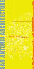
San Antonio Architecture
by San Antonio Boone PowellWith a history more than 290 years old, San Antonio boasts a diverse, eclectic, and important architectural inventory. From the Spanish Missions of the 17th century to invigorating adaptation and restoration of historic buildings alongside landmark new construction, there is a wide array of culturally significant assets reflecting Anglo and Hispanic traditions, alongside regional variations of southern and southwestern American styles.San Antonio Architecture is the comprehensive catalog of the architecture inventory of the city. Complete with color illustrations, keyed maps, and informative essays, it is a must-have book for every armchair and on foot architectural, art, and community historian.