- Table View
- List View
Atlas of Industrializing Britain, 1780-1914
by John Langton R.J. MorrisFirst published in 1986. Routledge is an imprint of Taylor & Francis, an informa company.
Atlas of Karst Collapses (Advances in Karst Science)
by Wanfang Zhou Mingtang Lei Xiaozhen Jiang Jianling Dai Meng YanThis book comprehensively documents the various types of karst collapse and related conceptual site models, before discussing these collapses in terms of their impacts on engineering and the environment. Featuring over 200 real-world photos to illustrate the variety of karst collapses and their consequences, the book also provides specific methods and techniques to prevent, investigate, monitor and remediate these collapses. Decades of experience with these collapses make it clear that addressing the related hazards requires a multi-disciplinary approach that integrates geomorphology, engineering geology, hydrology, hydrogeology, biology, geophysics, geochemistry, and risk assessment.
Atlas of Mineral Deposits Distribution in China (The China Geological Survey Series)
by Fanyu Qi Xiaolei Li Yuntao Shang Jie Meng Xuezheng Gao Zhaoyu Kong Haixin Li Haifei YanThis open access book includes instruction of national mineral database 2020 and atlas of national mineral deposits distribution derived from national mineral database 2020. National mineral database 2020 is based on data from National Geological Archives China(NGAC).Moreover, it introduces the construction method and updates maintenance mechanism of the mineral deposits database and proposes the concept of updating data based on collected archives. The construction guideline on national mineral deposits database provides guiding framework for the future development on geological database.
Atlas of Natural and Induced Fractures in Core
by John C. Lorenz Scott P. CooperAn invaluable reference that helps geologists recognize and differentiate the many types of natural fractures, induced fractures and artefacts found in cores Atlas of Natural and Induced Fractures in Core offers a reference for the interpretation of natural and induced fractures in cores. The natural and induced fracture data contained in cores provides a wealth of information once they are recognized and properly interpreted. Written by two experts in the field, this resource provides a much-needed tool to help with the accurate interpretation of these cores. The authorsinclude the information needed to identify different fracture types as well as the criteria for distinguishing between the types of fractures. The atlas shows how to recognize non-fracture artefacts in a core since many of them provide other types of useful information. In addition, the text’s illustrated structures combined with their basic interpretations are designed to be primary building blocks of a complete fracture assessment and analysis. The authors show how to recognize and correctly interpret these building blocks to ensure that subsequent analyses, interpretations, and modeling efforts regarding fracture-controlled reservoir permeability are valid. Presented in full color throughout, this comprehensive reference is written for geologists charged with interpreting fracture-controlled permeability systems in reservoirs as well as for students or other scientists who need to develop the skills to accurately interpret the natural and induced fractures in cores.
Atlas of Nepal in the Modern World: Atlas Of Nepal In The Modern World (Sustainable Development Set)
by Michael SillNepal is associated, in most people's imagination, with Everest (Sagarmatha to the Nepalese), vivid plants and picturesque villages and people. The truth, as always, is other. It is one of the poorest countries in the world, surrounded by big and powerful neighbours. It is immensely diverse, ranging from the great mountains to the north through the trans-Himalaya, a high barren plateau, through the deep valleys, which include the one which contains the ancient cities of Kathmandu, Patan and Bhaktapur, to the Terai which is an extension of Ganges plain. This atlas describes not only the complexity of the environment, but the people, the languages, the towns and industries, the agriculture, food and land management, the natural resources, the effects of tourism, sources of energy, transport and education policies. Originally published in 1991
Atlas of Quaternary Pollen and Spores in China
by Lingyu Tang Limi Mao Junwu Shu Chunhai Li Caiming Shen Zhongze ZhouThis book provides an important reference guide to pollen and spore identification for Chinese Quaternary palynological studies. Presenting and describing more than 400 color photomicrographs of pollen grains and spores retrieved from sediments in China, it offers a unique asset for researchers, graduate students, and newcomers to the field of Quaternary palynology, which constitutes a major aspect of Quaternary paleoecology, paleoclimatology, and paleogeography.
Atlas of Rangeland Plants in Hulun Buir
by Xiaohui Yang Yuanjun Zhu Baizhu Wang Yanshu LiuThis book includes description of main morphological characteristics of 435 species (including varieties and subspecies) belonging to 57 families and 233 genera of endemic and endangered plants of Hulun Buir Rangeland in China. A brief description of the morphological characteristics of each plant, flowering period, zoning, habitat, and the usage habits of most plants, together with 1 to 4 photographs taken in the field are provided. This work is designed not only for researchers working in rangeland science, ecological restoration and protection but also for professionals working in rangeland and related fields. The work is a result of many years of rangeland plant collection and specimens identification.
Atlas of Sedimentary Rocks Under the Microscope
by W. S. Mackenzie C. Guilford A. E. AdamsProvides a very clear guide to sedimentary rock types as seen under the microscope supported by practical aspects of slide preparation.
Atlas of Shear Zone Structures in Meso-scale (Springer Geology)
by Soumyajit MukherjeeStudy of structures associated with shear zones is a crucial aspect to understand the deformation mechanism associated with such zones. Shear zones have been emphasized since it will lead to many latest applied studies such as radioactive waste disposal, groundwater flow etc. For the sake of brevity, research papers cannot show all possible variation in structures found in shear zones. The proposed book aims to present some of these structures in great details with attractive colour photographs. Each photograph will have a comprehensive caption.
Atlas of Structural Geological Interpretation from Seismic Images
by Soumyajit Mukherjee Achyuta Ayan MisraThis comprehensive book deals primarily with reflection seismic data in the hydrocarbon industry. It brings together seismic examples from North and South America, Africa, Europe, Asia and Australia and features contributions from eleven international authors who are experts in their field. It provides structural geological examples with full-color illustrations and explanations so that students and industry professionals can get a better understanding of what they are being taught. It also shows seismic images in black and white print and covers compression related structures. Representing a compilation of examples for different types of geological structures, Atlas of Structural Geological Interpretation from Seismic Images is a quick guide to finding analogous structures. It provides extensive coverage of seismic expression of different geological structures, faults, folds, mobile substrates (shale and salt), tectonic and regional structures, and common pitfalls in interpretation. The book also includes an un-interpreted seismic section for every interpreted section so that readers can feel free to draw their own conclusion as per their conceptualization. Provides authoritative source of methodologies for seismic interpretation Indicates sources of uncertainty and give alternative interpretations Directly benefits those working in petroleum industries Includes case studies from a variety of tectonic regimes Atlas of Structural Geological Interpretation from Seismic Images is primarily designed for graduate students in Earth Sciences, researchers, and new entrants in industry who are interested in seismic interpretation.
Atlas of Structural Geological and Geomorphological Interpretation of Remote Sensing Images
by Soumyajit Mukherjee Achyuta Ayan MisraATLAS OF STRUCTURAL GEOLOGICAL AND GEOMORPHOLOGICAL INTERPRETATION OF REMOTE SENSING IMAGES An extensive compilation of case studies in structural geology and geomorphology for interpreting remotely sensed images In the Atlas of Structural Geological and Geomorphological Interpretation of Remote Sensing Images, a team of experts delivers an extensive collection of over 20 different examples of structural geological and geomorphological studies by remote sensing. The book demonstrates how to properly interpret geological features and gather robust and reliable information from remote sensing images. This atlas contains high-quality colour images that depict a diversity of structures and geomorphic features from different tectonic regimes and geographic localities in the Americas, Europe, and Australasia. While its primary emphasis is on structural geology, geomorphology is considered in some depth as well. The examples also cover geological hazards, including volcanic eruptions and earthquakes. Readers will also find: A thorough introduction to the background of remote sensing, including foundational concepts and the classification of remote sensing based on data type, source, platform and imaging media Comprehensive discussions of geomorphology, including explorations of lava fissures, badlands and beaches In-depth explorations of structural geology, including discussions of deformation bands, fault lines and earthquake effects Several examples of how to trace hydrological processes such as glacier retreat, changes in drainage patterns and bar formation Perfect for advanced students and researchers in the geoscience community, Atlas of Structural Geological and Geomorphological Interpretation of Remote Sensing Images will also earn a place in the libraries of practicing professionals with an interest in the interpretation of remote sensing images.
Atlas of Typical Seismic and Geological Sections for Major Petroliferous Basins in China (SpringerBriefs in Earth Sciences)
by Shouli QuThis book offers readers a comprehensive introduction to the seismic and geological response characteristics of major tectonic types, typical reservoirs, and typical geological bodies in China, illustrated in diagrams. The book is divided into four sections, the first of which covers the typical structural styles of petroliferous basins in China. The second focuses on the seismic response of typical stratigraphic and sedimentary features. The third section addresses the seismic response characteristics of clastic geological bodies such as fan bodies, river phase sand bodies, and delta sand bodies, while the fourth describes three typical oil and gas reservoirs
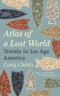
Atlas of a Lost World: Travels in Ice Age America
by Craig ChildsFrom the author of Apocalyptic Planet comes a vivid travelogue through prehistory, that traces the arrival of the first people in North America at least twenty thousand years ago and the artifacts that tell of their lives and fates.In Atlas of a Lost World, Craig Childs upends our notions of where these people came from and who they were. How they got here, persevered, and ultimately thrived is a story that resonates from the Pleistocene to our modern era. The lower sea levels of the Ice Age exposed a vast land bridge between Asia and North America, but the land bridge was not the only way across. Different people arrived from different directions, and not all at the same time.The first explorers of the New World were few, their encampments fleeting. The continent they reached had no people but was inhabited by megafauna—mastodons, giant bears, mammoths, saber-toothed cats, five-hundred-pound panthers, enormous bison, and sloths that stood one story tall. The first people were hunters—Paleolithic spear points are still encrusted with the proteins of their prey—but they were wildly outnumbered and many would themselves have been prey to the much larger animals.Atlas of a Lost World chronicles the last millennia of the Ice Age, the violent oscillations and retreat of glaciers, the clues and traces that document the first encounters of early humans, and the animals whose presence governed the humans’ chances for survival. A blend of science and personal narrative reveals how much has changed since the time of mammoth hunters, and how little. Across unexplored landscapes yet to be peopled, readers will see the Ice Age, and their own age, in a whole new light.
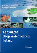
Atlas of the Deep-Water Seabed: Ireland
by Andrew J. Wheeler Boris Dorschel Koen Verbruggen Xavier MonteysPresented in an accessible, user-friendly format, this atlas sets out all the major features revealed during one of the largest ever deep-sea mapping campaigns. A unique insight into the morphology of the seabed along the continental margin of the North-East Atlantic, it reveals for the first time many features that have hitherto been hidden beneath the waves. It is organised both thematically and by region, with the sea floor and its biological hotspots - areas of high biodiversity such as seamounts - shown at a resolution not possible before. The atlas presents everything from submarine canyons to coral carbonate mounds, using digital terrain models generated from multibeam data and photographs taken from unmanned deep-water vehicles (ROVs). The full-colour imagery includes digital three-dimensional seabed maps as well as the photographs, with concise text descriptions and topic boxes used to highlight and explain the geological, biological and hydrographical features, in addition to their importance and context in the deep-sea realm. Alongside the wealth of background information and topic boxes on special highlights, extensive on-line resources link the reader to full data sets and GIS locations, while suggestions for further reading point to ongoing research highlights. This is a fascinating resource that will be of use to anyone involved in off-shore and underwater activities, whether scientific or commercial.
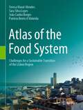
Atlas of the Food System: Challenges for a Sustainable Transition of the Lisbon Region
by Teresa Marat-Mendes Sara Silva Lopes João Cunha Borges Patrícia Bento d'AlmeidaThis book is a visual guide to the territorial dynamics operating within a territory. The reading of such dynamics is fundamental in understanding the role of food in cities. This atlas provides a refreshing approach to the study of the city and of its territory, expanded from the perspective of the food system. This book illustrates the impacts of urban planning options on the function of the contemporary Food System of the Lisbon Region, while disclosing its associated urban form solutions. It provides a possible methodology for the reading of the food system based on an analysis of planning instruments and their morphological outcomes, both in the territory but also on the various built forms which have resulted over time. A key focus of the atlas is exploring how planning has regulated the evolution of the Lisbon Region since the 20th century and its implications on the food system. The atlas results from an exhaustive survey and research work conducted in Lisbon Metropolitan Area for a research project, SPLACH – Spatial Planning for Change, for the past 3 years, in terms of the analysis of its Food System and Urban Planning, aiming to inform the delineation of planning strategies towards a sustainable urban environment. It is an important reference for planners, architects, planning and architecture students as well as municipal technicians and the general public, as it provides a refreshing and useful source of information to support further readings about the food system and its relations to urban planning instruments and urban form solutions. Furthermore, it builds a contemporary reading about possible solutions to promote a sustainable transition of the current food systems, while enhancing the strategic role of planning and urban form.
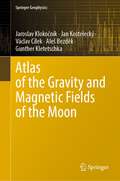
Atlas of the Gravity and Magnetic Fields of the Moon (Springer Geophysics)
by Jaroslav Klokočník Jan Kostelecký Aleš Bezděk Václav Cílek Gunther KletetschkaThis book presents gravity aspects (gravity disturbance, Marussi tensor, two gravity invariants, their certain ratio, the strike angles, and the virtual deformations) which are computed and evaluated for the Moon, using the recent static global gravity field model (GRGM1200A) to degree and order of 600 in spherical harmonic expansion. The magnetic anomaly model and surface topography (from the LOLA mission) are added. Results are shown for the whole Moon, for its segments around the Moon and as zooms for selected impact craters, maria and catenae; they are shortly interpreted and opened for further selenologic applications. The book contains information about the geology of the Moon, together with basic information about the magnetic field, mapping and topography models.
Atlas of the Rock-Forming Minerals in Thin Section
by W. S. Mackenzie C. Guilford'Hurray for Mackenzie and Guilford for at last we have a pictorial guide to the rock-forming minerals! . . . such feasts of colour in mineralogy books are rare . . . an admirable guide'New Scientist
Atlas of the World's Deserts (Ecosystems Ser.)
by Nathaniel HarrisThe Atlas of the World's Deserts examines the hostile and extreme environments that characterize deserts, and is divided into chapters that concentrate on specific aspects of a desert's geology, life forms, history, and future.For more information including sample pages, visit the Atlas of the World's Deserts web site. Also includes 160 color maps and photos.
Atlântida - As Testemunhas - Parte III: A Destruição da Atlântida
by Patrícia Pinto Walter ParksMuitas pessoas sempre acreditaram que Platão tinha sido o primeiro autor a escrever sobre a Atlântida, fê-lo no ano 360 D.C. Contudo, Platão não foi o primeiro a escrever sobre isso; encontrámos um documento muito anterior a essa data, escrito no ano de 9619 A.C, cerca de 9.250 anos anterior às escrituras de Platão. Descobrimos documentos, artefactos e novas evidências científicas que comprovam a existência da Atlântida e que influenciou tudo aquilo que somos hoje e, ainda, encontrámos as suas remanescências. Estruturámos essa evidência de forma a dar resposta às 3 perguntas básicas: como foi criada? Deixou alguma evidência da sua existência, algum legado? Como foi destruída? Este é a parte III da coleção de livros sobre a Atlântida.
Atlântida As Testemunhas - Parte I: A Criação da Atlântida
by Patrícia Pinto Walter ParksEncontrámos a prova geológica sobre a verdadeira existência da Atlântida. Muitas pessoas acreditam que a Atlântida foi uma ficção criada por Platão; porém, Platão não foi o prmeiro autor a escrever sobre isso. Encontrámos um documento muito anterior a essa época, que foi escrito no ano de 9619 A.C, cerca de 9.250 anos antes das escrituras de Platão. Acredita-se que este documento do passado seja o mais antigo de todos os que sobreviveram quase intactos, ao longo dos séculos. E ainda, os achados arqueológicos e as evidências científicas forneceram provas convincentes de que a Atlântida realmente existiu. Estruturámos as evidências que encontrámos de forma a dar resposta às 3 perguntas básicas: Se a Atlântida existiu, como é que foi criada? Se a Atlântida existiu, influenciou alguma coisa; deixou alguma evidência da sua existência; deixou um legado? Se a Atlântia existiu, onde estão as suas remanescências? Esta é a Parte I - A Criação da Atlântida. Leia e ficará convencido(a) que a Atlântida realmente existiu. Género: Natureza / Rochas e Minerais. Línguas: Inglês; PT Europeu; outras traduções em decurso. Número de páginas: 95 Informação de vendas: Várias centenas de livros vendidos, sem qualquer tipo de promoção.
Atlântida As Testemunhas - Parte II: O Legado da Atlântida
by Patrícia Pinto Walter ParksA Atlântida é a base de tudo aquilo que sabemos e tudo aquilo que somos. Descobrimos um relatório sobre a Atlântida que foi escrito 9.250 anos antes da época de Platão. Assim, conseguimos fornecer dados sobre as descobertas arqueológicas e fatos científicos que comprovam, de forma convincente, que a Atlântida existiu na realidade. E, ainda, encontrámos as suas remanescências. Apresentamos evidências para a criação; para a destruição e para o legado da Atlântida. Esta é a Parte II - O Legado da Atlântida.
Atmosphere and Climate
by Yeqiao WangAuthored by world-class scientists and scholars, The Handbook of Natural Resources, Second Edition, is an excellent reference for understanding the consequences of changing natural resources to the degradation of ecological integrity and the sustainability of life. Based on the content of the bestselling and CHOICE-awarded Encyclopedia of Natural Resources, this new edition demonstrates the major challenges that the society is facing for the sustainability of all well-being on the planet Earth. The experience, evidence, methods, and models used in studying natural resources are presented in six stand-alone volumes, arranged along the main systems of land, water, and air. It reviews state-of-the-art knowledge, highlights advances made in different areas, and provides guidance for the appropriate use of remote sensing and geospatial data with field-based measurements in the study of natural resources. Volume 6, Atmosphere and Climate, covers atmospheric pollution and the complexity of atmospheric systems and their interactions with human activity. As an excellent reference for fundamental information on air systems, the handbook includes coverage of acid rain and nitrogen deposition, air pollutants, elevated carbon dioxide, atmospheric circulation patterns, and climate change effects on polar regions and climatology. New in this edition are discussions on aerosols monitoring and mapping, greenhouse gases, the Greenland ice sheet, and mountainous regions. This book presents the key processes, methods, and models used in studying the impact of air pollution on ecosystems worldwide. Written in an easy-to-reference manner, The Handbook of Natural Resources, Second Edition, as individual volumes or as a complete set, is an essential reading for anyone looking for a deeper understanding of the science and management of natural resources. Public and private libraries, educational and research institutions, scientists, scholars, and resource managers will benefit enormously from this set. Individual volumes and chapters can also be used in a wide variety of both graduate and undergraduate courses in environmental science and natural science at different levels and disciplines, such as biology, geography, earth system science, and ecology.
Atmosphere in Urban Design: A Workplace Ethnography of an Architecture Practice (Ambiances, Atmospheres and Sensory Experiences of Spaces)
by Anette StenslundThis book offers an ethnographic exploration of the role that atmosphere plays in work processes undertaken within an urban design studio. It provides understandings of how architectural practices are fueled with atmosphere in various configurations throughout different design phases of selected projects for construction. From the outside architectural practices commonly appear well-ordered and carefully considered, established by proof and rationally justified. This book though poaches on architects’ preserves in order to draw attention to features of unpredictability and uncertainty within the design phases. By opening up into the ‘machinery room’ of urban designers the goal is not to spoil the plaster saint cover of a ‘starchitect’ business, but to remind about the crucial value that pockets of doubt issuing questions rather than answers, open-mindedness instead of single-mindedness, play to the processes of design production and creativity. The book identifies these pockets as atmospheres enveloping the architectural practice.
Atmosphere of Collaboration: Air Pollution Science, Politics and Ecopreneurship in Delhi
by Rohit Negi Prerna SrigyanThis book discusses air pollution in Delhi from scientific, social and entrepreneurial perspectives. Using key debates and interventions on air pollution, it examines the trajectories of environmental politics in the Delhi region, one of the most polluted areas in the world. It highlights the administrative struggles, public advocacy, and entrepreneurial innovations that have built creative new links between science and urban citizenship. The book describes the atmosphere of collaboration that pervades these otherwise disparate spheres in contemporary Delhi. Key features: · Presents an original case study on urban environmentalism from the Global South · Cuts across science, policy, advocacy and innovation · Includes behind-the-scenes discussions, tensions and experimentations in the Indian air pollution space · Uses immersive ethnography to study a topical and relevant urban issue As South Asian and Global South cities confront fast-intensifying environmental risks, this study presents a dialogue between urban political ecology (UPE) and science and technology studies on Delhi’s air. The book explores how the governance of air is challenged by scales, jurisdictions, and institutional structures. It also shows how technical experts are bridging disciplinary silos as they engage in advocacy by translating science for public understanding. The book serves as a reminder of the enduring struggles over space, quality of life, and citizenship while pointing to the possibilities for different urban futures being negotiated by variegated agents. The book will interest scholars and researchers of science and technology studies, urban studies, urban geography, environmental studies, environmental politics, governance, public administration, and sociology, especially in the Global South context. It will also be useful to practitioners, policymakers, bureaucrats, government bodies, civil society organisations, and those working on air pollution advocacy.
Atmosphere of Hope: Searching for Solutions to the Climate Crisis
by Tim FlanneryA decade ago, Tim Flannery’s #1 international bestseller, The Weather Makers, was one of the first books to break the topic of climate change out into the general conversation. <P><P>Today, Earth’s climate system is fast approaching a crisis. Political leadership has not kept up, and public engagement with the issue of climate change has declined. Opinion is divided between technological optimists and pessimists who feel that catastrophe is inevitable. <P><P>The publication of this new book is timed for the lead-up to the Climate Change Conference in Paris in December 2015, which aims to achieve a legally binding and universal agreement on climate from all the nations in the world. This book anticipates and will influence the debates. <P><P>Time is running out, but catastrophe is not inevitable. Around the world people are now living with the consequences of an altered climate-with intensified and more frequent storms, wildfires, droughts and floods. For some it’s already a question of survival. <P><P>Drawing on the latest science, Flannery gives a snapshot of the trouble we are in and more crucially, proposes a new way forward, including rapidly progressing clean technologies and a "third way” of soft geo-engineering. Tim Flannery, with his inimitable style, makes this urgent issue compelling and accessible. This is a must-read for anyone interested in our global future.