- Table View
- List View
Atlas of British Social and Economic History Since c.1700
by Rex PopeFirst published in 1990. Routledge is an imprint of Taylor & Francis, an informa company.
Atlas of Classical History
by Richard J.A. TalbertFrom the Bronze Age to the reign of Constantine, the Atlas of Classical History provides a comprehensive series of maps, diagrams, and commentary designed to meet the needs of classical scholars, as well as general readers. Over 135 maps of the Greek and Roman worlds clearly mark the political affiliations of the cities and states, major military events, trade routes, artistic, cultural and industrial centers, and colonization and exploration.
Atlas of Classical History: Revised Edition
by Richard Talbert Lindsay Holman Benet SalwayFeaturing over 130 colour maps of ancient physical and human landscapes spanning Britain to India and deep into the Sahara, this atlas is a compact kaleidoscope of peoples, migrations, empires, strife, cultures, cities and travels from Greece’s Bronze Age to Rome’s fall in the West. This revised edition of the Atlas of Classical History equips readers with a clear visual grasp of the spatial dimension, a vital aspect for understanding history. Users gain insight into the formative roles of physical landscape – seas, rivers, mountains, deserts – in Mediterranean peoples’ development. The maps in all their variety of scope, scale and colour offer an absorbing means to track the growth of states on the ground, especially their relationships, conflicts, urbanization, communications and cultures. Each map is enriched by readily identifiable symbols and concise accompanying texts, as well as recommendations for further reading. With its vast geographical sweep in a compact format, this book is a comprehensive reference work primarily aimed at non-specialists. With updated text and thoroughly revised maps now presented in colour, the Atlas of Classical History remains an essential reference volume for all those interested in the civilizations of ancient Europe, North Africa and Western Asia, as well as for students and scholars of ancient Greek and Roman history.
Atlas of Cursed Places: A Travel Guide to Dangerous and Frightful Destinations
by Olivier Le CarrerOliver Le Carrer brings us a fascinating history and armchair journey to the world's most dangerous and frightful places, complete with vintage maps and period illustrations in a handsome volume. This alluring read includes 40 locations that are rife with disaster, chaos, paranormal activity, and death. The locations gathered here include the dangerous Strait of Messina, home of the mythical sea monsters Scylla and Charybdis; the coal town of Jharia, where the ground burns constantly with fire; Kasanka National Park in Zambia, where 8 million migrating bats darken the skies; the Nevada Triangle in the Sierra Nevada mountains, where hundreds of aircraft have disappeared; and Aokigahara Forest near Mount Fuji in Japan, the world's second most popular suicide location following the Golden Gate Bridge.
Atlas of Early Modern Britain, 1485-1715
by Christopher DaniellThe Atlas of Early Modern Britain presents a unique visual survey of British history from the end of the Wars of the Roses through to the accession of George I in 1715. Featuring 117 maps, accompanied throughout by straightforward commentary and analysis, the atlas begins with a geographical section embracing England, Scotland, Ireland and Wales and providing clear orientation for the reader. It then focuses separately on the sixteenth and seventeenth centuries, dividing its coverage of each into four key themes: Geography and Counties - Outlining in detail how Britain's geography was shaped during the period; Politics and War - the main campaigns, rebellions and political changes in each century; Religion - including denominational concentrations, diocesan boundaries and witch trials; Economy and Culture -charting Britain's wealthiest towns, the locations of Britain's houses of aristocracy and the effects of The Great Fire of London; The broad scope of the atlas combines essential longer-term political, social, cultural and economic developments as well as key events such as the Spanish Armada, the Dissolution of the Monasteries, the Civil War and the Glorious Revolution. Its blend of clear visual aids and concise analysis represents an indispensable background and reference resource for all students of the early modern period.
Atlas of Emotion: Journeys in Art, Architecture, and Film
by Giuliana BrunoTraversing a varied and enchanting landscape with forays into the fields of geography, art, architecture, design, cartography and film, Giuliana Bruno’s Atlas of Emotion, winner of the 2004 Kraszna-Krausz award for "the world’s best book on the moving image", is a highly original endeavor to map a cultural history of spatio-visual arts. In an evocative montage of words and pictures she emphasizes that "sight" and "site" but also "motion" and "emotion" are irrevocably connected. In so doing, she touches on the art of Gerhard Richter and Annette Messagem: the film-making of Peter Greenaway and Michaelangelo Antonioni; the origins of the movie palace and its precursors, and on her own journeys to her native Naples. Visually luscious and daring in conception, Bruno opens new vistas and understandings at every turn.
Atlas of Industrializing Britain, 1780-1914
by John Langton R.J. MorrisFirst published in 1986. Routledge is an imprint of Taylor & Francis, an informa company.
Atlas of Jewish History
by Dan Cohn-SherbokIn this illuminating history, Dan Cohn-Sherbok traces the development of Jewish history from ancient times to the present day. Containing over 100 maps and 30 photographs, this is a comprehensive atlas of Jewish history designed for students and the general reader. It is ideally suited for those courses in Jewish or Biblical Studies, serving as a handy reference guide as well as a textbook.
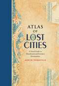
Atlas of Lost Cities: A Travel Guide to Abandoned and Forsaken Destinations
by Aude De TocquevilleLike humans, cities are mortal. They are born, they thrive, and they eventually die. In Atlas of Lost Cities, Aude de Tocqueville tells the compelling narrative of the rise and fall of such notable places as Pompeii, Teotihuacán, and Angkor. She also details the less well known places, including Centralia, an abandoned Pennsylvania town consumed by unquenchable underground fire; Nova Citas de Kilamba in Angola, where housing, schools, and stores were built for 500,000 people who never came; and Epecuen, a tourist town in Argentina that was swallowed up by water. Beautiful, original artwork shows the location of the lost cities and depicts how they looked when they thrived.
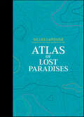
Atlas of Lost Paradises (Atlas Series #3)
by Gilles LapougeThoroughly documented, a worldwide selection of places representing many attempts made by mankind through the ages to re-create a paradise on Earth. "Paradises got off to a bad start early on. The one the Bible had arranged had to rapidly close its pearly gates when its first two occupants, Adam and Eve, had misbehaved." According to Gilles Lapouge, paradise is a paradoxical creation of our imagination, blending hope and nostalgia. Historically, mankind has sought to fashion a paradise, which could be accessed during its lifetime: ideal cities, cities made of glass and steel, castles of freedom, etc. This atlas embarks us upon a journey across civilizations, through the exploration of 27 real or fictional places, including • gardens of the Middle Ages • Atlantis • the castles of King Ludwig II • Oceana • Pitcairn Island • city of Manoa • Mausoleum of Qin Shi Huang Each place is illustrated with a specially designed map in a graphic style that has become the hallmark of this Atlas series.
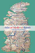
Atlas of Medieval Britain
by Christopher DaniellChristopher Daniell's Atlas of Medieval Britain presents a sweeping visual survey of Britain from the Roman occupation to 1485. Annotated throughout with clear commentary, this volume tells the story of the British Isles, and makes visually accessible the varied and often complex world of the Middle Ages. The Atlas depicts the spatial distribution of key events and buildings between 1066 and 1485, as well as providing the relevant Anglo-Saxon background. Charting the main political, administrative and religious features of medieval society, the maps also locate cultural landmarks such as the sites of mystery plays, universities and specific architectural styles. Topics covered include: Iron Age and Roman occupation Anglo-Saxons and Vikings changing political scenarios within England, Scotland, Wales and Ireland religious framework, including diocesan boundaries, monasteries and friaries government, society and economy. Complete with recommended further reading, this volume is an indispensable reference resource for all students of medieval British history.
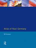
Atlas of Nazi Germany
by Michael Freeman Jayne Lewin Tim MasonOriginally published in hardback only in 1987, Michael Freeman's valuable guide to the history of Nazi Germany now returns to print in a substantially revised Second Edition. Dealing with all aspects of the Nazi regime, it is far more than just an atlas: the integration of the maps themselves with charts and other visually-displayed data, and an extensive and authoritative commentary, makes this a book to read as well as to refer to.
Atlas of Shipwrecks and Fortunes of the Sea (Atlas Series #4)
by Cyril HofsteinThis new title in this bestselling series relates 37 stories of shipwrecks, great discoveries, mysteries, and disappearances still thrilling adventure seekers. From the Atlantic to the Pacific Ocean, from the Baltic Sea to the Caribbean, the Antarctic, and the Indian Ocean; from ancient history to the present day, these short tales cover all aspects of high-seas adventure and feature prominent human incidents and tragic events. Combining tales of adventures and legends, they fuel the imagination of all those captivated by the sea and its sailors. The most-famous stories are part of our maritime heritage, like the legend of the Flying Dutchman, which inspired the ghost ship in Pirates of the Caribbean, or the fire that destroyed the MS Georges Philippar off the coast of Somalia, causing the death of senior reporter Albert Londres, who was then returning from China. Some are based on real historical events, like the sinking of La Belle, which put an end to the conquest of North America by the French, or the historic duel between the CSS Alabama, a Confederate raider, and a Union frigate USS Kearsarge, which moved the American Civil War to the English Channel. Many more have been long forgotten and are ready to come to life again.
Atlas of Slavery
by James WalvinSlavery transformed Africa, Europe and the Americas and hugely-enhanced the well-being of the West but the subject of slavery can be hard to understand because of its huge geographic and chronological span. This book uses a unique atlas format to present the story of slavery, explaining its historical importance and making this complex story and its geographical setting easy to understand.
Atlas of Vernacular Architecture of the World
by Paul Oliver Marcel Vellinga Alexander BridgeThe first world atlas ever compiled on vernacular architecture, this comprehensive work illustrates the variety and ingenuity of the world’s vernacular building traditions from a multi-disciplinary, cross-cultural and comparative approach, using over sixty world and regional maps.Mapping such diverse aspects as materials and resources, technologies, structural systems, symbolism, forms and service systems on a cross-cultural and comparative basis, the Atlas of Vernacular Architecture of the World reveals the distribution, diversity and relationships of the world’s vernacular building traditions. Indicating geographical patterns, developments, lacunae and anomalies, it gives rise to new insights and understandings, stimulating new hypotheses, questions and research efforts.Augmenting the award-winning Encyclopedia of Vernacular Architecture of the World, the Atlas of Vernacular Architecture of the World constitutes a unique and unparalleled resource for anyone involved in the growing field of vernacular architecture studies, including architects, geographers, art historians, planners, folklorists, conservationists, builders, and anthropologists as well as being of use to all those working in the fields of heritage conservation, architecture, regeneration, energy efficient building, resources management, development and sustainability.
Atlas of a Lost World: Travels in Ice Age America
by Craig ChildsFrom the author of Apocalyptic Planet comes a vivid travelogue through prehistory, that traces the arrival of the first people in North America at least twenty thousand years ago and the artifacts that tell of their lives and fates.In Atlas of a Lost World, Craig Childs upends our notions of where these people came from and who they were. How they got here, persevered, and ultimately thrived is a story that resonates from the Pleistocene to our modern era. The lower sea levels of the Ice Age exposed a vast land bridge between Asia and North America, but the land bridge was not the only way across. Different people arrived from different directions, and not all at the same time.The first explorers of the New World were few, their encampments fleeting. The continent they reached had no people but was inhabited by megafauna—mastodons, giant bears, mammoths, saber-toothed cats, five-hundred-pound panthers, enormous bison, and sloths that stood one story tall. The first people were hunters—Paleolithic spear points are still encrusted with the proteins of their prey—but they were wildly outnumbered and many would themselves have been prey to the much larger animals.Atlas of a Lost World chronicles the last millennia of the Ice Age, the violent oscillations and retreat of glaciers, the clues and traces that document the first encounters of early humans, and the animals whose presence governed the humans’ chances for survival. A blend of science and personal narrative reveals how much has changed since the time of mammoth hunters, and how little. Across unexplored landscapes yet to be peopled, readers will see the Ice Age, and their own age, in a whole new light.
Atlas of the English Civil War
by Peter NewmanOriginally published in 1985 the English Civil War is a subject which continues to excite enormous interest throughout the world. This atlas consists of over fifty maps illustrating all the major - and many of the minor - bloody campaigns and battles of the War, including the campaigns of Montrose, the battle of Edgehill and Langport.Providing a complete introductory history to the turbulent period, it also includes maps giving essential background information; detailed accompanying explanations; a useful context to events.
Atlas of the History of Modern Science 1500-2020: Overviews and Surveys in the Form of Charts, ‘Maps’ and Diagrams
by Thomas H. BrobjerThis Atlas of the History of Modern Science functions as a textbook to help the student, by means of diagrams and flowcharts, to better understand both science and the history of science. It thus also aids the reader to better grasp the modern worldview. Students can, at a glance, see the grand picture and orient him- or herself among different traditions and thinkers, and better organize and structure information about the history of science and the scientific developments. This atlas is an invaluable textbook to every student of science, of the history of science, as well as for others seeking to understand our modern Weltanschauung, and how we have arrived at it.
Atlas of the Transatlantic Slave Trade
by David Eltis David Richardson James G. Basker David Blight David Brion Davis<P>Between 1501 and 1867, the transatlantic slave trade claimed an estimated 12. 5 million Africans and involved almost every country with an Atlantic coastline. In this extraordinary book, two leading historians have created the first comprehensive, up-to-date atlas on this 350-year history of kidnapping and coercion. <P>It features nearly 200 maps, especially created for the volume, that explore every detail of the African slave traffic to the New World. The atlas is based on an online database (www. slavevoyages. org) with records on nearly 35,000 slaving voyages--roughly 80 percent of all such voyages ever made. <P>Using maps, David Eltis and David Richardson show which nations participated in the slave trade, where the ships involved were outfitted, where the captives boarded ship, and where they were landed in the Americas, as well as the experience of the transatlantic voyage and the geographic dimensions of the eventual abolition of the traffic. <P> Accompanying the maps are illustrations and contemporary literary selections, including poems, letters, and diary entries, intended to enhance readers' understanding of the human story underlying the trade from its inception to its end. <P>This groundbreaking work provides the fullest possible picture of the extent and inhumanity of one of the largest forced migrations in history.
Atlas, or the Anxious Gay Science: How To Carry The World On One's Back?
by Georges Didi-Huberman Shane B. LillisAby Warburg’s Mnemosyne Atlas (1925–1929) is a prescient work of mixed media assemblage, made up of hundreds of images culled from antiquity to the Renaissance and arranged into startling juxtapositions. Warburg’s allusive atlas sought to illuminate the pains of his final years, after he had suffered a breakdown and been institutionalized. It continues to influence contemporary artists today, including Gerhard Richter and Mark Dion. In this illustrated exploration of Warburg and his great work, Georges Didi-Huberman leaps from Mnemosyne Atlas into a set of musings on the relation between suffering and knowledge in Western thought, and on the creative results of associative thinking. Deploying writing that delights in dramatic jump cuts reminiscent of Warburg’s idiosyncratic juxtapositions, and drawing on a set of sources that ranges from ancient Babylon to Walter Benjamin, Atlas, or the Anxious Gay Science is rich in Didi-Huberman’s trademark combination of elan and insight.
Atlas: The Archaeology of an Imaginary City (Weatherhead Books on Asia)
by Kai-Cheung DungSet in the long-lost City of Victoria (a fictional world similar to Hong Kong), Atlas is written from the unified perspective of future archaeologists struggling to rebuild a thrilling metropolis. Divided into four sections—"Theory," "The City," "Streets," and "Signs"—the novel reimagines Victoria through maps and other historical documents and artifacts, mixing real-world scenarios with purely imaginary people and events while incorporating anecdotes and actual and fictional social commentary and critique. <P><P>Much like the quasi-fictional adventures in map-reading and remapping explored by Paul Auster, Jorge Luis Borges, and Italo Calvino, Dung Kai-cheung's novel challenges the representation of place and history and the limits of technical and scientific media in reconstructing a history. It best exemplifies the author's versatility and experimentation, along with China's rapidly evolving literary culture, by blending fiction, nonfiction, and poetry in a story about succeeding and failing to recapture the things we lose. Playing with a variety of styles and subjects, Dung Kai-cheung inventively engages with the fate of Hong Kong since its British "handover" in 1997, which officially marked the end of colonial rule and the beginning of an uncharted future.
Atlântida - As Testemunhas
by Patrícia Pinto Walter ParksAtlântida - As Testemunhas, por Walter Parks Os documentos antigos, artefactos e as remanescências da Atlântida provam que a Atlântida existiu, na realidade. Muitas pessoas acreditavam que a Atlântida era uma ficção criada por Platão. Porem, Platão não foi o primeiro a escrever sobre isso. Encontrámos um documento muito mais antigo, que foi escrito no ano de 9619 A.C., cerca de 9.250 anos antes das escrituras de Platão. Além disso, reunimos provas suficientes, em termos de achados arqueológicos e fatos científicos, que fornecem uma veracidade convincente de que a Atlântida, de fato, existiu e ainda encontrámos as suas remanescências. Estruturamos essas evidências de forma a dar respostas a 3 questões básicas: Como é que a Atlântida foi criada? Será que nos deixou uma evidência, ou um legado? Como foi destruída? Género: História/Antiguidade/Grécia Línguas: Inglesa e Portuguesa (outras traduções em decurso). Contagem de palavra: 46.288 (141 páginas). Informação de vendas: Várias centenas de livros vendidos, sem promoções.
Atlântida - As Testemunhas - Parte III: A Destruição da Atlântida
by Patrícia Pinto Walter ParksMuitas pessoas sempre acreditaram que Platão tinha sido o primeiro autor a escrever sobre a Atlântida, fê-lo no ano 360 D.C. Contudo, Platão não foi o primeiro a escrever sobre isso; encontrámos um documento muito anterior a essa data, escrito no ano de 9619 A.C, cerca de 9.250 anos anterior às escrituras de Platão. Descobrimos documentos, artefactos e novas evidências científicas que comprovam a existência da Atlântida e que influenciou tudo aquilo que somos hoje e, ainda, encontrámos as suas remanescências. Estruturámos essa evidência de forma a dar resposta às 3 perguntas básicas: como foi criada? Deixou alguma evidência da sua existência, algum legado? Como foi destruída? Este é a parte III da coleção de livros sobre a Atlântida.
Atlântida As Testemunhas - Parte II: O Legado da Atlântida
by Patrícia Pinto Walter ParksA Atlântida é a base de tudo aquilo que sabemos e tudo aquilo que somos. Descobrimos um relatório sobre a Atlântida que foi escrito 9.250 anos antes da época de Platão. Assim, conseguimos fornecer dados sobre as descobertas arqueológicas e fatos científicos que comprovam, de forma convincente, que a Atlântida existiu na realidade. E, ainda, encontrámos as suas remanescências. Apresentamos evidências para a criação; para a destruição e para o legado da Atlântida. Esta é a Parte II - O Legado da Atlântida.
Atmospheres Apollinaire
by Mark FrutkinShort-listed for the 1988 Governor General’s Literary Award for Fiction, Ottawa-Carleton Book Award and Trillium Book Award Paris, the City of Light, was once the scene of a brilliant magnesium flare, host to the belle epoque from 1900 to 1914. Tempting poets, painters, writers, and composers from across Europe, the city relied on one man to move among them all-Guillaume Apollinaire. His contemporaries called him brilliant, mad, whimsical. He was the bastard son of an Italian cavalry officer and a Polish woman addicted to gambling, but nevertheless let it be rumoured around Paris that he was the son of the pope.