- Table View
- List View
GeoHumanities and Health (Global Perspectives on Health Geography)
by Sarah Atkinson Rachel HuntThis volume brings together research in the GeoHumanities from various intellectual perspectives to illustrate the benefits of humanities-inspired approaches in understanding and confronting historically entrenched and recently emergent health-related challenges. In three main sections, this volume seeks to foreground the richness of work entangling medicine and health with the concerns of geography and of the Humanities. This volume will be of interest to academics and researchers in the Geographies of health and medicine, social sciences in GeoHumanities, and health humanities, and students in programs focusing on the humanities and health. In the book's first section, Bodies, the authors explore the material, sensory and more than physical capacities of bodies in accounting for experiences of death, air raids, immigration, dance therapy, asthma and blindness. Section two, Voice, addresses the nature of evidence, HIV/AIDS policy, patient voices in animal research, homelessness, and constructions of truth. The final section, Practice, focuses on creative writing, as well as the pedagogic tools of teaching with the asylum, the creative practice of nuclear emergency planning zones, arts-based care for the elderly, and cartographic practices within health research.
Geocoding Health Data: The Use of Geographic Codes in Cancer Prevention and Control, Research and Practice
by Dale L. Zimmerman Gerard Rushton Marc P. Armstrong Josephine Gittler Barry R. Greene Claire E. Pavlik Michele M. WestIn the past, disease pattern mapping depended on census tracts based on political units, such as states and counties. However, with the advent of geographic information systems (GIS), researchers can now achieve a new level of precision and flexibility in geographic locating. This emerging technology allows the mapping of many different kinds of ge
Geographic Adjustment in Medicare Payment
by Committee on Geographic Adjustment Factors in Medicare PaymentMedicare is the largest health insurer in the United States, providing coverage for 39 million people aged 65 and older and 8 million people with disabilities, and reaching more than an estimated $500 billion in payments in 2010. Although Medicare is a national program, it adjusts fee-for-service payments according to the geographic location of a practice. While there is widespread agreement about the importance of providing accurate payments to providers, there is disagreement about how best to adjust payment based on geographic location. At the request of Congress and the Department of Health and Human Services (HHS), the Institute of Medicine (IOM) examined ways to improve the accuracy of data sources and methods used for making the geographic adjustments to payments. The IOM recommends an integrated approach that includes moving to a single source of wage and benefits data; changing to one set of payment areas; and expanding the range of occupations included in the index calculations. The first of two reports, Geographic Adjustment in Medicare Payment: Phase I: Improving Accuracy, assesses existing practices in regards to accuracy, criteria consistency, evidence for adjustment, sound rationale, transparency, and separate policy adjustments to reform the current payment system. Adopting the recommendations outlined in this report will mean a change in the way that the indexes are calculated, and will require a combination of legislative, rule-making, and administrative actions, as well as a period of public comment. Geographic Adjustment in Medicare Payment will inform the work of government agencies such as HHS, the Centers for Medicare and Medicaid Services, congressional members and staff, the health care industry, national professional organizations and state medical and nursing societies, and Medicare advocacy groups.
Geographic Adjustment in Medicare Payment: Phase II
by Institute of Medicine Frank A. Sloan Board on Health Care Services A. Bruce Steinwald Margaret Edmunds Committee on Geographic Adjustment Factors in Medicare PaymentMedicare, the world's single largest health insurance program, covers more than 47 million Americans. Although it is a national program, it adjusts payments to hospitals and health care practitioners according to the geographic location in which they provide service, acknowledging that the cost of doing business varies around the country. Under the adjustment systems, payments in high-cost areas are increased relative to the national average, and payments in low-cost areas are reduced. In July 2010, the Department of Health and Human Services, which oversees Medicare, commissioned the IOM to conduct a two-part study to recommend corrections of inaccuracies and inequities in geographic adjustments to Medicare payments. The first report examined the data sources and methods used to adjust payments, and recommended a number of changes. Geographic Adjustment in Medicare Payment - Phase II:Implications for Access, Quality, and Efficiency applies the first report's recommendations in order to determine their potential effect on Medicare payments to hospitals and clinical practitioners. This report also offers recommendations to improve access to efficient and appropriate levels of care. Geographic Adjustment in Medicare Payment - Phase II:Implications for Access, Quality, and Efficiency expresses the importance of ensuring the availability of a sufficient health care workforce to serve all beneficiaries, regardless of where they live.
Geographic Health Data
by Tarek Rashed Daniel Goldberg Andrew Curtis Francis Boscoe Nathaniel Bell Jarvis Chen Christopher Saarnak Jin Chen Chetan Tiwari Kevin HenryFocussing on proven techniques for most real-world data sets, this book presents an overview of the analysis of health data involving a geographic component, in a way that is accessible to any health scientist or student comfortable with large data sets and basic statistics, but not necessarily with any specialized training in geographic information systems (GIS). Providing clear, straightforward explanations with worldwide examples and solutions, the book describes applications of GIS in disaster response.
Geographic Health Data: Fundamental Techniques for Analysis
by Tarek Rashed Daniel Goldberg Andrew Curtis Nathaniel Bell Jarvis Chen Christopher Saarnak Jin Chen Chetan Tiwari Kevin HenryFocussing on proven techniques for most real-world data sets, this book presents an overview of the analysis of health data involving a geographic component, in a way that is accessible to any health scientist or student comfortable with large data sets and basic statistics, but not necessarily with any specialized training in geographic information systems (GIS). Providing clear, straightforward explanations with worldwide examples and solutions, the book describes applications of GIS in disaster response.
Geographies of Behavioural Health, Crime, and Disorder: The Intersection of Social Problems and Place (GeoJournal Library #126)
by Jayajit Chakraborty Kim M. LerschThis book focuses on the intersection of place and overall community health thereby focusing on some of the most critical contemporary social problems, including the opioid crisis, suicide, socioeconomic status and ethnicity, mental illness, crime, homelessness, green criminology, and social and environmental justice. Scholars from a variety of disciplines, including geography, sociology, criminology, mental health, social work, and behavioural sciences discuss the importance of geography in our quality of life. Each chapter introduces the reader to an overview of the topic, presents theoretical frameworks and the most recent empirical evidence, and discusses real world policy implications. As such this book is a key resource for researchers, policy makers, and practitioners working in the field.
Geographies of Health and Development (Geographies of Health Series)
by Rachel Bezner Kerr Isaac LuginaahThe geographies of health and development is an emerging sub-discipline, tying in with many of the conceptual, theoretical and practical components of other disciplines working in health, health care, economics, and international development. Spatially and theoretically grounded in geography, this collection offers a fresh perspective on the dialectic relationships between health and development. Health problems in a developing context take on much higher rates of prevalence as a result of the varied cultural, structural and economic vulnerabilities of the people they impact. This book begins by exploring some of the circumstances surrounding the distinctive health inequities currently facing many developing countries, including malaria, maternal mortality and HIV/AIDS. This is followed by a discussion of how matters of physical access and human resource issues and, perhaps most importantly, the challenges of financing, together shape the access and utilization of health care. Examining how the environment interacts to influence the health of the people that live there, the next section includes discussion around challenges of food (in)security, and the importance of clean and uncontaminated water for health. Finally, the book explores the influence of globalization on health, specifically within the urban environment, against the backdrop of global health policy.
Geomedicine (CRC Press Revivals)
by Jul LagThis fascinating work features such topics as the relationships between iodine deficiency and goiter, fluorine deficiency and caries, selenium deficiency and muscular degeneration, mercury surplus and specific nerve diseases, cadmium surplus and kidney failure. This one-of-a-kind volume reveals discoveries which may be of importance in future preventive medicine for man and animals. It shows that the comprehensive progress in chemical analyses has established a valuable basis for determining many environmental features and for the foundation of modern geomedicine. Those involved with geology, soil science, nutrition, biology, veterinary sciences, and prophylactic socio-medical sciences will find this resource indispensable.
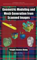
Geometric Modeling and Mesh Generation from Scanned Images (Chapman & Hall/CRC Mathematical and Computational Imaging Sciences Series #6)
by Yongjie Jessica ZhangCutting-Edge Techniques to Better Analyze and Predict Complex Physical Phenomena Geometric Modeling and Mesh Generation from Scanned Images shows how to integrate image processing, geometric modeling, and mesh generation with the finite element method (FEM) to solve problems in computational biology, medicine, materials science, and engineering. Based on the author’s recent research and course at Carnegie Mellon University, the text explains the fundamentals of medical imaging, image processing, computational geometry, mesh generation, visualization, and finite element analysis. It also explores novel and advanced applications in computational biology, medicine, materials science, and other engineering areas. One of the first to cover this emerging interdisciplinary field, the book addresses biomedical/material imaging, image processing, geometric modeling and visualization, FEM, and biomedical and engineering applications. It introduces image-mesh-simulation pipelines, reviews numerical methods used in various modules of the pipelines, and discusses several scanning techniques, including ones to probe polycrystalline materials. The book next presents the fundamentals of geometric modeling and computer graphics, geometric objects and transformations, and curves and surfaces as well as two isocontouring methods: marching cubes and dual contouring. It then describes various triangular/tetrahedral and quadrilateral/hexahedral mesh generation techniques. The book also discusses volumetric T-spline modeling for isogeometric analysis (IGA) and introduces some new developments of FEM in recent years with applications.
Geometric and Numerical Optimal Control: Application to Swimming at Low Reynolds Number and Magnetic Resonance Imaging (SpringerBriefs in Mathematics)
by Bernard Bonnard Monique Chyba Jérémy RouotThis book introduces readers to techniques of geometric optimal control as well as the exposure and applicability of adapted numerical schemes. It is based on two real-world applications, which have been the subject of two current academic research programs and motivated by industrial use – the design of micro-swimmers and the contrast problem in medical resonance imaging. The recently developed numerical software has been applied to the cases studies presented here. The book is intended for use at the graduate and Ph.D. level to introduce students from applied mathematics and control engineering to geometric and computational techniques in optimal control.
Geophagia: History, Epidemiology, and Etiology
by Anil GuptaIngestion of food is a physiological process among heterotrophic organisms to obtain nutrients for survival. The consumption of soil, clay and chalk by humans is labeled as geophagia. Ancient resources and modern references deliver valuable information concerning geophagia and pica in humans. This book takes a consistent, interdisciplinary approach for reviewing this aberrant behavior, crafting its etiology, charting its health effects and identifying the universal traits among the affected population. It puts forward a brief conceptual framework to achieve universality in its definition, history, epidemiology and multiple hypotheses thus help in adopting measures to control this habit. Key Features: 1. Systematic and meticulous flow of information on geophagia. 2. Guides general practioners, physicians, pediatricians to curb this practice in their patients. 3. A unique and concise treatise covering descriptive and research based work over a crucial health issue of worldwide prevalence.
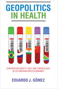
Geopolitics in Health: Confronting Obesity, AIDS, and Tuberculosis in the Emerging BRICS Economies
by Eduardo J. GómezAn in-depth analysis of why leaders from the BRICS respond to public health emergencies the way they do.In recent years, political leaders in Brazil, Russia, India, China, and South Africa, collectively known as the BRICS, have worked to reformulate international discussions and policies on issues ranging from fair and free trade to human rights. When it comes to health epidemics, however, the BRICS have differed greatly in terms of how—and when—they respond, highlighting important differences in their political commitment to meeting healthcare needs.In Geopolitics in Health, Eduardo J. Gómez takes a critical look at how the emerging BRICS economies dealt with the obesity, AIDS, and tuberculosis epidemics. Despite the countries having similar international political and economic ambitions, Gómez finds that domestic policy responses were driven mainly by international, as opposed to domestic, pressures and interests. Using a theoretical framework called geopolitical positioning, Gómez explores how nations respond to international pressures and policy criticisms, as well as offers of financial and technical assistance; countries then utilize domestic policy innovations and ultimately engage in global health diplomacy in order to bolster their international reputation.Gómez draws on extensive data and case studies and argues that leaders aspiring to build their reputations among elite nations have a ready way to demonstrate their status through quick and effective public health responses; those who scorn the international community tend to react slowly and ineffectively to the same type of crises. The first book of its kind to conduct an in-depth comparative historical analysis of how the BRICS deal with public health threats, this pathbreaking text demonstrates the value of positive geopolitical positioning and strong partnerships with other governments, nongovernmental organizations, and social health movements.
Georges Canguilhem and the Problem of Error
by Samuel TalcottExamining Georges Canguilhem’s enduring attention to the problem of error, from his early writings to Michel Foucault’s first major responses to his work, this pathbreaking book shows that the historian of science was also a centrally important philosopher in postwar France. Samuel Talcott elucidates Canguilhem’s contributions by drawing on previously neglected publications and archival sources to trace the continuity of commitment that led him to alter his early anti-vitalist, pacifist positions in the face of political catastrophe and concrete human problems. Talcott shows how Canguilhem critically appropriated the philosophical work of Alain, Bergson, Bachelard, and many others while developing his own distinct writings on medicine, experimentation, and scientific concepts in an ethical and political endeavor to resist alienation and injustice. And, while suggesting Canguilhem’s sometimes surprising philosophical importance for a range of younger thinkers, the book demonstrates Foucault’s own critical allegiance to Canguilhem’s spirit, techniques, and investigations.
Geospatial Analysis of Environmental Health
by Juliana A. Maantay Sara MclaffertyThis book focuses on a range of geospatial applications for environmental health research, including environmental justice issues, environmental health disparities, air and water contamination, and infectious diseases. Environmental health research is at an exciting point in its use of geotechnologies, and many researchers are working on innovative approaches. This book is a timely scholarly contribution in updating the key concepts and applications of using GIS and other geospatial methods for environmental health research. Each chapter contains original research which utilizes a geotechnical tool (Geographic Information Systems (GIS), remote sensing, GPS, etc.) to address an environmental health problem. The book is divided into three sections organized around the following themes: issues in GIS and environmental health research; using GIS to assess environmental health impacts; and geospatial methods for environmental health. Representing diverse case studies and geospatial methods, the book is likely to be of interest to researchers, practitioners and students across the geographic and environmental health sciences. The authors are leading researchers and practitioners in the field of GIS and environmental health.
Geospatial Analysis of Public Health (Global Perspectives on Health Geography)
by Gouri Sankar Bhunia Pravat Kumar ShitThis book is specifically designed to serve the community of postgraduates and researchers in the fields of epidemiology, health GIS, medical geography, and health management. It starts with the basic concepts and role of remote sensing, GIS in Kala-azar diseases. The book gives an exhaustive coverage of Satellite data, GPS, GIS, spatial and attribute data modeling, and geospatial analysis of Kala-azar diseases. It also presents the modern trends of remote sensing and GIS in health risk assessment with an illustrated discussion on its numerous applications.
Geospatial Approaches to Energy Balance and Breast Cancer (Energy Balance and Cancer #15)
by Nathan A. Berger David BerriganCancer occurs in specific places and spaces, each of which have identifiable geographic coordinates, characterized by unique natural, built and social characteristics, all of which contribute significantly to cancer across the spectrum from etiology through diagnosis, treatment and outcomes. In the first volume of this series, published in 2010, a single chapter was focused on these geographic influences. Since then, the field of geospatial studies of cancer prevention and control has exploded in approaches and applications. Accordingly, this volume focuses on what has now become a very specific research endeavor, Geospatial Factors Impacting Breast Cancer. The book provides important insights into this relatively new and rapidly developing field. It should be of value to all students of the Energy Balance & Cancer Series and a wide-ranging introduction to problems in cancer prevention and control for geographers, demographers and other researchers with a geospatial perspective. Moreover, it provides important information for all oncologists, endocrinologists, and behavioral modification professionals to better understand their patients in the context of their environment. It should also provide important considerations for physicians, scientists, public health professionals and disparity investigator planning clinical trials, community interventions and community planning.
Geospatial Data Analytics and Urban Applications (Advances in 21st Century Human Settlements)
by Sandeep Narayan KunduThis book highlights advanced applications of geospatial data analytics to address real-world issues in urban society. With a connected world, we are generating spatial at unprecedented rates which can be harnessed for insightful analytics which define the way we analyze past events and define the future directions. This book is an anthology of applications of spatial data and analytics performed on them for gaining insights which can be used for problem solving in an urban setting. Each chapter is contributed by spatially aware data scientists in the making who present spatial perspectives drawn on spatial big data. The book shall benefit mature researchers and student alike to discourse a variety of urban applications which display the use of machine learning algorithms on spatial big data for real-world problem solving.
Geospatial Data Science in Healthcare for Society 5.0 (Disruptive Technologies and Digital Transformations for Society 5.0)
by Martin Kappas Loveleen Gaur Pradeep Kumar Garg Nitin K. TripathiThe book introduces a variety of latest techniques designed to represent, enhance, and empower multi-disciplinary approaches of geographic information system (GIS), artificial intelligence (AI), deep learning (DL), machine learning, and cloud computing research in healthcare. It provides a unique compendium of the current and emerging use of geospatial data for healthcare and reflects the diversity, complexity, and depth and breadth of this multi-disciplinary area. This book addresses various aspects of how smart healthcare devices can be used to detect and analyze diseases. Further, it describes various tools and techniques to evaluate the efficacy, suitability, and efficiency of geospatial data for health-related applications. It features illustrative case studies, including future applications and healthcare challenges. This book is beneficial for computer science and engineering students and researchers, medical professionals, and anyone interested in using geospatial data in healthcare. It is also intended for experts, offering them a valuable retrospective and a global vision for the future, as well as for non-experts who are curious to learn about this important subject. The book presents an effort to draw how we can build health-related applications using geospatial big data and their subsequent analysis.
Geospatial Health Data: Modeling and Visualization with R-INLA and Shiny (Chapman & Hall/CRC Biostatistics Series)
by Paula MoragaGeospatial health data are essential to inform public health and policy. These data can be used to quantify disease burden, understand geographic and temporal patterns, identify risk factors, and measure inequalities. Geospatial Health Data: Modeling and Visualization with R-INLA and Shiny describes spatial and spatio-temporal statistical methods and visualization techniques to analyze georeferenced health data in R. The book covers the following topics: Manipulating and transforming point, areal, and raster data, Bayesian hierarchical models for disease mapping using areal and geostatistical data, Fitting and interpreting spatial and spatio-temporal models with the integrated nested Laplace approximation (INLA) and the stochastic partial differential equation (SPDE) approaches, Creating interactive and static visualizations such as disease maps and time plots, Reproducible R Markdown reports, interactive dashboards, and Shiny web applications that facilitate the communication of insights to collaborators and policymakers. The book features fully reproducible examples of several disease and environmental applications using real-world data such as malaria in The Gambia, cancer in Scotland and USA, and air pollution in Spain. Examples in the book focus on health applications, but the approaches covered are also applicable to other fields that use georeferenced data including epidemiology, ecology, demography or criminology. The book provides clear descriptions of the R code for data importing, manipulation, modelling, and visualization, as well as the interpretation of the results. This ensures contents are fully reproducible and accessible for students, researchers and practitioners.
Geospatial Information System Use in Public Organizations
by Nicolas Valcik Denis DeanThis book shows how Global Information Systems (GIS) can be used for operations management in public institutions. It covers theory and practical applications, ranging from tracking public health trends to mapping transportation routes, to charting the safest handling of hazardous materials. Along with an expert line-up of contributors and case studies, the editors provide a complete overview of how to use GIS as part of a successful, collaborative data analysis, and how to translate the information into cost-saving decisions, or even life-saving ones.
Geospatial Technologies for Urban Health (Global Perspectives on Health Geography)
by Yongmei Lu Eric DelmelleThis volume presents a timely collection of research papers on the progress, opportunities, and challenges related to the advancement of geospatial technologies for applications in urban health research and management. The chapter authors cover technologies ranging from traditional GIS and remote sensing technologies, to recently developed tracking/locational technologies and volunteered geographic information (VGI). In four main sections, the book uniquely contributes to the conversation of how geospatial technologies and other GIScience research may be enhanced by addressing the data and challenges presented by urban health issues. The book is intended for those with backgrounds in health and medical geography, social epidemiology, urban planning, health management, and lifestyle research. The book starts with an introduction by the editors, providing an overview of traditional and emerging geospatial technologies and how they each can significantly contribute to urban health studies. Section 1 covers urban health risk and disease, and analyses the spatial and temporal patterns of selected urban health issues. Section 2 addresses urban health service access, and demonstrates how traditional and new geospatial technologies apply to different segments of urban populations facing varied challenges. Section 3 focuses on incorporating geospatial technologies in promoting healthy behaviours and lifestyles in urban settings. Section 4 assesses how geospatial technologies may be incorporated into urban health policies and management practices. Adopting a forward-looking perspective, these papers examine the various health challenges in urban systems, and explore how new and emerging geospatial technologies will need to develop to address these problems.
Geospatial Technology for Human Well-Being and Health
by Fazlay S. FaruqueOver the last thirty years or so, there have been tremendous advancements in the area of geospatial health; however, somehow, two aspects have not received as much attention as they should have received. These are a) limitations of different spatial analytical tools and b) progress in making geospatial environmental exposure data available for advanced health science research and for medical practice. This edited volume addresses those two less explored areas of geospatial health with augmented discussions on the theories, methodologies and limitations of contemporary geospatial technologies in a wide range of applications related to human well-being and health. In 20 chapters, readers are presented with an up-to-date assessment of geospatial technologies with an emphasis on understanding general geospatial principles and methodologies that are often overlooked in the research literature. As a result, this book will be of interest to both newcomers and experts in geospatial analysis and will appeal to students and researchers engaged in studying human well-being and health. Chapters are presenting new concepts, new analytical methods and contemporary applications within the framework of geospatial applications in human well-being and health. The topics addressed by the various chapter authors include analytical approaches, newer areas of geospatial health application, introduction to unique resources, geospatial modeling, and environmental pollution assessments for air, water and soil.Although geospatial experts are expected to be the primary readers, this book is designed in such a way so that the public health professionals, environmental health scientists and clinicians also find it useful with or without any familiarity with geospatial analysis.
Geostatistics for Compositional Data with R (Use R!)
by Raimon Tolosana-Delgado Ute MuellerThis book provides a guided approach to the geostatistical modelling of compositional spatial data. These data are data in proportions, percentages or concentrations distributed in space which exhibit spatial correlation. The book can be divided into four blocks. The first block sets the framework and provides some background on compositional data analysis. Block two introduces compositional exploratory tools for both non-spatial and spatial aspects. Block three covers all necessary facets of multivariate spatial prediction for compositional data: variogram modelling, cokriging and validation. Finally, block four details strategies for simulation of compositional data, including transformations to multivariate normality, Gaussian cosimulation, multipoint simulation of compositional data, and common postprocessing techniques, valid for both Gaussian and multipoint methods. All methods are illustrated via applications to two types of data sets: one a large-scale geochemical survey, comprised of a full suite of geochemical variables, and the other from a mining context, where only the elements of greatest importance are considered. R codes are included for all aspects of the methodology, encapsulated in the R package "gmGeostats", available in CRAN.
Geosynchronous SAR: System and Signal Processing
by Teng Long Cheng Hu Zegang Ding Xichao Dong Weiming Tian Tao ZengThis book chiefly addresses the analysis and design of geosynchronous synthetic aperture radar (GEO SAR) systems, focusing on the algorithms, analysis, methods used to compensate for ionospheric influences, and validation experiments for Global Navigation Satellite Systems (GNSS). Further, it investigates special problems in the GEO SAR context, such as curved trajectories, the Earth’s rotation, the ‘non-stop-and-go’ model, high-order Doppler parameters, temporal-variant ionospheric errors etc. These studies can also be extended to SAR with very high resolution and long integration time. Given the breadth and depth of its coverage, scientists and engineers in SAR and advanced graduate students in related areas will greatly benefit from this book.
