- Table View
- List View
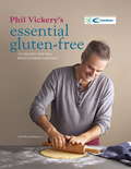
Phil Vickery's Essential Gluten Free
by Phil VickerySince Phil Vickery published his first gluten-free book in 2009, the number of people opting to go gluten-free has risen dramatically - 13% of the UK population now say they avoid gluten; in Finland the number of coeliacs has more than doubled in 20 years and in Italy it has doubled since 2007. A notoriously restrictive diet, it can seem the end of exciting food, but Phil uses his Michelin-starred cooking talents and simple, honest ingredients to create dishes that everyone in the family can eat - including the pizza, bread, pasta, cakes and biscuits that you thought you would never enjoy again. The 175 delicious recipes take their inspiration from cuisines around the world and range from Lasagnette with Asparagus and Tomatoes to Easy Pad Thai Noodles and American-style Pancakes with Pears and Almonds.
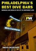
Philadelphia's Best Dive Bars
by Brian McmanusPhiladelphia's Best Dive Bars reviews the grittiest drinking establishments in the city of brotherly love. If you want to avoid the tourist traps listed in those other bar guides and find out where to get wasted after visiting the Liberty Bell, then this book is required reading.Brian McManus is the music editor and a contributing food writer at Philadelphia Weekly. He's written for Houston Press, San Francisco Weekly, Chicago Reader, Cleveland Scene, and Spin magazine.
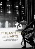
Philanthropy and the Arts
by Jennifer Radbourne Kenneth WatkinsPhilanthropy and the Arts documents an emerging model of philanthropy that moves beyond the fundraising process to capture the essence of philanthropy in the intrinsic values held by donors, benefactors and philanthropic leaders. These values are the same as those that the arts bring to society, so the act of philanthropy itself embodies a commitment to ensuring the arts deliver for Australia a better community in which to live. Philanthropy and the Arts contains stories of successful philanthropy in the arts and acknowledges the relevant research in fundraising and philanthropy, translating this into the tools required for effective practice. While focusing on The Australian Ballet in particular, it has application across all art forms and arts companies and the non-profit sector more broadly.
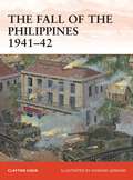
The Philippines 1941-42
by Howard Gerrard Clayton ChunThe Philippine Islands were one of two major US bases in the Pacific, the other being Pearl Harbor. The Japanese considered the capture of the Philippines crucial for its efforts to control resource-laden Southeast Asia. As opposed to its attack on Pearl Harbor, the Japanese intention was to invade and occupy the Philippines in a campaign that was to last five months. The flamboyant Douglas MacArthur, a hero of World War I and former Chief of Staff led the defense of the Philippines when the Japanese attacked on 8 December 1941. Despite warnings about the Pearl Harbor attack, the Japanese air forces caught MacArthur's aircraft on the ground resulting in half of his modern bomber and fighter aircraft destroyed. Army Air Forces B-17s attempted to bomb Formosa, but Japanese fighters eliminated them and a Japanese full-scale invasion followed days later.Japanese forces landed in northern Luzon from Formosa. B-17s and naval attacks tried in vain to stop the invasion, but failed. Poorly trained and equipped Philippine Army units could not halt the Japanese and the American and Filipino forces withdrew, even though they outnumbered the initial Japanese forces. Japanese Army units broke through several defensive lines as they drove on to Manila, which was abandoned by the Americans as Macarthur withdrew to Bataan. The Japanese gradually reduced this pocket until the only American position was Corregidor Island. MacArthur left for Australia, as a direct order from President Franklin Roosevelt and was awarded the Medal of Honor, one of the more controversial aspects of the campaign. With little hope of survival, Corregidor fell, with organized resistance ending on 9 May 1942.Although a defeat, the American and Filipino defensive efforts upset the Japanese plan for a swift victory and provided time for Australia and the United States to build up their defenses. It also gave hope to the American public that Americans could stand up to Japan, with the "Battling Bastards of Bataan" providing a source of inspiration. Unfortunately, for the survivors of the campaign, it meant a grueling three years of captivity for some. The Bataan Death March was one of the most infamous events in World War II, with Japanese forces responsible for the deaths of about 600 Americans and between 5,000-10,000 Filipino soldiers dying in the march, some summarily executed by beheading.
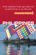
Philippines - Culture Smart!
by Graham Collins-JonesCulture Smart! provides essential information on attitudes, beliefs and behavior in different countries, ensuring that you arrive at your destination aware of basic manners, common courtesies, and sensitive issues. These concise guides tell you what to expect, how to behave, and how to establish a rapport with your hosts. This inside knowledge will enable you to steer clear of embarrassing gaffes and mistakes, feel confident in unfamiliar situations, and develop trust, friendships, and successful business relationships.Culture Smart! offers illuminating insights into the culture and society of a particular country. It will help you to turn your visit-whether on business or for pleasure-into a memorable and enriching experience. Contents include* customs, values, and traditions* historical, religious, and political background* life at home* leisure, social, and cultural life* eating and drinking* do's, don'ts, and taboos* business practices* communication, spoken and unspoken"Culture Smart has come to the rescue of hapless travellers." Sunday Times Travel"... the perfect introduction to the weird, wonderful and downright odd quirks and customs of various countries." Global Travel"...full of fascinating-as well as common-sense-tips to help you avoid embarrassing faux pas." Observer"...as useful as they are entertaining." Easyjet Magazine"...offer glimpses into the psyche of a faraway world." New York Times
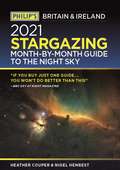
Philip's 2021 Stargazing Month-by-Month Guide to the Night Sky in Britain & Ireland (Philip's Stargazing)
by Nigel Henbest"If you buy just one guide... you won't do better than this" BBC Sky at Night Magazine"You're very much in the dark without this illuminating superstar of a guide." Popular Astronomy"I will continue to enjoy 'Philip's Stargazing' as the months go by" Helen Sharman, Astronaut "Very useful indeed" Chris Lintott, Sky at Night presenterDiscover the latest in star gazing with the new and definitive guide to the night sky.Whether you're a seasoned astronomer or just starting out, Philip's Stargazing 2021 is the only book you'll need. Compiled by experts and specially designed for use in Britain and Ireland, Stargazing 2021 acts as a handily illustrated and comprehensive companion.- 12 Brand-New Maps for year-round astronomical discovery- Month-to-Month informationDaily Moon Phase Calendar, highlighting special lunar events throughout the year- Planet Watch for ideal viewing days in 2021- Avoid light pollution with our detailed Dark Sky Map- Expert advice and insight throughout from internationally renowned Professors Couper and Henbest- Using Binoculars - Stargazing recommendations from expert Robin Scagell- Perfect for home use during lockdown- Complete calendar of major astronomical events, including the Top 20 Sky Sights of 2021- Jargon Buster, explaining common or confusing terms - The planets' movements explained from solar and lunar eclipses to meteor showers and comets
Philip's 2021 Stargazing Month-by-Month Guide to the Night Sky in Britain & Ireland
by Nigel Henbest Heather Couper"If you buy just one guide... you won't do better than this" BBC Sky at Night Magazine"You're very much in the dark without this illuminating superstar of a guide." Popular Astronomy"I will continue to enjoy 'Philip's Stargazing' as the months go by" Helen Sharman, Astronaut "Very useful indeed" Chris Lintott, Sky at Night presenterDiscover the latest in star gazing with the new and definitive guide to the night sky.Whether you're a seasoned astronomer or just starting out, Philip's Stargazing 2021 is the only book you'll need. Compiled by experts and specially designed for use in Britain and Ireland, Stargazing 2021 acts as a handily illustrated and comprehensive companion.- 12 Brand-New Maps for year-round astronomical discovery- Month-to-Month informationDaily Moon Phase Calendar, highlighting special lunar events throughout the year- Planet Watch for ideal viewing days in 2021- Avoid light pollution with our detailed Dark Sky Map- Expert advice and insight throughout from internationally renowned Professors Couper and Henbest- Using Binoculars - Stargazing recommendations from expert Robin Scagell- Perfect for home use during lockdown- Complete calendar of major astronomical events, including the Top 20 Sky Sights of 2021- Jargon Buster, explaining common or confusing terms - The planets' movements explained from solar and lunar eclipses to meteor showers and comets
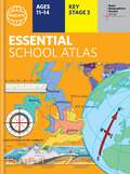
Philip's Essential School Atlas (Philip's World Atlas #25)
by Philip's Maps"An excellent world atlas. Very illuminating, good colours, clear texts...good glossary and, last but not least, up-to-date". Amazon customer review- The ideal school atlas for Key Stage 3 pupils and Scotland's National Qualifications., 11-14 years old- All updated for 2024 specifically to meet curriculum needs- Specially focused 16-page UK and Ireland section- Comprehensive 62-page world section includes thematic maps on the environment, climate change, people, quality of life, and energy- Published in association with the Royal Geographical SocietyPhilip's RGS Essential School Atlas has been specially created for lower-secondary geography students (11-14 year olds). The maps have been carefully designed to be uncluttered and easy to read, containing specially selected place names and detail. A clear set of symbols and scale information accompanies every map, with a useful introductory section covering basic atlas skills, including aerial photographs and satellite images to further explain particular features on the maps. Latitude and longitude co-ordinates are included in the index, alongside figure-letter references. Fully up-to-date, the atlas includes detailed regional maps, charts and satellite images of Europe, Italy, the Middle East, China, Japan, Kenya, USA, Brazil, and the Arctic and Antarctica. It also focuses on areas of special interest for students of geography, such as Japan's volcanoes and earthquakes, and conservation in Kenya.Philip's RGS Essential School Atlas is ideal for special project work and is available in both hardback and paperback editions.
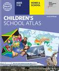
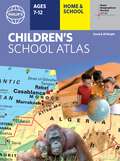
Philip's RGS Children's Atlas (Philip's World Atlas #27)
by David Wright Jill Wright Philip's Maps"This is such a great book for primary school age children and a little beyond for finding out about the world, its countries and people" Amazon customer review- Philip's atlas, designed specially to use at home and at school with guidance for parents and teachers- Clear maps and fascinating facts bring geography to life for readers aged 7-12- Published by Philip's in association with the Royal Geographical Society- Quizzes, activity ideas and puzzles to make learning fun- Past winner of the Geographical Association's award for making a significant contribution to geographyThe atlas is organized spread by spread in the classic sequence: first Europe, then its land neighbour Asia, followed by Africa, Australia and Oceania, North America and South America. Illustrated with captivating full-colour photographs and packed with fact boxes, curiosities, flags, stamps and quiz questions, Philip's RGS Children's Atlas is both fun to use and easy to understand.Now in its 17th edition, Philip's RGS Children's Atlas is a past winner of the Geographical Association's award for making a significant contribution to geography. The atlas was judged "an excellent 'all round' children's atlas with simple yet well-designed maps, well-illustrated with colour photographs. It links places to issues, events and real people, giving a clear sense of place."
Philip's RGS Children's School Atlas (Philip's World Atlas #26)
by David Wright Jill Wright Philip's Maps Rachel Noonan"This is such a great book for primary school age children and a little beyond for finding out about the world, its countries and people" Amazon customer review- Philip's atlas, designed specially to use at home and at school with guidance for parents and teachers- Clear maps and fascinating facts bring geography to life for readers aged 7-12- Published by Philip's the UK's leading school atlas publisher, in association with the Royal Geographical Society- Quizzes, activity ideas and puzzles to make learning fun- Past winner of the Geographical Association's award for making a significant contribution to geographyThe atlas is organized spread by spread in the classic sequence: first Europe, then its land neighbour Asia, followed by Africa, Australia and Oceania, North America and South America.Illustrated with captivating full-colour photographs and packed with fact boxes, curiosities, flags, stamps and quiz questions, Philip's RGS Children's Atlas is both fun to use and easy to understand.Now in its 16th edition, Philip's RGS Children's Atlas is a past winner of the Geographical Association's award for making a significant contribution to geography. The atlas was judged "an excellent 'all round' children's atlas with simple yet well-designed maps, well-illustrated with colour photographs. It links places to issues, events and real people, giving a clear sense of place."
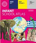
Philip's RGS Infant School Atlas: Key Stage 1 (Ages 5-7) (Philip's World Atlas #27)
by Philip's Maps David Wright Rachel NoonanWritten for 5 to 7 year-old this atlas is ideal for teaching Key Stage 1, helping to cover geography, history, science, citizenship and literacy requirements- Written by experts Professor David Wright and Rachel Noonan- Published in association with the Royal Geographical Society- 50 pages of clear, child-friendly maps showing our world today- Countries of the world brought to life with flags, illustrations and photos- Bold text, simple words and short sentences to encourage reading skills- Starts with the Earth as a Planet then zooms into each of the world's regions with maps and illustrations- Numbered balloons on each map link to photos of a real placeFully revised and updated, the atlas is for children aged 5-7 in the early stages of reading, with simple text to explain what is happening on the maps and illustrations - all compatible with National Curriculum Key Stage 1.Clear, child-friendly maps are combined with vibrant photographs and facts about the world. Guidance is given at the beginning of the atlas on how to use the maps, encouraging the early development of map skills. Each colourful spread is illustrated with photographs and packed with fact boxes, curiosities, flags, stamps and simple quiz questions. Philip's RGS Infant School Atlas is both fun to use and easy to understand. The text is simple and uncomplicated to encourage early reading skills.
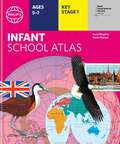
Philip's RGS Infant's School Atlas (Philip's World Atlas #27)
by David Wright Jill Wright Philip's MapsWritten for 5 to 7 year-old this atlas is ideal for teaching Key Stage 1, helping to cover geography, history, science, citizenship and literacy requirements- Written by experts Professor David Wright and Rachel Noonan- Published in association with the Royal Geographical Society- 50 pages of clear, child-friendly maps showing our world today- Countries of the world brought to life with flags, illustrations and photos- Bold text, simple words and short sentences to encourage reading skills- Starts with the Earth as a Planet then zooms into each of the world's regions with maps and illustrations- Numbered balloons on each map link to photos of a real placeFully revised and updated, the atlas is for children aged 5-7 in the early stages of reading, with simple text to explain what is happening on the maps and illustrations - all compatible with National Curriculum Key Stage 1.Clear, child-friendly maps are combined with vibrant photographs and facts about the world to provide essential geographical information for young children. Guidance is given at the beginning of the atlas on how to use the maps, encouraging the early development of map skills and knowledge of the world. Each colourful spread is illustrated with photographs and packed with fact boxes, curiosities, flags, stamps and simple quiz questions. Philip's RGS Infant School Atlas is both fun to use and easy to understand. The text is simple and uncomplicated to encourage early reading skills.
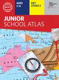
Philip's RGS Junior School Atlas (Philip's World Atlas #28)
by Philip's MapsThe 11th edition of the market-leading atlas for primary school pupils, Philip's RGS Junior School Atlas has been fully revised and updated with all the latest facts and curriculum requirements. - The essential atlas for primary schools with clear and easy-to-follow maps and diagrams - updated for 2021/22- Published in association with the Royal Geographical Society- Recommended for Key Stage 2 of the National Curriculum - and all 7-11 year olds - An excellent introduction to mapping concepts such as scale, direction, symbols, longitude and latitude- 22-page Britain and Ireland section with clear thematic charts, diagrams and large-scale regional maps- 22-page section on The World, with political maps - and thematic treatment of key themes, from volcanoes and earthquakes to transport and tourism- Continents section with physical and political maps- Easy-to-follow map references and 1,000-place indexThe market-leading atlas for pupils at primary schools, Philip's RGS Junior School Atlas is a stimulating and authoritative first introduction to the world of maps, and is recommended for Key Stage 2 of the National Curriculum.The introductory section describes the meaning of scale, how to measure distances using the maps, and explains the symbols on the maps.The following section is devoted to the United Kingdom and Ireland. Thematic maps cover topics such as mountains and rivers, climate and weather, population and cities, farming and fishing, industry and energy, transport, tourism and conservation. Regional maps of England and Wales, Scotland and Ireland complete this section.The rest of the atlas is made up of world thematic maps and world continental maps. Included are topics such as the world's climate, vegetation, agriculture, energy sources, and environmental concerns, such as global warming. A simple letter-figure index completes the atlas - a useful introduction to help the young reader find his/her way around the maps. Available in both hardback and paperback editions.
Philip's RGS Junior School Atlas (Philip's World Atlas #28)
by Philip's MapsThe 12th edition of the market-leading atlas for primary school pupils, Philip's RGS Junior School Atlas has been fully revised and updated with all the latest facts and curriculum requirements.- The essential atlas for primary schools with clear and easy-to-follow maps and diagrams - updated for 2024/2025- Published in association with the Royal Geographical Society- Recommended for Key Stage 2 of the National Curriculum - and all 7-11 year olds - An excellent introduction to mapping concepts such as scale, direction, symbols, longitude and latitude- 22-page Britain and Ireland section with clear thematic charts, diagrams and large-scale regional maps- 22-page section on The World, with political maps - and thematic treatment of key themes, from volcanoes and earthquakes to transport and tourism- Continents section with physical and political maps- Easy-to-follow map references and 1,000-place indexThe introductory section describes the meaning of scale, how to measure distances using the maps, and explains the symbols on the maps.The following section is devoted to the United Kingdom and Ireland. Thematic maps cover topics such as mountains and rivers, climate and weather, population and cities, farming and fishing, industry and energy, transport, tourism and conservation. The rest of the atlas is made up of world thematic maps and world continental maps. Included are topics such as the world's climate, vegetation, agriculture, energy sources, and environmental concerns, such as global warming. A simple letter-figure index completes the atlas. Available in both Hardback and Paperback editions.
Philip's Stargazing 2022 Month-by-Month Guide to the Night Sky in Britain & Ireland (Philip's Stargazing)
by Nigel Henbest<p>"If you buy just one guide...you won't do better than this" - BBC Sky at Night Magazine<p> <p>"I will continue to enjoy 'Philip's Stargazing' as the months go by" - Helen Sharman, Astronaut<p> <p>"Very useful indeed" - Chris Lintott, Sky at Night presenter<p> <p>Discover the latest in stargazing with the new and definitive guide to the night sky. Whether you're a seasoned astronomer or just starting out, Philip's Stargazing 2022 is the only book you'll need. Compiled by experts and specially designed for use in Britain and Ireland, Stargazing 2022 acts as a handily illustrated and comprehensive companion.<p> <p>- 12 Brand-New Maps for year-round astronomical discovery- Month-to-Month information. Daily Moon Phase Calendar, highlighting special lunar events throughout the year- Planet Watch for ideal viewing days in 2022- Avoid light pollution with our detailed Dark Sky Map- Expert advice and insight throughout from internationally renowned Professor Nigel Henbest- A 'Behind the Scenes' look at astrophotography from expert Robin Scagell- Complete calendar of major astronomical events, including the Top 20 Sky Sights of 2022- Jargon Buster, explaining common or confusing terms - The planets' movements explained from solar and lunar eclipses to meteor showers and comets.<p>
Philip's Stargazing 2023 Month-by-Month Guide to the Night Sky Britain & Ireland (Philip's Stargazing)
by Nigel Henbest"If you buy just one guide...you won't do better than this" BBC Sky at Night Magazine"I will continue to enjoy 'Philip's Stargazing' as the months go by" Helen Sharman, Astronaut"Very useful indeed" Chris Lintott, Sky at Night presenterNow including the top astronomical places to visit, star festivals and the latest on star parties in Britain and Ireland, the new 2023 edition is totally up-to-date for exploring the wonder of the night skies, month-by-month and day-by-day. Whether you're a seasoned astronomer or just starting out, Philip's Stargazing 2023 is the only book you'll need. Compiled by experts and specially designed for easy and daily use, Stargazing 2023 acts as a handily illustrated and comprehensive companion.- 12 updated sky charts for year-round astronomical discovery- Month-to-Month information. Daily Moon Phase Calendar, highlighting special lunar events throughout the year- Planet Watch for ideal viewing days in 2023- The best places to experience Dark Skies, along with the latest on Star Festivals and Star Parties- Top places to visit for astronomical insights- Expert advice and insight throughout from internationally renowned Prof Nigel Henbest- The latest on electronic telescopes from expert Robin Scagell- Complete calendar of major astronomical events, including the Top 20 Sky Sights of 2023- Jargon Buster, explaining common or confusing terms - The planets' movements explained from solar and lunar eclipses to meteor showers and comets
Philosophers and Religious Leaders: An Encyclopedia Of People Who Changed The World (Lives And Legacies Ser. #Vol. 2)
by Matthew Smith Scott L. Harris Alexandra Honigsberg Daniel Jurkovic Daniel Magurshak Oliver K. Olson G. Thomas Osterfield Christine Renaud Philipp Saltz Christian D. von Dehsen Frederick W. Weidmann K. Timothy Weidmann Mimi YangPhilosophers and Religious Leaders provides a synopsis of the lives and legacies of 200 men and women from the areas of religion and philosophy who have "changed the world." These individuals have developed, extended, or exemplified ideas fundamental to the way human beings perceive the meaning and purpose of their own lives and of their societies. Some have challenged prevailing convictions and worked for immediate change during their lifetimes; others have proposed new modes of thinking that have flourished only after their passing.
Philosophers as Educational Reformers (International Library of the Philosophy of Education Volume 10): The Influence of Idealism on British Educational Thought
by Peter Gordon John WhiteThis volume assesses how far the ideas and achievements of the 19th century British Idealist philosophical reformers are still important for us today when considering fundamental questions about the structure and objectives of the education system in England and Wales. Part 1 examines those ideas of the Idealists, especially T. H. Green, which had most bearing on the educational reforms carried out between 1870 and the 1920s and traces their connection with the philosophy and educational theory of Hegel and other post-Kantians. Part 2 is an historical survey, concentrating on the innovations in the organization and contents of education in England and Wales brought about by the administrators and educationists educated in philosophical idealism. Part 3 considers what relevance the philosophical and practical ideas of this interconnected group of reformers have to education today.