- Table View
- List View
American Protest Literature (The John Harvard library #99)
by Howard Zinn“I like a little rebellion now and then”—so wrote Thomas Jefferson to Abigail Adams, enlisting in a tradition that throughout American history has led writers to rage and reason, prophesy and provoke. This is the first anthology to collect and examine an American literature that holds the nation to its highest ideals, castigating it when it falls short and pointing the way to a better collective future.American Protest Literature presents sources from eleven protest movements—political, social, and cultural—from the Revolution to abolition to gay rights to antiwar protest. Each section reprints documents from the original phase of the movement as well as evidence of its legacy in later times. Informative headnotes place the selections in historical context and draw connections with other writings within the anthology and beyond. Sources include a wide variety of genres—pamphlets, letters, speeches, sermons, legal documents, poems, short stories, photographs, posters—and a range of voices from prophetic to outraged to sorrowful, from U.S. Presidents to the disenfranchised. Together they provide an enlightening and inspiring survey of this most American form of literature.
American Red Cross First Aid/CPR/AED: Participant’s Manual
by American Red CrossThis participant's manual is part of the American Red Cross First Aid/ CPR/AED program. This manual contains three parts: 1. First Aid Basics; 2. First Aid for Cardiac Emergencies and Choking; and 3. First Aid for Common Illnesses and Injuries.
American Red Cross Lifeguarding Manual
by American Red CrossDesigned to simplify learning, the participants manual reinforces key points from the course. The manual can also be used as a reference for working lifeguards after the course.
American Religions and the Family: How Faith Traditions Cope with Modernization and Democracy
by David A. Clairmont Don S. Browning Eds.Religions respond to capitalism, democracy, industrialization, feminism, individualism, and the phenomenon of globalization in a variety of ways. Some religions conform to these challenges, if not capitulate to them; some critique or resist them, and some work to transform the modern societies they inhabit. <P><P>In this unique collection of critical essays, scholars of Judaism, Christianity, Islam, Hinduism, Buddhism, Confucianism, and Native American thought explore the tension between modernization and the family, sexuality, and marriage traditions of major religions in America. Contributors examine how various belief systems have confronted changing attitudes regarding the meaning and purpose of sex, the definition of marriage, the responsibility of fathers, and the status of children. They also discuss how family law in America is beginning to acknowledge certain religious traditions and how comparative religious ethics can explain and evaluate diverse family customs.Studies concerning the impact of religious thought and behavior on American society have never been more timely or important. Recent global events cannot be fully understood without comprehending how belief systems function and the many ways they can be employed to the benefit and detriment of societies. Responding to this critical need, American Religions and the Family presents a comprehensive portrait of religious cultures in America and offers secular society a pathway for appreciating religious tradition.
American Revolution 100: The Battles, People, and Events of the American War for Independence, Ranked by Their Significance
by Michael Lee LanningA controversial ranking of the Revolution's biggest battles, events, and leaders. The American Revolution 100 brings you onto the charred battlefields and inside the maneuverings of the war that produced America. In comprehensive fashion it explains, analyzes, and ranks the war's most significant events, leaders, and battles according to their importance. Celebrated veteran and military expert Michael Lee Lanning introduces the war's various causes and primary players. The 100 ranked entries that follow include bloody battles, outspoken politicians, military heroes, causes of the conflict, and monumental events. The War of Independence pitted king against colonialist, monarchy against democracy. Men risked execution for treason in order to bring about the model government that would inspire a world. The American Revolution 100 brings to life its battles, people, and events, including maps and illustrations.
American Science Fiction and the Cold War: Literature and Film (America In The 20th/21st Century Ser. #Vol. 3)
by David SeedFirst Published in 1999. Routledge is an imprint of Taylor & Francis, an informa company.
American Sign Language For Dummies
by Angela Lee Taylor Adan R. Penilla IIGrasp the rich culture and language of the Deaf community To see people use American Sign Language (ASL) to share ideas is remarkable and fascinating to watch. Now, you have a chance to enter the wonderful world of sign language. American Sign Language For Dummies offers you an easy-to-access introduction so you can get your hands wet with ASL, whether you're new to the language or looking for a great refresher. Used predominantly in the United States, ASL provides the Deaf community with the ability to acquire and develop language and communication skills by utilizing facial expressions and body movements to convey and process linguistic information. With American Sign Language For Dummies, the complex visual-spatial and linguistic principles that form the basis for ASL are broken down, making this a great resource for friends, colleagues, students, education personnel, and parents of Deaf children. Grasp the various ways ASL is communicated Get up to speed on the latest technological advancements assisting the Deaf Understand how cultural background and regionalism can affect communication Practice signing with videos online If you want to get acquainted with Deaf culture and understand what it's like to be part of a special community with a unique shared and celebrated history and language, American Sign Language For Dummies gets you up to speed on ASL fast.
American Sign Language for Beginners: Learn Signing Essentials in 30 Days
by Rochelle BarlowA 30-day beginner's guide for learning American Sign LanguageThere's an easy way to leap right in to learning American Sign Language (ASL). American Sign Language for Beginners delivers 30 days of lessons that will help you sign with those in your home, community, and classroom.From letters and numbers to essential vocabulary and grammar basics, this beginner's guide provides the essentials needed to develop a solid foundation for American Sign Language in the real world. Each daily lesson takes less than 30 minutes to complete and focuses on a single set of vocabulary or ASL grammar. Throughout the course, you'll find key phrases, helpful memory tips, signing practice activities, and insight into deaf culture. Start your ASL masterclass today.American Sign Language for Beginners includes:30 Days of easy ASL—Start off right with an accelerated plan designed to help you begin signing in just one month.Easy-to-understand instructions—Lessons concentrate on a single idea or subject and include photographs to demonstrate signs.Everyday phrases—Daily instruction highlights vocabulary you're most likely to need as you explore ASL in your daily life.Jump-start your learning experience with American Sign Language for Beginners!

American Speeches: Political Oratory from Abraham Lincoln to Bill Clinton
by Ted WidmerFrom the book: Public speeches have profoundly shaped American history and culture, transforming not only our politics but also our language and our sense of national identity. This volume collects the unabridged texts of 83 eloquent and dramatic speeches delivered by 45 American public figures between 1865 and 1997, beginning with Abraham Lincoln's last speech on Reconstruction and ending with Bill Clinton's heartfelt tribute to the Little Rock Nine. During this period American political oratory continued to evolve, as a more conversational style, influenced by the intimacy of radio and television, emerged alongside traditional forms of rhetoric. Included are speeches on Reconstruction by Thaddeus Stevens and African-American congressman Robert Brown Elliott, Frederick Douglass's brilliant oration on Abraham Lincoln, and Oliver Wendell Holmes's "touched with fire" Memorial Day Address. Speeches by Robert Ingersoll and William Jennings Bryan capture the fervor of 19th-century political conventions, while Theodore Roosevelt and Carl Schurz offer opposing views on imperialism. Ida B. Wells and Mary Church Terrell denounce the cruelty of lynching and the injustice of Jim Crow; Susan B. Anthony, Elizabeth Cady Stanton, and Carrie Chapman Catt advocate the enfranchisement of women; and Woodrow Wilson and Henry Cabot Lodge present conflicting visions of the League of Nations. Also included are wartime speeches by George Patton and Dwight Eisenhower; an address on the atomic bomb by J. Robert Oppenheimer; Richard Nixon's "Checkers Speech"; Malcolm X's "The Ballot or the Bullet"; Barry Goldwater's speech to the 1964 Republican convention; Mario Savio urging Berkeley students to stop "the machine"; Barbara Jordan defending the Constitution during Watergate; and an extensive selection of speeches by Franklin Roosevelt, Martin Luther King, John F. Kennedy, and Ronald Reagan. Ted Widmer, editor, is t
American Women's Fiction, 1790-1870: A Reference Guide (Routledge Library Editions: Women, Feminism and Literature)
by Barbara A. WhiteAn annotated bibliography on women who wrote fiction in the US during the period 1790-1870. The first part is an annotated list of sources that discuss women's fiction in the period and women authors born before 1840 who published before 1870. The second part is an alphabetical list of the approximately 325 19th century writers who meet those criteria. There are indexes by pseudonym, editor, and subject. The sources provide information not only about the individual authors but also about the history of criticism and literary politics, especially women's place in the American literary canon.
Among the Heroes: United Flight 93 & the Passengers & Crew Who Fought Back
by Jere Longman“A powerful reconstruction of the flight’s final moments. . . . Made me think of John Hersey’s Hiroshima.” — New York Times Book ReviewThedefinitive story of the courageous men and women aboard Flight 93 on September 11, 2001, and of the day that forever changed the way Americans view the world and themselves.Of the four horrific hijackings on September 11, Flight 93 resonates as one of epic resistance. At a time when the United States appeared defenseless against an unfamiliar foe, the gallant passengers and crew of Flight 93 provided for many Americans a measure of victory in the midst of unthinkable defeat. Together, they seemingly accomplished what all the security guards and soldiers, military pilots and government officials, could not—they thwarted the terrorists, sacrificing their own lives so that others might live.The culmination of hundreds of interviews with family members and months of investigation,this powerful and deeply moving book is a lasting testament to American heroes.
Amphibians and Reptiles of Land Between the Lakes
by David H. Snyder A. Floyd Scott Edmund J. Zimmerer David F. FrymireKnown for its natural beauty, Land Between the Lakes National Recreation Area is the largest inland peninsula in the United States. Consisting of 170,000 acres of forested and protected public land between Kentucky Lake (Tennessee River) and Lake Barkley
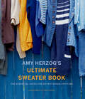
Amy Herzog's Ultimate Sweater Book: The Essential Guide for Adventurous Knitters
by Amy HerzogA comprehensive guide to knitting sweaters and designing and modifying sweater patterns, by the author of You Can Knit and Knit to Flatter.Yarn and fiber enthusiasts everywhere will celebrate the latest addition to Amy Herzog’s beloved knitting series (which includes You Can Knit That, Knit to Flatter, and Knit Wear Love). This essential guide details every aspect of sweater knitting, starting with instructions for four basic sweater types: yoke, raglan, drop shoulder, and set-in sleeve. Patterns are offered in multiple sizes and yarn gauges for broad appeal. Following the basics for each of the four sweater types are a diverse range of customizing options, including how to add a hood, cowl neck, turtleneck, pockets, and zip or cardigan front, just to name a few. Amy’s clear instruction and expert tips expand the many knitting possibilities, creating the essential knitting resource for knitters everywhere.
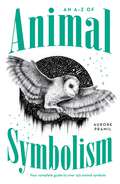
An A-Z of Animal Symbolism: Your complete guide to over 150 animal symbols
by Aurore PramilLearn to interpret the messages the animal world has for you!A bird knocks insistently on your window, your cat brings you a lizard, you find yourself face to face with a spider or you dream of an elephant ... what if each animal had a message for you? Animals have always been a source of fascination for humans - we love to watch them, learn about them and keep them as pets. But what if animals could actually communicate with us? In this complete guide, you'll find everything you need to know about the symbolism and signs of more than 150 animals, whether they appear to you in a dream or 'happen' to cross your path. You'll learn their individual characteristics as well as the elements and seasons they're associated with. You'll also discover what these encounters mean for different aspects of your life including love, career, family and health. Messages from the animal world are always filled with compassion but animals aren't there to flatter your ego. Rather, they aim to help you advance in consciousness in your life's journey. Sometimes you'll receive an encouraging sign that confirms you're on the right path or guidance to help you move forward. Other times, an animal will deliver a deeper lesson for you to explore, because that's how we learn. More than anything, their messages can open avenues of questioning and help to make your way forward clearer. The animals wish you well; they want you to hear their messages. Let them become your guides!
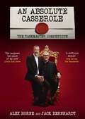
An Absolute Casserole: The Taskmaster Compendium
by Alex HorneHow many eggs have been broken in the making of this programme? What is the worst thing Alex has eaten? Are you more likely to win Taskmaster if you wear a hat? Why is the Taskmaster always right?This hilarious compendium celebrates a decade of Taskmaster's inspired chaos. Relive the most outrageous tasks, iconic meltdowns, and ingenious victories from your favourite contestants.Inside you'll find: - Unforgettable challenges: From the brilliantly bizarre to the wonderfully pointless, revisit the tasks that left us howling with laughter. - Comedy gold moments: Contestant blunders, inspired madness and Greg Davies' withering put-downs - Behind the scenes: Get the inside scoop on the show's creation, meet the show's creators and find out which tasks nearly set the Taskmaster house on fire. - Statistical analysis: 17 series, 85 contestants and thousands of smashed eggs - what's the best star sign to be if you want to win? This is the ultimate gift for any Taskmaster fanatic. So grab a cup of 'warm milk' (or something stronger) and relive ten years of comedic chaos!
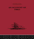
An Account of Tibet: The Travels of Ippolito Desideri of Pistoia, S.J. 1712- 1727
by Ippolito DesideriFirst published in 1932.As well as an extensive introduction, this edition contains notes to all four books, a bibliographical index, a general index and an index of Tibetan words. The introduction is particularly valuable in that it sets the importance of Desideri's mission in the general context of the Jesuit Missions to Tibet.In Desideri's account we receive the first accurate general description of Tibet: from the natural world to the sociological and anthropological aspects of the people and a complete exposition of Lamaism. His is the only complete reconstruction that we possess of the Tibetan religion, founded entirely on canonical texts. And all of this more than a century before Europeans had any knowledge of the Tibetan language.
An Action A Day: Keeps Global Capitalism Away
by Mike Hudema“An Action A Day Keeps Global Capitalism Away,” according to Mike Hudema, describing his action guide for the 21st century. This lively, challenging, and decidedly fun book is designed for activists and concerned citizens who want to change the world. Hudema introduces readers to a variety of issues, including social action, organizing, theatrical action, civil disobedience, and using the media.The book contains fifty-two tried and tested actions, one for every week. Each action includes a rationale–what you need to pull it off, and examples of where it could be used. From Radical Cheerleading, to Fishing in the Sewers, and Gas Mask Car Shopping, there’s something for everybody.
An Actor Rehearses: What to Do When and Why
by David HlavsaWith a commonsense approach, An Actor Rehearses takes performers through the rehearsal process and explains exactly what to do when. The actor’s process is explained simply, sequentially, and in detail, starting from the period before rehearsals begin and continuing through first read-through, blocking rehearsals, technical rehearsals, and performances. Packed with exercises that are useful in the classroom and in the rehearsal studio, An Actor Rehearses is an indispensable guide to the rehearsal process that makes building a character easier and more rewarding for both actor and audience. And because author David Hlavsa’s emphasis is on relating acting to life, performers learn to make a remarkable connection between becoming a better actor and becoming a better person: more compassionate, more vital, more alive. Clear, practical, usable advice for actors at every level Unique focus: learning to become a better actor means learning to become a better person Huge potential audienceAllworth Press, an imprint of Skyhorse Publishing, publishes a broad range of books on the visual and performing arts, with emphasis on the business of art. Our titles cover subjects such as graphic design, theater, branding, fine art, photography, interior design, writing, acting, film, how to start careers, business and legal forms, business practices, and more. While we don't aspire to publish a New York Times bestseller or a national bestseller, we are deeply committed to quality books that help creative professionals succeed and thrive. We often publish in areas overlooked by other publishers and welcome the author whose expertise can help our audience of readers.
An Actor's Companion
by Seth Barrish Anne Hathaway"I was totally unprepared for the transformation that Seth's technique created in me. . . . I realized that what I thought I knew about acting up to that point was largely misguided . . . but I now had a great, talented, dedicated teacher who generously wanted to share his tools with everyone. There is muscularity, not to mention wisdom and truth to Seth's techniques. He is a wonderful teacher, and I know that having him as my first guide is one of the luckiest things to have happened to me in my career and life. And when I can't get back to class with him, I am so grateful I have this book to turn to."--Anne Hathaway"This book is truly unlike anything else I know--these pieces are haikus on specific elements of performance and character building."--Philip Himberg, executive director, Sundance Theatre InstituteA collection of practical acting tips, tools, and exercises, An Actor's Companion is ideal for both the seasoned professionals and actors-in-training. The tips--all simple, direct, and useful--are easy to understand and even easier to apply, in both rehearsal and in performance.Seth Barrish is an actor, teacher, and the co-artistic director of The Barrow Group in New York City. In his thirty-year career, he has directed the award-winning shows My Girlfriend's Boyfriend (Lucille Lortel Award for Best Solo Show, Drama Desk and Outer Critics Circle nominations for Best Solo Show), Sleepwalk With Me (Nightlife Award for Outstanding Comedian in a Major Performance), The Tricky Part (Obie Award, Drama Desk nominations for Best Play and Best Solo Show), Pentecost (Drama Desk nomination for Best Play), Old Wicked Songs (Los Angeles Drama Critics Circle Award and Garland Award for Best Direction), and Good (Straw Hat Award for Best Direction), among dozens of others.
An Actor's Guide—Making It in New York City, Third Edition: Everything a Working Actor Needs to Survive and Succeed in the Big Apple
by Glenn AltermanA Step-by-Step Guide for the Actor Pursuing a Career in New York A great deal has changed in the industry in the last decade. In this new, third edition of An Actor&’s Guide—Making It in New York City, Glenn Alterman provides everything actors need to know. You&’ll discover the ten things that it takes to make it as a successful actor in the city, how to support yourself, where and how to start your life as a New York actor, understanding and marketing &“your brand,&” the best acting schools and conservatories, effective ways to contact agents and casting directors, and more. The author, a successful working actor, also shares many insider tips on topics such as: how to network effectivelyheadshots, photographers, and how to have a successful photo sessioncreating your actor websitesthe best Internet resources and casting siteshow to give winning auditions and interviewsfinding and developing great monologuesoff and off-off Broadway opportunitiesTV and film opportunitiesvoice-overscommercial print modelingcommercialssurvival jobsappropriate behavior in the businessscams and rip-offs to avoidinformation for actors with disabilitiesinformation on diversity and LGBTQ concernsa listing of agents, casting directors and theaters Among the book&’s many interviews are legendary show business figures, such as actors Henry Winkler, Alison Fraser, Dylan Baker, Lisa Emery, and Charles Busch, as well as casting directors Juliet Taylor, Ellen Lewis, Jay Binder, Donna DeSeta, and Liz Lewis, among many others. With Alterman&’s essential guide, you&’ll be prepared to launch and maintain your dream career in the city that never sleeps.
An African Path to Disability Justice: Community, Relationships and Obligations (Ius Gentium: Comparative Perspectives on Law and Justice #78)
by Oche OnaziHow should disability justice be conceptualised, not by orthodox human rights or capabilities approaches, but by a legal philosophy that mirrors an African relational community ideal? This book develops the first comprehensive answer to this question through the contemporary literature on African philosophy, which is relied upon to construct a legal philosophy of disability justice comprising of ethical ideals of community, human relationships and obligations. From these ideals, an African legal philosophy of disability justice is offered as a criterion for critically evaluating existing laws, legal and political institutions, as well as providing an ethical basis for creating new ones to ensure that they are inclusive to people with disabilities. In taking an alternative perspective on the subject, the book outlines and emphasises the need for a new public culture of obligations owed to people with disabilities, highlighting both the prospects and difficulties of achieving the ideal of disability justice that continues to elude the lived experiences of millions of Africans today. Oche Onazi's An African Path to Disability Justice is the first book-length exploration of disability in the light of African ethics, as contrasted with the human rights and capabilities frameworks. Of particular interest are Onazi's thoughtful reflections on how various conceptions of community salient in African moral philosophy––including group-based, reciprocal and relational––bear on what we owe to the disabled. --Thaddeus Metz, Distinguished Professor, University of Johannesburg
An Ageless Woman's Guide to Heart Health
by Elizabeth JacksonHeart disease has long been thought of as a men's issue, when it is actually the leading cause of death in both men and women. In fact, since 1984, more American women than men have died of heart disease. Are you surprised?.Often at the helm of their family's overall health, diet, and nutrition, a woman and her lifestyle decisions can affect not only her own wellbeing; they can determine the habits of her partner and children as well. By becoming better educated, a woman can have a profound, permanent impact on the health of the people around her..An Ageless Woman's Guide to Heart Health is every woman's guidebook to enjoying a heart-healthy life. Renowned cardiologist Dr. Lisa Jackson shares tips and resources to help you make positive steps toward improving your health. Whether you're younger or older, fit or ailing, it's never too late to make changes in your life that can lead you-and those you love-to a healthier heart.
An Andrew Marvell Companion (Routledge Revivals #Vol. 1243)
by Robert H. RayFirst published in 1998, this title provides for the reader of the renowned metaphysical poet and politician a valuable reference and resource volume. It is a compendium of useful information for any reader of Andrew Marvell, including crucial biographical material, historical contextualisation, and details about his life’s work. The intention throughout is to enhance understanding and appreciation, without being exhaustive. The major portion of the volume, in both importance and size, is ‘A Marvell Dictionary’. Its entries are arranged alphabetically: they identify, describe and explain the most influential persons in Marvell’s life and works, as well as places, characters, allusions, ideas, concepts, individual words, phrases and literary terms that are relevant to a rounded appreciation of his poetry and prose. An Andrew Marvell Companion will prove invaluable for all students of English poetry and seventeenth-century political history.