- Table View
- List View

The Digestive System (A True Book (Relaunch))
by Christine Taylor-ButlerAn introduction to the digestive system.This book introduces readers (Grades 3-5) to the digestive system, including the digestive process, the organs involved in digestion, and common problems and diseases associated with the digestive system.

The Digestive System (A True Book: Health And The Human Body Ser.)
by Christine Taylor-ButlerAn introduction to the digestive system. This book introduces readers (Grades 3-5) to the digestive system, including the digestive process, the organs involved in digestion, and common problems and diseases associated with the digestive system.

The Digestive System (TIME FOR KIDS Nonfiction Readers)
by Jennifer PriorDiscover the journey that your food takes through the digestive system in this fascinating nonfiction title! Featuring vivid diagrams and photos, fresh and informative text, and stimulating facts, readers will be engaged from cover to cover.
The Digital Age in Agriculture
by Mehmet Metin OzguvenThe Digital Age in Agriculture presents information related to the digital age in the agriculture sector. Agriculture is an essential activity for the continuity of life, yet is very labor-intensive and faces a wide variety of challenges. In the struggle against these difficulties, the superior features offered by technology provide important benefits. These technologies require expertise in various technical disciplines, and The Digital Age in Agriculture provides information to readers allowing them to make more informed decisions and giving them the opportunity to improve agricultural productivity. Written by Mehmet Metin Özgüven, an expert who has conducted field studies and with a working technical knowledge of various topics pertaining to the agriculture age, this book covers many subjects important to the age of digital agriculture, including precision agriculture and livestock farming, using agricultural robots and unmanned arial vehicles in agriculture practices, and image processing and machine vision. It is an essential read for researchers, agriculture sector workers, and agricultural engineers.
The Digital Dialectic: New Essays On New Media
by Peter LunenfeldComputers linked to networks have created the first broadly used systems that allow individuals to create, distribute, and receive audiovisual content with the same box. They challenge theorists of digital culture to develop interaction-based models to replace the more primitive models that allow only passive use. The Digital Dialectic is an interdisciplinary jam session about our visual and intellectual cultures as the computer recodes technologies, media, and art forms. Unlike purely academic texts on new media, the book includes contributions by scholars, artists, and entrepreneurs, who combine theoretical investigations with hands-on analysis of the possibilities (and limitations) of new technology. The key concept is the digital dialectic: a method to ground the insights of theory in the constraints of practice. The essays move beyond journalistic reportage and hype into serious but accessible discussion of new technologies, new media, and new cultural forms.
The Digital Ecosystem of Kenya: Transforming Governance for a Sustainable Digital Development
by Carolin StötzelThe impact of the digital transformation on countries’ sustainable development is increasingly discussed in both theory and practice. This multidisciplinary book analyzes the implications of digital technologies and services for governance structures and government action, particularly in Kenya. Using the emerging concept of digital ecosystems, it uniquely combines digital development, sustainability, and governance research. This book identifies factors characterizing digital ecosystems and challenges to their sustainable digital development (e.g., lack of common understanding, power asymmetries and dependencies of multi-stakeholders). For addressing these challenges, it proposes coordination mechanisms including governance roles, governance formats such as multi-stakeholder partnerships, as well as alternative solutions such as coordinative digital platforms. These findings emphasize a deeper discussion around the digital transformation as a driving force and the global emphasis on partnerships if these are to foster and not impede sustainable development. About the author Carolin Stötzel holds a PhD in Political Science focusing on digital policy and international cooperation. She is an expert in digital transformation, governance, and sustainable development.
The Digital Factory for Knowledge: Production and Validation of Scientific Results
by Alain Bensoussan Renaud Fabre Lucille Colin Marie Blanquart Louki-Geronimo RichouThis book explores how the technical upheavals of the 21st century have changed the structures and architecture of the creation, sharing and regulation of knowledge. From the new economic and technical models of production and dissemination of knowledge, the book deals with all new forms of valorisation. It also explains how the legislative deficit in the world and in Europe, around digital is being filled by new initiatives, such as the law for a Digital Republic, in France. It is therefore a book that provides a valuable follow-up to the book "The New Challenges of Knowledge", of which it constitutes the continuation and operational deepening.
The Digital Innovation Race: Conceptualizing the Emerging New World Order
by Bengt-Åke Lundvall Cecilia RikapThis book develops new theoretical perspectives on the economics and politics of innovation and knowledge in order to capture new trends in modern capitalism. It shows how giant corporations establish themselves as intellectual monopolies and how each of them builds and controls its own corporate innovation system. It presents an analysis of a new form of production where Google, Amazon, Facebook, Apple and Microsoft, and their counterparts in China, extract value and appropriate intellectual rents through privileged access to AI algorithms trained by data from organizations and individuals all around the world. These companies’ specific form of production and rent-seeking takes place at the global level and challenges national governments trying to regulate intellectual monopolies and attempting to build stronger national innovation systems. It is within this context that the authors provide new insights on the complex interplay between corporate and national innovation systems by looking at the US-China conflict, understood as a struggle for global technological supremacy. The book ends with alternative scenarios of global governance and advances policy recommendations as well as calls for social activism. This book will be of interest to students, academics and practitioners (both from national states and international organizations) and professionals working on innovation, digital capitalism and related topics.
The Digital Jepson Manual
by Robert Patterson Bruce G. Baldwin David J Keil Thomas J. Rosatti Douglas GoldmanThe second edition of The Jepson Manual thoroughly updates this acclaimed work, the single most comprehensive resource on California's amazingly diverse flora. This work integrates the latest science, the results of intensive fieldwork, institutional collaboration, and the efforts of hundreds of contributing authors into an essential reference on California's native and naturalized vascular plants.For the first time, the University of California Press is offering this resource as an e-book. The Digital Jepson Manual provides an unparalleled new level of interactivity, portability, and convenience. Extensive linking and e-book-friendly illustrations make it easier for users to learn about plant characteristics and identify the native and naturalized plants of California--all in a format ideally suited for use in the field. Using readily available e-book readers, field researchers, students, and enthusiasts can click on links to rapidly navigate through keys to families, genera, species, and subspecies or varieties. Specific features of The Digital Jepson Manual include the following:--Keys link forward and backward to other taxonomic levels.--Plate references in taxonomic treatments link to plates for rapid reference.--Plate captions link to taxonomic treatments.--Individual taxon figures appear next to species descriptions, and full plates are gathered in a special section.--Glossary terms link to any relevant illustrations.--List of families links each family to its taxonomic treatment.--Index is fully linked to taxonomic treatments.Optimal devices: iPad, Kindle Fire (but only after conversion)Will also work on: Computers, Barnes and Noble Nook, Kindle (after conversion)
The Digital Mind: How Science Is Redefining Humanity (The\mit Press Ser.)
by Arlindo OliveiraHow developments in science and technology may enable the emergence of purely digital minds—intelligent machines equal to or greater in power than the human brain.What do computers, cells, and brains have in common? Computers are electronic devices designed by humans; cells are biological entities crafted by evolution; brains are the containers and creators of our minds. But all are, in one way or another, information-processing devices. The power of the human brain is, so far, unequaled by any existing machine or known living being. Over eons of evolution, the brain has enabled us to develop tools and technology to make our lives easier. Our brains have even allowed us to develop computers that are almost as powerful as the human brain itself. In this book, Arlindo Oliveira describes how advances in science and technology could enable us to create digital minds. Exponential growth is a pattern built deep into the scheme of life, but technological change now promises to outstrip even evolutionary change. Oliveira describes technological and scientific advances that range from the discovery of laws that control the behavior of the electromagnetic fields to the development of computers. He calls natural selection the ultimate algorithm, discusses genetics and the evolution of the central nervous system, and describes the role that computer imaging has played in understanding and modeling the brain. Having considered the behavior of the unique system that creates a mind, he turns to an unavoidable question: Is the human brain the only system that can host a mind? If digital minds come into existence—and, Oliveira says, it is difficult to argue that they will not—what are the social, legal, and ethical implications? Will digital minds be our partners, or our rivals?
The Digital Pencil: One-to-One Computing for Children
by Jing LeiThis book takes a serious historical and international look at the "digital pencil" movement to equip every student with a computing device with wireless connection. Using an ecological perspective as an overarching framework, and drawing on their own studies and available literature that illuminate the issues related to one-to-one computing, the a
The Digital Person: Technology and Privacy in the Information Age (Ex Machina: Law, Technology, and Society #1)
by Daniel J SoloveA startling account of personal data dossiers and the newest grave threat to privacySeven days a week, twenty-four hours a day, electronic databases are compiling information about you. As you surf the Internet, an unprecedented amount of your personal information is being recorded and preserved forever in the digital minds of computers. For each individual, these databases create a profile of activities, interests, and preferences used to investigate backgrounds, check credit, market products, and make a wide variety of decisions affecting our lives. The creation and use of these databases—which Daniel J. Solove calls “digital dossiers”—has thus far gone largely unchecked. In this startling account of new technologies for gathering and using personal data, Solove explains why digital dossiers pose a grave threat to our privacy.The Digital Person sets forth a new understanding of what privacy is, one that is appropriate for the new challenges of the Information Age. Solove recommends how the law can be reformed to simultaneously protect our privacy and allow us to enjoy the benefits of our increasingly digital world.This is the first volume in the series EX MACHINA: LAW, TECHNOLOGY, AND SOCIETY.
The Digital Republic: On Freedom and Democracy in the 21st Century
by Jamie SusskindFrom one of the leading intellectuals of the digital age, The Digital Republic is the definitive guide to the great political question of our time: how can freedom and democracy survive in a world of powerful digital technologies?A Financial Times &“Book to Read&” in 2022 Not long ago, the tech industry was widely admired, and the internet was regarded as a tonic for freedom and democracy. Not anymore. Every day, the headlines blaze with reports of racist algorithms, data leaks, and social media platforms festering with falsehood and hate. In The Digital Republic, acclaimed author Jamie Susskind argues that these problems are not the fault of a few bad apples at the top of the industry. They are the result of our failure to govern technology properly. The Digital Republic charts a new course. It offers a plan for the digital age: new legal standards, new public bodies and institutions, new duties on platforms, new rights and regulators, new codes of conduct for people in the tech industry. Inspired by the great political essays of the past, and steeped in the traditions of republican thought, it offers a vision of a different type of society: a digital republic in which human and technological flourishing go hand in hand.
The Digital Transformation of Product Formulation: Concepts, Challenges, and Applications for Accelerated Innovation
by Alix Schmidt Kristin WallaceIn competitive manufacturing industries, organizations embrace product development as a continuous investment strategy since both market share and profit margin stand to benefit. Formulating new or improved products has traditionally involved lengthy and expensive experimentation in laboratory or pilot plant settings. However, recent advancements in areas from data acquisition to analytics are synergizing to transform workflows and increase the pace of research and innovation. The Digital Transformation of Product Formulation offers practical guidance on how to implement data-driven, accelerated product development through concepts, challenges, and applications. In this book, you will read a variety of industrial, academic, and consulting perspectives on how to go about transforming your materials product design from a twentieth-century art to a twenty-first-century science. Presents a futuristic vision for digitally enabled product development, the role of data and predictive modeling, and how to avoid project pitfalls to maximize probability of success Discusses data-driven materials design issues and solutions applicable to a variety of industries, including chemicals, polymers, pharmaceuticals, oil and gas, and food and beverages Addresses common characteristics of experimental datasets, challenges in using this data for predictive modeling, and effective strategies for enhancing a dataset with advanced formulation information and ingredient characterization Covers a wide variety of approaches to developing predictive models on formulation data, including multivariate analysis and machine learning methods Discusses formulation optimization and inverse design as natural extensions to predictive modeling for materials discovery and manufacturing design space definition Features case studies and special topics, including AI-guided retrosynthesis, real-time statistical process monitoring, developing multivariate specifications regions for raw material quality properties, and enabling a digital-savvy and analytics-literate workforce This book provides students and professionals from engineering and science disciplines with practical know-how in data-driven product development in the context of chemical products across the entire modeling lifecycle.
The Digital and Its Discontents (Electronic Mediations #62)
by Alexander R. Galloway Aden EvensA groundbreaking critique of the digital world that analyzes its universal technological foundations Whence that nagging sense that something in the digital is amiss—that, as wonderful as our devices are, time spent on smartphones and computers leaves us sour, enervated, alienated? The Digital and Its Discontents uniquely explains that worry and points us toward a more satisfying relationship between our digital lives and our nondigital selves, one that requires a radical change in the way we incorporate technology into our lives. Aden Evens analyzes universal technological principles—in particular, the binary logic—to show that they encourage certain ways of thinking while making others more challenging or impossible. What is out of reach for any digital machine is contingency, the ontological principle that refuses every rule. As humans engage ourselves and our world ever more through digital machines, we are losing touch with contingency and so banishing from our lives the accidental and unexpected that fuel our most creative and novel possibilities for living. Taking cues from philosophy rather than cultural or media theory, Evens argues that the consequences of this erosion of contingency are significant yet often overlooked because the same values that make the digital seem so desirable also make contingency seem unimportant—without contingency the digital is confined to what has already been thought, and yet the digital&’s ubiquity has allowed it to disguise this inherent sterility. Responsive only to desires that meet the demands of its narrow logic, the digital requires its users to practice those same ideological dictates, instituting a hegemony of thought and value sustained by the pervasive presence of digital mechanisms. Interweaving technical and philosophical concepts, The Digital and Its Discontents advances a powerful and urgent argument about the digital and its impact on our lives. Retail e-book files for this title are screen-reader friendly.
The Digitalization Conundrum in India: Applications, Access and Aberrations (India Studies in Business and Economics)
by Keshab Das Bhabani Shankar Prasad Mishra Madhabananda DasThis book examines the nature, extent and implications of rapid strides digitalization has made in India since the turn of the millennium. These have been examined not merely in the sphere of information and communication technology (ICT) but its multifarious applications spreading across almost all aspects of production, services and institutions which have profound repercussions for the transformation of the society and economy at the micro, meso and macro levels. With contributions from both ICT scholars and social scientists, this book presents diverse scenarios and unravels challenges faced in the process of technical applications, access by the users of these disruptive technologies (automation, e-commerce, big data analytics & algorithms, artificial intelligence, cloud computing, etc.) which, unlike heavy machines (embodied technology), mostly defy physical space, pace of mobility and inoperability between technologies. Chapters in this volume address challenges and possibilities in establishing and operating intricate engineering infrastructure, technical and societal constraints encountered in broad-basing digitalization across layers of educational and social skills conducive to difficult geographies. Issues dealt within this book include farming, healthcare, education, food processing, e-commerce, labour, rural community development, open source data and information democracy. The chapters also reflect upon implications on local economy and society, of the very global nature of these seamless technologies where inter-operability remains the quintessential advantage of digitalization whether promoted or spearheaded through the state, private sector or global capital. The book critiques policy inadequacies and suggests plausible policy approaches to reduce the adverse impacts of fast digitalization and broad-base potential benefits across space and levels of socio-economic development of regions and society. This book would be of interest to scholars, practitioners, technocrats, industry analysts, policy makers and civil society agencies.
The Dilemma of Boundaries
by Makoto Taniguchi Takayuki ShiraiwaWater circulates continuously and seamlessly on Earth with little regard for the boundaries we draw. There are natural boundaries as between land and ocean and surface and subsurface environments, as well as human or demographic boundaries between nations, cultures, and religions. Although considered necessary by societies, these human-created boundaries disrupt natural water circulation, leading to serious water-related environmental problems. The dilemma of how to manage water beyond our boundaries remains, and nations have different ways and means of controlling each form of water, whether as vapor, surface water, groundwater, or seawater. Recent findings on the interaction of water from land, oceans, and the atmosphere encourage researchers to undertake collaborative work that goes beyond the boundaries of each discipline, be it oceanography, surface and subsurface hydrology, climatology, or glaciology. Drawing on all these fields, the book focuses on two major boundaries: that between surface water and ground water, and that between terrestrial water and ocean water. This comprehensive work is of great value to experts in academia, international organizations, consulting firms, water resources, fisheries, and urban development planning agencies.
The Dilemmas of an Upright Man: Max Planck and the Fortunes of German Science, With a New Afterword
by J. L. HeilbronIn this moving and eloquent portrait, Heilbron describes how the founder of quantum theory rose to the pinnacle of German science. He shows how Planck suffered morally and intellectually as his lifelong habit of service to his country and to physics was confronted by the realities of World War I and the brutalities of the Third Reich.

The Dimensions of Federalism: State Governments and Pollution Control Policies
by William R. LowryThe resurgence of state involvement in policymaking in recent years has renewed a long-standing debate about the most effective role for states within a federal system of government. In The Dimensions of Federalism, William R. Lowry assesses and examines the responsiveness and innovation of state governments in the area of air and water pollution control policies. Building a theoretical model that demonstrates the relationship between state and federal governments, Lowry combines econometric analysis of data on all fifty states with an in-depth study of a leading state in each of four major areas of pollution policy to conclude that state policymakers will often experiment and willingly improve upon federal pollution control standards. But this willingness is tempered, he maintains, both by a fear of losing important constituents to interstate competition and by the difficulty of coordinating efforts and disseminating information without the active involvement of the federal government. Originally published in 1992, this book continues to be pertinent in a political climate that will inevitably see an increased role for states in domestic policymaking. It will be of great interest to students and scholars of American public policy, federalism, and environmental politics and policy.
The Dinosaur Artist: Obsession, Betrayal, and the Quest for Earth's Ultimate Trophy
by Paige WilliamsIn 2012, a New York auction catalogue boasted an unusual offering: "a superb Tyrannosaurus skeleton." In fact, Lot 49135 consisted of a nearly complete T. bataar, a close cousin to the most famous animal that ever lived. The fossils now on display in a Manhattan event space had been unearthed in Mongolia, more than 6,000 miles away. At eight-feet high and 24 feet long, the specimen was spectacular, and when the gavel sounded the winning bid was over $1 million. <p><p> Eric Prokopi, a thirty-eight-year-old Floridian, was the man who had brought this extraordinary skeleton to market. A onetime swimmer who spent his teenage years diving for shark teeth, Prokopi's singular obsession with fossils fueled a thriving business hunting, preparing, and selling specimens, to clients ranging from natural history museums to avid private collectors like actor Leonardo DiCaprio. <p> But there was a problem. This time, facing financial strain, had Prokopi gone too far? As the T. bataar went to auction, a network of paleontologists alerted the government of Mongolia to the eye-catching lot. As an international custody battle ensued, Prokopi watched as his own world unraveled. <p> In the tradition of The Orchid Thief, The Dinosaur Artist is a stunning work of narrative journalism about humans' relationship with natural history and a seemingly intractable conflict between science and commerce. A story that stretches from Florida's Land O' Lakes to the Gobi Desert, The Dinosaur Artist illuminates the history of fossil collecting--a murky, sometimes risky business, populated by eccentrics and obsessives, where the lines between poacher and hunter, collector and smuggler, enthusiast and opportunist, can easily blur. <p> In her first book, Paige Williams has given readers an irresistible story that spans continents, cultures, and millennia as she examines the question of who, ultimately, owns the past.
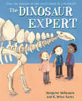
The Dinosaur Expert (Mr. Tiffin's Classroom Series)
by Margaret McNamaraJoin Mr. Tiffin and his students on a trip to a natural history museum and learn all about dinosaurs and the scientists who discovered them!Mr. Tiffin and his students are back in another picture book, and this time the focus is on dinosaur-loving Kimmy. During a field trip to the natural history museum, Kimmy is thrilled to share what she knows about the Stegosaurus and the Archaeopteryx and even the ginormous Titanosaurus. That changes when one of her classmates questions whether girls can be paleontologists. Kimmy starts to feel shy. What if they can't? What if no one wants to hear what she has to say? It will take some help from Mr. Tiffin--and from a famous scientist--for Kimmy to find her voice again.Join Mr. Tiffin's class as they learn about dinosaurs big and small, feathered and scaly, winged and ocean-dwelling. And root for Kimmy, the dinosaur expert . . . who might just learn something about herself.
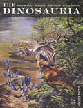
The Dinosauria
by Halszka Osmólska David B. Weishampel Peter DodsonWhen the The Dinosauria was first published more than a decade ago, it was hailed as "the best scholarly reference work available on dinosaurs" and "an historically unparalleled compendium of information." This second, fully revised edition continues in the same vein as the first but encompasses the recent spectacular discoveries that have continued to revolutionize the field. A state-of-the-science view of current world research, the volume includes comprehensive coverage of dinosaur systematics, reproduction, and life history strategies, biogeography, taphonomy, paleoecology, thermoregulation, and extinction. Its internationally renowned authors--forty-four specialists on the various members of the Dinosauria--contribute definitive descriptions and illustrations of these magnificent Mesozoic beasts. The first section of The Dinosauria begins with the origin of the great clade of these fascinating reptiles, followed by separate coverage of each major dinosaur taxon, including the Mesozoic radiation of birds. The second part of the volume navigates through broad areas of interest. Here we find comprehensive documentation of dinosaur distribution through time and space, discussion of the interface between geology and biology, and the paleoecological inferences that can be made through this link. This new edition will be the benchmark reference for everyone who needs authoritative information on dinosaurs.
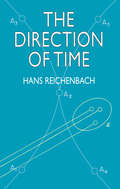
The Direction of Time
by Hans ReichenbachEver a source of philosophical conjecture and debate, the concept of time represents the beating heart of physics. This final work by the distinguished physicist Hans Reichenbach represents the culmination and integration of a lifetime's philosophical contributions and inquiries into the analysis of time. The result is an outstanding overview of such qualitative, or topological, attributes of time as order and direction.Beginning with a discussion of the emotive significance of time, Reichenbach turns to an examination of the time order of mechanics, the time direction of thermodynamics and microstatistics, the time direction of macrostatistics, and the time of quantum physics. He offers coherent explanations of the analytic methods of scientific philosophy in the investigation of probability, quantum mechanics, the theory of relativity, and causality — methods that he not only applies here but also helped to develop and refine.Physics Today observed that "For a generation Professor Reichenbach has worked as almost no other man to bring to the interpretation of modern physics the critical and reflective thinking of a trained philosopher. Most physicists who retain an interest in philosophy, and many who wanted simply to understand physics, have read some of the earlier books of Reichenbach. This one is . . . the best by a good deal." Introduction. Appendix. Index.
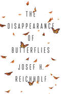
The Disappearance of Butterflies
by Josef H. ReichholfIn the last fifty years our butterfly populations have declined by more than eighty per cent and butterflies are now facing the very real prospect of extinction. It is hard to remember the time when fields and meadows were full of these beautiful, delicate creatures – today we rarely catch a glimpse of the Wild Cherry Sphinx moths, Duke of Burgundy or the even once common Small Tortoiseshell butterflies. The High Brown Fritillary butterfly and the Stout Dart Moth have virtually disappeared. The eminent entomologist and award-winning author Josef H. Reichholf began studying butterflies in the late 1950s. He brings a lifetime of scientific experience and expertise to bear on one of the great environmental catastrophes of our time. He takes us on a journey into the wonderful world of butterflies - from the small nymphs that emerge from lakes in air bubbles to the trusting purple emperors drunk on toad poison - and immerses us in a world that we are in danger of losing forever. Step by step he explains the science behind this impending ecological disaster, and shows how it is linked to pesticides, over-fertilization and the intensive farming practices of the agribusiness. His book is a passionate plea for biodiversity and the protection of butterflies.
The Disappearing Spoon: And Other True Tales of Madness, Love, and the History of the World from the Periodic Table of the Elements
by Sam KeanFrom New York Times bestselling author Sam Kean comes incredible stories of science, history, finance, mythology, the arts, medicine, and more, as told by the Periodic Table. Why did Gandhi hate iodine (I, 53)? How did radium (Ra, 88) nearly ruin Marie Curie's reputation? And why is gallium (Ga, 31) the go-to element for laboratory pranksters?*The Periodic Table is a crowning scientific achievement, but it's also a treasure trove of adventure, betrayal, and obsession. These fascinating tales follow every element on the table as they play out their parts in human history, and in the lives of the (frequently) mad scientists who discovered them. THE DISAPPEARING SPOON masterfully fuses science with the classic lore of invention, investigation, and discovery--from the Big Bang through the end of time. *Though solid at room temperature, gallium is a moldable metal that melts at 84 degrees Fahrenheit. A classic science prank is to mold gallium spoons, serve them with tea, and watch guests recoil as their utensils disappear.