- Table View
- List View
Gold Nanostars
by Giuseppe Chirico Mykola Borzenkov Piersandro PallaviciniThis Brief focuses on the synthesis, functionalization techniques, optical properties and biomedical application of gold nanostars (GNS). Various facilities of gold nanostars synthesis as well as functionalization of GNS with PEG, organic dyes, bioactive compounds are discussed. The authors discuss physical origin of the Localized Surface Plasmon Resonances and the way the nano-environment affects them. The implication of the LSPR of gold nanostars surface enhanced Raman scattering is also discussed. The emphasis has been done on the application of GNS for current and emerge needs of medicine, biology and pharmacy. Moreover, properties of gold nanostars as contrast agents for in vivo imaging and interaction of GNS with cells are also discussed in this Brief.
Gold Rush Stories: 49 Tales of Searchers, Scoundrels, Struggle and Serendipity
by Gary NoyThis volume explores the deeply human stories of the California Gold Rush generation, drawing out all the brutality, tragedy, humor, and prosperity as lived by those who experienced it. In less than ten years, more than 300,000 people made the journey to California, some from as far away as Chile and China. Many of them were dreamers seeking a better life, like Mifflin Wistar Gibbs, who eventually became the first African American judge, and Eliza Farnham, an early feminist who founded California's first association to advocate for women's civil rights. Still others were eccentrics—perhaps none more so than San Francisco's self-styled king, Norton I, Emperor of the United States. As Gold Rush Stories relates the social tumult of the world rushing in, so too does it unearth the environmental consequences of the influx, including the destructive flood of yellow ooze (known as “slickens”) produced by the widespread and relentless practice of hydraulic mining. In the hands of a native son of the Sierra, these stories and dozens more reveal the surprising and untold complexities of the Gold Rush.
Gold Rush! The Young Prospector's Guide to Striking It Rich
by James Klein Michael RohaniThis guide combines treasure hunting and historical facts in a fun, informative way. Explaining all young readers need to know to go prospecting in the United States and Canada, "Gold Rush!" provides an introduction to the wacky personalities and fascinating circumstances that led to some of the world's greatest gold--and other mineral--rushes.
Gold and its Complexes in Anticancer Chemotherapy
by Mohmmad Younus Wani Manzoor Ahmad MalikThis book presents an overview of cancer and the genesis, and development of different treatment strategies and modalities against cancer. The emergence of gold and its complexes as promising anticancer chemotherapeutic agents have the potential to substitute or replace the platinum based chemotherapeutic agents. Gold complexes have demonstrated considerable anti-proliferative properties, chiefly attributed to their anti-mitochondrial effects, they make gold complexes excellent candidates as anti-cancer agents compared to their platinum-based counterparts. This book provides a critical review of recent advances made in the development of gold complexes as anti-cancer agents. In this context, it examines a number of different ligand architectures, provides comprehensive information on gold complexes’ mechanism of action and toxicity issues and, in closing, outlines future research directions.
Gold in The Black Hills
by Watson Parker(back cover) Gold in the Black Hills brings to life the days "when adventure stood by a man's elbow, fortune lay at the tip of his shovel, and it was good to be alive." In this classic account of the Black Hills gold rush of 1874-1879, Watson Parker weaves a delightful and authoritative guide out of the chaotic and complex history of early settlement. Gold in the Black Hills is an essential resource for anyone who wants a unified picture of a thrilling episode in American history. A skillful storyteller, watson PARKER taught history at the University of Wisconsin at Oshkosh, where he was awarded a Rosebush Professorship for excellence in teaching, professional achievement, and public service. Retired since 1986, he again lives in the Black Hills where he grew up and continues to research the history of the region.
Gold!: The Story of the 1848 Gold Rush and How It Shaped a Nation
by Fred RosenA riveting true account of gold rush fever in mid-nineteenth-century America, rich with the thrilling exploits of daring fortune seekers and dangerous outlaws America was never the same after January 24, 1848. It was on that day that a carpenter named James Marshall discovered a tiny nugget of gold while building a sawmill at Sutter's Fort, just east of Sacramento, California. Marshall's find ignited a fever the nation had never known before, drawing people from all over the country to the West Coast with high hopes of getting rich quick. Over the next six years, three hundred thousand prospectors raced to the California gold fields to make their fortunes, leaving their lands and families behind in order to chase a dream of easy wealth, but all too often encountering a reality of lawlessness, disease, cruelty, and death. A former columnist for the New York Times, author Fred Rosen takes readers back to the seminal moment when the American dream exploded. Chock full of fascinating details, unforgettable characters, and shocking real-life events, the captivating true story of the California gold rush brings an era of unparalleled change to breathtaking life. Rosen's enthralling history of the gold rush of 1848 demonstrates how this golden ideal was supplanted by a culture of selfishness and greed that endures in America to this very day.
Gold-Catalyzed Cycloisomerization Reactions Through Activation of Alkynes
by Antoine SimonneauAntoine Simonneau's thesis highlights the development of new cycloisomerization reactions through the activation of alkynes with gold complexes. First Simonneau describes 1,6-enynes and their direct conversion into allenes through 1,5-hydride or ester migration processes. The author and his team used appropriate propargylic functional groups to achieve this conversion. This study shows that O-tethered 1,6-enynes carrying a strained cycloalkane at the propargylic position could undergo a cyclopropanation/ring expansion cascade reaction. The author employed this rearrangement as the starting point in the design of a new macro cycle synthesis. The next part of the thesis focuses on the cycloisomerization of diynes involving as the first step of the process the rearrangement of one alkyne partner into an allene thanks to a gold-catalyzed 1,3-shift of a propargylic ester. The thesis discloses a new cycloisomerization pattern featuring a 1,5-carbonyl transfer, giving rise to unprecedented cross-conjugated diketones. In the final part of the research, Simmoneau investigates the gold-catalyzed cycloisomerization mechanism of 1,6-enynes and questions the intermediacy of gold acetylides. By the means of NMR and mass spectrometry analysis, theoretical treatment and solution experiments, it was possible to rule out the involvement of these species in the catalytic cycle. This thesis has led to a number of publications in high-impact journals.
Gold: Science and Applications
by Christopher Corti Richard HollidayGold is used in a wide range of industrial and medical applications and accounts for over 10 percent of the annual demand for metal, worth billions of dollars annually. While much has been written about the mystique and trade of gold, very little has been written about the science and technology in which it is involved. Edited by two respected auth
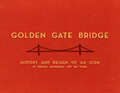
Golden Gate Bridge: History and Design of an Icon
by Ira Nadel Donald MacDonaldAn award-winning architect explores the history and engineering of a modern marvel with “easygoing prose [and] dozens of delightfully accessible sketches” (SFGate.com).Nine million people visit the Golden Gate Bridge each year, yet how many know why it’s painted that stunning shade of “international orange”? Or that ancient Mayan and Art Deco buildings influenced the design? Current bridge architect Donald MacDonald answers these questions and others in a friendly, informative look at the bridge’s engineering and seventy-year history.This accessible account is accompanied by seventy of MacDonald’s own charming color illustrations, making it easy to understand how the bridge was designed and constructed. A fascinating study for those interested in architecture, design, or anyone with a soft spot for San Francisco, Golden Gate Bridge is a fitting tribute to this timeless icon.
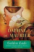
Golden Lads: Sir Francis Bacon, Anthony Bacon, and Their Friends
by Daphne Du Maurier"Daphne du Maurier has no equal." --Sunday TelegraphPrior to the publication of Golden Lads, Anthony Bacon was viewed as a footnote in the history of his younger brother, Francis. A fascinating historical figure in his own right, Anthony Bacon was a contemporary of the brilliant band of gallants who gathered around the court of Elizabeth I, was closely connected to the Earl of Essex, and worked in France as a spy for Sir Francis Walsingham. While living in France he became acquainted with Henri IV and the essayist Michel de Montaigne, and it was there that Daphne du Maurier discovered a secret that, if disclosed during Bacon's lifetime, could have put an end to his political career. Du Maurier did much to uncover the truth behind matters that had long puzzled Elizabethan historians, while telling a strange and fascinating tale.
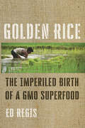
Golden Rice: The Imperiled Birth of a GMO Superfood
by Ed RegisThe first book to tell the shocking story of Golden Rice, a genetically modified grain that provides essential Vitamin A and can save lives in developing countries—if only they were allowed to grow it.Ordinary white rice is nutrient poor; it consists of carbohydrates and little else. About one million people who subsist on rice become blind or die each year from vitamin A deficiency. Golden Rice, which was developed in the hopes of combatting that problem by a team of European scientists in the late '90s, was genetically modified to provide an essential nutrient that white rice lacks: beta-carotene, which is converted into vitamin A in the body. But twenty years later, this potentially sight- and life-saving miracle food still has not reached the populations most in need—and tens of millions of people in India, China, Bangladesh, and throughout South and Southeast Asia have gone blind or have died waiting. Supporters claim that the twenty-year delay in Golden Rice's introduction is an unconscionable crime against humanity. Critics have countered that the rice is a "hoax," that it is "fool's gold" and "propaganda for the genetic engineering industry." Here, science writer Ed Regis argues that Golden Rice is the world's most controversial, maligned, and misunderstood GMO. Regis tells the story of how the development, growth, and distribution of Golden Rice was delayed and repeatedly derailed by a complex but outdated set of operational guidelines and regulations imposed by the governments and sabotaged by anti-GMO activists in the very nations where the rice is most needed. Writing in a conversational style, Regis separates hyperbole from facts, overturning the myths, distortions, and urban legends about this uniquely promising superfood. Anyone interested in GMOs, social justice, or world hunger will find Golden Rice a compelling, sad, and maddening true-life science tale.
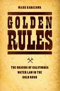
Golden Rules: The Origins of California Water Law in the Gold Rush
by Mark KanazawaFresh water has become scarce and will become even more so in the coming years, as continued population growth places ever greater demands on the supply of fresh water. At the same time, options for increasing that supply look to be ever more limited. No longer can we rely on technological solutions to meet growing demand. What we need is better management of the available water supply to ensure it goes further toward meeting basic human needs. But better management requires that we both understand the history underlying our current water regulation regime and think seriously about what changes to the law could be beneficial. For Golden Rules, Mark Kanazawa draws on previously untapped historical sources to trace the emergence of the current framework for resolving water-rights issues to California in the 1850s, when Gold Rush miners flooded the newly formed state. The need to circumscribe water use on private property in support of broader societal objectives brought to light a number of fundamental issues about how water rights ought to be defined and enforced through a system of laws. Many of these issues reverberate in today’s contentious debates about the relative merits of government and market regulation. By understanding how these laws developed across California’s mining camps and common-law courts, we can also gain a better sense of the challenges associated with adopting new property-rights regimes in the twenty-first century.
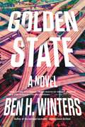
Golden State
by Ben WintersFrom award-winning, New York Times bestselling novelist Ben H. Winters comes a mind-bending novel set in a world governed by absolute truth, where lies are as dangerous as murder.In a strange alternate society that values law and truth above all else, Laszlo Ratesic is a nineteen-year veteran of the Speculative Service. He lives in the Golden State, a nation standing where California once did, a place where like-minded Americans retreated after the erosion of truth and the spread of lies made public life and governance impossible.In the Golden State, knowingly contradicting the truth is the greatest crime--and stopping those crimes is Laz's job. In its service, he is one of the few individuals permitted to harbor untruths, to "speculate" on what might have happened.But the Golden State is less a paradise than its name might suggest. To monitor, verify, and enforce the truth requires a veritable panopticon of surveillance and recording. And when those in control of the facts twist them for nefarious means, the Speculators are the only ones with the power to fight back.
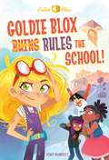
Goldie Blox Rules the School! (GoldieBlox)
by Stacy Mcanulty Lissy MarlinAn original chapter-book series featuring the characters from GoldieBlox!This all-new chapter-book series based on the successful toy line focuses on Goldie Blox’s mission to encourage girls to roll up their sleeves and get building! When Goldie Blox accidentally blows off the roof of her school, she and her friends Val, Ruby, and Li have to work together and use their creative know-how to rebuild the school. This 128-page early chapter book is a nonstop laugh-out-loud adventure and perfect for future engineers ages 6 to 9.From the Trade Paperback edition.
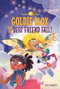
Goldie Blox and the Best Friend Fail! (GoldieBlox)
by Random House Stacy McAnultyCalling all Maker-kids! This STEM-based chapter book series stars engineering whiz Goldie Blox and her friends, the Gearheads!When Goldie Blox accidentally lets down her best friend, Ruby, she's determined to make it up to her by throwing her BFF the best birthday celebration ever. But will Goldie be able to pull off her wildly complicated party--or will it all end in disaster? This 128-page early chapter book is a nonstop laugh-out-loud adventure perfect for future engineers.
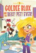
Goldie Blox and the Best! Pet! Ever! (GoldieBlox)
by Stacy Mcanulty Alan BatsonIn this exciting chapter book, Goldie Blox enters a pet talent show contest with the best dog ever—Nacho! When Goldie Blox enters her beloved dog Nacho in a pet talent show contest, she’s pretty sure he could win. But Nacho isn’t perfect. He doesn’t sit or shake. Instead, he farts and chases his tail. And the competition heats up when Goldie’s rival Zeek brags that he can beat Nacho with an expensive robot dog that obeys every command. Zeek thinks he can buy his way to the top, but Goldie is determined to prove him wrong. Goldie Blox’s mission is to encourage girls to roll up their sleeves and get building! This 128-page early chapter book is a nonstop laugh-out-loud adventure and perfect for future engineers ages 6 to 9.
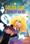
Goldie Blox and the Haunted Hacks! (A Stepping Stone Book(TM))
by Random House Stacy McAnultyA spooky original chapter book featuring the characters from GoldieBlox!The Problem: Of course Goldie Blox doesn't believe in ghosts. But in order to save the cool old Bloxtown Inn, she will have to prove that it's haunted.The Mission: Invent glow-in-the-dark goo and pulley-operated ghosts. Use them to haunt the inn. And--yikes!--be sure not to run into an actual ghost!This chapter-book series based on the successful toy line focuses on Goldie Blox's mission to encourage girls to roll up their sleeves and get building! This 128-page early chapter book is a nonstop laugh-out-loud adventure and perfect for future engineers ages 6 to 9.The Summer 2018 GoldieBlox list includes one chapter book.
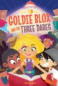
Goldie Blox and the Three Dares (GoldieBlox)
by Stacy Mcanulty Alan Batson Grace MillsAn original chapter-book series featuring the characters from GoldieBlox!This all-new chapter-book series based on the successful toy line focuses on Goldie Blox’s mission to encourage girls to roll up their sleeves and get building! When Goldie finds her beloved Gran’s book of 100 dares, she is determined to complete the last three challenges—before Gran’s 77th birthday. With the clock ticking, Goldie and her friends, the Gearheads, must use all their smarts and creativity to finish the dares and make Gran proud. This 128-page early chapter book is perfect for future engineers ages 6 to 9.From the Trade Paperback edition.
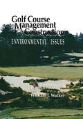
Golf Course Management & Construction: Environmental Issues
by James C. Balogh William J. WalkerGolf Course Management & Construction presents a comprehensive summary and assessment of technical and scientific research on the environmental effects of turfgrass system construction and maintenance. Although the book focuses on golf courses, it also discusses turfgrass systems for residential and commercial lawns, parks, and greenways. The book is an excellent introduction to the concepts of nonpoint source environmental impacts of turfgrass management for turfgrass scientists and specialists, landscape and golf course architects, turfgrass system and golf course developers, golf course superintendents, environmental scientists, and land-use regulators.
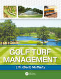
Golf Turf Management
by Lambert McCartyGolf Turf Management provides information on major agronomic and economic topics related to building and maintaining a viable golf course. The book features basic and applied information on available grasses including selection and use; applied turfgrass physiology; soils and soil amendments; environmental concerns; and comprehensive information on turfgrass physiology, plant nutrition, turf fertilizers, and water management. It discusses managing turf diseases, insects, and weeds; turf cultural practices; managing greens and tees as well as corporate course management strategies. Color photographs throughout illustrate concepts and topics including all major pest problems associated with golf courses and various agronomic practices necessary for successful and profitable course operation. The book suggests strategies to develop best management practices for golf courses including personnel and financial considerations when developing and implementing annual budgets, leasing versus buying equipment, and managing inventory. This book features sixteen chapters organized in a logical sequence conducive for teaching and practical use. Drawing on the author's more than thirty years of experience and research, the author brings together a wealth of information on how to optimize golf turf management and performance. Golf Turf Management is the only complete, up-to-date text dedicated to agronomic practices and personnel management practices necessary for fiscal success.
Golf and Wind: The Physics of Playing Golf in Wind
by Shantanu Malik Sandeep SahaThis book simulates the complete trajectories (flight and subsequent ground run) of golf shots using the aerodynamic and material properties of golf balls, and establish the significance of wind’s impact on gameplay. It also presents insight into how physical parameters like launch conditions (speed, angle and spin-rate) and wind conditions affect the trajectory of a golf ball. It discusses the specific effects of wind on the flight trajectory and explore the consequences of effect of wind direction; impact of golf club selection on the wind-induced deviation; strategies and their effectiveness to counter the diversion due to wind; and the sensitivity of the trajectory to aerodynamic characteristics of golf balls. Furthermore, the impact of wind on a player's strategy is elucidated with cases studies on the renowned holes of three golf courses: (i) Hole 17, TPC Sawgrass, (ii) Hole 8, Muirfield Golf Club, and (iii) Hole 18, Pebble beach Golf links. It presents an integrated mathematical model and quantitative data on ball trajectory accompanied by insights and illustrations for players, golf-course designers, ball manufacturers, scientific community, and golf enthusiasts. This book will be useful for researchers and professionals in the fields of aerodynamics engineering, sports science and physics. Additionally, this book will be a good read for golf players and coaches, golf-course designers, as well as golf-ball manufacturers.
Golf's Holy War: The Battle for the Soul of a Game in an Age of Science
by Brett CyrgalisJust as Michael Lewis&’s Moneyball captured baseball at a technological turning point, Brett Cyrgalis&’s Golf&’s Holy War takes us inside golf&’s clash between its beloved artistic tradition and its analytic future. The world of golf is at a crossroads. As technological innovations displace traditional philosophies, the golfing community has splintered into two deeply combative factions: the old-school teachers and players who believe in feel, artistry, and imagination, and the technical minded who want to remake the game around data. In Golf&’s Holy War, Brett Cyrgalis takes readers inside the heated battle playing out from weekend hackers to PGA Tour pros. At the Titleist Performance Institute in Oceanside, California, golfers clad in full-body sensors target weaknesses in their biomechanics, while others take part in mental exercises designed to test their brain&’s psychological resilience. Meanwhile, coaches like Michael Hebron purge golfers of all technical information, tapping into the power of intuitive physical learning by playing rudimentary games. From historic St. Andrews to manicured Augusta, experimental communes in California to corporatized conferences in Orlando, William James to Ben Hogan to theoretical physics, the factions of the spiritual and technical push to redefine the boundaries of the game. And yet what does it say that Tiger Woods has orchestrated one of the greatest comebacks in sports history without the aid of a formal coach? But Golf&’s Holy War is more than just a book about golf—it&’s a story about modern life and how we are torn between resisting and embracing the changes brought about by the advancements of science and technology. It&’s also an exploration of historical legacies, the enriching bonds of education, and the many interpretations of reality.
Gone Dark
by Amanda PanitchDry meets Hatchet in this thrilling tale of survival following a teen girl who must lead her friends across the country to the safety of her estranged father&’s survivalist compound after a mass power failure leaves the country in chaos.When seventeen-year-old Zara escaped her father&’s backwoods survivalist compound five years ago, she traded crossbows and skinning hides for electricity and video games…and tried to forget the tragedy that drove her away. Until a malware attack on the United States electrical grids cuts off the entire country&’s power. In the wake of the disaster and the chaos that ensues, Zara is forced to call upon skills she thought she&’d never use again—and her best bet to survive is to go back to the home she left behind. Drawing upon a resilience she didn&’t know she had, Zara leads a growing group of friends on an epic journey across a crumbling country back to her father&’s compound, where their only hope for salvation lies. But with every step she takes, Zara wonders if she truly has what it takes to face her father and the secrets of her past, or if she&’d be better off hiding in the dark.
Gone Tomorrow: The Hidden Life of Garbage
by Heather Rogers&“A galvanizing exposé&” of America&’s trash problem from plastic in the ocean to &“wasteful packaging, bogus recycling, and flawed landfills and incinerators&” (Booklist, starred review). Eat a take-out meal, buy a pair of shoes, or read a newspaper, and you&’re soon faced with a bewildering amount of garbage. The United States is the planet&’s number-one producer of trash. Each American throws out 4.5 pounds daily. But garbage is also a global problem. Today, the Pacific Ocean contains six times more plastic waste than zooplankton. How did we end up with this much rubbish, and where does it all go? Journalist and filmmaker Heather Rogers answers these questions by taking readers on a grisly and fascinating tour through the underworld of garbage. Gone Tomorrow excavates the history of rubbish handling from the nineteenth century to the present, pinpointing the roots of today&’s waste-addicted society. With a &“lively authorial voice,&” Rogers draws connections between modern industrial production, consumer culture, and our throwaway lifestyle (New York Press). She also investigates the politics of recycling and the export of trash to poor countries, while offering a potent argument for change. &“A clear-thinking and peppery writer, Rogers presents a galvanizing exposé of how we became the planet&’s trash monsters. . . . [Gone Tomorrow] details everything that is wrong with today&’s wasteful packaging, bogus recycling, and flawed landfills and incinerators. . . . Rogers exhibits black-belt precision.&” —Booklist, starred review
Good Clinical Practices in Pharmaceuticals (Drugs and the Pharmaceutical Sciences)
by Graham P. BunnGood clinical practice (GCP) is a set of internationally recognized ethical and scientific quality requirements that must be followed when designing, conducting, recording, and reporting trials that involve the participation of human subjects. Compliance with GCP assures patients and the public that the rights, safety, and wellbeing of people taking part in studies are protected and that research data is reliable. Presents details on GCP, the international ethical, scientific, and practical standard to which all clinical research is conducted. Provides the most up‑to‑date and best practices, techniques, and methodologies in good clinical practice. Discusses applicable laws and regulations supporting GCP compliance, quality and operations. Describes who is responsible for implementing and maintaining quality assurance and quality control systems to ensure that studies are conducted and data are generated, documented, and reported in compliance with the protocol.