- Table View
- List View
Green Engineering: Innovation, Entrepreneurship and Design
by Riadh HabashThis is a primary text project that combines sustainability development with engineering entrepreneurship and design to present a transdisciplinary approach to modern engineering education. The book is distinguished by extensive descriptions of concepts in sustainability, its principles, and its relevance to environment, economy, and society. It can be read by all engineers regardless of their disciplines as well as by engineering students as they would be future designers of products and systems. This book presents a flexible organization of knowledge in various fields, which allows to be used as a text in a number of courses including for example, engineering entrepreneurship and design, engineering innovation and leadership, and sustainability in engineering design
Green Entrepreneur Handbook: The Guide to Building and Growing a Green and Clean Business (What Every Engineer Should Know Ser.)
by Eric KoesterWritten by a practicing business attorney with startup experience in the environmental and technology sectors, this comprehensive handbook assists entrepreneurs in tackling the wide variety of opportunities to go green. A one-stop resource for entrepreneurs, it helps readers incorporate clean technology, environmental practices, and green business approaches into the work environment. The book discusses how to sell to utilities, explores fundraising outlets for green businesses, covers government incentives, presents key startup tools aimed at green businesses, and addresses challenges of many new businesses, such as raising money and making sales. Additional resources are available on the book's website.
Green Extraction and Valorization of By-Products from Food Processing
by Francisco J. Barba Elena Rosello Soto Mladen Brncic Jose Manuel RodriquezGenerating of agricultural wastes and by-products during the production, processing and consumption of agricultural commodities is unavoidable and over the last decades, an increased public interest has been shown in the challenge of food wastage. Apart from its significant quantities, the physicochemical characteristics of the various agricultural waste and by-products denote that there is immense potential for their reuse, recycle, and valorisation through various different processes. Green Extraction and Valorization of By-Products from Food Processing provides an overview about the valorization or reuse of agricultural wastes and by-products during the production, processing and consumption of agricultural commodities. Waste disposal and by-product management in food processing industry pose problems in the areas of environmental protection and sustainability. However, they could be a great source of valuable nutraceuticals, which can be used to deal with the prospects of feeding fast growing population in 21st century. Features: Gives detailed guidance and presents case-studies about valorization of food wastes and by-products Shows the main conventional and innovative extraction techniques for food waste and by-products valorization Provides an estimated idea regarding the recovery of high-added value compounds Discusses the recovery of high-added value compounds Perspectives originated from the enormous amounts of food related materials that are discharged worldwide and the existing technologies, which promise the recovery, recycling and sustainability of high-added value ingredients inside food chain will be discussed in this book. This book is of value to academics, research institutes, and food industry engineers particularly the research and development professionals who are looking for effective management and utilization of food processing wastes and byproducts. In addition, it is suitable for undergraduate, post- graduate students, research scholars, postdoctoral fellows and faculty members from universities and colleges who pursue academic careers in Food Technology, Food Biotechnology, Fermentation and Bioengineering, Bioprocess Technology, Food science and Technology.
Green Extraction in Separation Technology
by Ali Haghighi Asl Maryam KhajenooriSubcritical water is a green extraction solvent compared to conventional extraction solvents. While experimental results on subcritical water extraction (SWE) technology have been published piecemeal, there has been no comprehensive review of the state of the art. Green Extraction in Separation Technology fills that gap, serving to cover extracting with subcritical water as an environmentally friendly solvent. FEATURES Presents new technologies for extracting natural compounds from plants and compares the advantages and disadvantages versus SWE Explains research on SWE over the last 15 years Offers an overview of the solubility of different compounds in SWE and related theoretical content Discusses modeling of SWE and describes the development of a new model for this process This monograph is aimed at researchers and advanced students in chemical and biochemical engineering.
Green Fashion: Volume 2 (Environmental Footprints And Eco-design Of Products And Processes)
by Subramanian Senthilkannan Muthu Miguel Angel GardettiThis book details the crux of green fashion, addressing various environmental aspects and discussing the importance of sustainable fashion in the apparel industry. It addresses various important topics such as Relationship marketing in green fashion, Animal Ethics and Welfare in the Fashion and Lifestyle Industries, Green Flame retardants, etc.
Green Fields Forever: The Conservation Tillage Revolution In America
by Charles E. LittleGreen Fields Foreverchanges the way Americans think about agriculture. It is the story of 'conservation tillage'--a new way to grow food for the first time that works with, rather than against, the soil. Farmers who are revolutionizing the course of American agriculture explain how conservation tillage works.
Green Flotation Depressants
by Saeed Chehreh Chelgani Ali Asimi Neisiani Darius Wonyen Amir Hossein Mohammad Zadeh Roozbeh SaneieThis book presents biodegradable depressants, delving deep into their performance, intricate structures, and adsorption mechanisms. The book presents diverse minerals and materials where these depressants have been used for their upgrading. Encompassing the entirety of current research, it is an indispensable read for both industry professionals and researchers in the field, especially on courses centered around froth flotation and recycling. From the starch-based solutions in Chapter 1 to the diverse array of gums explored in Chapters 7 to 10, and the intriguing polyaspartate and tripolyphosphate in Chapters 11 and 12 respectively, each section unfolds a rich tapestry of knowledge, providing a holistic understanding of biodegradable depressants and their pivotal role in mineral processing.
Green From the Ground Up: Sustainable, Healthy, And Energy-Efficient Home Construction (Builder's Guide Ser.)
by David Johnston Scott GibsonMy passion for green building is based on experience. I know that building green results in better houses and that it improves the lives of the people who live in them, not to mention the health of our planet.
Green Fuels Technology
by Satinder Kaur Brar Carlos Ricardo Soccol Craig Faulds Luiz Pereira RamosThis book presents key recent developments in biofuel policy, products, processes, patents and innovative technologies. It presents several case studies, which maximize reader insights into how innovative green energy technologies can be implemented on an industrial scale, with illustrations, photos and new approaches. It also analyzes in detail several different technological aspects of the research into and production of green fuels from the first, second and third generation, such as, bioethanol, biogas, biohydrogen, biobutanol, biofuels from pyrolysis, and discusses their economic and environmental impacts. A new source of information for engineers, technicians and students involved in production and research in the biofuels sector, this book also provides a valuable resource for industry, covering the current and future status of biofuels.
Green Gold: Contested Meanings and Socio-Environmental Change in Argentine Yerba Mate Cultivation (SpringerBriefs in Latin American Studies)
by Adam S. DohrenwendThis book applies an approach to study the externalization of cost under capitalism in the production of Argentine yerba mate, an infusion with stimulant properties long used by indigenous peoples. Consumption in today’s globalized economy makes it difficult to understand the consequences of our actions across the globe. A political-ecological lens, informed by the work of Robert Sack and Ian Cook, can help guide an analysis that geographically reconstructs supply chains and reveal the realities of consumption. The use of yerba mate has become a cornerstone of Argentine society and identity, and yerba mate processors are working to expand exports globally. In Argentina’s Misiones Province, the heart of yerba mate production, the true costs of production are borne by the children, the impoverished laborers, and the environment of Argentina’s Atlantic Rainforest. These consequences of modernity, along with the efforts of an NGO to remedy them, are presented and assessed.
Green Growth, Green Profit
by Roland BergerGreen business is here. It is a multi billion business with enormous growth potential, driven by megatrends such as demographic change, climate change and urbanization. It is driving the transformation of existing businesses and changing the way customers and suppliers act, forcing them to rethink their business strategy.
Green H2 Transport through LH2, NH3 and LOHC: Opportunities and Challenges (SpringerBriefs in Applied Sciences and Technology)
by Laura A. Pellegrini Elvira Spatolisano Federica Restelli Giorgia De Guido Alberto R. de Angelis Andrea LainatiThis book explores the opportunities and challenges of hydrogen transport through different carriers (i.e., liquefied hydrogen, ammonia, toluene, and dibenzyltoluene). Each value chain analyzed includes: renewable H2 conversion to the carrier, storage of the hydrogenated carrier, its seaborne transport, reconversion of the carrier to produce H2 and hydrogen distribution. The conversion and reconversion processes are the cost drivers of the whole value chain. These stages are investigated through an in-depth techno-economic assessment, to highlight the critical issues and the need for further investigation (low TRL). The alternatives are examined considering: different H2 applications (industrial and mobility sector); different costs of utilities (present and future scenarios); and different distances from the loading to the unloading terminal. All these scenarios are discussed and compared by means of the levelized cost method, to understand which is the most cost-effective choice for each case study. As a result, H2 application to the industrial sector shows the lowest costs, with ammonia being the best alternative for transporting and storing hydrogen in this case. Liquefied hydrogen is the most expensive H2 carrier for the industrial application, as a consequence of the high liquefaction costs while holding promises for the mobility sector.
Green Heterogeneous Wireless Networks
by Muhammad Ismail Muhammad Zeeshan Shakir Khalid A. Qaraqe Erchin SerpedinThis book focuses on the emerging research topic "green (energy efficient) wireless networks" which has drawn huge attention recently from both academia and industry. This topic is highly motivated due to important environmental, financial, and quality-of-experience (QoE) considerations. Specifically, the high energy consumption of the wireless networks manifests in approximately 2% of all CO2 emissions worldwide. This book presents the authors' visions and solutions for deployment of energy efficient (green) heterogeneous wireless communication networks. The book consists of three major parts. The first part provides an introduction to the "green networks" concept, the second part targets the green multi-homing resource allocation problem, and the third chapter presents a novel deployment of device-to-device (D2D) communications and its successful integration in Heterogeneous Networks (HetNets). The book is novel in that it specifically targets green networking in a heterogeneous wireless medium, which represents the current and future wireless communication medium faced by the existing and next generation communication networks. The book focuses on multi-homing resource allocation, exploiting network cooperation, and integrating different and new network technologies (radio frequency and VLC), expanding the network coverage and integrating new device centric communication paradigms such as D2D Communications. Whilst the book discusses a significant research topic supported with advanced mathematical analysis, the resulting algorithms and solutions are explained and summarized in a way that is easy to follow and grasp. This book is suitable for networking and telecommunications engineers, researchers in industry and academia, as well as students and instructors.
Green High-Performance Concrete with Manufactured Sand
by Zhengwu JiangThis book presents the features of manufactured sand (MS) and its application in concrete as the fine aggregate. It first introduces the production and technical properties of manufactured sand and demonstrates the properties of concrete, followed by the mix proportioning of concrete with manufactured sand. It also focuses on the applications of manufactured sand in several practical engineering projects using self-compacting concrete (SCC), rubble-filled SCC, and high-performance concrete with manufactured sand for special purposes. This book is useful and attractive to a wide readership in the field of materials science, civil engineering, and related fields.
Green Hybrid Composite in Engineering and Non-Engineering Applications (Composites Science and Technology)
by Mohammad Jawaid Tabrej KhanThis book introduces the different advanced hybrid composite materials used in aerospace, automotive, marine, and general engineering infrastructures. It represents the current development processes and applications in aircraft, automobile, and marine structures. This book also contains test cases and their validation using a finite element approach using computer tools. The book also deals with the design approach for innovative hybrid composite materials focused on diverse engineering and non-engineering applications. A detailed review of the state-of-the-art composite materials study presented here would be of interest to scientists, academics, students, and engineers and professionals in general working in the field of advanced composite materials and structures. This book is also useful for Ph.D. research scholars to improve their fundamental understanding of advanced materials and is also suitable for master’s and undergraduate courses on composite materials.
Green Hydrogen Production by Water Electrolysis
by Min Yang Junbo HouThe world’s largest economies have set clear development plans for hydrogen energy. From an Economy, Energy, and Environment (3E) point of view, hydrogen energy can be considered an ideal technology for enabling the energy transition from fossil fuels, restructuring energy systems, securing national energy sources, accelerating carbon neutralization, and driving the development of technologies and industry.Green hydrogen production by water electrolysis is the key for hydrogen energy, and this book offers urgently needed guidance on the most important scientific fundamentals and practical applied technologies in this field.This book:• Details materials, electrochemistry, and mechanics.• Covers ALK, PEM, AEM, and SOEC water electrolysis, including fundamentals and applications.• Addresses trends, opportunities, and challenges.This comprehensive reference is aimed at engineers and scientists working on renewable and alternative energy to meet global energy demands and climate action goals.The Open Access version of this book, available at http://www.taylorfrancis.com, has been made available under a Creative Commons Attribution-Non Commercial-No Derivatives (CC-BY-NC-ND) 4.0 license.
Green Hydrogen in Power Systems (Green Energy and Technology)
by Behnam Mohammadi-Ivatloo Vahid Vahidinasab Jeng Shiun LimGreen Hydrogen in Power Systems examines state-of-the-art applications and the latest developments in technology, protocols, implementation, and application of green hydrogen in power and energy systems. The first book to comprehensively analyze the opportunities and challenges in this field, it brings together global experts from different disciplines to provide a comprehensive study of the role of green hydrogen in power systems of the future and its important role in energy evolution and decarbonization efforts around the world. The book is a multidisciplinary reference for researchers and industry stakeholders who have focused on the field of hydrogen integration into the power and energy systems, as well as researchers and developers from different branches of engineering, energy, computer sciences, data, economic, and operation research fields.
Green ICT & Energy: From Smart to Wise Strategies
by Anwar Osseyran Martijn Warnier Jaco H. AppelmanThis book provides the connection between the growing body of literature on sustainability and the topics of energy and ICT. It aims to show how stakeholders active in this area need to play their part ensuring that the ICT-sector evolves towards a sector that can lead throughgreening by IT and also shows that it cangreen its own IT as well.
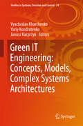
Green IT Engineering: Concepts, Models, Complex Systems Architectures
by Janusz Kacprzyk Vyacheslav Kharchenko Yuriy KondratenkoThis volume provides a comprehensive state of the art overview of a series of advanced trends and concepts that have recently been proposed in the area of green information technologies engineering as well as of design and development methodologies for models and complex systems architectures and their intelligent components. The contributions included in the volume have their roots in the authors presentations, and vivid discussions that have followed the presentations, at a series of workshop and seminars held within the international TEMPUS-project GreenCo project in United Kingdom, Italy, Portugal, Sweden and the Ukraine, during 2013-2015 and at the 1st - 5th Workshops on Green and Safe Computing (GreenSCom) held in Russia, Slovakia and the Ukraine. The book presents a systematic exposition of research on principles, models, components and complex systems and a description of industry- and society-oriented aspects of the green IT engineering. A chapter-oriented structure has been adopted for this book following a vertical view of the green IT, from hardware (CPU and FPGA) and software components to complex industrial systems. The 15 chapters of the book are grouped into five sections: (1) Methodology and Principles of Green IT Engineering for Complex Systems, (2) Green Components and Programmable Systems, (3) Green Internet Computing, Cloud and Communication Systems, (4) Modeling and Assessment of Green Computer Systems and Infrastructures, and (5) Gree "
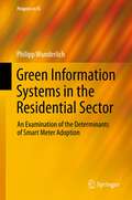
Green Information Systems in the Residential Sector
by Philipp WunderlichGiven rising electricity consumption, coupled with finite resources, and a growing awareness surrounding sustainable energy, ICT-enabled electrical networks such as smart grids are increasingly being deployed by energy companies. One aspect of smart grids is smart meter technology (SMT), which are sophisticated digital electrical meters, having the potential to increase energy efficiency in both residential and industrial sectors. However, a challenge to SMT-implementation in residential settings has been its successful adoption by consumers. As many cases in the US, and other parts of the world highlight, such implementation projects have run into resistance from the consumers. Despite these challenges, little research has been conducted on this topic. This study is one of the first that attempts to fill that void by empirically examining the antecedents of SMT adoption amongst potential customers and a group of SMT users. Specifically, this study developed a model surrounding consumers' intention to adopt and use SMT, by drawing on theories of adoption and motivational psychology and also by including a set of context-specific variables.
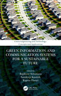
Green Information and Communication Systems for a Sustainable Future (Green Engineering and Technology)
by Rajshree Srivastava, Sandeep Kautish and Rajeev TiwariGreen Information and Communication Systems for a Sustainable Future covers the fundamental concepts, applications, algorithms, protocols, new trends, challenges, and research results in the area of Green Information and Communication Systems. This book provides the reader with up-to-date information on core and specialized issues, making it highly suitable for both the novice and the experienced researcher in the field. The book covers theoretical and practical perspectives on network design. It includes how green ICT initiatives and applications can play a major role in reducing CO2 emissions, and focuses on industry and how it can promote awareness and implementation of Green ICT. The book discusses scholarship and research in green and sustainable IT for business and organizations and uses the power of IT to usher sustainability into other parts of an organization. Business and management educators, management researchers, doctoral scholars, university teaching personnel and policy makers as well as members of higher academic research organizations will all discover this book to be an indispensable guide to Green Information and Communication Systems. It will also serve as a key resource for Industrial and Management training organizations all over the world.
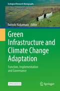
Green Infrastructure and Climate Change Adaptation: Function, Implementation and Governance (Ecological Research Monographs)
by Futoshi NakamuraThis open access book introduces the function, implementation and governance of green infrastructure in Japan and other countries where lands are geologically fragile and climatologically susceptible to climate change. It proposes green infrastructure as an adaptation strategy for climate change and biodiversity conservation.In the face of climate change, dams, levees and floodways built as disaster prevention facilities do not sufficiently function against extraordinary events such as mega-floods and tsunami disasters. To prevent those disasters and loss of biodiversity in various ecosystems, we should shift from conventional hard measures to more adaptive strategies using various functions that natural and semi-natural ecosystems provide. Green infrastructure is an interconnected network of waterways, wetlands, woodlands, wildlife habitats and other natural areas that support native species, maintain natural ecological processes, sustain air and water resources and contribute to the health and quality of life for communities and people. Green infrastructure has mainly been discussed from adaptation strategy perspectives in cities and urban areas. However, to protect cities, which are generally situated at downstream lower elevations, we explore the preservation and restoration of forests at headwater basins and wetlands along rivers from a catchment perspective. In addition, the quantitative examination of flood risk, biodiversity, and social-economic benefits described in this book brings new perspectives to the discussion.The aim of this book is to accelerate the transformative changes from gray-based adaptation strategies to green- or hybrid-based strategies to adapt to climate change. The book provides essential information on the structure, function, and maintenance of green infrastructure for scientists, university students, government officers, and practitioners.
Green Infrastructure: Incorporating Plants and Enhancing Biodiversity in Buildings and Urban Environments (Routledge Studies in Urban Ecology)
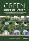
by John W. DoverWith more than half of the world's population now living in urban areas, it is vitally important that towns and cities are healthy places to live. The principal aim of this book is to synthesize the disparate literature on the use of vegetation in the built environment and its multifunctional benefits to humans. The author reviews issues such as: contact with wildlife and its immediate and long-term effects on psychological and physical wellbeing; the role of vegetation in removing health-damaging pollutants from the air; green roofs and green walls, which provide insulation, reduce energy use and decrease the carbon footprint of buildings; and structural vegetation such as street trees, providing shading and air circulation whilst also helping to stop flash-floods through surface drainage. Examples are used throughout to illustrate the practical use of vegetation to improve the urban environment and deliver ecosystem services. Whilst the underlying theme is the value of biodiversity, the emphasis is less on existing high-value green spaces (such as nature reserves, parks and gardens), than on the sealed surfaces of urban areas (building surfaces, roads, car parks, plazas, etc.). The book shows how these, and the spaces they encapsulate, can be modified to meet current and future environmental challenges including climate change. The value of existing green space is also covered to provide a comprehensive textbook of international relevance.
Green Infrastructure: Materials and Applications
by Rohana Hassan Nor Hayati Abdul Hamid Ahmad Kamil Arshad Anizahyati Alisibramulisi Muhd Norhasri Muhd Sidek Norshariza Mohamad Bhkari Ekarizan ShaffieThis book presents the meaning of green infrastructure and its concerns to the contribution of materials and applications. It explores the evolving contested material under “green infrastructure” covering timber, concrete, soil, and pavement. It discusses the resistance to the ambiguity of managing the construction of green infrastructure and drawing on wider debates around applications and processes on construction. These contributions are by no means definitive, but rather an attempt to provide a detached and holistic perspective on the engineering “green infrastructure” concept.
Green Infrastructure: Materials and Sustainable Management
by Rohana Hassan Nor Hayati Abdul Hamid Ahmad Kamil Arshad Anizahyati Alisibramulisi Muhd Norhasri Muhd Sidek Norshariza Mohamad Bhkari Ekarizan Shaffie Ummu Raihanah HashimThis second volume of "Green Infrastructure" provides a comprehensive exploration of both established and evolving green infrastructure materials, along with sustainable practices across various facets that hold the potential to shape our future. Emphasizing emerging domain materials such as timber, concrete, soil, and pavement, among others, this book delves into the pivotal role these elements play in fostering sustainable urban development. It underscores the significance of these materials in preserving ecosystem services and constructive management, thus leading to the attainment of manifold advantages. Bridging a critical void in the existing literature, this volume serves as an indispensable resource, serving to guide forthcoming research endeavors concerning green materials and their applications within the realm of sustainability.
