- Table View
- List View
Satellite Image Analysis: Clustering and Classification (SpringerBriefs in Applied Sciences and Technology)
by Surekha Borra Rohit Thanki Nilanjan DeyThanks to recent advances in sensors, communication and satellite technology, data storage, processing and networking capabilities, satellite image acquisition and mining are now on the rise. In turn, satellite images play a vital role in providing essential geographical information. Highly accurate automatic classification and decision support systems can facilitate the efforts of data analysts, reduce human error, and allow the rapid and rigorous analysis of land use and land cover information. Integrating Machine Learning (ML) technology with the human visual psychometric can help meet geologists’ demands for more efficient and higher-quality classification in real time. This book introduces readers to key concepts, methods and models for satellite image analysis; highlights state-of-the-art classification and clustering techniques; discusses recent developments and remaining challenges; and addresses various applications, making it a valuable asset for engineers, data analysts and researchers in the fields of geographic information systems and remote sensing engineering.
Satellite Monitoring of Inland and Coastal Water Quality: Retrospection, Introspection, Future Directions
by Robert P. BukataSatellite Monitoring of Inland and Coastal Water Quality: Retrospection, Introspection, Future Directions reviews how aquatic optics models can convert remote determinations of water color into accurate assessments of water quality. This book illustrates how this conversion can generate products of value for the environmental monitoring of opticall
Satellite Navigation Systems and Technologies (Space Science and Technologies)
by Jun Xie Haihong Wang Peng Li Yansong MengBased on the design theory and development experience of Beidou navigation satellite system (BDS), this book highlights the space segment and the related satellite technologies as well as satellite-ground integration design from the perspective of engineering. The satellite navigation technology in this book is divided into uplink and reception technology, broadcasting link technology, inter-satellite link technology, time-frequency system technology, navigation signal generation and assessment technology, navigation information management technology, autonomous operation technology of navigation satellite. In closing, the book introduces readers to the technological development status and trend of BDS and other GNSS, and propose the technologies of future development.Unlike most current books on this topic, which largely concentrate on principles, receiver design or applications, the book also features substantial information on the role of satellite system in the GNSS and the process of signal information flow, and each chapter not only studies on the theoretical function and main technologies, but also focuses on engineering development. Accordingly, readers will gain not only a better understanding of navigation satellite systems as a whole, but also of their main components and key technologies.
Satellite Network Robust QoS-aware Routing
by Fei LongSatellite Network Robust QoS-aware Routing presents a novel routing strategy for satellite networks. This strategy is useful for the design of multi-layered satellite networks as it can greatly reduce the number of time slots in one system cycle. The traffic prediction and engineering approaches make the system robust so that the traffic spikes can be handled effectively. The multi-QoS optimization routing algorithm can satisfy various potential user requirements. Clear and sufficient illustrations are also presented in the book. As the chapters cover the above topics independently, readers from different research backgrounds in constellation design, multi-QoS routing, and traffic engineering can benefit from the book. Fei Long is a senior engineer at Beijing R&D Center of 54th Research Institute of China Electronics Technology Group Corporation.
Satellite Photoelectric Sensing Technology: Communication, Navigation and Reconnaissance
by Jianjun Zhang Jing LiThis book helps to solve the problems and challenges of satellite sensing in the current environment of increasing communications bandwidths and multiplicity of electromagnetic signals. It presents technology that makes full use of the broadband low-loss advantages of optoelectronic technology and research into new broadband radio-frequency channelization and receiving technology based on photoelectric sensing. The methods presented allow improvements in system performance in terms of receiving bandwidth, frequency-sensing accuracy, channel equalization, adjacent channel crosstalk, dynamic range, and complexity of the system structure. In addressing the difficulty of satellite spectrum control, including the issue of high-precision and real-time wide-spectrum sensing not being able to be obtained simultaneously, the book solves the problem of accurate and parallel-decomposition sensing technology using the dual-phase optical frequency comb. This method avoids the involvement of fine filtering and does not require fine alignment between the source and the filter but achieves high perceptual accuracy. Satellite Photoelectric Sensing Technology explores the research background, significance, and current challenges associated with the technology, making it relevant and interesting to academics, practitioners, and postgraduate students in this field.
Satellite Precipitation Measurement: Volume 2 (Advances in Global Change Research #69)
by Vincenzo Levizzani Christopher Kidd Dalia B. Kirschbaum Christian D. Kummerow Kenji Nakamura F. Joseph TurkThis book offers a complete overview of the measurement of precipitation from space, which has made considerable advancements during the last two decades. This is mainly due to the Tropical Rainfall Measuring Mission (TRMM), the Global Precipitation Measurement (GPM) mission, CloudSat and a carefully maintained constellation of satellites hosting passive microwave sensors. The book revisits a previous book, Measuring Precipitation from Space, edited by V. Levizzani, P. Bauer and F. J. Turk, published with Springer in 2007. The current content has been completely renewed to incorporate the advancements of science and technology in the field since then. This book provides unique contributions from field experts and from the International Precipitation Working Group (IPWG).The book will be of interest to meteorologists, hydrologists, climatologists, water management authorities, students at various levels and many other parties interested in making use of satellite precipitation data sets.
Satellite Precipitation Measurement: Volume 1 (Advances in Global Change Research #67)
by Vincenzo Levizzani Christopher Kidd Dalia B. Kirschbaum Christian D. Kummerow Kenji Nakamura F. Joseph TurkThis book offers a complete overview of the measurement of precipitation from space, which has made considerable advancements during the last two decades. This is mainly due to the Tropical Rainfall Measuring Mission (TRMM), the Global Precipitation Measurement (GPM) mission, CloudSat and a carefully maintained constellation of satellites hosting passive microwave sensors. The book revisits a previous book, Measuring Precipitation from Space, edited by V. Levizzani, P. Bauer and F. J. Turk, published with Springer in 2007. The current content has been completely renewed to incorporate the advancements of science and technology in the field since then. This book provides unique contributions from field experts and from the International Precipitation Working Group (IPWG). The book will be of interest to meteorologists, hydrologists, climatologists, water management authorities, students at various levels and many other parties interested in making use of satellite precipitation data sets.
Satellite Radiothermovision of Atmospheric Processes: Method and Applications (Springer Praxis Books)
by Dmitry M. ErmakovThis book summarizes the author’s research resulted in developing the satellite radiothermovision approach which allows retrieving dynamical and energy characteristics of atmospheric mesoscale and synoptic-scale processes based on a close scheme of satellite passive radiometry data processing. The book introduces new applications of the satellite passive microwave observations to detailed systematic study of tropical cyclones’ evolution, climatology and characteristics of atmospheric river, parameters of global atmospheric circulation and their variations on climatically significant scales. The results presented in the book demonstrate a clear relation between the convergence/divergence of latent heat from the lower atmosphere to the center of tropical cyclone with variations of its intensity and provide a better insight into the tropical cyclone dynamical energy balance based on remote data.
Satellite Rainfall Applications for Surface Hydrology
by Faisal Hossain Mekonnen GebremichaelWhile there are a growing number of high-resolution space-based systems for measuring precipitation, instances of the use of these products for surface hydrology are rare. This book, which covers both scientific and practical matters, aims to change that. With contributions from a panel of researchers from a wide range of fields, the chapters focus on evaluating the potential, utility and application of high resolution satellite precipitation products in relation to surface hydrology. Focusing on the way the algorithms for the precipitation products evolved, the accuracy assessment of those products in different regions of the world, and the application of the precipitation products to various decision support systems, the book is at the interface between satellite rainfall and surface hydrologic applications. It dwells on issues that are of concern at hydrologic scales of application. In doing so, it provides very useful information to practitioners, researchers and graduate students who need to explore the latest on satellite precipitation products for various hydrological purposes. Crucially, the book provides examples of real-world applications of satellite rainfall products in operational hydrology and real-time decision-making. This enables readers to understand the potential of satellite rainfall products for practical applications ranging from agricultural/crop monitoring to flood and landslide detection in developing countries.
Satellite Remote Sensing
by Nicola Masini Rosa LasaponaraThis book provides a state-of-the art overview of satellite archaeology and it is an invaluable volume for archaeologists, scientists, and managers interested in using satellite Earth Observation (EO) to improve the traditional approach for archaeological investigation, protection and management of Cultural Heritage. The recent increasing development of EO techniques and the tremendous advances in Information and Communication Technologies (ICT) have resulted primarily in Cultural Heritage applications. The book focuses on new challenging prospects for the use of EO in archaeology not only for probing the subsurface to unveil sites and artifacts, but also for the management and valorization as well as for the monitoring and preservation of cultural resources. The book provides a first-class understanding of this revolutionary scenario which was unthinkable several years ago. The book offers: (i) an excellent collection of outstanding articles focusing on satellite data processing, analysis and interpretation for archaeological applications, (ii) impressive case studies, (iii) striking examples of the high potential of the integration of multi-temporal, multi-scale, multi-sensors techniques. Each chapter is composed as an authoritative contribution to help the reader grasp the value of its content. The authors are renowned experts from the international scientific community. Audience: This book will be of interest to scientists in remote sensing applied to archeology, geoarcheology, paleo-environment, paleo-climate and cultural heritage.
Satellite Remote Sensing in Hydrological Data Assimilation
by Mehdi KhakiThis book presents the fundamentals of data assimilation and reviews the application of satellite remote sensing in hydrological data assimilation. Although hydrological models are valuable tools to monitor and understand global and regional water cycles, they are subject to various sources of errors. Satellite remote sensing data provides a great opportunity to improve the performance of models through data assimilation.
Satellite Remote Sensing of Natural Resources (Mapping Science Ser. #4)
by David L. VerbylaSatellite Remote Sensing of Natural Resources offers an introduction to digital remote sensing. This comprehensive text emphasizes the basics, with simple concepts presented in clear, easy-to-understand language. For those who are interested in practical remote sensing but do not have an extensive background in math and statistics, this primer is invaluable. The main topics covered include satellite images, image processing systems, spectral regions, radiometric and geometric corrections, supervised and unsupervised classification, and accuracy assessment. Each chapter concludes with a section of sample problems and list of additional readings.
Satellite Remote Sensing Technologies (Space Science and Technologies)
by Jindong LiThis book provides in-depth explanations of design theories and methods for remote sensing satellites, as well as their practical applications. There have been significant advances in spacecraft remote sensing technologies over the past decade. As the latest edition of the book “Space Science and Technology Research,” it draws on the authors’ vast engineering experience in system design for remote sensing satellites and offers a valuable guide for all researchers, engineers and students who are interested in this area. Chiefly focusing on mission requirements analyses and system design, it also highlights a range of system design methods.
Satellite Systems Engineering in an IPv6 Environment
by Daniel MinoliCapitalize on Expert Foresight into the Future of Satellite Communication Satellite technology will maintain its key role in the evolving communications needs of government, military, IPTV, and mobile video industries because of its intrinsic multicast/broadcast capabilities, mobility aspects, global reach, reliability, and ability to quickly suppo
Satellitenfrequenzkoordinierung
by Hans Dodel René WörfelFunksysteme bilden zunehmend die Grundlage von Kommunikation, privat ebenso wie in Industrie und Wirtschaft. Von WLAN bis zur Satellitenkommunikation müssen die Kommunikations-, Navigations- und Rundfunksatelliten und ihre Bodenanlagen national und international regulatorisch koordiniert werden. Das Buch beschreibt anschaulich das Prozedere einer Funkanmeldung, erörtert Beispiele von Satellitenprojekten und zeigt Wege auf, wie das endliche Spektrum effektiv genutzt werden kann, damit auch in Zukunft weitere Systeme zugelassen werden können.
Satellitennavigation
by Hans Dodel Dieter HäuplerDie Ortung und Navigation mit Hilfe von Satelliten steht an einem Wendepunkt. Mit dem europäischen Satellitennavigationssystem GALILEO ist die Entscheidung für ein eigenes europäisches Navigationssystem gefallen, das neue Maßstäbe setzt und der europäischen Wirtschaft nachhaltige Impulse geben kann. Wie funktioniert GALILEO? Warum brauchen wir dieses System? Welche Anwendungen werden damit möglich? Diese Fragen beantwortet das Buch und stellt den aktuellen Wissensstand zu diesem Thema dar, einschließlich der mathematischen Grundlagen.
Satellitennavigation: Wie sie funktioniert und wie sie unseren Alltag beeinflusst (Technik im Fokus)
by Tobias SchüttlerFaszination Satellitennavigation – welche Rolle spielt sie im täglichen Leben? Wie funktioniert diese Technik? Was wäre, wenn GPS abgeschaltet würde? Und wie steht es um das europäische Galileo-System?In den vergangenen 20 Jahren hat sich die Satellitennavigation von einer anfangs rein militärischen Technologie hin zur vollkommen selbstverständlich genutzten Alltagstechnik entwickelt. Die Bandbreite reicht vom Navigationsgerät im Auto über Smartphones und kleine Empfänger für Outdoorsportler bis hin zu hochgenauen Spezialgeräten zum Zwecke der Landvermessung. Der Autor erläutert die im Prinzip sehr einfache Funktionsweise, welche jedoch in der konkreten Umsetzung modernste Methoden der Nachrichten- und Elektrotechnik, der Geographie und der Physik erfordert. In der zweiten Auflage wird verstärkt auf das europäische Galileo-System eingegangen und dessen aktueller Ausbaustand beschrieben.
Satellites: Learn All About Satellites and Their Special Missions to Connect, Inform, and Protect All of US on Planet Earth (Adventures in Tech)
by Kate PeridotAn informative and beautiful guide to satellites for children.Satellites introduces children aged 7-9 to smart satellite technology and the ways satellites monitor the planet's health and help us take action.Every day, thousands of satellites orbit the Earth doing important jobs. Meet NOAA, Galileo, Aura, James Webb, and more, and find out about their special missions to connect, inform, and protect all of us on planet Earth.This science book for children offers: The start of a new series that combines space technology and earth science with elements of communication, conservation, and exploration.An inspiring book on the positive impact of technology in protecting and preserving our planet.A refreshing new perspective for space and technology curriculum activities that also explains how everyday tech works.Look up into a clear night sky and soon enough, you'll see a dot of light zip past. It’s not a shooting star, it's a satellite.The book uniquely combines Earth science and the latest space tech and is designed to fascinate and reassure. It includes a multitude of news-related themes: climate change, deforestation, wildlife tracking, storm/fire warnings, exploration, space junk, and more. There has never been a better time to learn about our 'eyes in the sky’.
Satellites for Atmospheric Sciences 1: Meteorology, Climate and Atmospheric Composition
by Thierry Phulpin Didier Renaut Hervé Roquet Claude Camy-PeyretHow can atmospheric variables such as temperature, wind, rain and ozone be measured by satellites? How are these measurements taken and what has been learned since the first measurements in the 1970s? What data are currently available and what data are expected in the future? The first volume of this encyclopedic book answers these questions by reporting the history of satellite meteorology and addresses how national and international agencies define coordinated programs to cover user needs. It also presents the principles of satellite remote sensing to deliver products suited to user requirements. This book is completed by a glossary and appendices with a list of supporting instruments already in use.
Satellites for Atmospheric Sciences 2: Meteorology, Climate and Atmospheric Composition
by Thierry Phulpin Didier Renaut Hervé Roquet Claude Camy-PeyretHow can atmospheric variables such as temperature, wind, rain and ozone be measured by satellites? How are these measurements taken and what has been learned since the first measurements in the 1970s? What data are currently available and what data are expected in the future? The second volume of this encyclopedic book presents each field of application – meteorology, atmospheric composition and climate – with its main aims as well as the specific areas which can be addressed through the use of satellite remote sensing. This book presents the satellite products used for operational purposes as well as those that allow for the advancement of scientific knowledge. The instruments that are at their origin are described, as well as the processing, delivery times and the knowledge they provide. This book is completed by a glossary and appendices with a list of supporting instruments already in use.
Satoumi Science: Co-creating Social-Ecological Harmony Between Human and the Sea (Ecological Research Monographs)
by Shinichiro Kakuma Tetsuo Yanagi Tetsu SatoThis book guides readers to the new concept of “Satoumi” and explains how its practice works to solve challenges in complex social-ecological systems of coastal areas. The book describes the significance of Satoumi Science as a transdisciplinary process. It starts with introducing the definition of Satoumi, highlights the important distinction between active measures (direct actions to improve ecosystem functions and services) and passive measures (a variety of management activities), and presents the concept of Integrated Local Environmental Knowledge (ILEK) as a knowledge base for Satoumi activities. It also introduces residential researchers and bilateral knowledge translators as the key actors of Satoumi co-creation through the transdisciplinary processes. The concept of Satoumi goes beyond the idea of protecting pristine nature by eliminating humans. It is about creating coastal environments where humans closely connect with the sea, which leads to the effective conservation and sustainable management of various natural resources and ecosystem services. This book will be of high interest to managers, governments, environmental groups, and the research community. Chapters cover current and emerging concerns, such as over- and under-use of natural resources, restoration of damaged ecosystems, and co-creation of new relations between humans and coastal seas, from transdisciplinary approaches to tackle with complex and 'wicked' challenges of coastal social-ecological systems.
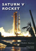
Saturn V Rocket (Images of Modern America)
by Alan LawrieIn 1961, Pres. John F. Kennedy set the challenge of landing a man on the moon by the end of the decade. In order to achieve this, NASA partnered with US industry to build the largest rocket ever produced, the Saturn V. It was designed and tested in record time and made its first flight in 1967. Less than two years later and within the timescales set by the president, the crew of Apollo 11 was launched on a Saturn V and watched live by millions of people on televisions around the world. From this launch, Neil Armstrong made his famous giant leap for mankind, later to be followed by 11 other astronauts who also walked on the moon.
Saturn V Rocket
by Ed Stewart II Mike Jetzer Alan LawrieIn 1961, Pres. John F. Kennedy set the challenge of landing a man on the moon by the end of the decade. In order to achieve this, NASA partnered with US industry to build the largest rocket ever produced, the Saturn V. It was designed and tested in record time and made its first flight in 1967. Less than two years later and within the timescales set by the president, the crew of Apollo 11 was launched on a Saturn V and watched live by millions of people on televisions around the world. From this launch, Neil Armstrong made his famous giant leap for mankind, later to be followed by 11 other astronauts who also walked on the moon.
Saucer: Books 1-3: Saucer, Saucer: The Conquest, Saucer: Savage Planet (Saucer Ser. #2)
by Stephen CoontsThe sequel to Saucer by the New York Times–bestselling author—a “humorous UFO thriller . . . a gripping aerial duel of saucers up and down the East Coast” (Publishers Weekly).Rip Cantrell is brought back to give the saucer one last flight. Charlotte “Charley” Pine has started flying for a rich French tycoon, and there is believed to be another downed saucer somewhere in the area. Rip can’t quite get over the fact that Charley has dumped him. But when push comes to shove Rip and the United States Government are going to go head to head with this crazy Frenchman in trying to be the first to the saucer.As Stephen Coonts proved in his last outing, there is a great deal of high-flying adventure to be found in the Saucer series. And this one not only promises all the excitement of the last one, but it delivers with much, much more.Praise for Saucer“A comic, feel-good SF adventure.” —Kirkus Reviews“A flight of fancy . . . tough to put down.” —Publishers Weekly
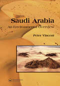
Saudi Arabia: An Environmental Overview
by Peter VincentA comprehensive overview of Saudi Arabia‘s environment, this volume is a unique and authoritative text on the geological and environmental aspects of Saudi Arabia, a country about which little is known by the outside world. Saudi Arabia is a fascinating country with a long tradition of environmental awareness and sensitivity, pitted again
