- Table View
- List View
Spatial Mathematics: Theory and Practice through Mapping
by Joseph J. Kerski Sandra Lach ArlinghausIn terms of statistics, GIS offers many connections. With GIS, data are gathered, displayed, summarized, examined, and interpreted to discover patterns. Spatial Mathematics: Theory and Practice through Mapping uses GIS as a platform to teach mathematical concepts and skills through visualization of numbers. It examines theory and practice from disp
Spatial Modeling and Assessment of Environmental Contaminants: Risk Assessment and Remediation (Environmental Challenges and Solutions)
by Debashish Sengupta Pravat Kumar Shit Partha Pratim AdhikaryThis book demonstrates the measurement, monitoring and mapping of environmental contaminants in soil & sediment, surface & groundwater and atmosphere. This book explores state-of-art techniques based on methodological and modeling in modern geospatial techniques specifically focusing on the recent trends in data mining techniques and robust modeling. It also presents modifications of and improvements to existing control technologies for remediation of environmental contaminants. In addition, it includes three separate sections on contaminants, risk assessment and remediation of different existing and emerging pollutants. It covers major topics such as: Radioactive Wastes, Solid and Hazardous Wastes, Heavy Metal Contaminants, Arsenic Contaminants, Microplastic Pollution, Microbiology of Soil and Sediments, Soil Salinity and Sodicity, Aquatic Ecotoxicity Assessment, Fluoride Contamination, Hydrochemistry, Geochemistry, Indoor Pollution and Human Health aspects. The content of this book will be of interest to researchers, professionals, and policymakers whose work involves environmental contaminants and related solutions.
Spatial Multimedia and Virtual Reality
by Antonio S. CamaraThe intersection of two disciplines and technologies which have become mature academic research topics in the 1990s was destined to be a dynamic area for collaboration and publication. However, until now no significant book-length treatment of the meeting of GIS and Virtual Reality has been available. This volume puts that situation to rights by bringing these together to cement some common understanding and principles in a potentially highly promising area for technological collaboration and cross-fertilisation. The result is a volume which ranges in subject matter from studies of a Virtual GIS Room to Spatial Agents, and from an Environmental Multimedia System to Computer-Assisted 3D Geographic Education. All the contributors are well-known international scientists, principally from the computational side of GIS. It will be a valuable resource for any GIS researcher or professional looking to understand the leading edge of this fertile field.
Spatial Networking in the United Physical, Virtual, and Mental World (Studies in Systems, Decision and Control #533)
by Peter S. SapatyThe current book chooses graphs and networks as primary and global research objectives after reviewing different types and areas of networking and existing works on graph and network operations. The ideas of this book originate from the WAVE approach which allowed us, more than half a century ago, to implement citywide heterogeneous computer networks and solve distributed problems on them in flexible and mobile way. The invented management paradigm evolved into Spatial Grasp Technology resulted in European patent and nine previous books oriented on concrete applications in social and defense systems, security, crises management, collective robotics, space research, and others. Many obtained results were dealing with graph and network structures and problems which were extremely important in the researched areas. It aims at development of higher-level social infrastructures effectively integrating different types of networking under the same universal approach, also application of networking in new areas like organoids and brain research. This book is oriented toward system scientists, application programmers, industry managers, university students, philosophers, psychologists, and United Nations personnel too.
Spatial Observation of Giant Panda Habitat: Techniques and Methods
by Xinyuan Wang Jing Zhen Qingkai MengThis book evaluates the past, present, and future habitat suitability of giant pandas based on spatial observation technology involving optical remote sensing, microwave remote sensing, and LiDAR to discover the mysterious ecological environment of giant panda habitat. Considering the problems faced by the world natural heritage site protection, it takes the world natural heritage site “Sichuan Giant Panda Sanctuaries – Wolong, Mt Siguniang and Jiajin Mountains” as the research area, exemplifies systematically the various techniques and methodologies of spatial information technology for monitoring, evaluation, and prediction of rare and endangered species habitats, and provides scientific suggestions for sustainable development of giant panda habitat based on a series of comprehensive case analysis at Wolong national nature reserve and Ya'an prefecture, Sichuan province, China. The book serves both as a textbook in the field of natural heritage protection, remote sensing, and GIS application, as well as a reference for managing natural heritage sites.
Spatial Optical-Fiber Coupling Technology in Optical-Wireless Communication (Optical Wireless Communication Theory and Technology)
by Xizheng KeThis book analyzes the development of space light-fiber coupling research, highlights its importance, examines the underlying theory and key problems, and elaborates on methods to improve the space light-fiber coupling efficiency. Starting from the basic theory of electromagnetic field, the transmission characteristics of light in optical fibers are expounded, and the coupling characteristics of optical signals of different modes are investigated. The spatial light-fiber coupling techniques such as mode conversion method, lens coupling method, and wavefront distortion correction method are discussed in detail, and the key technologies involved are verified by experiments. This book is suitable for the vast majority of engineering and technical personnel and teachers in colleges and institutions who are engaged in wireless optical communication. It can also be used to train senior undergraduates and graduate students in relevant fields.
Spatial Planning and Sustainable Development
by Ming Zhang Jen-Te Pai Mitsuhiko Kawakami Xiao-Lu Gao Zhen-Jiang ShenThis book attempts to provide insights into the achievement of a sustainable urban form, through spatial planning and implementation; here, we focus on planning experiences at the levels of local cities and some metropolitan areas in Asian countries. This book investigates the impact of planning policy on spatial planning implementation, from multidisciplinary viewpoints encompassing land-use patterns, housing development, transportation, green design, and agricultural and ecological systems in the urbanization process. We seek to learn from researchers in an integrated multidisciplinary platform that reflects a variety of perspectives, such as economic development, social equality, and ecological protection, with a view to achieving a sustainable urban form.
Spatial Polarization Characteristics of Radar Antenna: Analysis, Measurement and Anti-jamming Application
by Hong Xie Jia Luo Huanyao Dai Xuesong Wang Shunping XiaoThis book presents novel research ideas and offers insights into radar system design, artificial intelligence and signal processing applications. Further, it proposes a new concept of antenna spatial polarization characteristics (SPC), suggesting that the antenna polarization is a function of the spatial direction and providing new ideas for radar signal processing (RSP) and anti-jamming. It also discusses the design of an advanced signal-processing algorithm, and proposes new polarimetric and anti-jamming methods using antenna inherent properties. The book helps readers discover the potential of radar information processing and improve its anti-interference and target identification ability. It is of interest to university researchers, radar engineers and graduate students in computer science and electronics who wish to learn the core principles, methods, algorithms, and applications of RSP.
Spatial Resilience in Social-Ecological Systems
by Graeme S. CummingSpatial Resilience is a new and exciting area of interdisciplinary research. It focuses on the influence of spatial variation - including such things as spatial location, context, connectivity, and dispersal - on the resilience of complex systems, and on the roles that resilience and self-organization play in generating spatial variation. Prof. Cumming provides a readable introduction and a first comprehensive synthesis covering the core concepts and applications of spatial resilience to the study of social-ecological systems. The book follows a trajectory from concepts through models, methods, and case study analysis before revisiting the central problems in the further conceptual development of the field. In the process, the author ranges from the movements of lions in northern Zimbabwe to the urban jungles of Europe, and from the collapse of past societies to the social impacts of modern conflict. The many case studies and examples discussed in the book show how the concept of spatial resilience can generate valuable insights into the spatial dynamics of social-ecological systems and contribute to solving some of the most pressing problems of our time. Although it has been written primarily for students, this book will provide fascinating reading for interdisciplinary scientists at all career stages as well as for the interested public. "Graeme Cumming, central in the development of resilience thinking and theory, has produced a wonderful book on spatial resilience, the first ever on this topic. The book will become a shining star, a classic in the explosion of new ideas and approaches to studying and understanding social-ecological systems." Carl Folke, Stockholm Resilience Centre, Sweden
Spatial Similarity Relations in Multi-scale Map Spaces
by Haowen Yan Jonathan LiHow does one determine how similar two maps are? This book aims at the theory of spatial similarity relations and its application in automated map generalization, including the definitions, classification and features of spatial similarity relations. Included also are calculation models of spatial similarity relations between arbitrary individual objects and between arbitrary object groups, and the application of the theory in the automation of the algorithms and procedures in map generalization.
Spatial Simulation
by David O'Sullivan George L. PerryA ground-up approach to explaining dynamic spatial modelling for an interdisciplinary audience.Across broad areas of the environmental and social sciences, simulation models are an important way to study systems inaccessible to scientific experimental and observational methods, and also an essential complement to those more conventional approaches. The contemporary research literature is teeming with abstract simulation models whose presentation is mathematically demanding and requires a high level of knowledge of quantitative and computational methods and approaches. Furthermore, simulation models designed to represent specific systems and phenomena are often complicated, and, as a result, difficult to reconstruct from their descriptions in the literature. This book aims to provide a practical and accessible account of dynamic spatial modelling, while also equipping readers with a sound conceptual foundation in the subject, and a useful introduction to the wide-ranging literature.Spatial Simulation: Exploring Pattern and Process is organised around the idea that a small number of spatial processes underlie the wide variety of dynamic spatial models. Its central focus on three 'building-blocks' of dynamic spatial models - forces of attraction and segregation, individual mobile entities, and processes of spread - guides the reader to an understanding of the basis of many of the complicated models found in the research literature. The three building block models are presented in their simplest form and are progressively elaborated and related to real world process that can be represented using them. Introductory chapters cover essential background topics, particularly the relationships between pattern, process and spatiotemporal scale. Additional chapters consider how time and space can be represented in more complicated models, and methods for the analysis and evaluation of models. Finally, the three building block models are woven together in a more elaborate example to show how a complicated model can be assembled from relatively simple components.To aid understanding, more than 50 specific models described in the book are available online at patternandprocess.org for exploration in the freely available Netlogo platform. This book encourages readers to develop intuition for the abstract types of model that are likely to be appropriate for application in any specific context. Spatial Simulation: Exploring Pattern and Process will be of interest to undergraduate and graduate students taking courses in environmental, social, ecological and geographical disciplines. Researchers and professionals who require a non-specialist introduction will also find this book an invaluable guide to dynamic spatial simulation.
Spatial Sound: Principles and Applications
by Bosun XieSpatial sound is an enhanced and immersive set of audio techniques which provides sound in three-dimensional virtual space. This comprehensive handbook sets out the basic principles and methods with a representative group of applications: sound field and spatial hearing; principles and analytic methods of various spatial sound systems, including two-channel stereophonic sound, and multichannel horizontal and spatial surround sound; ambisonics; wavefield synthesis; binaural playback and virtual auditory display; recording and synthesis, and storage and transmission of spatial sound signals; and objective and subjective evaluation. Applications range from cinemas to small mobile devices. The only book to review spatial sound principles and applications extensively Covers the whole field of spatial sound The book suits researchers, graduate students, and specialist engineers in acoustics, audio, and signal processing.
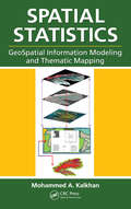
Spatial Statistics: GeoSpatial Information Modeling and Thematic Mapping
by Mohammed A. KalkhanGeospatial information modeling and mapping has become an important tool for the investigation and management of natural resources at the landscape scale. Spatial Statistics: GeoSpatial Information Modeling and Thematic Mapping reviews the types and applications of geospatial information data, such as remote sensing, geographic information systems
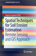
Spatial Techniques for Soil Erosion Estimation: Remote Sensing And Gis Approach (Springerbriefs In Gis Ser.)
by Rupesh Jayaram PatilThis book presents a novel computation of the topographic LS factor of the USLE model to estimate spatial soil erosion. In developing countries, soil erosion is one of the main concerns as it adversely affects agriculture and reduces food production. Therefore, the author presents a particularly relevant approach, as he demonstrates how the C++ programming allows us to identify important erosion stages like detachment and deposition. He does this by assessing the annual rate of soil erosion from the Shakkar River watershed in India using distributed information and applying RS and GIS techniques. He also discusses different approaches that have been proposed to work out the influence of topography on erosion. Simulated and observed data of sediment loss are compared for the period 1992 to 2006.This book provides an easy-to-understand basic piece of soil erosion and hydrological research and reaches out to young researchers and students at the graduate and undergraduate level as well as applicants of soil erosion models.
Spatial Technology and Archaeology: The Archaeological Applications of GIS
by David Wheatley Mark GillingsGeographical Information Systems (GIS) and related spatial technologies have a new and powerful role to play in archaeological interpretation. Beginning with a conceptual approach to the representation of space adopted by GIS, this book examines spatial databases; the acquisition and compilation of data; the analytical compilation of data; the anal
Spatial Temporal Information Systems: An Ontological Approach using STK
by Linda M. McNeil T.S. KelsoDesigned to be a high-level, approachable resource for engineers who need further insight into spatial temporal information systems from an ontological perspective, Spatial Temporal Information Systems: An Ontological Approach using STK explains the dynamics of objects interaction from signal analysis to trajectory design, spatial modeling, and oth
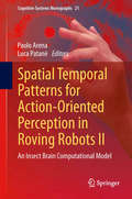
Spatial Temporal Patterns for Action-Oriented Perception in Roving Robots II
by Paolo Arena Luca PatanèThis book presents the result of a joint effort from different European Institutions within the framework of the EU funded project called SPARK II, devoted to device an insect brain computational model, useful to be embedded into autonomous robotic agents. Part I reports the biological background on Drosophila melanogaster with particular attention to the main centers which are used as building blocks for the implementation of the insect brain computational model. Part II reports the mathematical approach to model the Central Pattern Generator used for the gait generation in a six-legged robot. Also the Reaction-diffusion principles in non-linear lattices are exploited to develop a compact internal representation of a dynamically changing environment for behavioral planning. In Part III a software/hardware framework, developed to integrate the insect brain computational model in a simulated/real robotic platform, is illustrated. The different robots used for the experiments are also described. Moreover the problems related to the vision system were addressed proposing robust solutions for object identification and feature extraction. Part IV includes the relevant scenarios used in the experiments to test the capabilities of the insect brain-inspired architecture taking as comparison the biological case. Experimental results are finally reported, whose multimedia can be found in the SPARK II web page: www. spark2. diees. unict. it
Spatial Thinking in Environmental Contexts: Maps, Archives, and Timelines
by Joseph J. Kerski Sandra L. Arlinghaus Ann Evans Larimore Matthew NaudSpatial Thinking in Environmental Contexts: Maps, Archives, and Timelines cultivates the spatial thinking "habit of mind" as a critical geographical view of how the world works, including how environmental systems function, and how we can approach and solve environmental problems using maps, archives, and timelines. The work explains why spatial thinking matters as it helps readers to integrate a variety of methods to describe and analyze spatial/temporal events and phenomena in disparate environmental contexts. It weaves together maps, GIS, timelines, and storytelling as important strategies in examining concepts and procedures in analyzing real-world data and relationships. The work thus adds significant value to qualitative and quantitative research in environmental (and related) sciences. Features Written by internationally renowned experts known for taking complex ideas and finding accessible ways to more broadly understand and communicate them. Includes real-world studies explaining the merging of disparate data in a sensible manner, understandable across several disciplines. Unique approach to spatial thinking involving animated maps, 3D maps, GEOMATs, and story maps to integrate maps, archives, and timelines—first across a single environmental example and then through varied examples. Merges spatial and temporal views on a broad range of environmental issues from traditional environmental topics to more unusual ones involving urban studies, medicine, municipal/governmental application, and citizen-scientist topics. Provides easy to follow step-by-step instructions to complete tasks; no prior experience in data processing is needed.
Spatial Variation and Seasonality in Growth and Reproduction of Enhalus Acoroides (L.f.) Royle Populations in the Coastal Waters Off Cape Bolinao, NW Philippines
by Rene. N. RollonThis text explores the spatial variation and seasonality in growth and reproduction of "Enhalus acoroides" (L.f.) Royle populations in the coastal waters off Cape Bolinao, NW Phillipines.
Spatial Variation of Seismic Ground Motions: Modeling and Engineering Applications (Advances in Engineering Series)
by Aspasia ZervaThe spatial variation of seismic ground motions denotes the differences in the seismic time histories at various locations on the ground surface. This text focuses on the spatial variability of the motions that is caused by the propagation of the waveforms from the earthquake source through the earth strata to the ground surface, and it brings toge
Spatial-Temporal Cooperative Guidance for Multiple Flight Vehicles
by Ming Xin Wei Dong Chunyan Wang Fang Deng Jianan WangThe spatial-temporal cooperative guidance problem for multiple flight vehicles has garnered significant attention in recent years due to its potential benefits in both military and civil fields. This book provides a concise but holistic introduction to this practical problem and presents a summative collection of the latest solutions to the concerned challenges, thereby providing some theoretical support for enhancing the synergism and applicability of cooperative guidance for multiple flight vehicles. This book consists of nine chapters. In Chapter 1, recent works on cooperative guidance are systematically recalled. Chapter 2 introduces the common formulation and unique challenges of the cooperative guidance problem from a practical viewpoint. In Chapter 3, a varying-gain proportional navigation guidance law with accurate time-to-go prediction is developed to realize precise control of the impact time. In Chapter 4, in response to the inherent finite-time property of the cooperative guidance problem, a fixed-time convergent error dynamic is proposed to design a 3D distributed cooperative guidance law with enhanced convergence. In Chapter 5, a command-decoupled design strategy is proposed to address the challenging spatial-temporal cooperative guidance problem through the derivation and combination of the coplanar cooperative guidance and planar pursuit guidance commands. In Chapter 6, an integrated design strategy based on rotational operations on spatial vectors is proposed to simultaneously satisfy the impact angle and time constraints. In Chapter 7, a multiple-stage cooperative guidance strategy is developed to satisfy the spatial-temporal constraints without relying on time-to-go information. In Chapter 8, a unified command augmentation method is proposed to prevent the seeker's FOV from exceeding the boundary throughout the cooperative guidance. Finally, Chapter 9 concludes this book and offers an instructive opinion on the future directions of the cooperative guidance problem in both academic and engineering investigations. Therefore, this book can not only serve as a reference for researchers who are interested in this field with systematic and inspirational perspectives, but also be a useful handbook for engineers engaged in cooperative guidance and control of multiple flight vehicles.
Spatially Resolved Characterization in Thin-Film Photovoltaics
by Matevž Bokalič Marko TopičThe book is devoted to the spatial characterization of solar cells and PV modules. It is written both as a monograph as well as a succinct guide for the state-of-the-art spatial characterization techniques and approaches. Amongst the approaches discussed are visual imaging, electro- and photo-luminescence imaging, thermography, and light beam induced mapping techniques. Emphasis is given on the luminescence image acquisition and interpretation due to its great potential. Characterization techniques are accompanied by simulation tools. The contents are aimed at a readership of students and senior researchers in R&D as well as engineers in industry who are newcomers to the spatial characterization of either solar cells or PV modules. The concepts and approaches presented herein are based on but not limited to case studies of real thin-film PV devices. Key features: Review of spatially resolved characterization techniques and accompanying SPICE simulations in photovoltaics Use of spatially resolved characterization techniques and their combinations for the identification of inhomogeneities in small area CdTe and dye-sensitized solar cells Case studies of electroluminescence imaging of commercial PV modules (c-Si, CIGS, CdTe, a-Si, tandem and triple junction thin-film-Si) The contents are aimed at a readership of students and senior researchers in R&D as well as engineers in industry who are newcomers to the spatial characterization of either solar cells or PV modules. The concepts and approaches presented herein are based on but not limited to case studies of real thin-film PV devices. Key features: Review of spatially resolved characterization techniques and accompanying SPICE simulations in photovoltaics Use of spatially resolved characterization techniques and their combinations for the identification of inhomogeneities in small area CdTe and dye-sensitized solar cells Case studies of electroluminescence imaging of commercial PV modules (c-Si, CIGS, CdTe, a-Si, tandem and triple junction thin-film-Si)
Spatio-Temporal Modeling and Device Optimization of Passively Mode-Locked Semiconductor Lasers (Springer Theses)
by Stefan MeineckeThis thesis investigates passively mode-locked semiconductor lasers by numerical methods. The understanding and optimization of such devices is crucial to the advancement of technologies such as optical data communication and dual comb spectroscopy. The focus of the thesis is therefore on the development of efficient numerical models, which are able both to perform larger parameter studies and to provide quantitative predictions. Along with that, visualization and evaluation techniques for the rich spatio-temporal laser dynamics are developed; these facilitate the physical interpretation of the observed features.The investigations in this thesis revolve around two specific semiconductor devices, namely a monolithically integrated three-section tapered quantum-dot laser and a V-shaped external cavity laser. In both cases, the simulations closely tie in with experimental results, which have been obtained in collaboration with the TU Darmstadt and the ETH Zurich. Based on the successful numerical reproduction of the experimental findings, the emission dynamics of both lasers can be understood in terms of the cavity geometry and the active medium dynamics. The latter, in particular, highlights the value of the developed simulation tools, since the fast charge-carrier dynamics are generally not experimentally accessible during mode-locking operation. Lastly, the numerical models are used to perform laser design explorations and thus to derive recommendations for further optimizations.
Spatio-temporal Trend Analysis of Rainfall using R Software and ArcGIS: A Case Study of an Agro-climatic Zone-1 of Gujarat, India (SpringerBriefs in Climate Studies)
by K. Naveena Ramiz Tasiya Shilpesh RanaThis book aims to provide an advanced R software approach that can carry out rainfall trend analysis using Mann-Kendall and Sen’s slope estimator tests. The research study follows a systematic approach while utilizing R software as it can greatly facilitate the analysis of rainfall trends. About 30 stations located in the study area and 41 to 50 years’ time series were selected for the purpose of analysis. The data for the research was collected from the State Water Data Centre (SWDC) in Gujarat, Indian Meteorological Department (IMD) in Pune, DAAC (NASA), and ESRI. Cluster analysis has been performed to analyze the variability of the mean rainfall. The stations have been divided into 2 clusters with 17 and 13 stations in each cluster which significantly differ from each other. This book is aimed at researchers, scientists and government organizations working in the field of climate change.
Spatio-temporal characterisation of drought: data analytics, modelling, tracking, impact and prediction (IHE Delft PhD Thesis Series)
by Vitali Diaz MercadoStudies of drought have increased in light of new data availability and advances in spatio-temporal analysis. However, the following gaps still need to be filled: 1) methods to characterise drought that explicitly consider its spatio-temporal features, such as spatial extent (area) and pathway; 2) methods to monitor and predict drought that include the above-mentioned characteristics and 3) approaches for visualising and analysing drought characteristics to facilitate interpretation of its variation. This research aims to explore, analyse and propose improvements to the spatio-temporal characterisation of drought. Outcomes provide new perspectives towards better prediction. The following objectives were proposed. 1) Improve the methodology for characterising drought based on the phenomenon’s spatial features. 2) Develop a visual approach to analysing drought variations. 3) Develop a methodology for spatial drought tracking. 4) Explore machine learning (ML) techniques to predict crop-yield responses to drought. The four objectives were addressed and results are presented. Finally, a scope was formulated for integrating ML and the spatio-temporal analysis of drought. Proposed scope opens a new area of potential for drought prediction (i.e. predicting spatial drought tracks and areas). It is expected that the drought tracking and prediction method will help populations cope with drought and its severe impacts.
