- Table View
- List View
Geodesigning Our Future: Urban Development Dynamics in Israel (The Urban Book Series)
by Shlomit Flint AsheryThis book examines how map-based collaboration software can facilitate negotiations in areas undergoing contentious pressures for significant change. Based on case studies from Israel, it aims to introduce a useful model of planning implementation as an outcome of complex interaction to reduce the gap between planning and urban reality. It puts an analytical realist foundation for a productive discussion of the role of future planning and bares meaningful scientific contributions to the general frame of the negotiating process and implementation, which still needs further research and elaboration.Geodesign, a cutting-edge planning approach that is rooted in the history of planning practice, has become one of the most popular approaches for sustainable planning and design activities after 2000s. Planners tend to think of design at a site scale, but geodesign covers a variety of scales, bridging the gap between the regional and the local contexts.This is important because to be practically effective and politically prudent, "smart growth" plans need to make sense across a spectrum of scales and disciplines. This ranges from design, urban design, community planning, town and city planning, and regional planning, up to planning for mega-regions.
Geodiversity
by Murray GrayThe first book to focus exclusively on the subject, Geodiversity, Second Edition describes the interrelationships between geodiversity and biodiversity, the value of geodiversity to society, as well as current threats to its existence. Illustrated with global case studies throughout, the book examines traditional approaches to protecting geodiversity and the new management agenda now being implemented. The Second Edition of this successful textbook continues to build on the success of the first edition which is still the standard reference for the subject.Fully revised and updated throughout, the Second Edition now includes new material on geoparks, geotourism and implications of climate change for geoconservation.Reviews of previous edition:"Murray Gray's new book is the first widely available text to bring together and analyse some of these emerging ideas....The result is a book that should be in the library of every land manager and one that is likely to lead many practicing geoscientists and quaternarists to a new view of the importance of their field for nature conservation and environmental management... (Journal of Quaternary Science, Vol.19, No.8, December 2004) "It is strange that it is necessary to justify the importance of geodiversity.... Murray Gray does it with brilliance, not only to convince 'non-believers', but giving inspiration to us that have worked in geoconservation for a long time" (ProGEO News, 3 & 4, 2003) "...The author provides a timely review of recent advances in the integration of geodiversity into wider conservation and planning strategies..." ...." (Journal of Quaternary Science, Vol.19, No.8, December 2004) "...the book is well-written and follows a clear and concise outline." (Environmental Geology, Vol. 48, No. 2, July 2005)
Geoecological Risk Management in Polar Areas (Environmental Pollution #28)
by Vladimir N. Bashkin Rauf V. GaliulinThis monograph is devoted to full-scale geoecological risk assessment in gas industry impacted polar areas and the relevant risk management options using innovative nature-like biogeochemical technologies. Readers will discover more about geoecological risks during gas production, transportation, storage and refining. Chapters discuss in detail the geodynamic dangers associated with the designing and building of main gas pipelines. The book has interdisciplinary appeal, and specialists and practitioners in environmental sciences, ecology, biogeochemistry and those within the energy sector who are interested in understanding ecosystems affected by anthropogenic impacts in severe climatic conditions will find it particularly engaging. Through this book, readers will learn more about recultivation of contaminated soils as well as health risk assessments of chemical substances associated with the gas industry.
Geoecology: An Evolutionary Approach
by Richard HuggettAnimals, plants and soils interact with one another, with the terrestrial spheres, and with the rest of the Cosmos. On land, this rich interaction creates landscape systems or geoecosystems. Geoecology investigates the structure and function of geoecosystems, their components and their environment. The author develops a simple dynamic systems model, the `brash' equation, to form the conceptual framework for the book suggesting an `ecological' and `evolutionary' approach. Exploring internal of `ecological' interactions between geoecosystems and their near-surface environments - the atmosphere, hydrosphere, toposhere, and lithosphere - and external influences, both geological and cosmic, Geoecology presents geoecosystems as dynamic entities constantly responding to changes within themselves and their surroundings. An `evolutionary' view emerges of geoecological systems, and the animals, plants, and soils comprising them, providing a new way of thinking for the whole environmental complex and the rich web of interdependencies contained therein.
Geoecology of Landscape Dynamics (Advances in Geographical and Environmental Sciences)
by R. B. Singh Manish Kumar Seema SahdevThis book provides an overview of the ecological indicators of landscape dynamics in the context of geographical landscape integration. Landscape dynamics depicts every change that occurs in the physical, biological, and cognitive assets of a landscape. To understand and interpret the complex physical, biological, and cognitive phenomena of landscapes, it is necessary to operate conceptually and practically on a broad range of spatial and temporal scales. Rapid land use changes have become a concern to environmentalists and planners because of their impacts on the natural ecosystem, which further determines socioeconomic dynamics. In this regard, the book discusses case studies that share new insights into how landscape patterns and processes impact small creatures, and how small creatures in turn influence landscape structure and composition. In turn, the relevant aspects of land use and land cover dynamics are covered, and the multi-faceted relationship between the substrata and ecological community is highlighted. The book is unique in its focus on the application of spatial informatics such as automatic building extraction from high-resolution imagery; a soil resource inventory for meeting the challenges of land degradation; hydrological modeling; the temporal variation analysis of glacier area and the identification and mapping of glacial lakes; morphometric analysis of river basins; and the monitoring and modeling of urban sprawl, among other features.
Geoenergy Modeling II
by Haibing Shao Philipp Hein Agnes Sachse Olaf KolditzThis book is dedicated to the numerical modeling of shallow geothermal systems. The utilization of shallow geothermal energy involves the integration of multiple Borehole Heat Exchangers (BHE) with Ground Source Heat Pump (GSHP) systems to provide heating and cooling. The modeling practices explained in this book can improve the efficiency of these increasingly common systems. The book begins by explaining the basic theory of heat transport processes in man-made as well as natural media. . These techniques are then applied to the simulation of borehole heat exchangers and their interaction with the surrounding soil. The numerical and analytical models are verified against analytical solutions and measured data from a Thermal Response Test, and finally, a real test site is analyzed through the model and discussed with regard to BHE and GSHP system design and optimization.
Geoengineering Responses to Climate Change
by Naomi Vaughan Tim LentonFailure by the international community to make substantive progress in reducing CO2 emissions, coupled with recent evidence of accelerating climate change, has brought increasing urgency to the search for additional remediation approaches. This book presents a selection of state-of-the-art geoengineering methods for deliberately reducing the effects of anthropogenic climate change, either by actively removing greenhouse gases from the atmosphere or by decreasing the amount of sunlight absorbed at the Earth's surface. These methods contrast with more conventional mitigation approaches which focus on reducing emissions of greenhouse gases, especially carbon dioxide. Geoengineering technologies could become a key tool to be used in conjunction with emissions reduction to limit the magnitude of climate change. Featuring authoritative, peer-reviewed entries from the Encyclopedia of Sustainability Science and Technology, this book presents a wide range of climate change remediation technologies.
geoENV VII – Geostatistics for Environmental Applications
by C. D. Lloyd Peter M. AtkinsonThis volume brings together selected contributions from geoENV 2008, the 7th International Conference on Geostatistics for Environmental Applications, held in Southampton, UK, in September 2008. This book presents the state-of-the-art in geostatistics for the environmental sciences. It includes a wide range of methodological advances and applications. It offers insight and guidance for researchers, professionals, graduate students and others seeking information on the latest perspectives in the field. The rich body of applications will enable those new to geostatistics to assess the utility of the methods for their own applications. The book includes 35 chapters on topics as diverse as methodological developments, applications in the soil sciences, climatology, pollution, health, wildlife mapping, fisheries and remote sensing, amongst other areas. With its focus on environmental applications of geostatistics, rather than the more traditional geostatistical remit of mining and petroleum exploration, this book is part of a series that presents an invaluable resource. This book will be a first port of call for those who wish to apply geostatistical methods in the environmental sciences.
Geoenvironmental and Geotechnical Issues of Coal Mine Overburden and Mine Tailings (Springer Transactions in Civil and Environmental Engineering)
by Sarat Kumar Das Krishna R. Reddy Lohitkumar Nainegali Surabhi JainThis contributed book edited by leading global experts focuses on the geoenvironmental and geotechnical issues of coal mine overburden and mine tailings and its unengineered dumping. It aims to provide knowledge-based information for diverse readers to assess, monitor, and manage coal mine overburden and mine tailings in various engineering applications while highlighting efficient solutions to reutilize the waste and conserve natural resources leading to sustainable development. The content also assesses mine backfilling, techniques to stabilize mine tailing storage facilities, mineral carbonation of mine tailings, landfill liners and barrier systems, reclamation of coal mine overburden, and geochemical, microbial, and environmental sustainability assessment, among others. This book is a useful resource for those in academia and industry.
Geoenvironmental Engineering: Contaminated Soils, Pollutant Fate, and Mitigation
by Raymond N. YongGeoenvironmental Engineering: Contaminated Soils, Pollutant Fate, and Mitigation focuses on why soils and sediments remain contaminated. The reader will understand why specific contaminants remain in soils and sediments, how much of a threat they pose to human health and the environment, and what steps to take for mitigation. Subjects covered include the basic properties of soils affecting accumulation of contaminants, long-term retention of contaminants and their fate, including the development of intermediate products. The author emphasizes the factors, interactions, and mechanisms important in the bonding and partitioning process.
Geoethics: Manifesto for an Ethics of Responsibility Towards the Earth
by Silvia Peppoloni Giuseppe Di CapuaThis book outlines the current development of geoethical thinking, proposing to the general public reflections and categories useful for understanding the ethical, cultural, and societal dimensions of anthropogenic global changes. Geoethics identifies and orients responsible behaviors and actions in the management of natural processes, redefining the human interaction with the Earth system based on a critical, scientifically grounded, and pragmatic approach. Solid scientific knowledge and a philosophical reference framework are crucial to face the current ecological disruption. The scientific perspective must be structured to help different human contexts while respecting social and cultural diversity. It is impossible to respond to global problems with disconnected local actions, which cannot be proposed as standard and effective operational models. Geoethics tries to overcome this fragmentation, presenting Earth sciences as the foundation of responsible human action toward the planet. Geoethics is conceived as a rational and multidisciplinary language that can bind and concretely support the international community, engaged in resolving global environmental imbalances and complex challenges, which have no national, cultural, or religious boundaries that require shared governance. Geoethics is proposed as a new reading key to rethinking the Earth as a system of complex relationships, in which the human being is an integral part of natural interactions.
Geoethics in Peru: A Pathway for Latin America (SpringerBriefs in Geoethics)
by Sandra Paula Villacorta ChambiThe book discusses geoscience issues in Peru from a geoethical perspective, based on the leading experience of the Peruvian section of the International Association for Promoting Geoethics, in its seven years of activity.The introduction will present past and current activities to promote geoethics in Peru, such as the organization of the MinerLima exhibition (that has teaching purposes); the implementation of geoethics in georisk communication with vulnerable populations, as well as the promotion of adequate knowledge about national geological heritage. The other chapters will describe the main geoethical issues in Peru, related to georisk management and communication, mining, paleontology and geoheritage, geoducation. Some proposals for actions that should be taken to improve societal awareness and to make progress in problem-solving from a geoethical perspective will be discussed for each issue.In the final chapter Peruvian geoescience implications and new roles for geoscientists will be discussed, providing clues to their participation in the management of socio-environmental problems that affect Latin American region. It will be also underlined how geoethics represents a new theoretical and practical approach that may contribute in the current process to modernize geoscience education in Latin America.In this sense, this publication provides a solid base to apply the theoretical framework of Geoethics in Peru that may be suggested as an example to promote geoethics in other Latin American countries. As a result, the need to inform and prepare the population of growing countries such as Peru to face the problems of the modern world is evident.In order to attract more readers in Latin America, each chapter will be provided with a summary in Spanish.
Geofaktor Mensch: Eingriffe in die Umwelt und ihre Folgen
by Diethard E. Meyer„Lässt sich die Erde retten? Sicherlich nicht mit einem neuen Buch wie diesem - aber es kann helfen, die Umweltprobleme besser zu verstehen!“ Der Aufstieg des Menschen zur wirksamsten geologischen Kraft auf dem Planeten Erde - kurz „Geofaktor Mensch“ genannt - vollzog sich allmählich. Im Industriezeitalter steigerte sich diese Kraft enorm durch neue Techniken. Diese ermöglichten die Inanspruchnahme fast sämtlicher Georessourcen für eine obendrein dramatisch anwachsende Menschheit, die weiterhin weltweit nach einem höheren Lebensstandard strebt. Kaum ein Gebiet der Erde bleibt verschont. Diese anthropogenen Eingriffe in das Naturgeschehen sind in vielfacher Hinsicht einzigartig - sowohl in ihrem Umfang als auch in ihrer Qualität. Seit kurzem wird dieser neuartige Zeitabschnitt in der Geschichte unseres Planeten als das „Anthropozän“ bezeichnet. Anschaulich und mit vielen Fotos und Diagrammen belegt dieses Werk das teilweise höchst komplexe Zusammenspiel der menschlichen Eingriffe in Natur und Umwelt. Zunächst schleichend, dann aber sehr plötzlich kann dieses an bestimmten „Kipp-Punkten“ zu anthropogen induzierten Katastrophen führen. Und genau diese gilt es von vornherein durch wissenschaftlich fundierte Planung unter strikter Kontrolle bei sich verändernden Rahmenbedingungen zu verhindern. Für Geowissenschaftler, Ökologen, Ingenieure und Landschaftsarchitekten sowie alle Tätigen in der Landschaftsplanung oder im Umwelt- und Naturschutz und nicht zuletzt die Entscheidungsträger in Politik und Wirtschaft vermittelt Geofaktor Mensch über das Orientierungswissen hinaus ein tieferes Verständnis der geologischen und ökologischen Prozesse. Diese zu kennen ist Voraussetzung für eine verlässliche Beurteilung des Systems der belebten Erde - der Geobiosphäre. Die zahlreichen Literaturhinweise ermöglichen eine gezielte Vertiefung der einzelnen Themen, besonders auch für Studierende.
Geoforming Mars: How could nature have made Mars more like Earth?
by Robert MalcuitThis book offers an exercise in theoretical planetology, presenting five different scenarios to assess the evolution of habitable conditions on Mars to assess planetary terraforming potential and to give insight into the ongoing search for habitable exoplanets. Four of the scenarios involve Martian satellite capture models, in which gravitational capture via tidal deformation and energy dissipation processes are measured to predict a pathway of biological evolution, while the fifth scenario analyzes the possible model that led to the Mars that we have today (i.e. with no life forms). In ten chapters, readers will learn how a Mars-like terrestrial planet can be transformed into a habitable planet, and what conditions must be assessed when searching for exoplanets in a star-centered orbit to support life. The book is intended for planetologists, and general enthusiasts of planetary evolution and our solar system.
The Geographic Mosaic of Coevolution
by John N. ThompsonCoevolution—reciprocal evolutionary change in interacting species driven by natural selection—is one of the most important ecological and genetic processes organizing the earth's biodiversity: most plants and animals require coevolved interactions with other species to survive and reproduce. The Geographic Mosaic of Coevolution analyzes how the biology of species provides the raw material for long-term coevolution, evaluates how local coadaptation forms the basic module of coevolutionary change, and explores how the coevolutionary process reshapes locally coevolving interactions across the earth's constantly changing landscapes. Picking up where his influential The Coevolutionary Process left off, John N. Thompsonsynthesizes the state of a rapidly developing science that integrates approaches from evolutionary ecology, population genetics, phylogeography, systematics, evolutionary biochemistry and physiology, and molecular biology. Using models, data, and hypotheses to develop a complete conceptual framework, Thompson also draws on examples from a wide range of taxa and environments, illustrating the expanding breadth and depth of research in coevolutionary biology.
A Geographic Perspective of Cuban Landscapes (Landscape Series #15)
by Jennifer GebeleinBeginning in the era of the Spanish conquest and taking the reader right up to the present day, this book focuses on how the landscape of Cuba has changed and evolved into the environment we see today. It illustrates the range of factors - economic, political and cultural - that have determined Cuba's physical geography, and explores the shifting conservation measures which have been instituted in response to new methods in agriculture and land management. The text uses historical documents, fieldwork, Geographic Information System (GIS) data and remotely-sensed satellite imagery to detail Cuba's extensive land-use history as well as its potential future. The author goes further to analyze the manner, speed and methods of landscape change, and examines the historical context and governing agendas that have had an impact on the relationship between Cuba's inhabitants and their island. Gebelein also assesses the key role played by agricultural production in the framework of international trade required to sustain Cuba's people and its economy. The book concludes with a review of current efforts by Cuban and other research scientists, as well as private investors, conservation managers and university professors who are involved in shaping Cuba's evolving landscape and managing it during the country's possible transition to a more politically diverse, enfranchised and open polity.
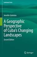
A Geographic Perspective of Cuba’s Changing Landscapes (Landscape Series #33)
by Jennifer GebeleinThis book is based on research that gives the reader a nonfiction view of how Cuba’s landscape has changed since the time when Columbus first set foot on the island and encountered the Indigenous peoples who lived there in 1492 to present day.An analysis of landscape change over time is presented and that transformation from a heavily forested island to less than (currently) 18% forest cover is described. The government has established a system of protected areas and strong governmental controls over environmental policies and the manner with which the island can be built upon by foreign investors, urban expansion projects, or natural resource exploitation.Current GIS and remote sensing research of Cuba’s atmosphere, physical landscape and aquatic features is provided to underscore the complex environmental structures that epitomize Cuba. The author discusses past, present and future impact factors including history, technological assessments, laws and policies, relationships with other countries and education.
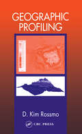
Geographic Profiling
by D. Kim RossmoAs any police officer who has ever walked a beat or worked a crime scene knows, the street has its hot spots, patterns, and rhythms: drug dealers work their markets, prostitutes stroll their favorite corners, and burglars hit their favorite neighborhoods. But putting all the geographic information together in cases of serial violent crime (murder, rape, arson, bombing, and robbery) is highly challenging. Just ask the homicide detectives of the Los Angeles Police Department who hunted the Hillside Stranglers, or law enforcement officers in Louisiana who tracked the brutal South Side rapist.Geographic Profiling introduces and explains this cutting-edge investigative methodology in-depth. Used to analyze the locations of a connected series of crimes to determine the most likely area of offender residence, geographic profiling allows investigators and law enforcement officers to more effectively manage information and focus their investigations.This extensive and exhaustive work explains geographic profiling theories and principles, and includes an extensive review of the literature and research in the areas of criminal profiling, forensic behavioral science, serial violent crime, environmental criminology, and the geography of crime. For investigators and police officers deployed in the field, as well as criminal analysts, Geographic Profiling is a "must have" reference.
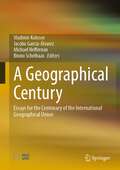
A Geographical Century: Essays for the Centenary of the International Geographical Union
by Vladimir Kolosov Jacobo García-Álvarez Michael Heffernan Bruno SchelhaasThis volume of specially commissioned interpretative essays marks the centenary of the establishment of the International Geographical Union in 1922. Written by leading human and physical geographers from all parts of the world, A Geographical Century considers the history and present condition of geography as an international science. Based on the latest research, A Geographical Century provides new and critical analyses of the different forms of geographical internationalism that emerged during the 20th century; the changing relations between geography and cognate disciplines in the natural and social sciences; the geopolitics of international geographical collaboration; and the prospects of geography as a 21st century international science.
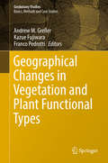
Geographical Changes in Vegetation and Plant Functional Types (Geobotany Studies)
by Andrew M. Greller Kazue Fujiwara Franco PedrottiThis book presents studies on current vegetation topics, from polar to tropical regions. It is a festschrift to mark the 70th birthday of Prof. Elgene O. Box, who has studied vegetation all over the world, both through fieldwork and modeling. It reflects a number of his interests, including basic ecological plant forms (cf ‘plant functional types’), temperate-zone forests, and evergreen versus seasonal patterns. Section 1 discusses the concept of vegetation series, while Section 2 has two global-scale chapters on plant functional traits and whether they are related more to climate or phylogeny. Section 3 has nine chapters focusing on vegetation history, regional vegetation, and how these have influenced current species organizations and distributions. Regions treated include Russia, China, the USA, Mexico and Mediterranean areas. Lastly, Section 4 addresses aspects of vegetation change and plant ecology. Every chapter in this unique book offers original ideas on the topic of vegetation, as the authors are assembled from a world-wide population of leading vegetational ecologists, whose interests range from local communities to global theoretical questions.
Geographical Data Science and Spatial Data Analysis: An Introduction in R (Spatial Analytics and GIS)
by Lex Comber Chris BrunsdonWe are in an age of big data where all of our everyday interactions and transactions generate data. Much of this data is spatial – it is collected some-where – and identifying analytical insight from trends and patterns in these increasing rich digital footprints presents a number of challenges. Whilst other books describe different flavours of Data Analytics in R and other programming languages, there are none that consider Spatial Data (ie the location attached to data), or that consider issues of inference, linking Big Data, Geography, GIS, Mapping and Spatial Analytics. This is a ‘learning by doing’ text book, building on the previous book by the same authors, An Introduction to R for Spatial Analysis and Mapping. It details the theoretical issues in analyses of Big Spatial Data and developing practical skills in the reader for addressing these with confidence.
Geographical Dynamics and Firm Spatial Strategy in China
by Shengjun Zhu John Pickles Canfei HeThis book offers the first detailed account of the complex geographical dynamics currently restructuring China's export-oriented industries. The topics covered are relevant to post-socialist geography, development studies, economics, economic sociology and international studies. It offers academics, international researchers, postgraduate and advanced undergraduate students in these fields an accessible, grounded, yet theoretically sophisticated account of the geographies of global production networks, value chains, and regional development in developing countries and emerging economies. It is of particular interest to economic geographers and economic sociologists involved in the growing debates over local clusters, embeddedness, global sourcing and global production, and over the global value chain/global production network. It also appeals to national policymakers, since it directly addresses economic and industrial policy issues, such as industrial competitiveness, regional and national development, industrial and employment restructuring and trade regulation.
Geographical Indication and Global Agri-Food: Development and Democratization (Earthscan Food and Agriculture)
by Alessandro Bonanno; Kae Sekine; Hart N. FeuerThis book addresses the relevance of geographical indication (GI) as a tool for local and socio-economic development and democratization of agri-food, with case studies from Asia, Europe and the Americas. A geographical indication is a sign used on products that have a specific geographical origin and possess qualities or a reputation that are due to that origin. It provides not only a way for businesses to leverage the value of their geographically unique products, but also to inform and attract consumers. A highly contested topic, GI is praised as a tool for the revitalization of agricultural communities, while also criticized for being an instrument exploited by global corporate forces to promote their interests. There are concerns that the promotion of GI may hamper the establishment of democratic forms of development. The contributing authors address this topic by offering theoretically informed investigations of GI from around the world. The book includes case studies ranging from green tea in Japan, olive oil in Turkey and dried fish in Norway, to French wine and Mexican Mezcal. It also places GI in the broader context of the evolution and trends of agri-food under neoliberal globalization. The book will be of interest to researchers, policy makers and students in agri-food studies, sociology of food and agriculture, geography, agricultural and rural economics, environmental and intellectual property law, and social development.
Geographie für Dummies (Für Dummies)
by Charles A. HeatwoleBei der Geografie geht es längst nicht nur darum, zu wissen, wo welches Land oder welcher Fluss zu finden ist. "Geografie für Dummies" erklärt Ihnen, wie das geografische Koordinatensystem aufgebaut ist, wie man damit Orte bestimmt und so Karten richtig deutet. Im Mittelpunkt des Buches stehen die Geofaktoren Boden, Wasser und Klima und deren Wechselwirkungen miteinander: Wie formen Vulkane, Erosion und Wetter die Erdoberfläche? Wie beeinflussen die Ozeane das Klima? Und wie ist es möglich, dass Wüste und Regenwald nur durch eine Bergkette voneinander getrennt sind? Aber auch der Einfluss des Menschen kommt nicht zu kurz, so wird auch die urbane, politische und wirtschaftliche Geografie erläutert. Egal, ob Sie wissen möchten, wie das Klima die Erde beeinflusst oder wo ein günstiger Standort für das nächste Eigenheim wäre, dieses Buch liefert Ihnen alle Antworten.
